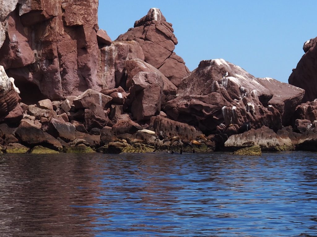
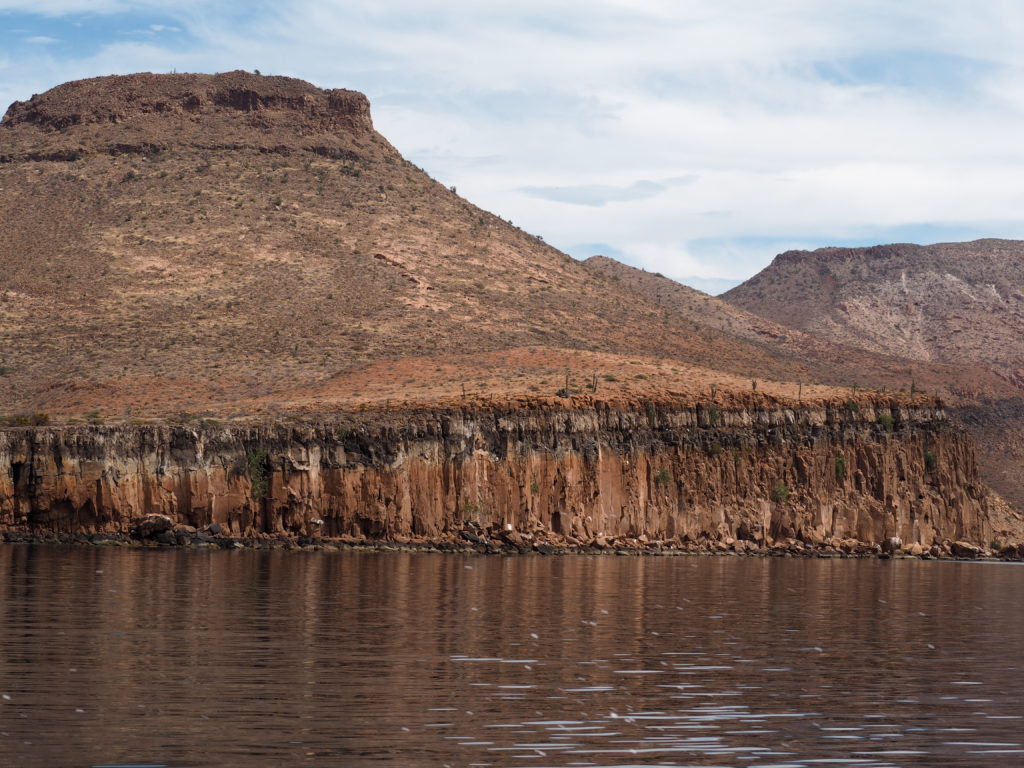
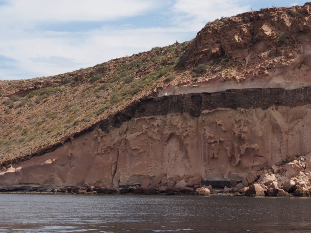
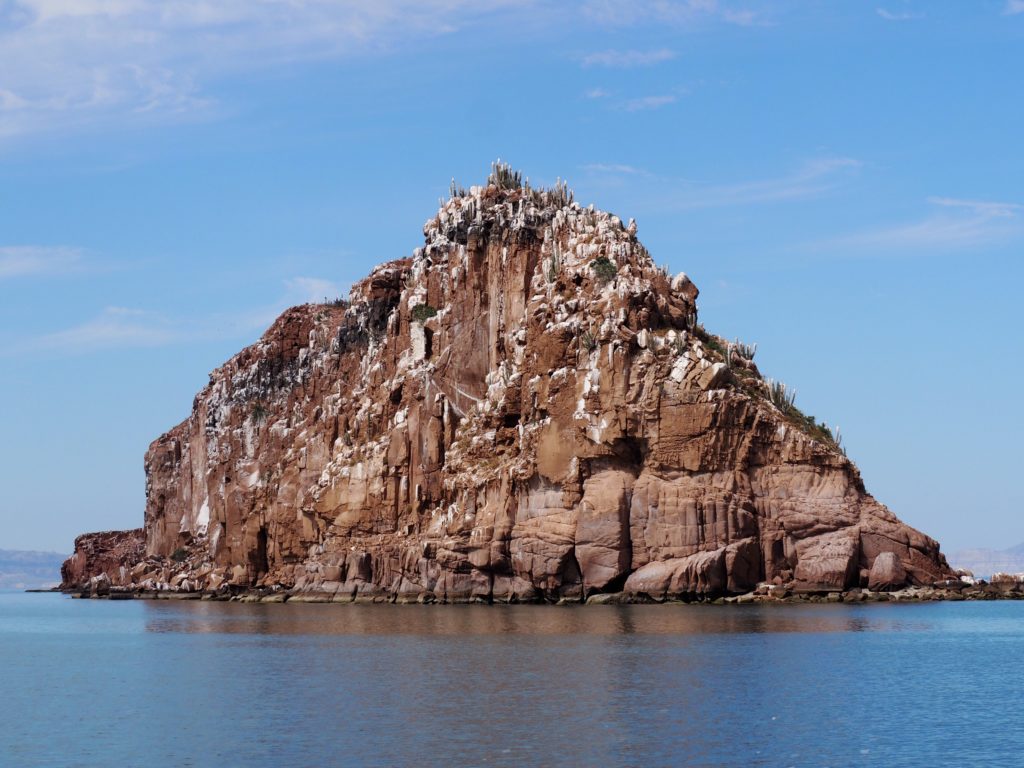
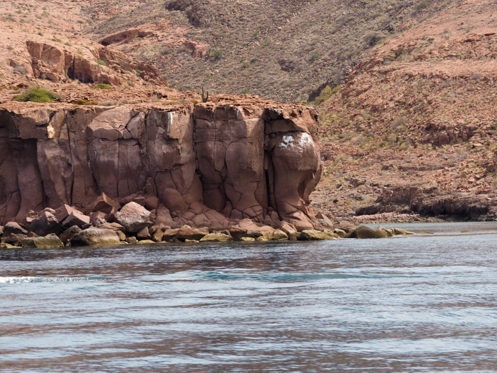
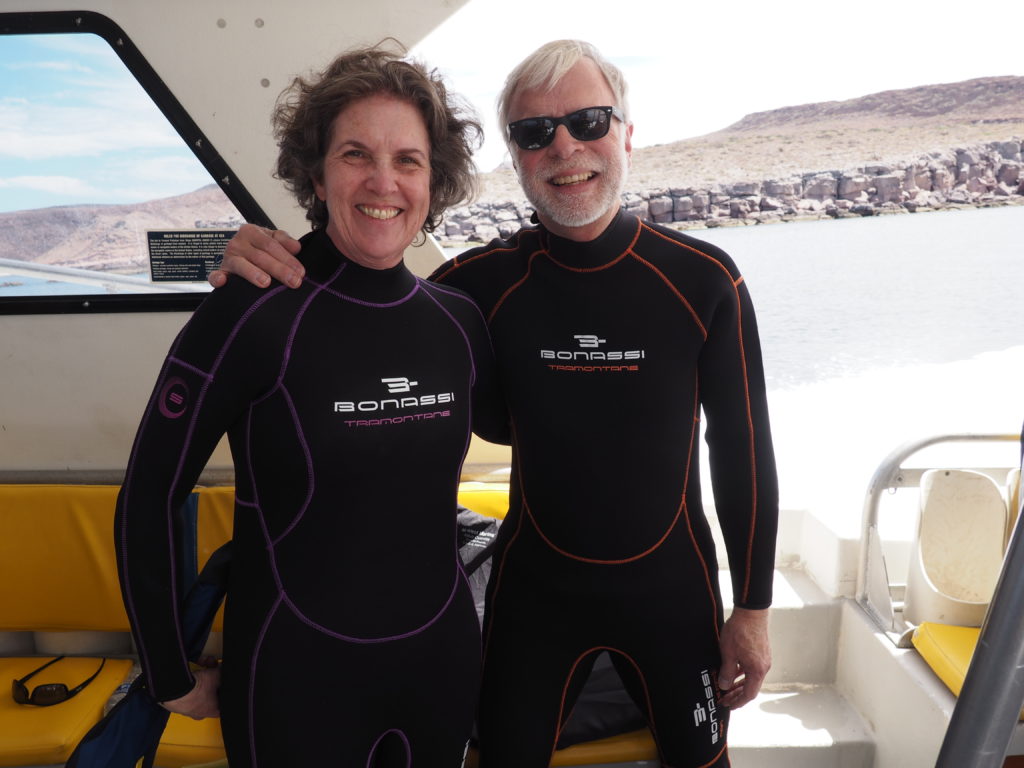
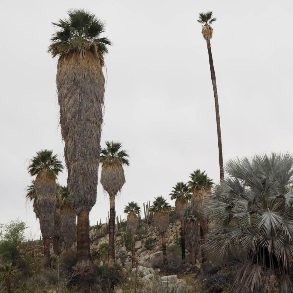
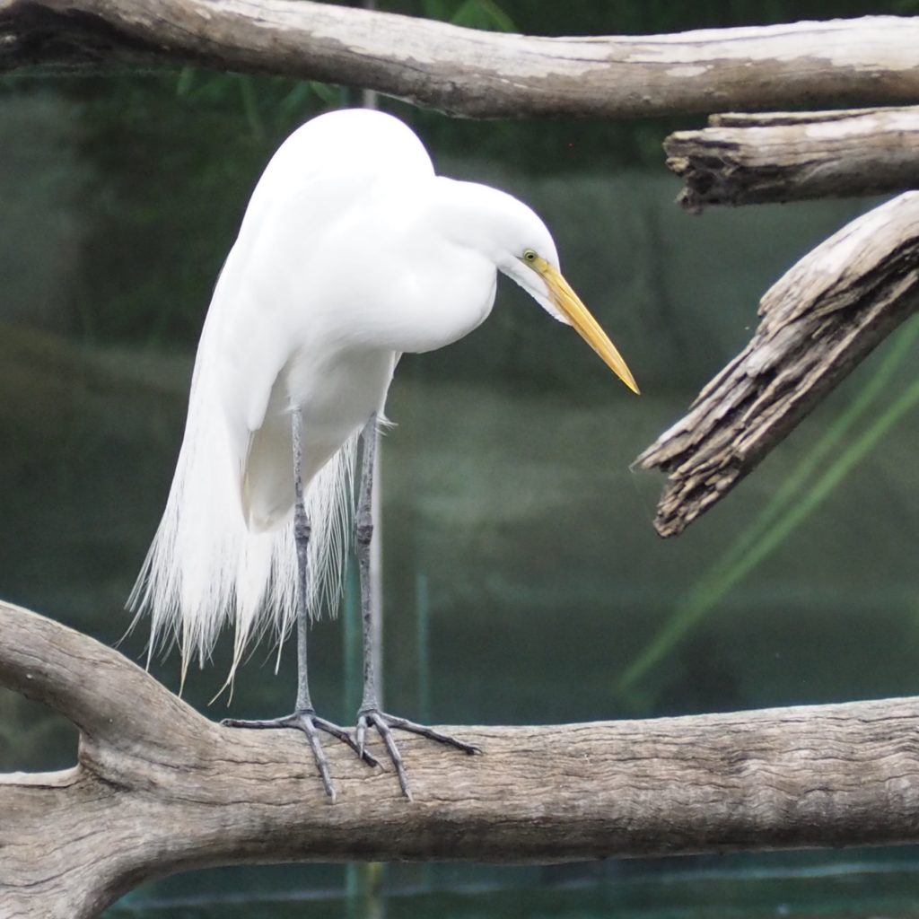
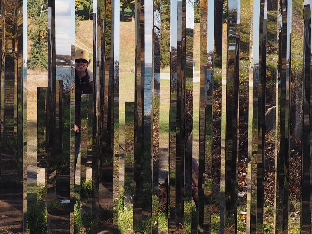
The islands and water around Espírito Santo are protected and tightly controlled. The islands with their reefs and wild occupants may only be approached by small boats for snorkeling. This is what we did.
Despite being in the Sea of Cortez approaching the Tropic of Cancer, the water is not Caribbean warm if you plan on spending any time in it. We were rewarded with sea lions swimming near us and an abundance of colorful fish, including parrot fish, sergeant majors, and barber fish tending to the coral in the guano enriched waters. Indeed, juvenile sea lions will bump into you or come charging at you in play. Star fish, sea urchins, moray eel, crabs and the ever present brown pelicans competed for attention less aggressively. Our guide was vigilant in making sure we kept a proper distance from the shore where the adult sea lions were hanging out and remained in “neutral water.” We were glad for this when a huge male cruised by, vocalized and gave us a look of acknowledgment.
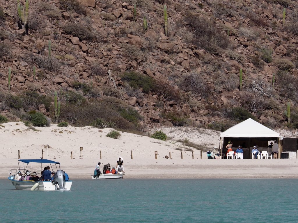
Lunch on uninhabited island (Isla Espírito Santo) with marine toilets.
Cabo San Lucas
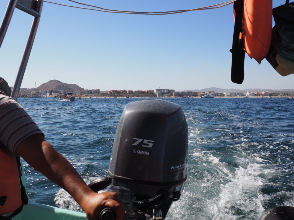
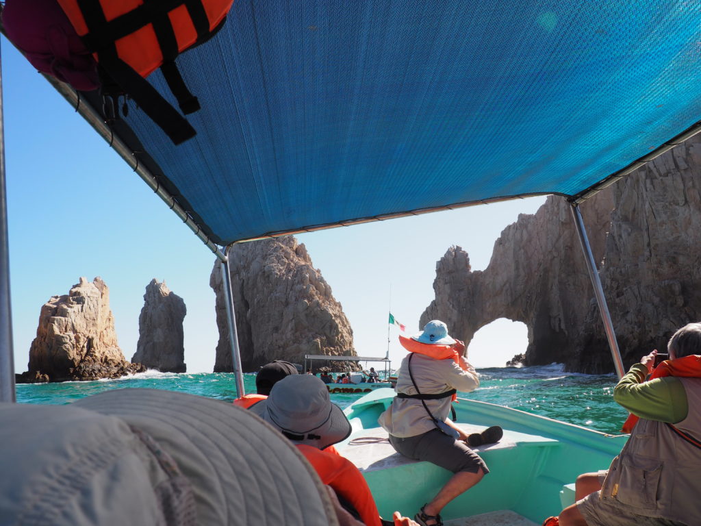
Motoring out from Cabo
Despite the insanity of the harbor and the party atmosphere, we enjoyed Cabo in a different way. Our guide (piloting the boat) likes to call it Cabo San Loco and it is unabashedly crass and commercial, but the exuberance of the place also has something to say for it. And, we were very lucky to have an excellent guide.
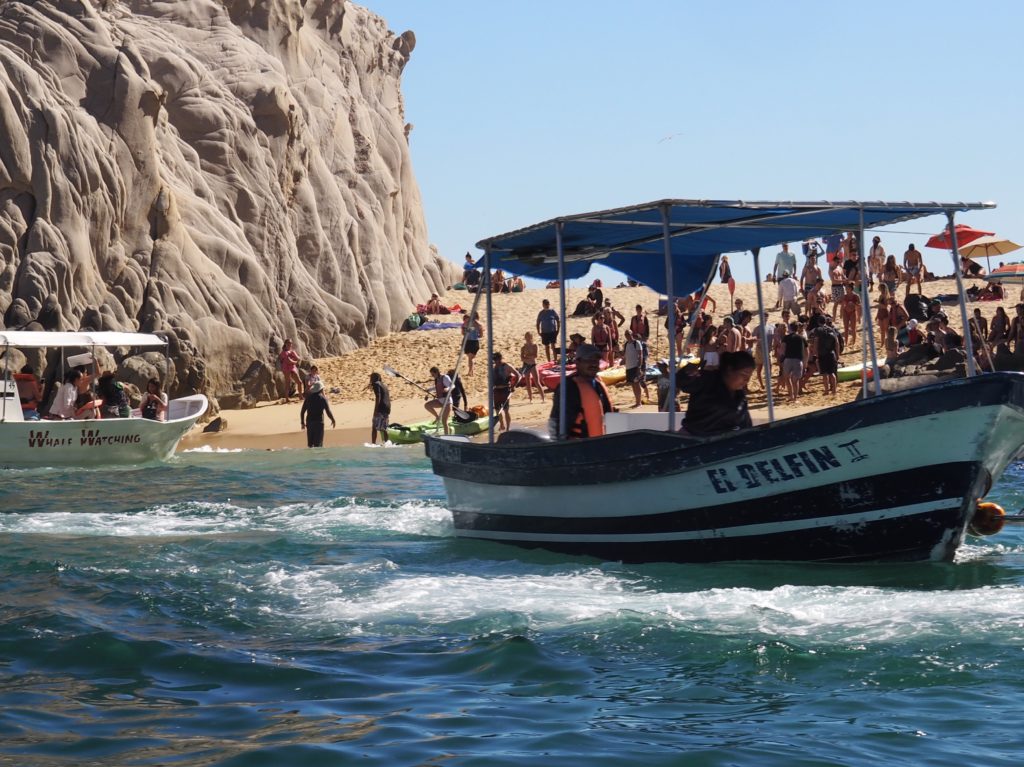
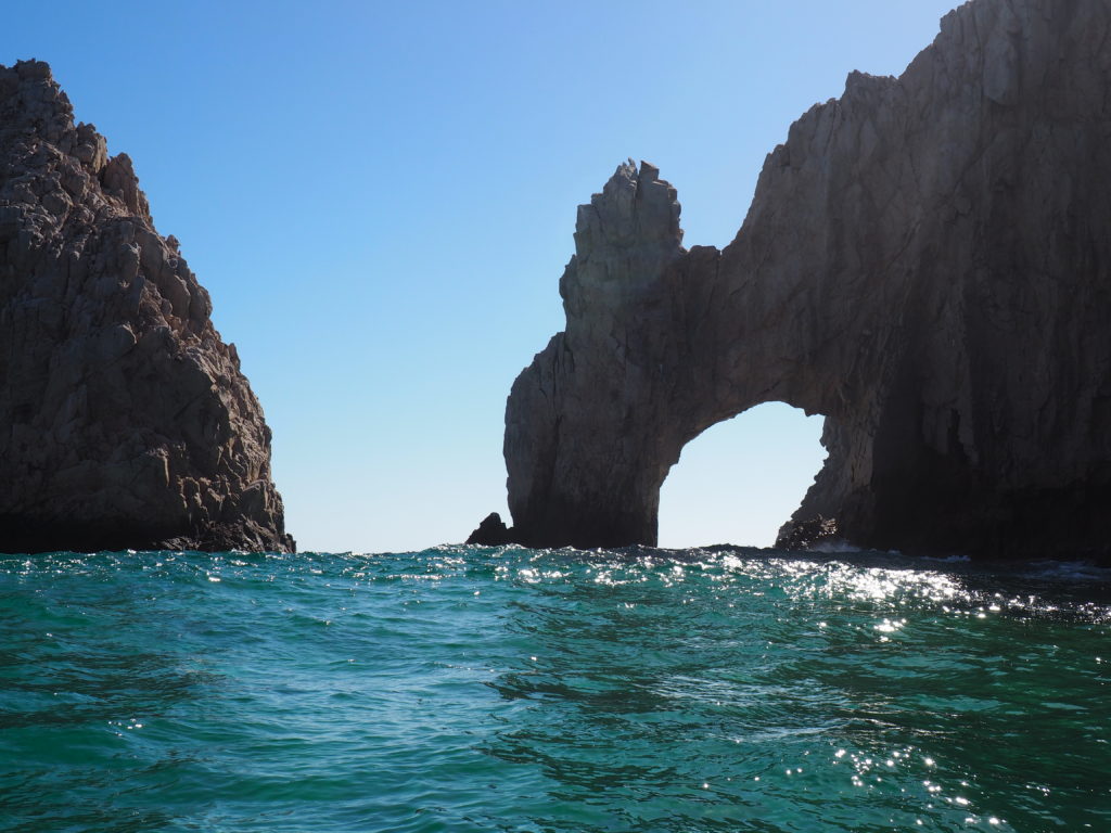
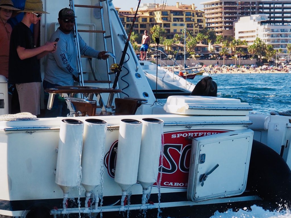
Tourists being dropped at Lover’s Beach on the Sea of Cortez. On the other side of this point of land is Divorce Beach, facing the Pacific Ocean, large waves and a very dangerous undertow where unwary tourists are occasionally swept out to sea.Getting pictures of the arch. Our photo of the arch. Southernmost point of Baja California Sur. “Strictly Business.” (Yes, that’s a sea lion the guides have named Pablo who begs for the left over bait fish from sports fishing captains returning to port. Sport fishing is catch-and-release only. They fly a flag on their return to indicate what they’ve caught and a second flag to confirm that it was released.)
Cabo San Lucas is the fastest growing city in Mexico and is now second only to Cancun as the largest resort area. It has grown at such a remarkable pace that each ten years it is newly unrecognizable. Its economy is entirely based on tourism as commercial fishing is prohibited in the area, but it draws the rich and famous along with the spring break crowd. Needless to say, the people who work there cannot afford to live any closer than 30 to 40 minutes away. Although people may think they live in paradise, as the shirt of the young entrepreneur offering the shirt attests, it’s “strictly business.” All has also not been paradise in terms of crime and lawlessness, with Cabo the location of a death from tainted alcohol and numerous violent crimes. However, after a disastrous 2017, the government stepped in to drastically increase policing and the violent crime rate dropped by 90% in 2018.
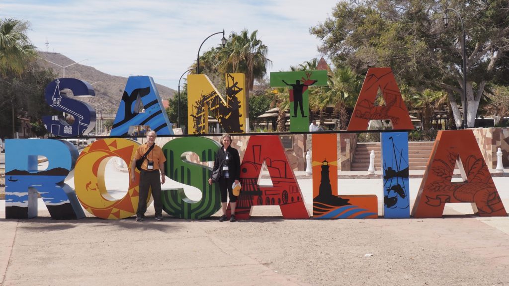
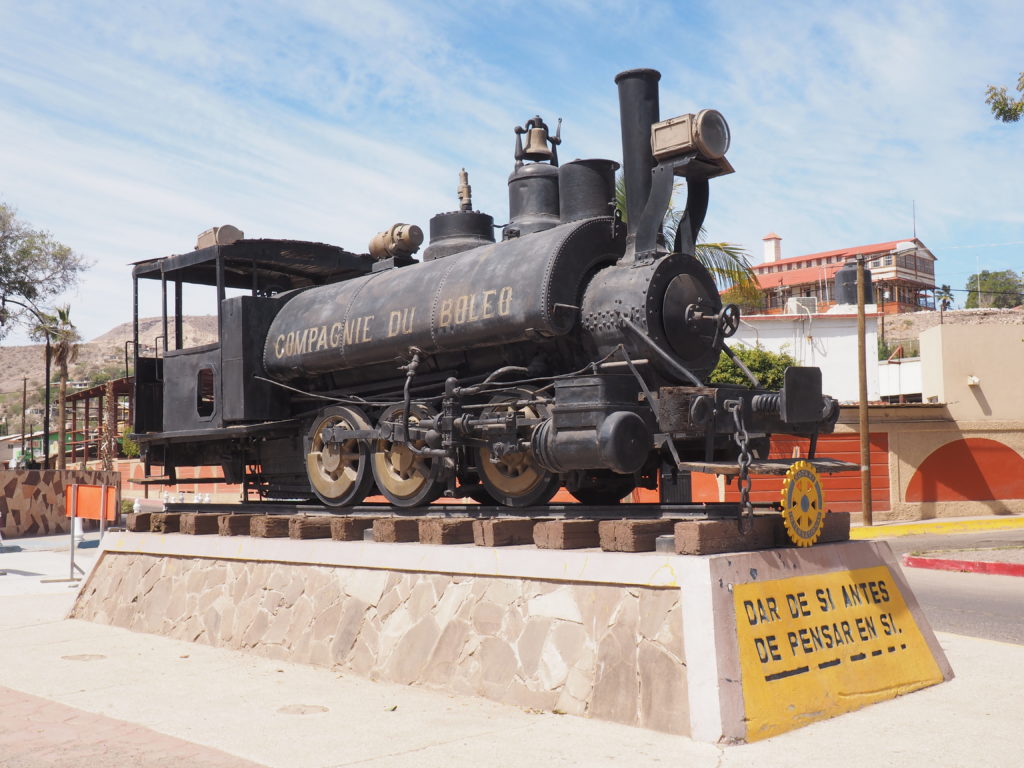
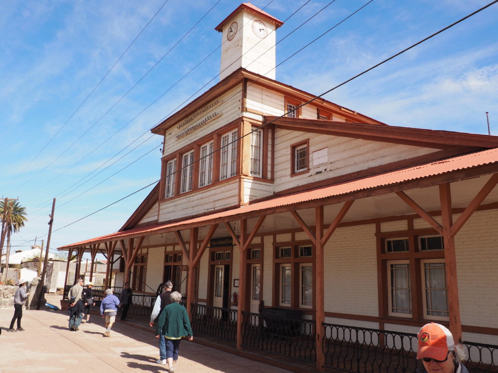
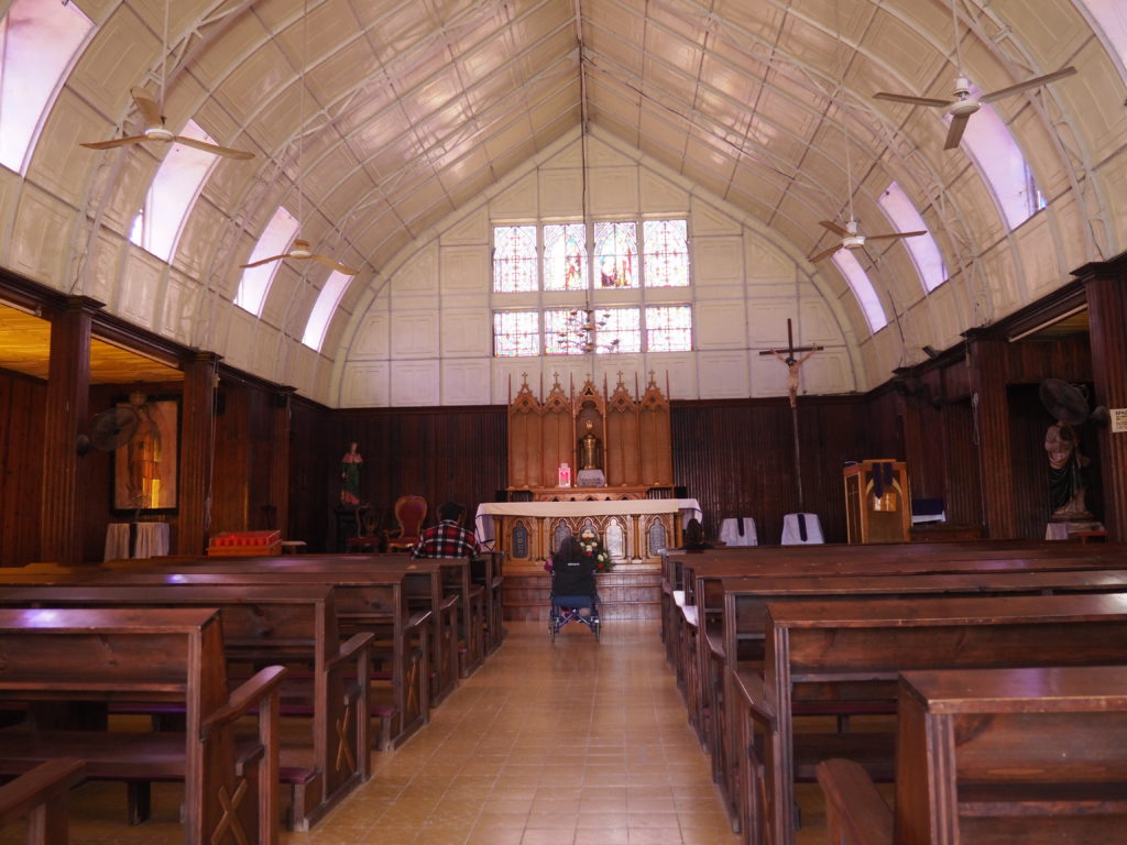
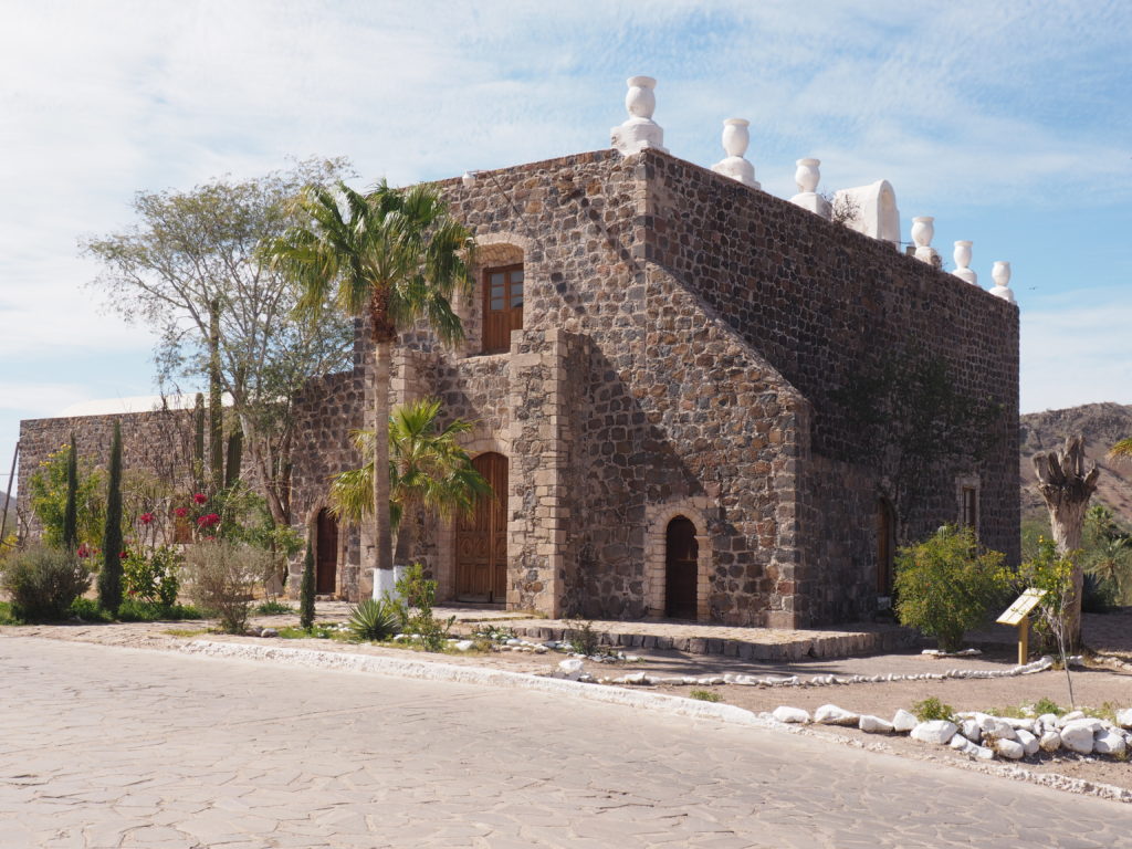
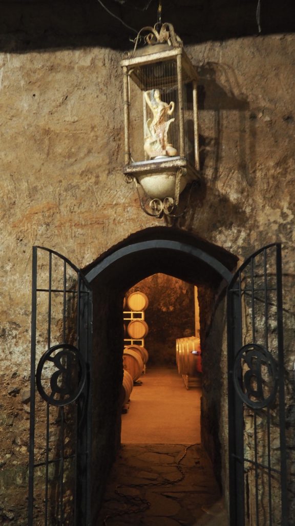
Although the outskirts of town have a grim industrial look, Santa Rosalia is a pleasant small city once dominated by Compagnie du Boleo, a French mining company.
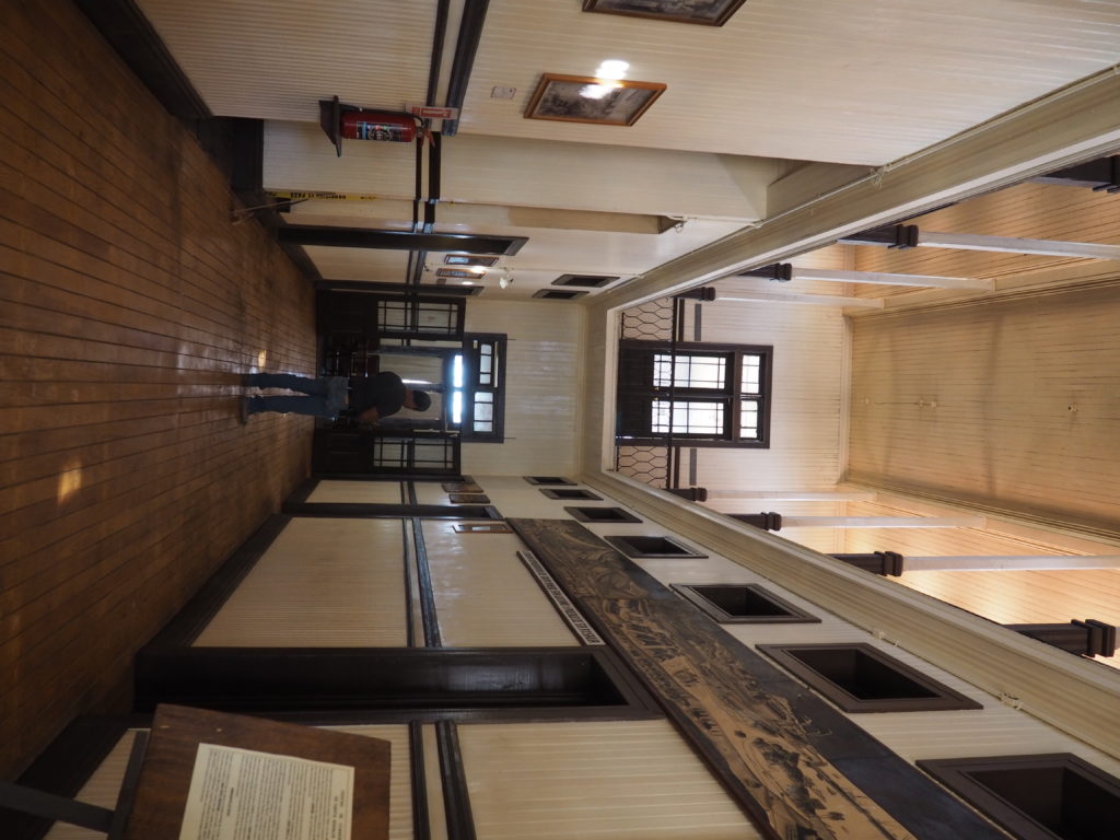
Former Headquarters of Compagnie du Boleo. All of the wood was imported from France because the peninsula lacks building timber.
Like a Hollywood set for colonial architecture.
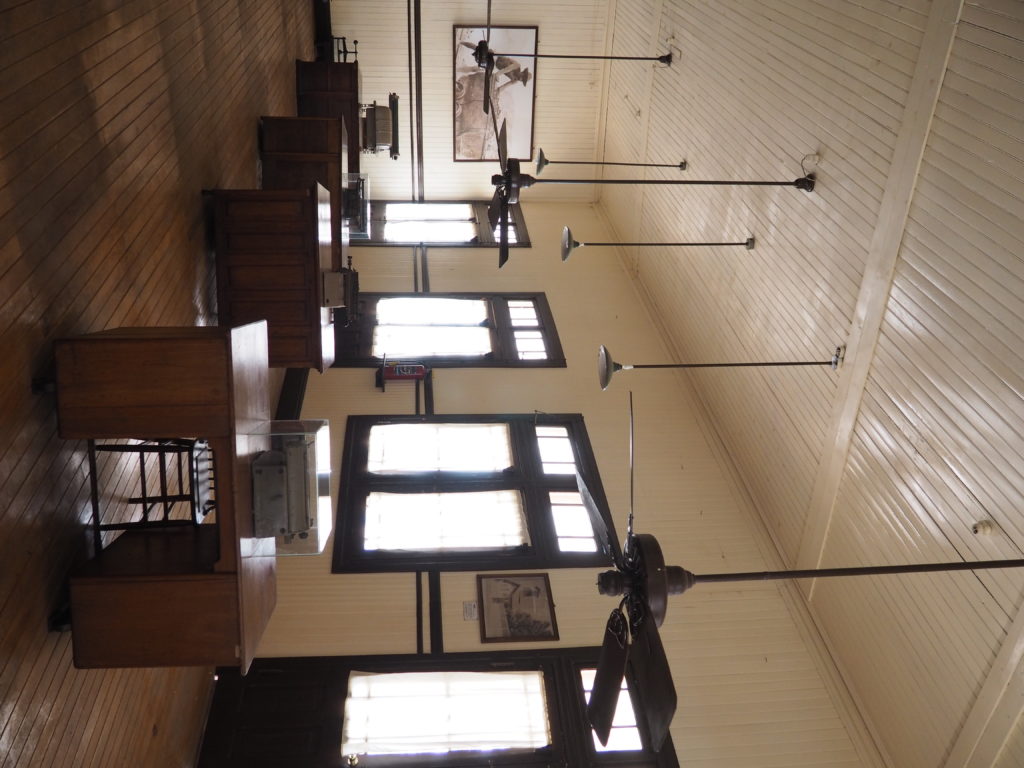
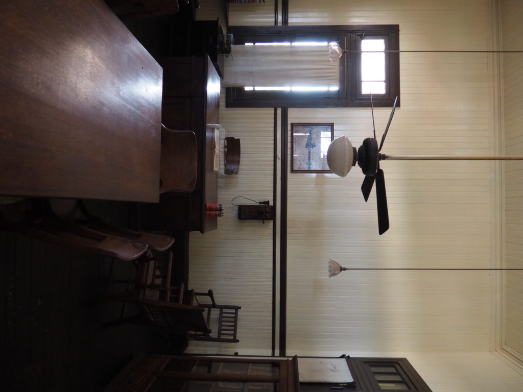
Main room for the accountants.
The Director’s office.
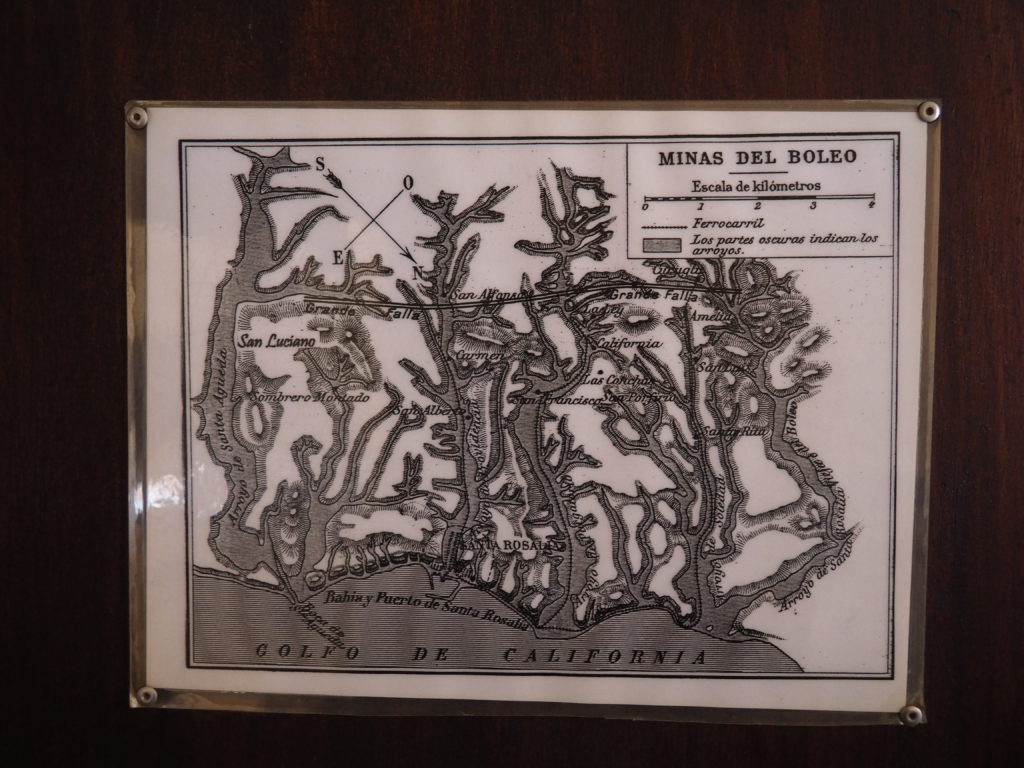
Map of the Copper Mines at Santa Rosalia.
Now that’s a big clock!
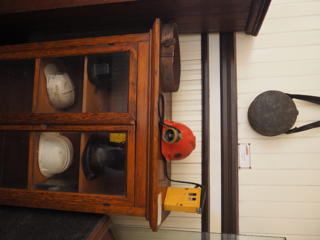
Mining gear, but N.B. the height of the wood work to understand just how big that clock is!
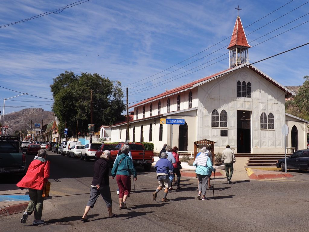
Church designed by Gustav Eiffel, Santa Rosalia.
Lacking wood to build their church, the Compagnie du Boleo bought a metal church designed by Gustav Eiffel out from under some South Africans who wanted it because of the problems where termites reign supreme.
Interior of Metal Church. Bet it gets hot!
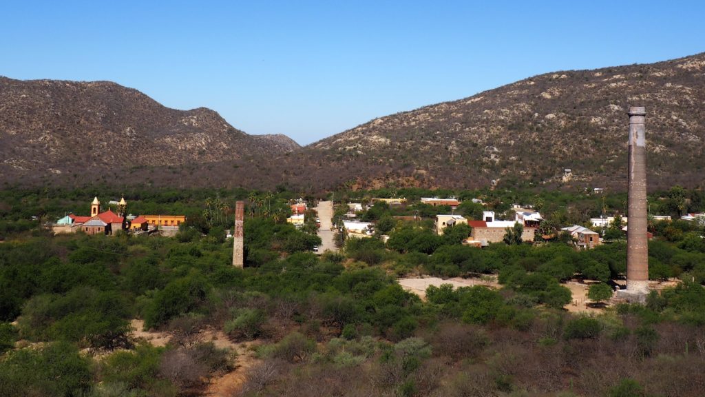
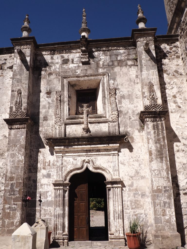
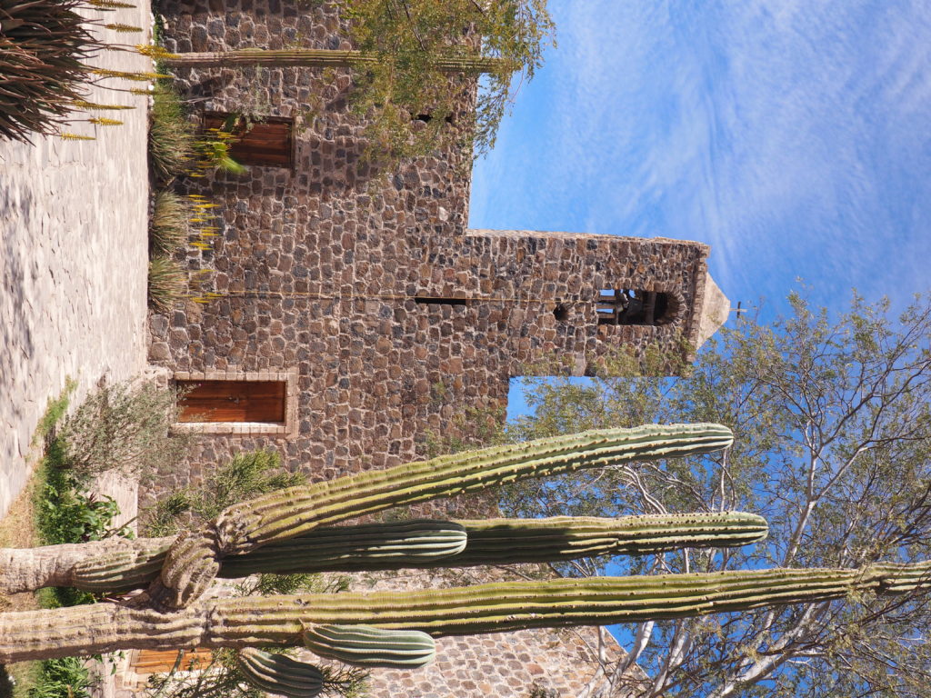
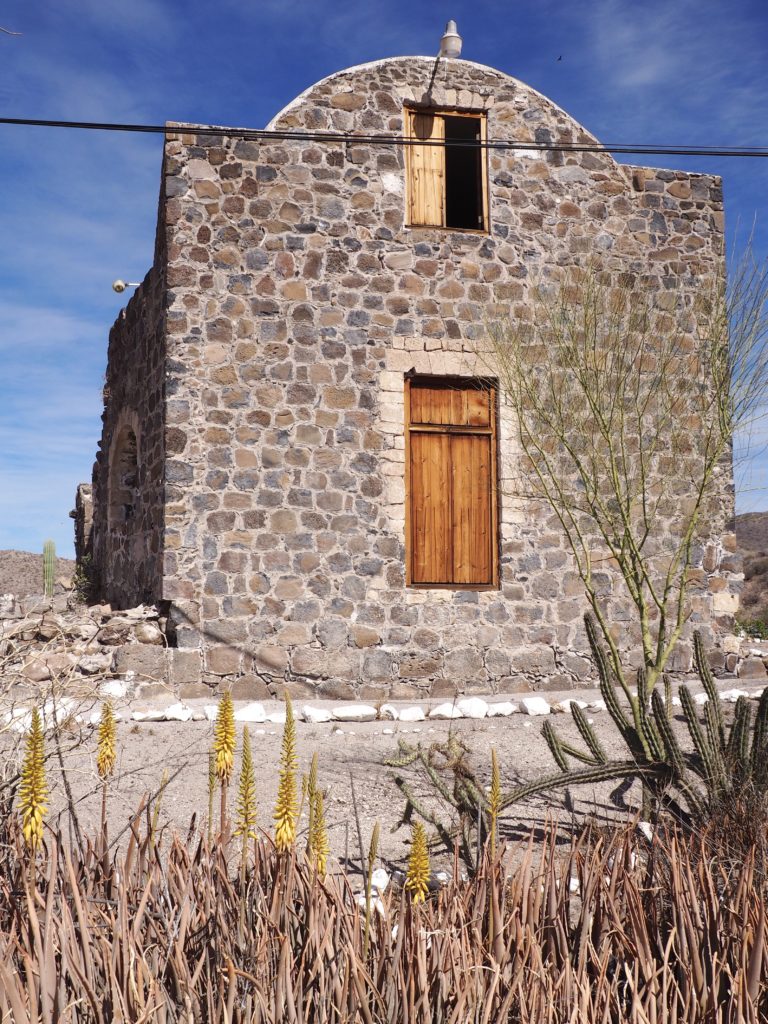
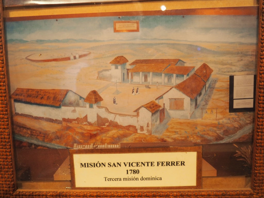
El Triunfo de la Santa Cruz
View of Town and Smelter Chimneys (“New & Improved” on right).
In the 1750s gold and silver mines were established at El Triunfo. By the 19th Century they had figured out that the fumes from the smelting operation that were killing off people, so a truly massive chimney (at the time, one of the tallest in North America) was created to try to keep them from settling on the town. By midcentury, operations had ceased and many of the bricks were carted off to La Paz for construction there.
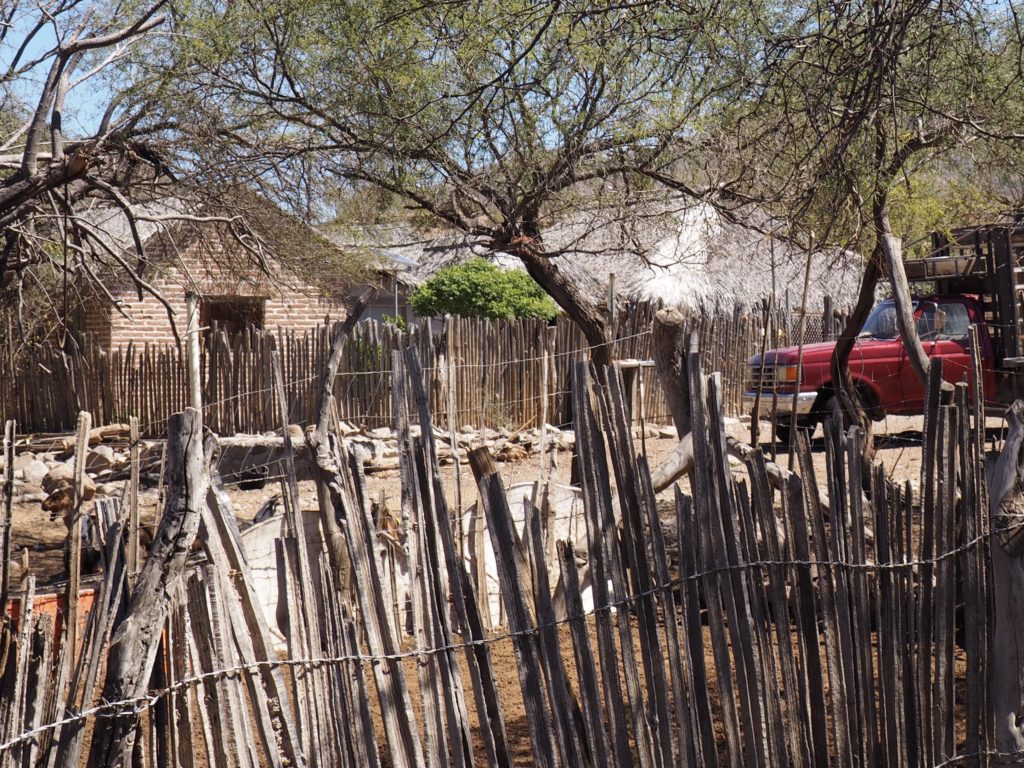
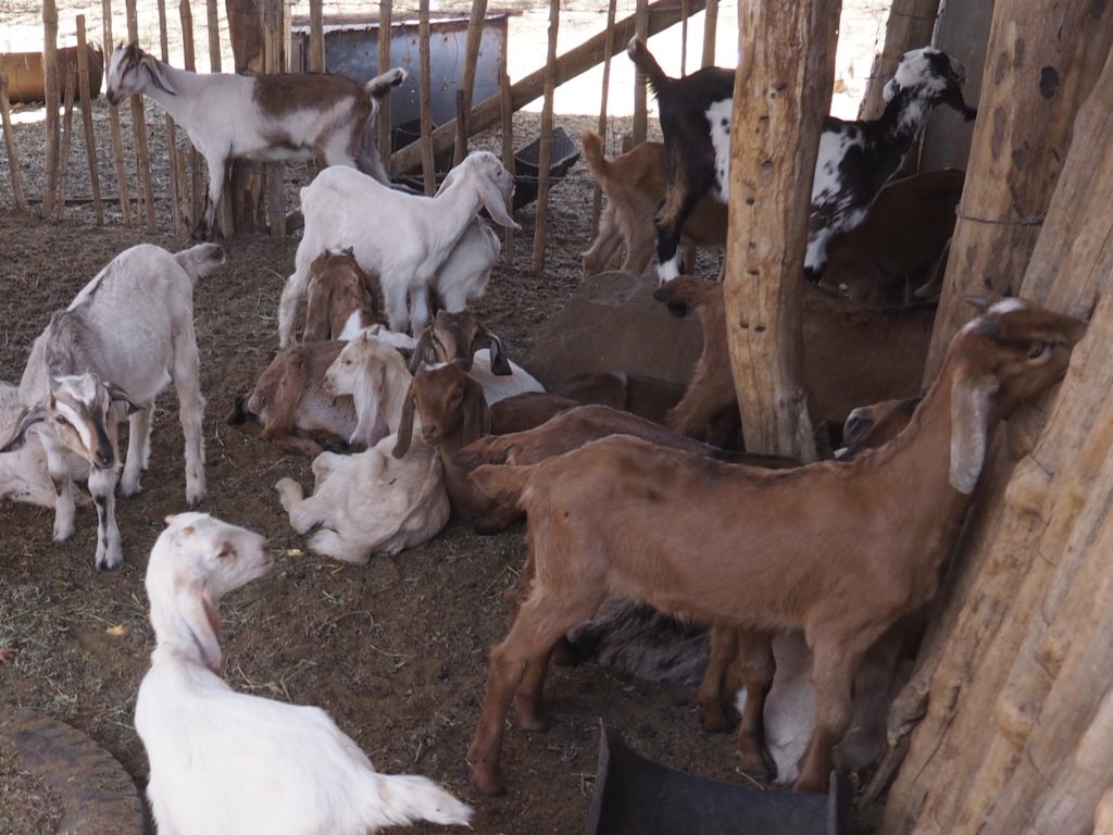
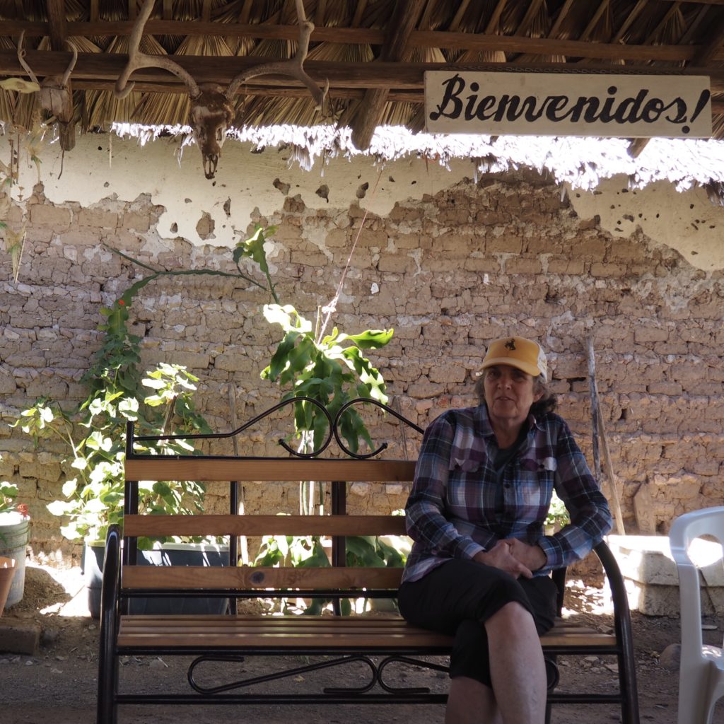
Goat Ranching up in the Hills
If there’s not gold or silver or water enough for crops, there’s always goats.
Reluctant mom with one day old kids.
Hanging out with the gang.
The owner has 40 lactating goats she milks in 1 1/2 hours. We thought that was pretty impressive. Many of the other goats are free range and her husband will go out with his dog to gather them in. They simply follow like a pack.
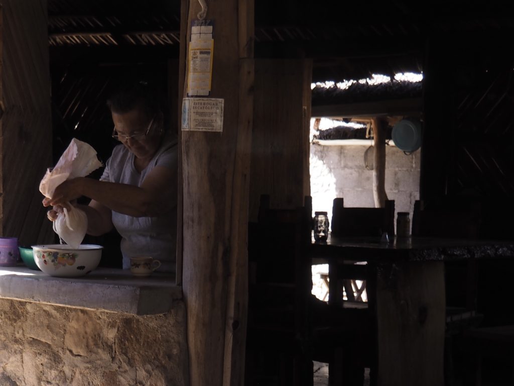
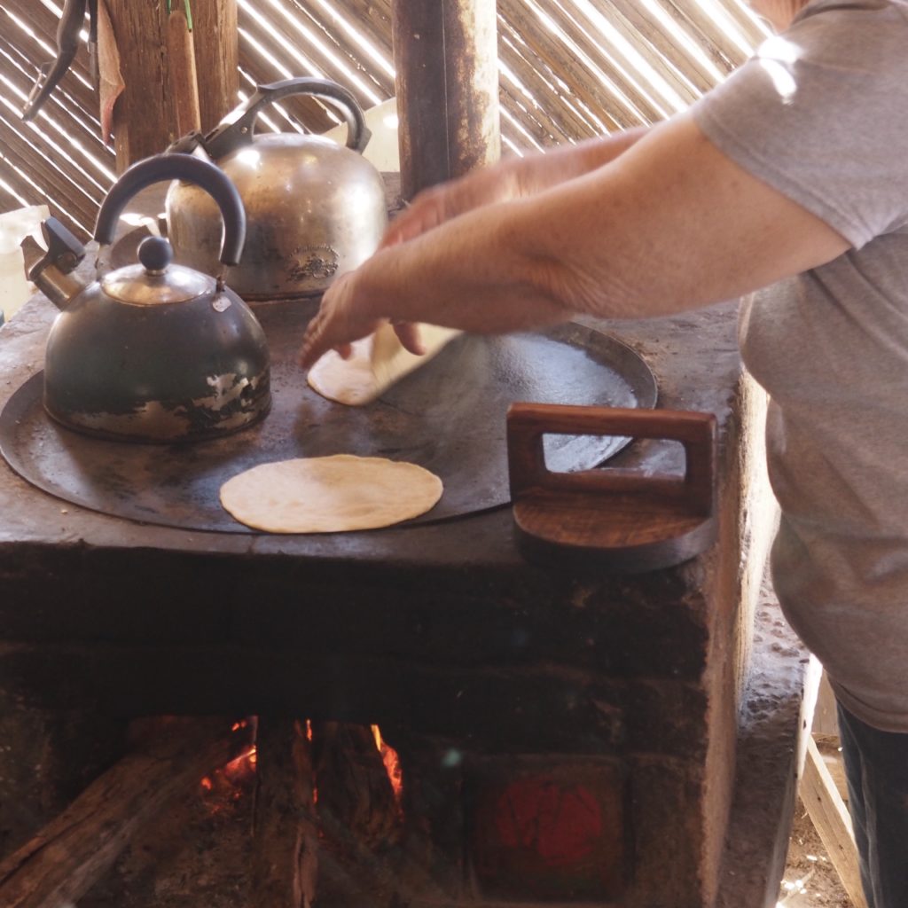
The owner demonstrating cheese making, using cow milk rennet as a starter and milk and salt as the only other ingredients. The owner also gave a tortilla making lesson.We decided to relax in the shade instead!
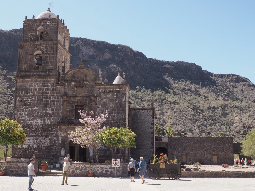
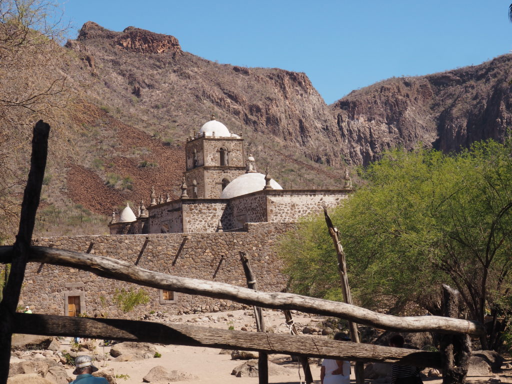
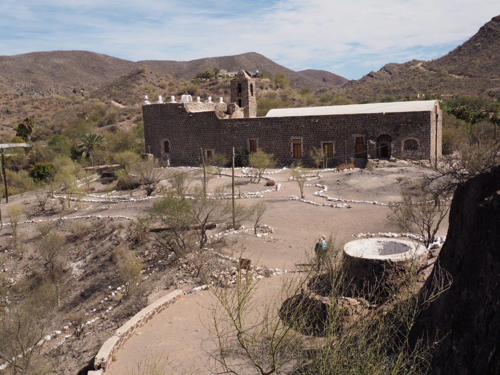
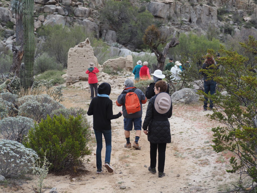
The Loreto Mission, having been built in 1697, was in complete ruins. The parish priest long dreamed of reconstructing it and promised in his prayers that if he played and won the lottery he would use the money to rebuild the Mission. Obviously, he won. He also kept his promise to God. He kept asking the authorities in Mexico City to share the Mission’s plans from the archives of Jesuit records so that it could be faithfully reconstructed. They never responded. So, he proceeded to reconstruct the Mission the best he knew how, including the common feature of a bell tower. Once construction was completed, the authorities notified the priest that the newfound source of town pride must be demolished because the original Mission did not have a bell tower. However, the indignant community worked together to overturn the demolition order.
A local shopkeeper invited us to go up on the roof of his building to get a good photograph of the Mission. Glad we took him up on it. It’s the bell tower that makes it beautiful.
San Javier Mission
San Javier Mission
In 1699 the Jesuits founded their second mission in Baja California, San Javier.
When the Jesuits arrived, the indigenous people (the Cochimies in the area of this Mission) were hunter gatherers with a Stone Age lifestyle. The Jesuits located their Missions where water was available for agriculture and started growing the crops important to them, namely figs, dates, olives, grapes, wheat, barley and pomegranate. They then recruited the native people as a labor force for both agriculture and for building the Mission itself, with the understanding that to be part of the agricultural age they must give up their traditional lifestyle and become part of the Mission community.
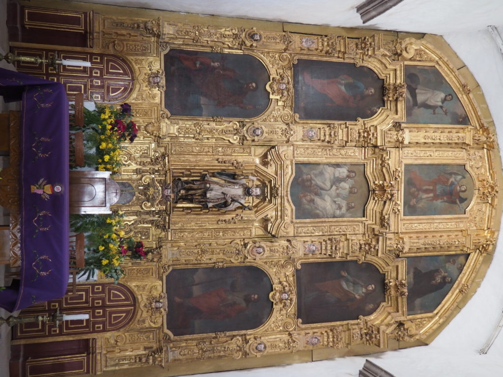
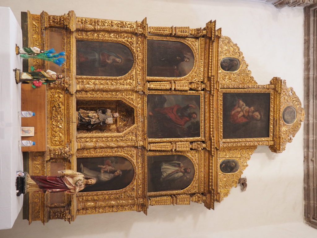
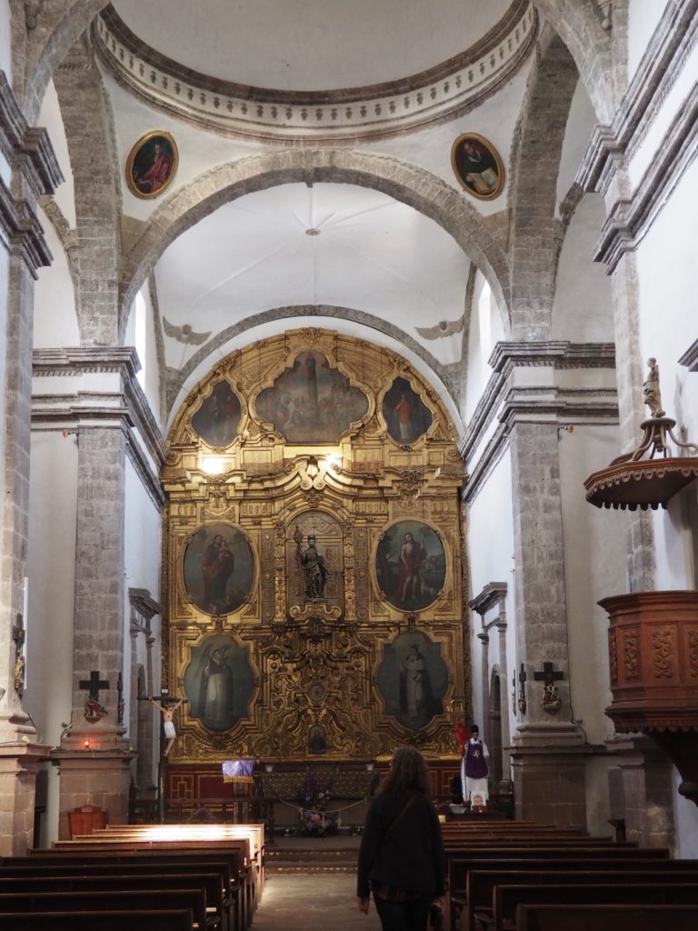
Alter piece, San Javier Mission
These alter pieces from Spain are 300+ years old, according to a friendly man from town.
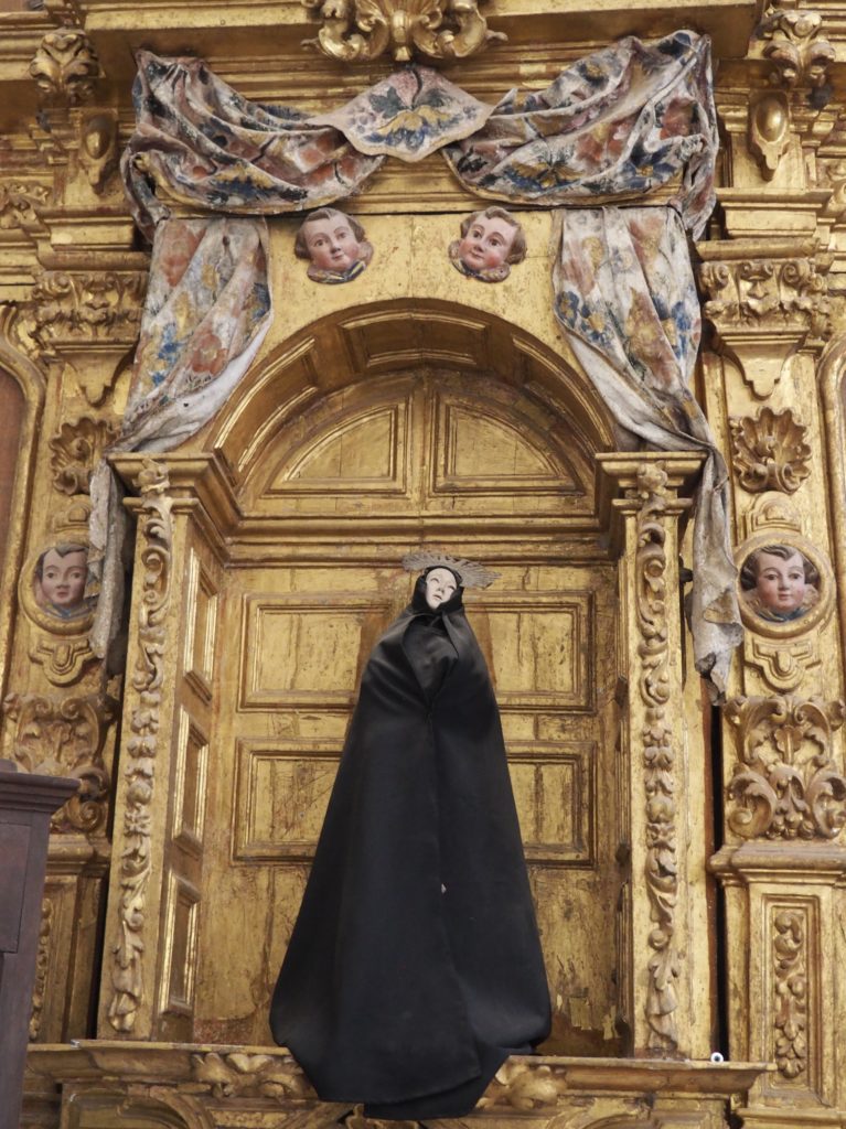
Saint Maria Delores
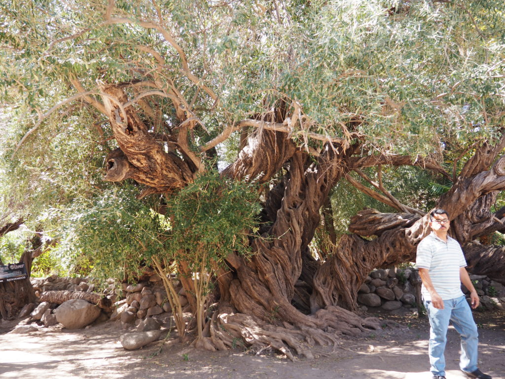
Olive Tree, 300+ years old. Driver, much younger, seems to like R&B.
This very old olive tree survives from what had been the Jesuit’s orchard. People from the community use the grounds to grow a number of crops and take advantage of the water reservoir that’s been long established.
Santa Rosalia de Mulegé Mission
Founded in 1705, construction began in 1766. The native population dropped precipitously during the mission years, from 40 to 50,000 people on the peninsula to 2,000 due to European infectious diseases.
View of Santa Rosalia de Mulegé
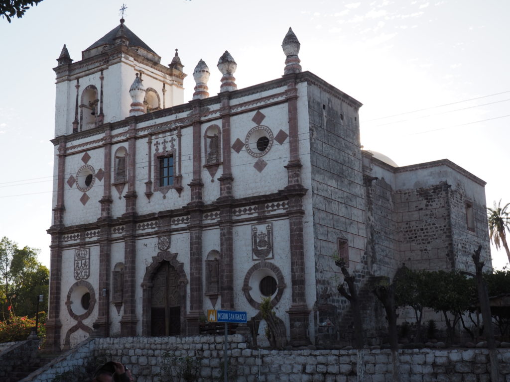
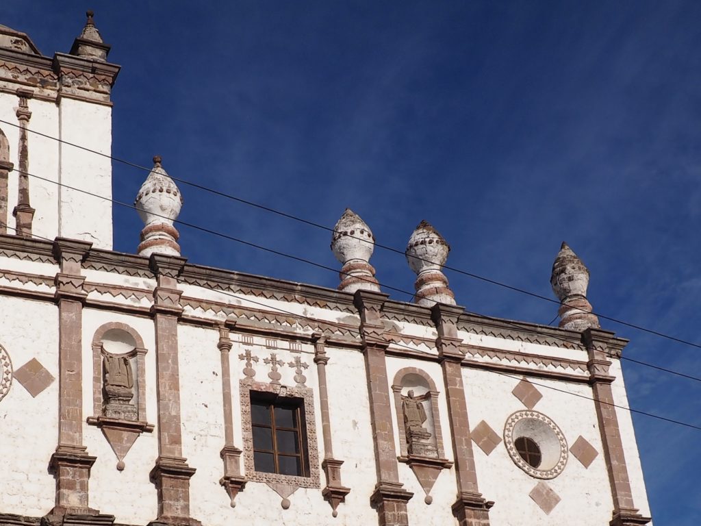
San Ignacio Mission
San Ignacio Mission
Once again, the Jesuits founded (in 1728) a Mission in a favorable location at an oasis in this largely desert peninsula where the native inhabitants were close at hand to be proselytized and recruited to the work of the Mission. In addition to being quite well preserved, a distinction of San Ignacio is that it bears the traces not only of Jesuit architecture, but of the successor religious orders which took on the Missions after the Jesuits were evicted by the Spanish government around 1768 (accused of accumulating wealth and power, not without basis).
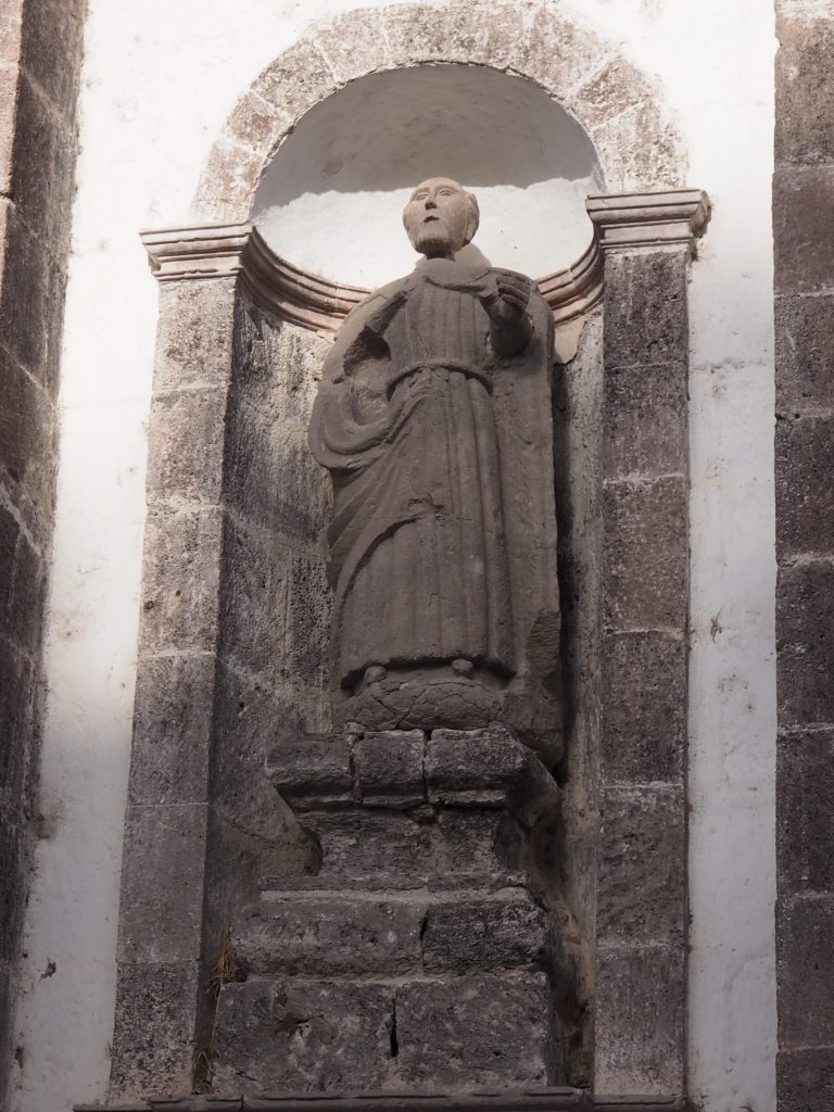
Exterior Statuary of Franciscan Monk, San Ignacio Mission
When the Franciscan Order took over the Jesuit Missions of Baja California, they added their own touches such as this statuary representation of a Franciscan wearing the rough garment and cord around the waist adopted by St. Francis when he took his vow of poverty. Of course, poverty does not preclude vanity.
The Dominican Order took over this particular Mission after the Franciscans lost interest and added the distinctively shaped structures on the roof line (or so we were told). However, the Dominicans were not new to Baja, having arrived in 1722. The Missionary Era ended in 1843.
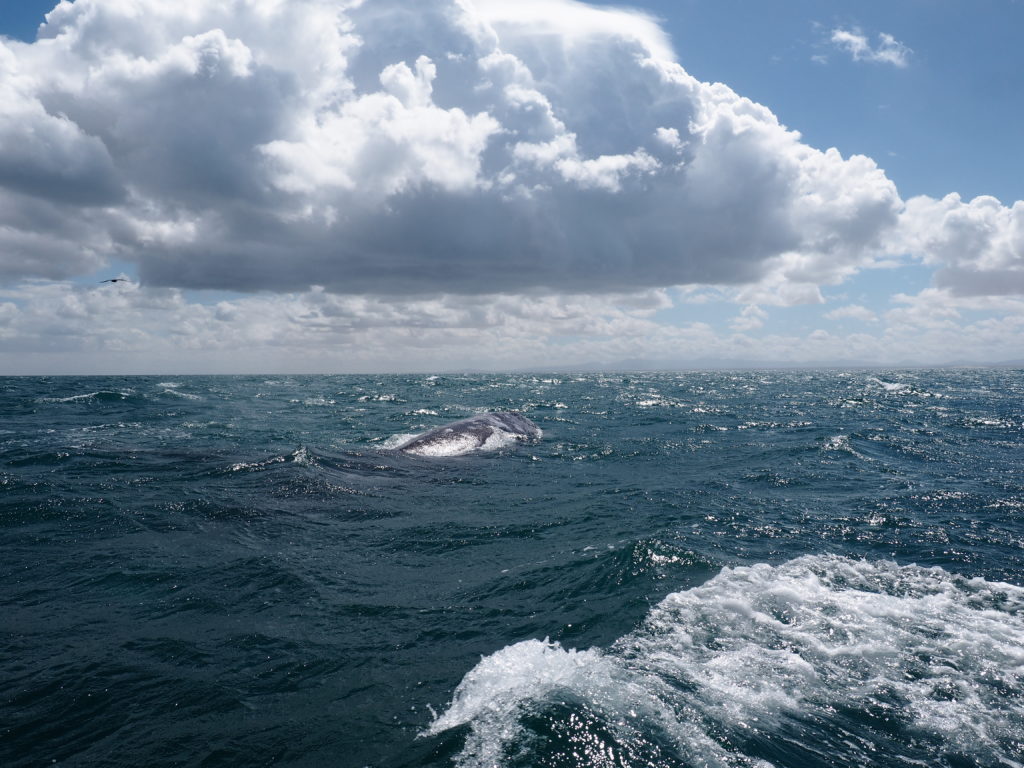
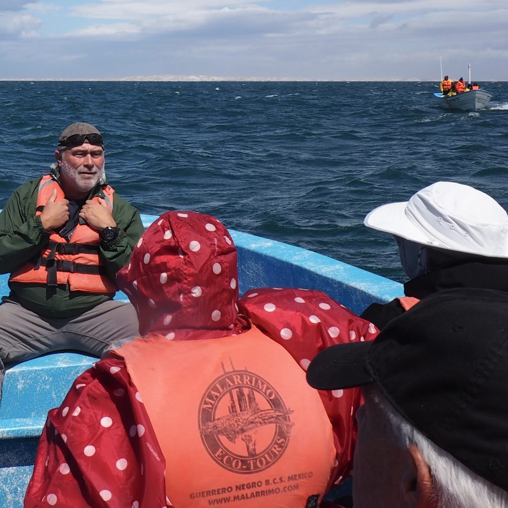
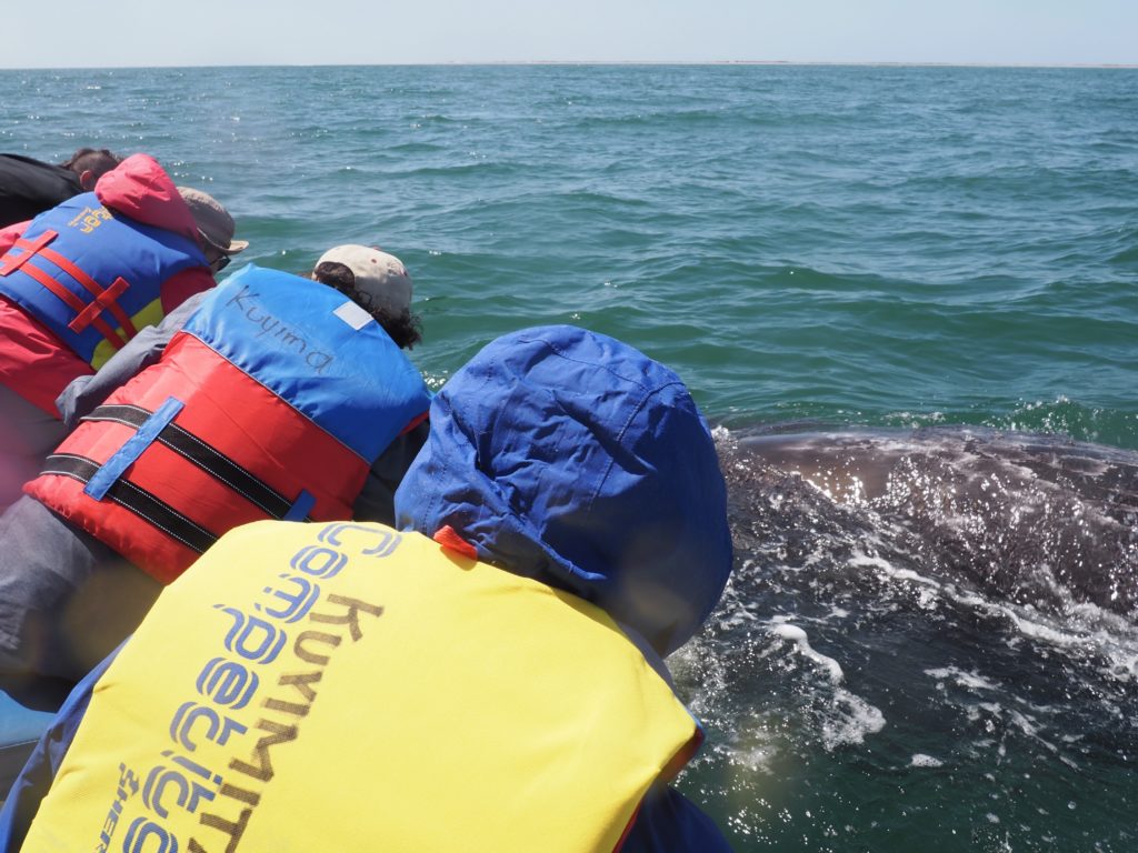
One of the most unusual ecotourist attractions of the Baja Peninsula is the opportunity to encounter Gray Whales, up close and in small boats.
Splashing water to attract a whale.
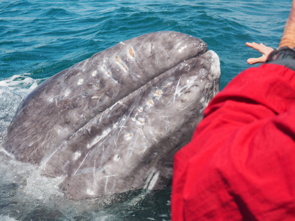
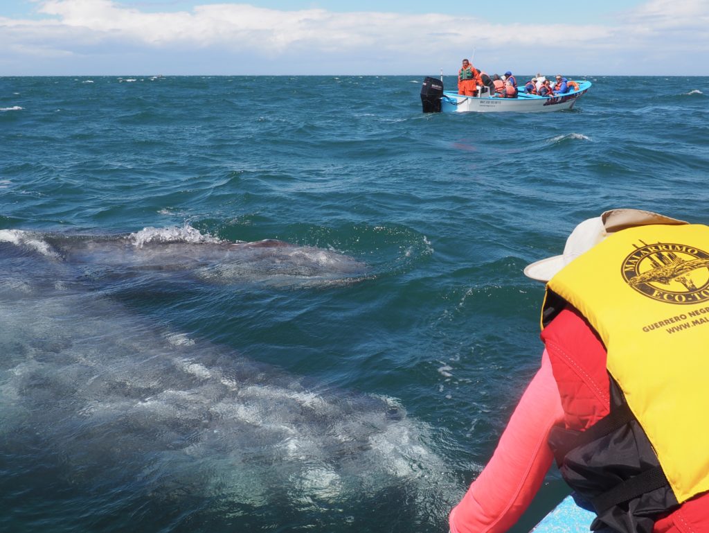
Gray Whales are bottom feeding baleen whales sometimes referred to as “mud suckers” because they take in a great mouthful of bottom mud and express the water with their enormous tongues through the baleen. An adult is roughly 45’ long and 35 tons, living up to at least 70 years. They feed in the Arctic, but breed in the lagoons of Baja California and spend most of their lives migrating back and forth. The population along the western coast of North America is stable and healthy at about 27,000 individuals, although they are extinct in the Atlantic.
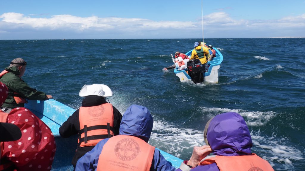
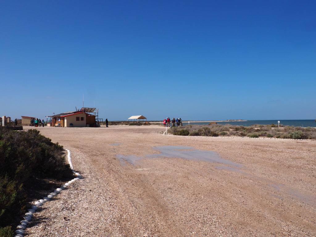
The first day out was in the lagoon of Guerrero Negro on a very blustery day. It had been a somewhat rough van ride out on dirt roads and then one of those thud-thud-thud rides out to the area of the lagoon in which whale encounters are permitted under tightly controlled conditions. An association is run by the outfitters to facilitate this small tourist industry consistent with protecting the whales.
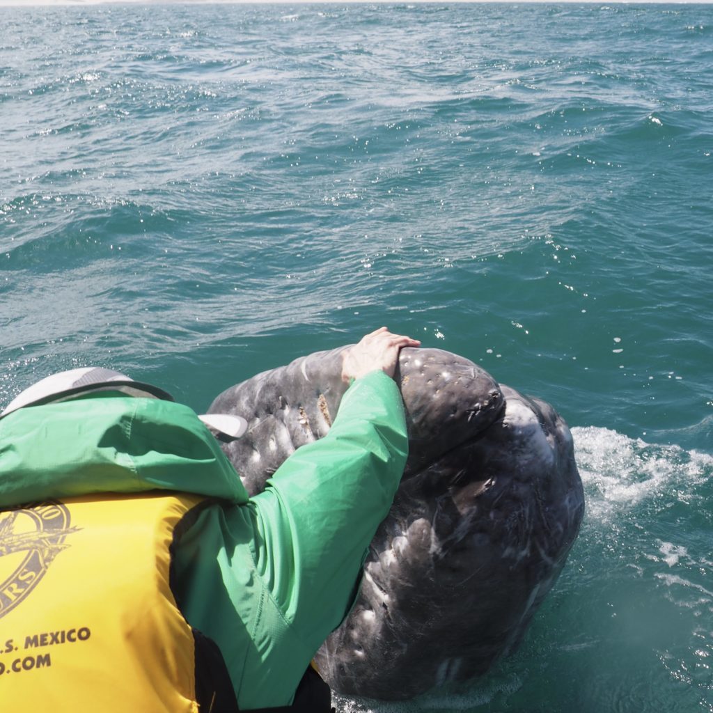
Amanda greeting a Gray Whale
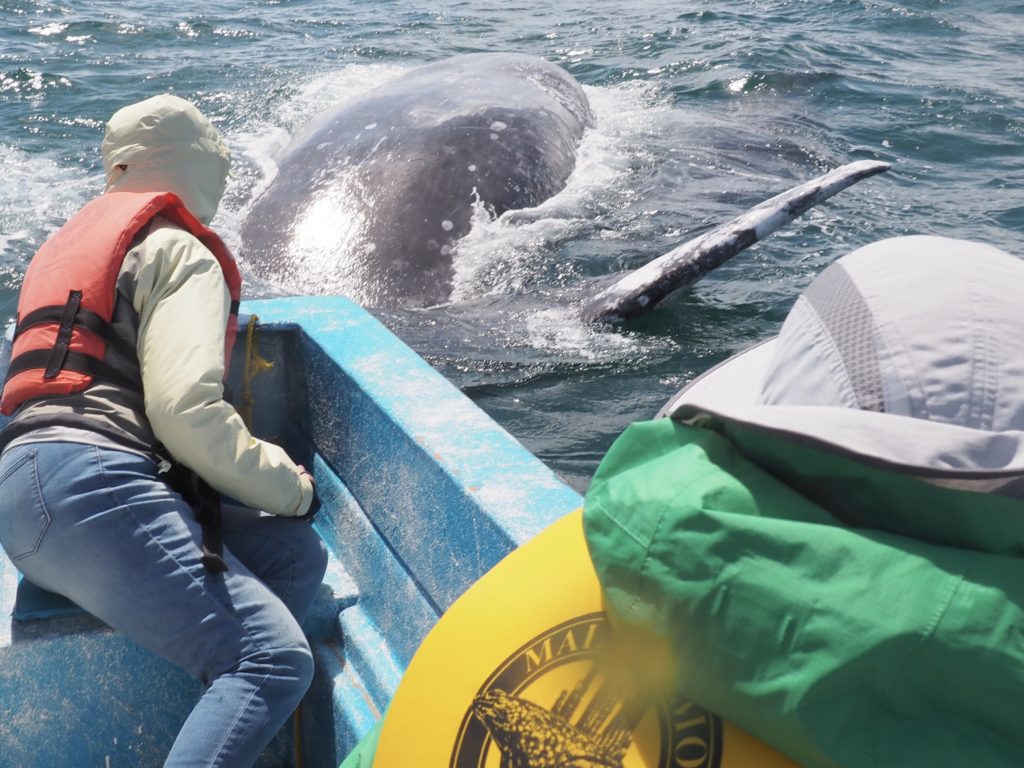
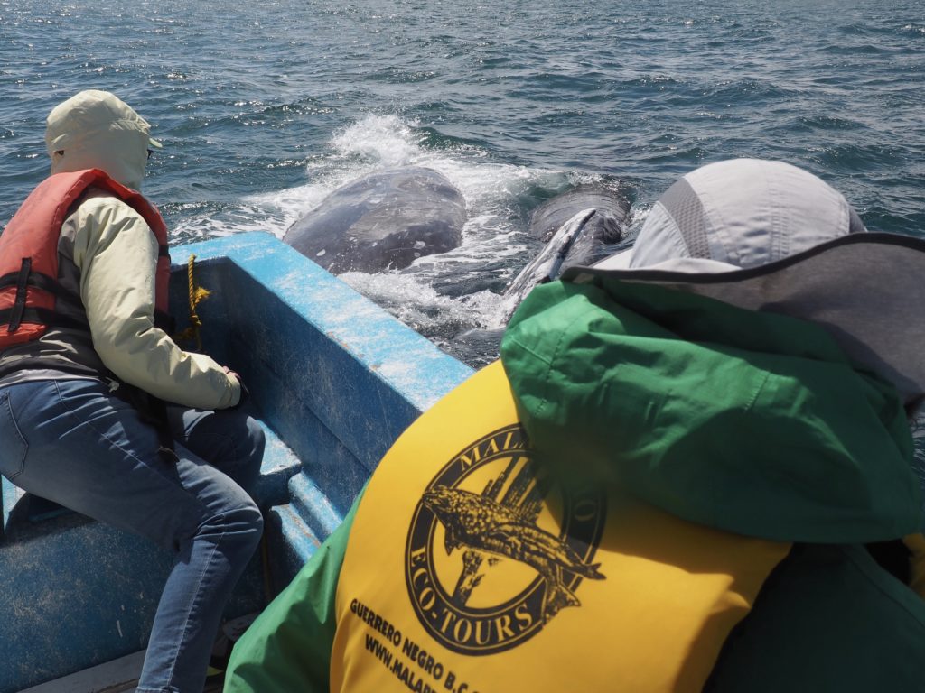
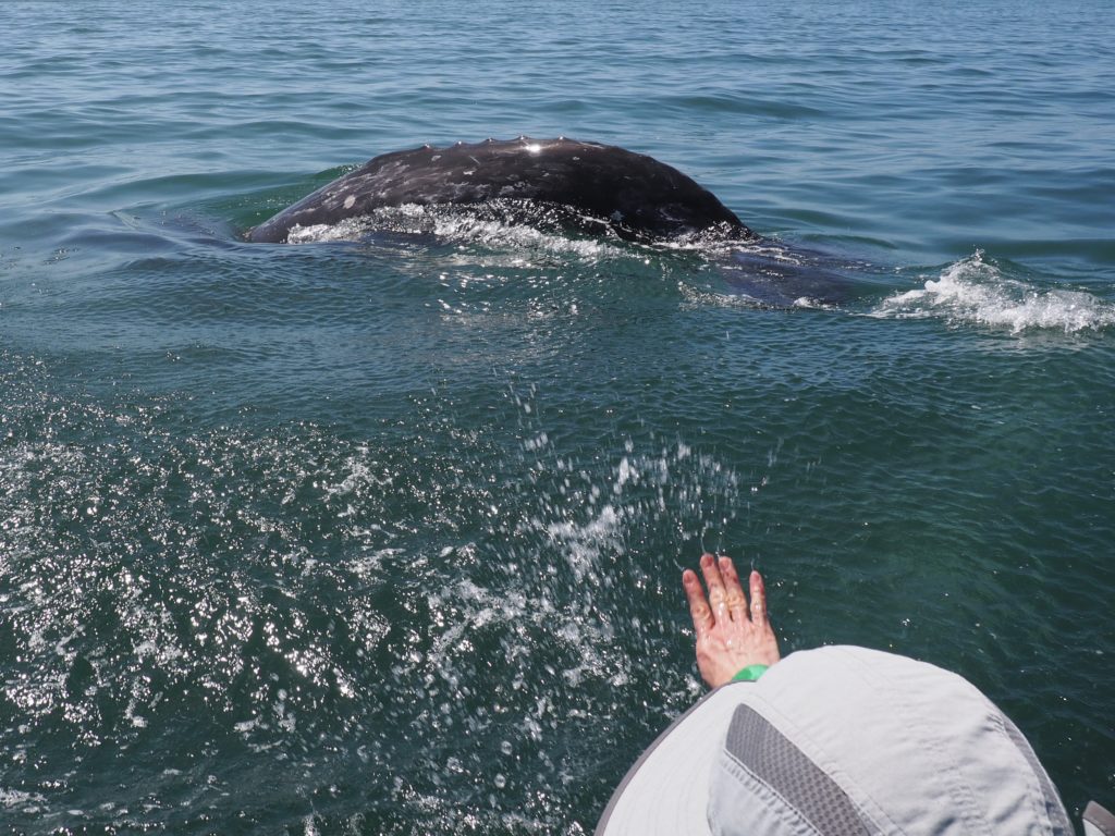
The big payoff for us was when Amanda got to “say hello” to one of the whales. We, of course, attributed it to our wonderful job of singing and whistling and splashing water to encourage the whales to come to the boat. This curious “friendly behavior” (by the whales) was accidentally discovered some years ago by a terrified fisherman. Before that, people referred to the whales as “devil fish” because of the many lives lost in whaling days when the whales resorted to self defense. Given the extreme ages to which some whales are known to live, we were hoping that we wouldn’t encounter a methuselah with a long memory.
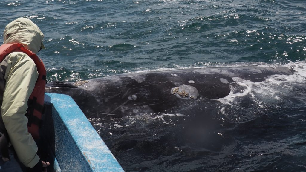
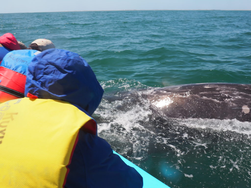
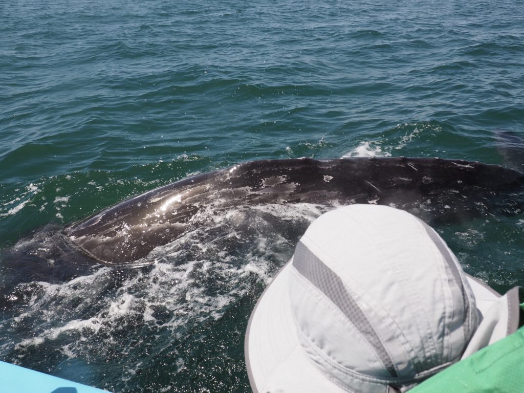
Gray Whale coming in close.
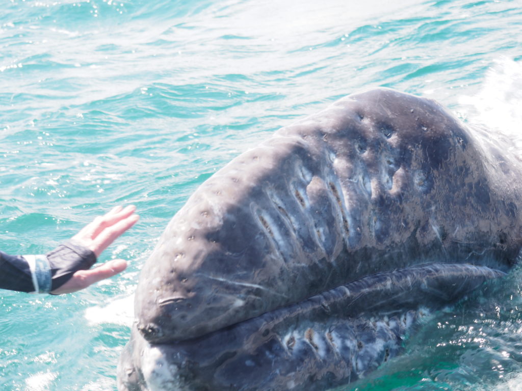
The whales will scrape their backs against the sea floor apparently in an attempt to dislodge barnacles and sea lice. We’ve now learned that they appreciate a good scratching on their skin, something only humans can help with.
A mother and calf approach the boat.
Lagoon of San Ignacio
The next day was a gorgeous one with very little wind, making for a smoother time on the water. San Ignacio Lagoon is considerably smaller than Guerrero Negro and is where the history of whale encounters began.
Amanda & Whale
Try as we might, we only got close to the whales and didn’t establish contact on our second day out. But, we did come home with some exceptional memories of some extraordinary fellow creatures.
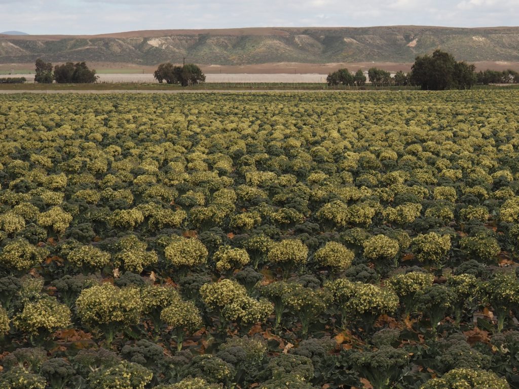
We hadn’t appreciated just how much food is grown in Baja California. We passed vast fields of produce wedged among the ever present mountains. Speculation about why this field (above) was allowed to go to seed ranged from it being a field meant to produce seed to wondering if a contract for the crop had somehow fallen through. The truly surprising thing, however, was that the white in the background of the photo isn’t a body of water. It’s crops being grown under cover. Again, mile after mile we passed extensive fields of white, of white tents overstuffed with growing plants.
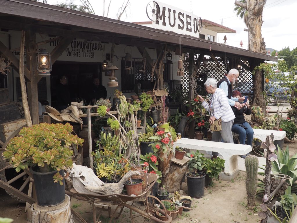
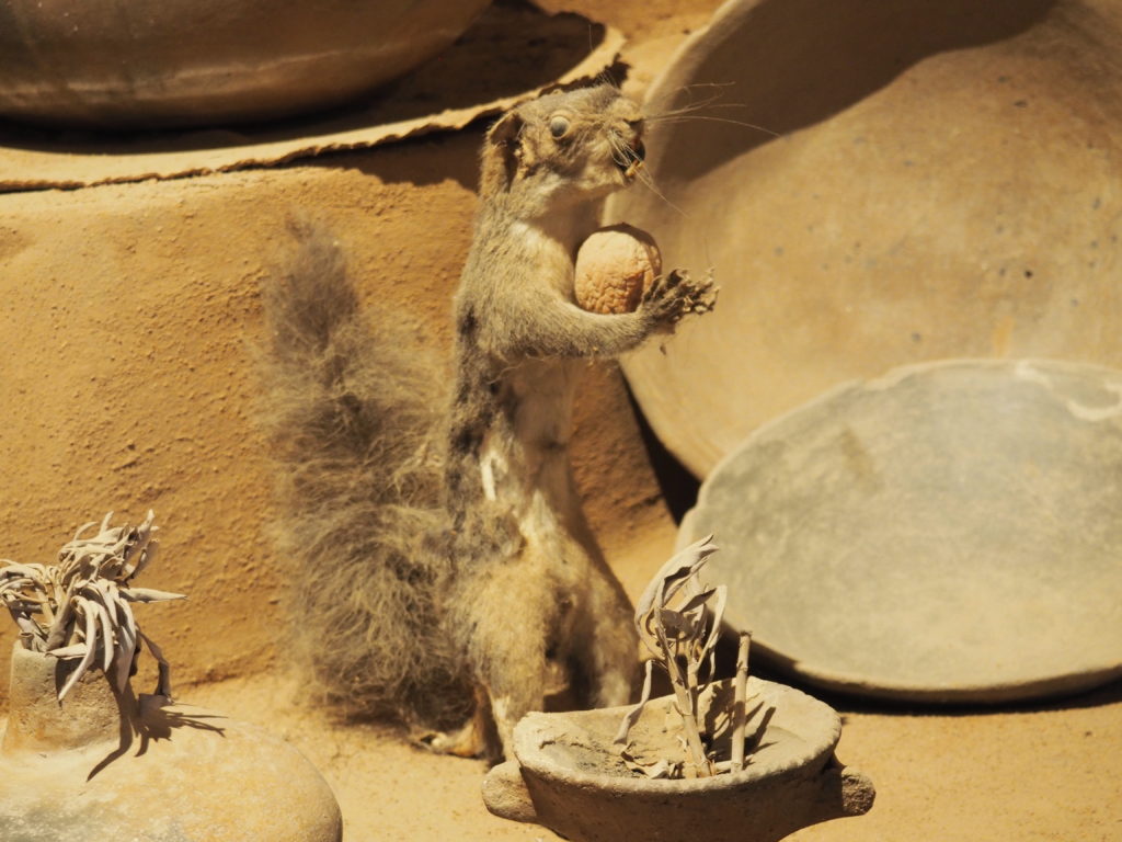
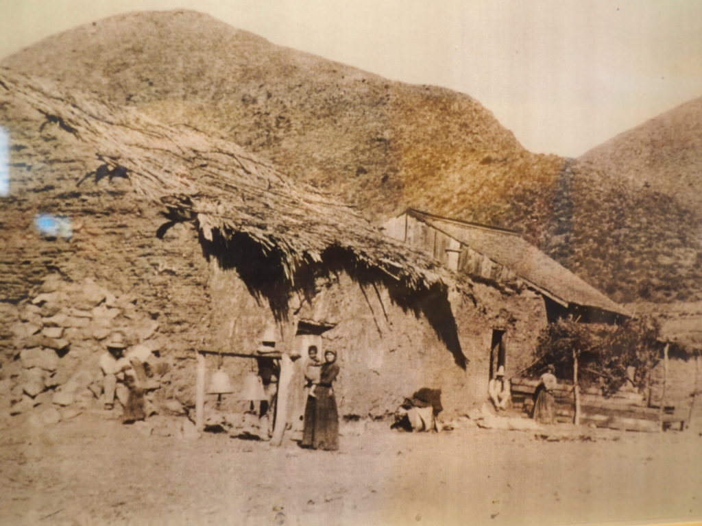
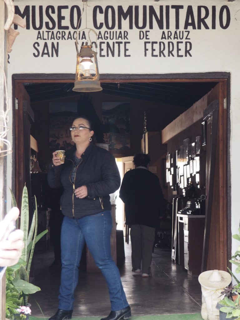
Community Museum, San Vicente
The farming community of San Vicente has a little museum. Many community members contributed the artifacts that said something about the lives of their families. The history of the iron pieced together from what was left from everyone’s grandmothers and great grandmothers reminded Jim of the row of irons left behind by his grandmother in her summer kitchen, including the ones that fit into the surface of the wood burning stove.
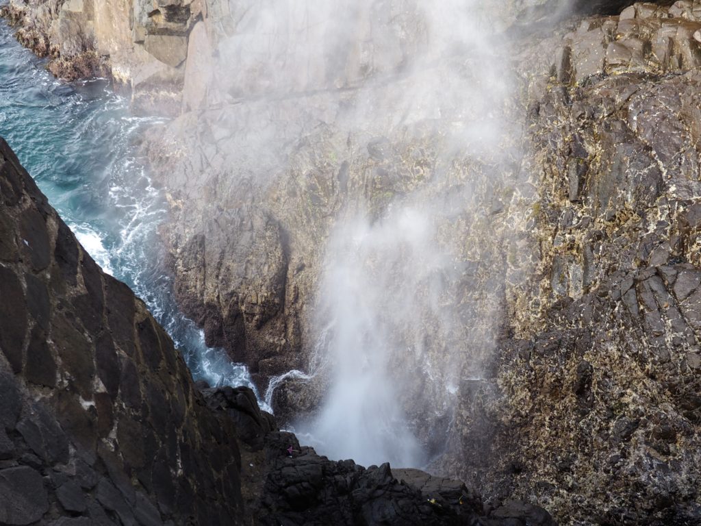
La Bufadora
Being a surfer, Hiroki was very helpful in letting us know when the next series of big waves would rush the shore and push water deep into the rocks and up and out in a big water spout. It’s one of the largest marine geysers in North America. Vendors line the road to the sea spout like the way to a religious shrine, selling all sorts of food and souvenirs.
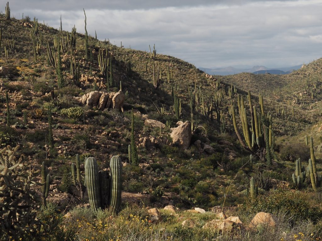
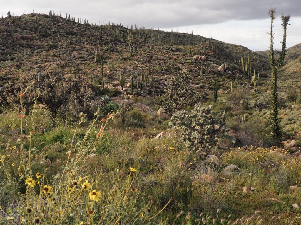
The Sonoran (?) Desert
It seems odd to call it the Sonoran Desert when half of the desert lies in the states of the Baja Peninsula, but it has no other name except “the desert.”
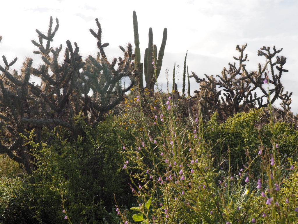
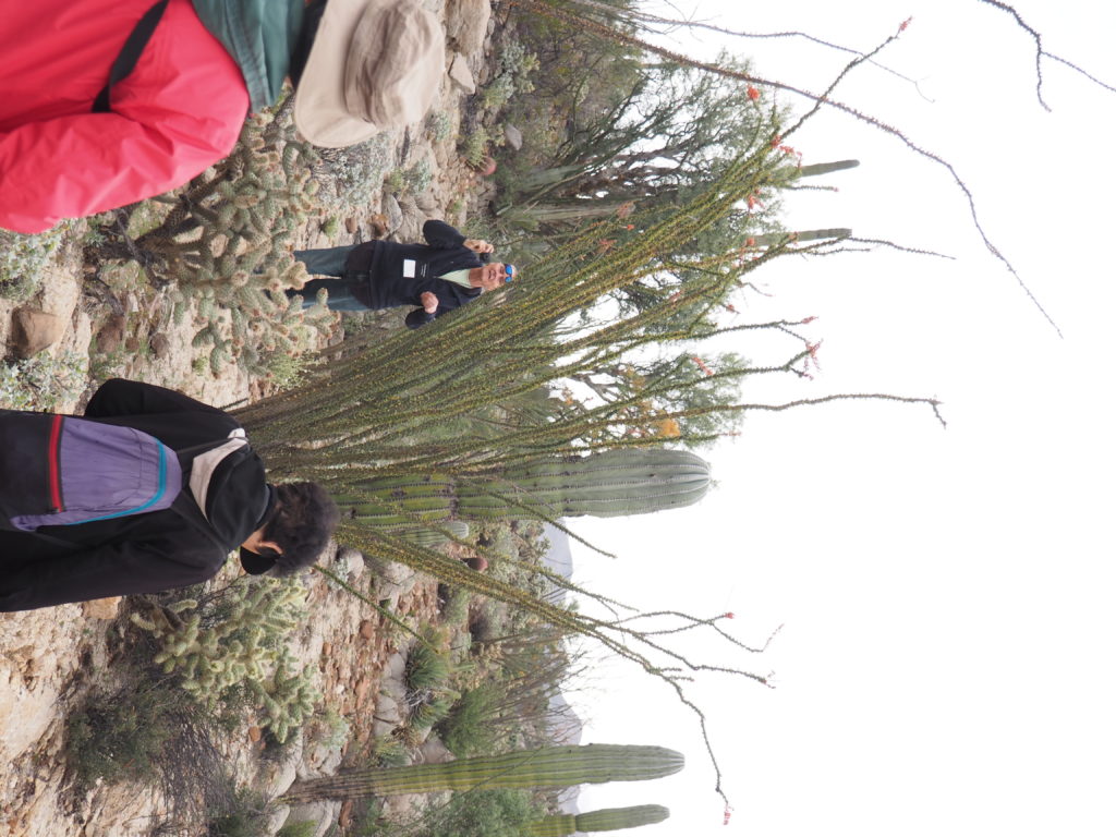
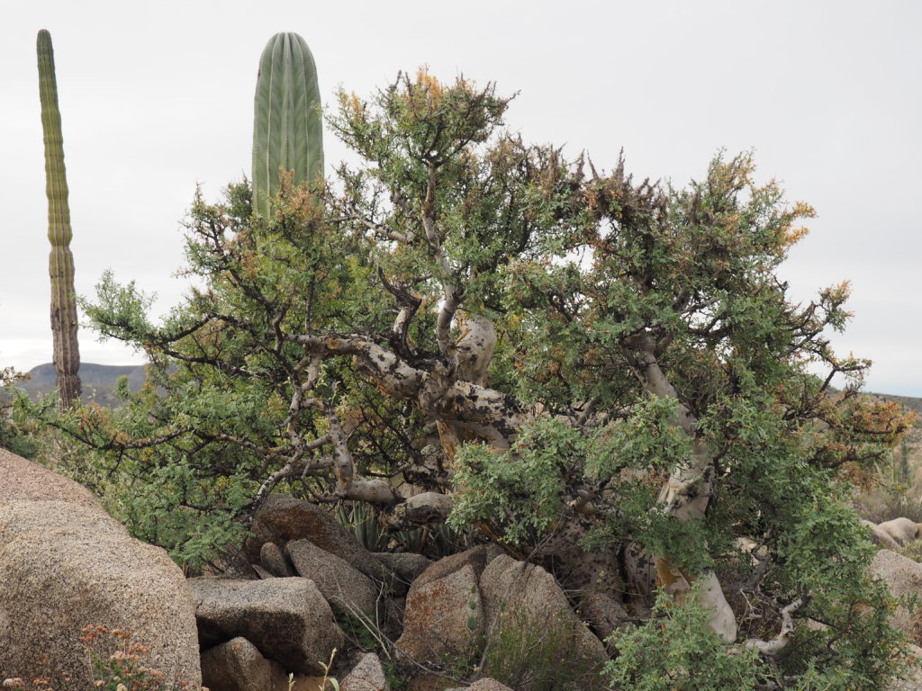
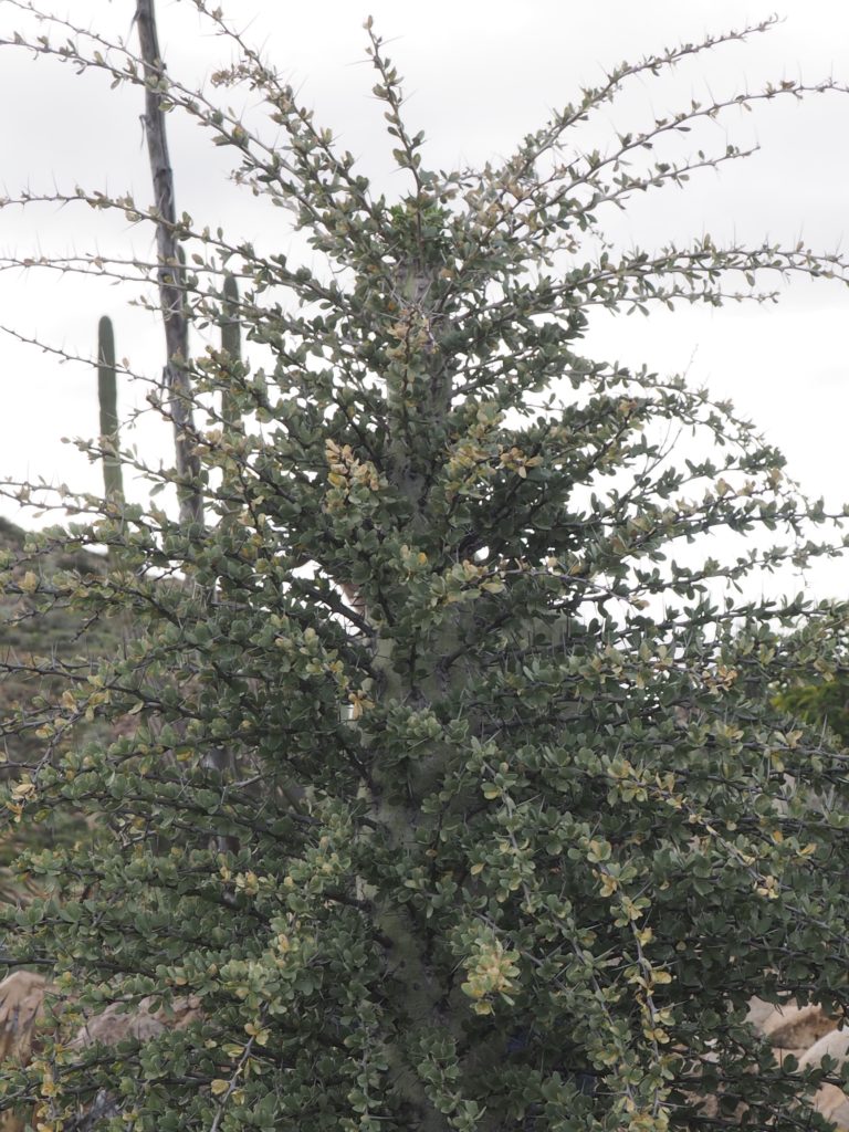
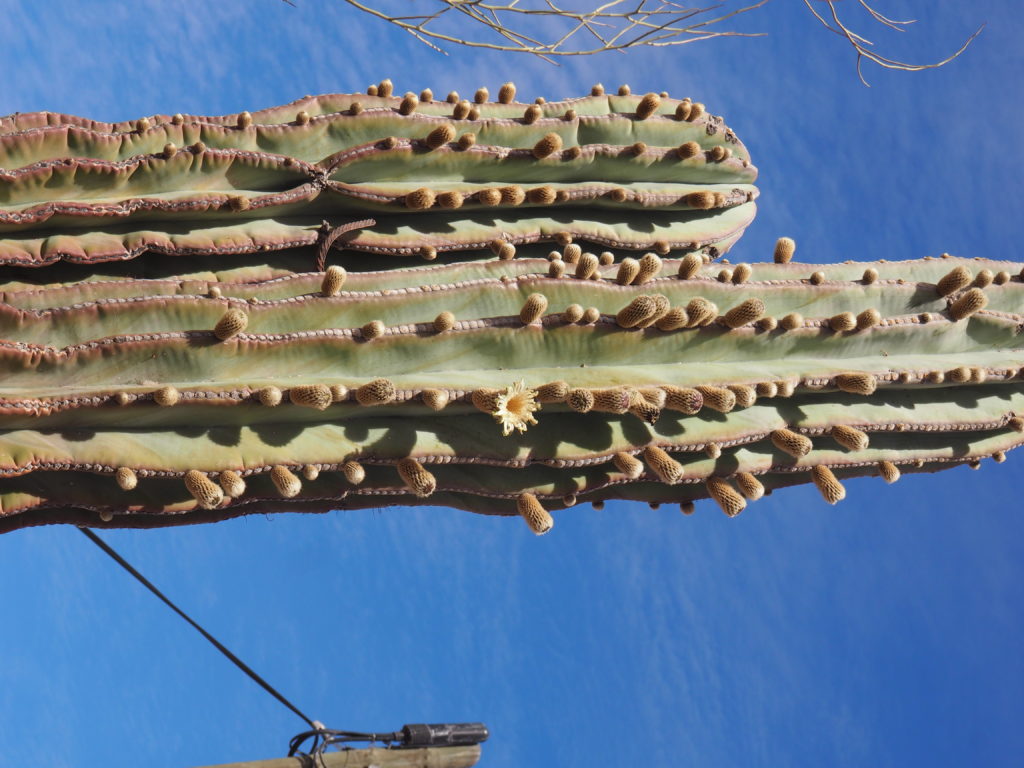
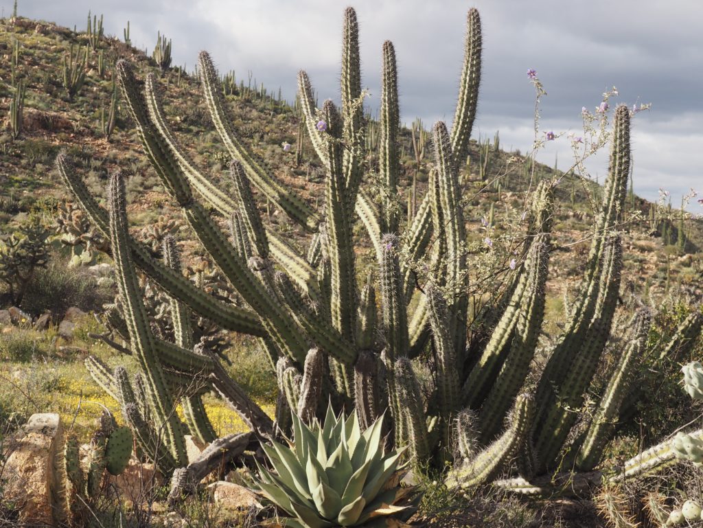
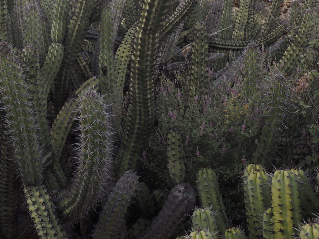
The desert in Baja is, we’re told, the most biodiverse in the world. This is not difficult to believe. The variety of plant life is startling. Each time we entered the desert we would see communities of plants of every description, many of them exotic even for desert plants. From the Elephant Tree, the Cardón, and Boojum Tree (Cirio) to the Ocotillo, there are plants found nowhere else.
The Boojum Tree (above, far right) has a double literary inheritance. An American naturalist was camping in the desert with his son who had been reading Lewis Carroll’s “The Hunting of the Snark,” a tale of people hunting a Snark (which may turn out to be a highly dangerous Boojum). The fantastical and creepily sinister look of the Cirio plant apparently caused the son to keep referring to the plants as Boojum, a name that stuck. And, of course, anyone who sees a Boojum Tree thinks of Dr. Seuss. It’s that simple. What’s not simple is tracking down any confirmation of the story we heard that Dr. Seuss, in fact, was a visitor to the peninsula and that the trees were an inspiration for some of his illustrations. If it’s not true, that would be sad, don’t you think?
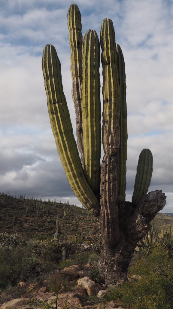
The massive Cardón is similar to a Saguaro, only the branching starts low to the ground.
OcotilloElephant Tree
A Young Boojum
Ocotillo Flower
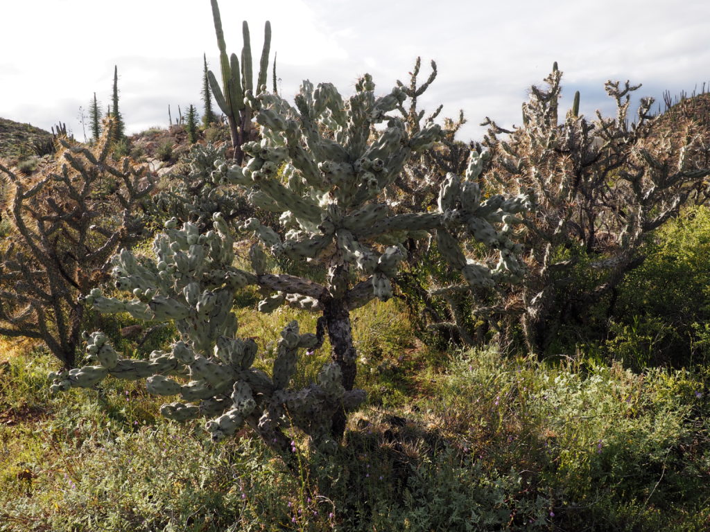
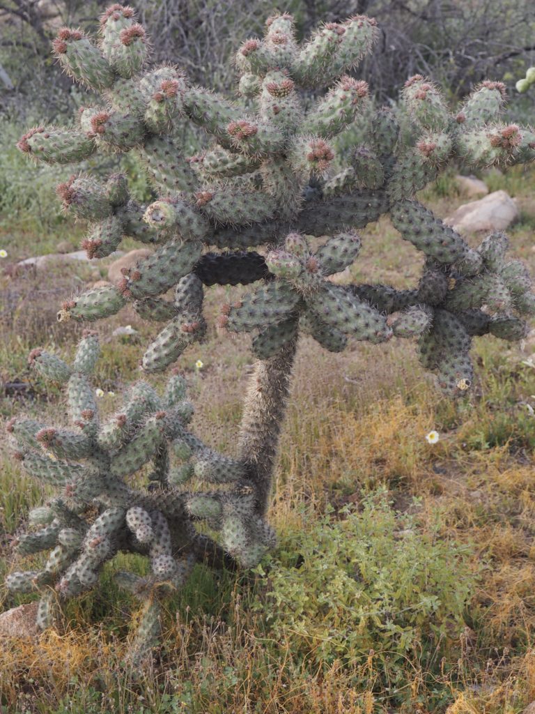
Cholla
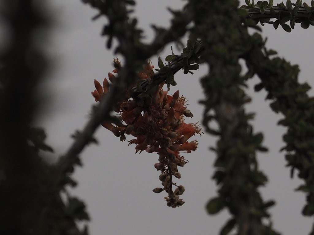
Cardón Buds & Blossoms
The Cholla is one of the more dangerous plants in the desert, as it seems to attack passersby without provocation. Not only will the slightest touch will embed a barbed thorn, but the plant seems to spread by the segments that break off very easily and start more little devils growing in a path.
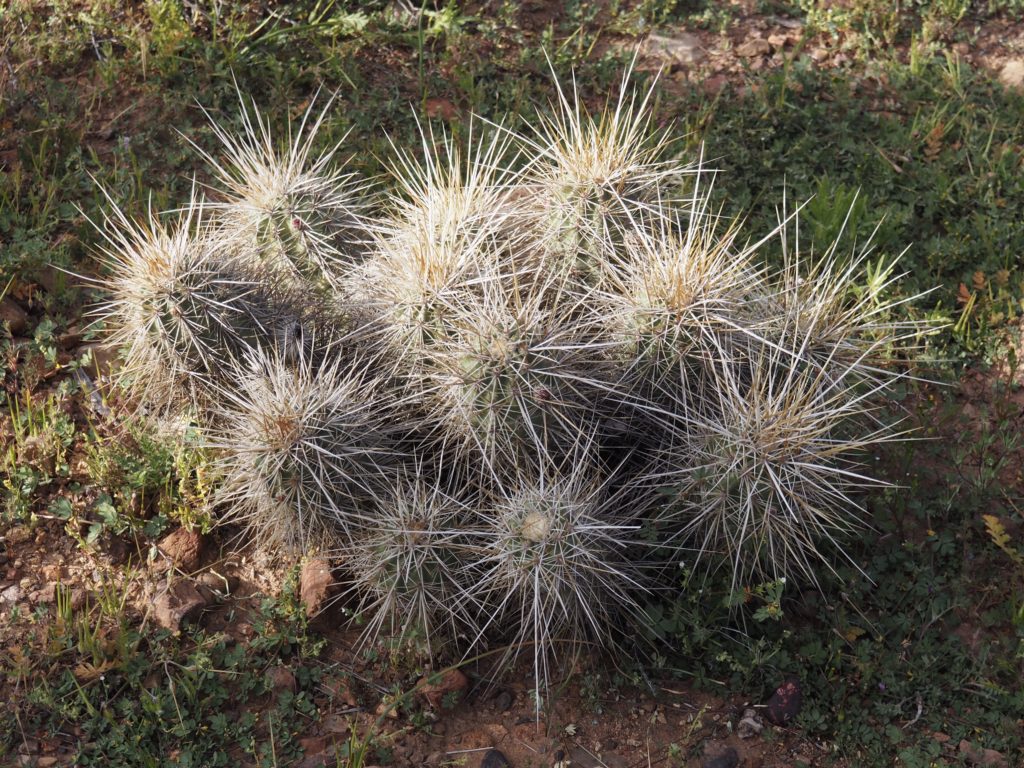
Red Barrel Cactus
Nightshade
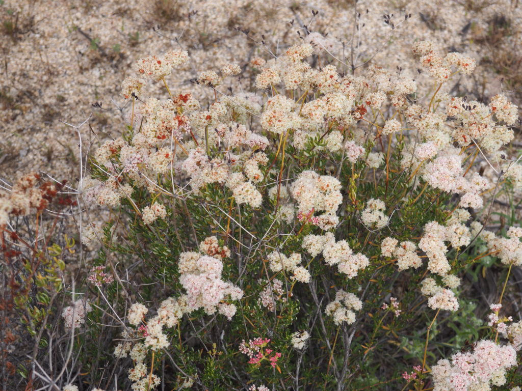
Buckwheat
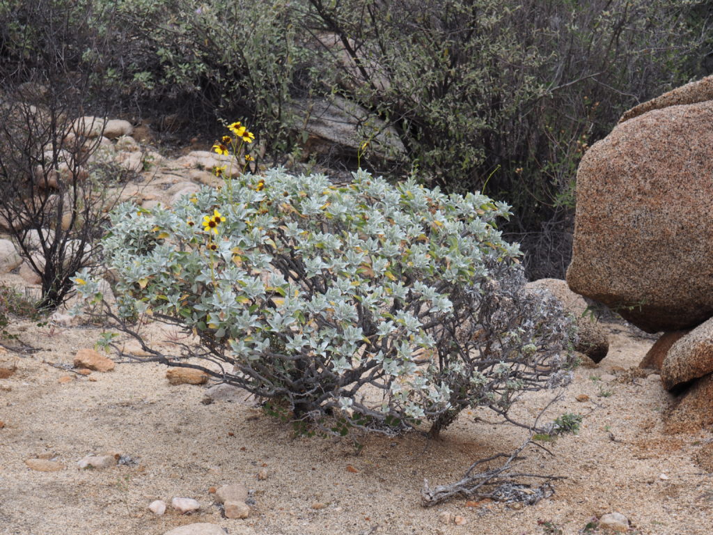
Brittlebush
Blue Fan Palm (in dried river beds)Local students joined us for a couple of walks in the desert.
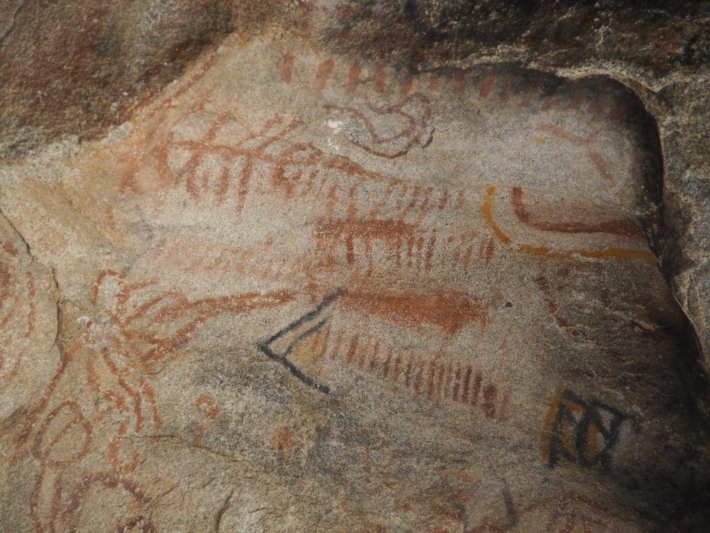
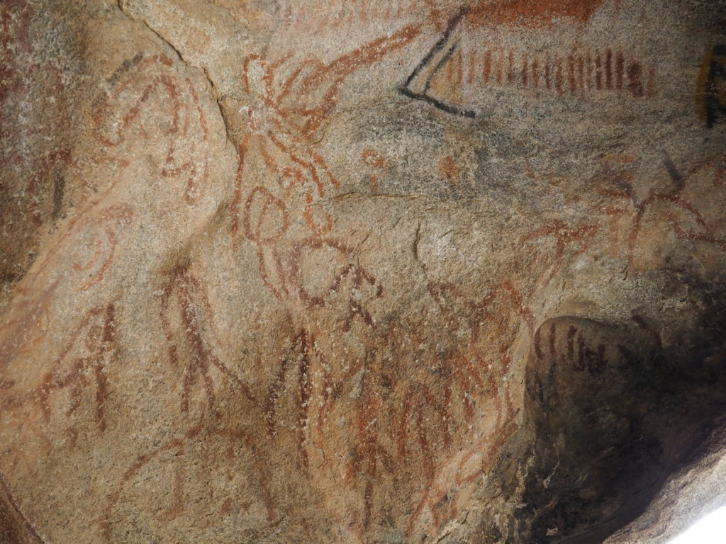
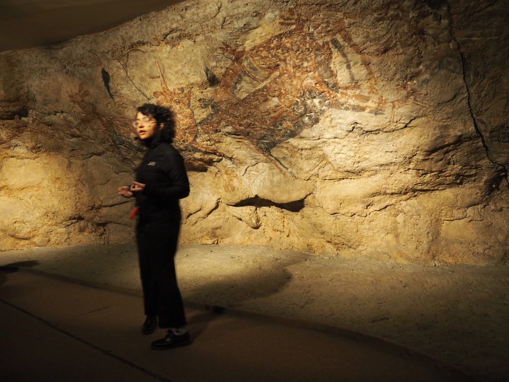
Cave Paintings
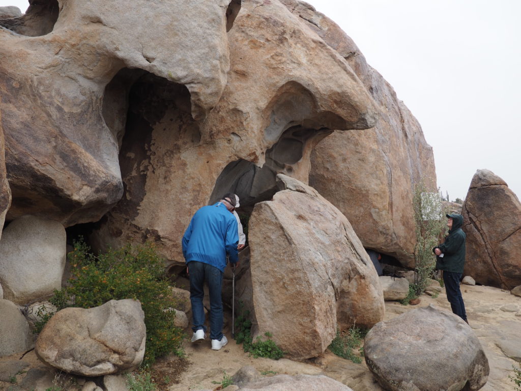
Cave Entrance
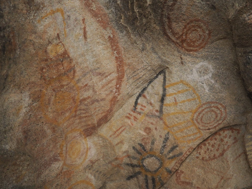
On a rainy day we climbed through the rocks up to one of the more accessible caves with Paleolithic paintings. Other caves with paintings +/- 9,000 years old can be seen, but take a day to get to through very rough terrain and a day to return, making it a three day commitment.
The estimated age of these paintings is 700-1,000 years. The pigments used are not local to the area of the cave. They aren’t as well rendered or nearly as large as older Baja California cave paintings, but did remind us of some of the very old cave paintings in Spain.
When we arrived in Ensenada, we followed Angel’s recommendation (San Diego Uber driver) and took an Uber about 4 miles from our hotel down the coast road to a restaurant overlooking the ocean, instead of using the vouchers for the hotel restaurant. If you come for the food, you have to take the chances you get to sample it. After our order was taken, another waiter came over to explain that our original waiter really hadn’t understood what we wanted to eat and he would help us (nonexistent Spanish only getting us so far). The portions were generous, so we had ordered too much food (and the new waiter kept us from ordering even more). The seviche was the highlight, followed by octopus and smoked tuna tacos. Everything was delicious and Jim really enjoyed his stuffed fish filets with three different sauces. The staff were disappointed we refused a doggie bag, as were our mates from the tour when we got back to the hotel and described our dinner.
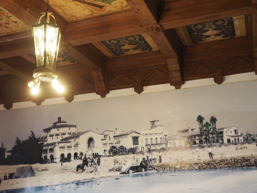
Riviera del Pacifico
Down the coast from Tijuana, Ensenada is a town of about 500,000 frequented by large cruise ships. In fact, it has a history of being a playground for wealthy Americans. The former Riviera del Pacifico casino is now a city-owned social and convention center. It was quite glamorous back in the 1920s and 30s when the Hollywood set came to play and the boxer Jack Dempsey was the manager. Rumors that it was owned by Al Capone were never confirmed. As you can see in the old photo, the casino used to sit right on a beautiful wide beach. Now it is several blocks from the water and there’s no beach, as a harbor was built instead.
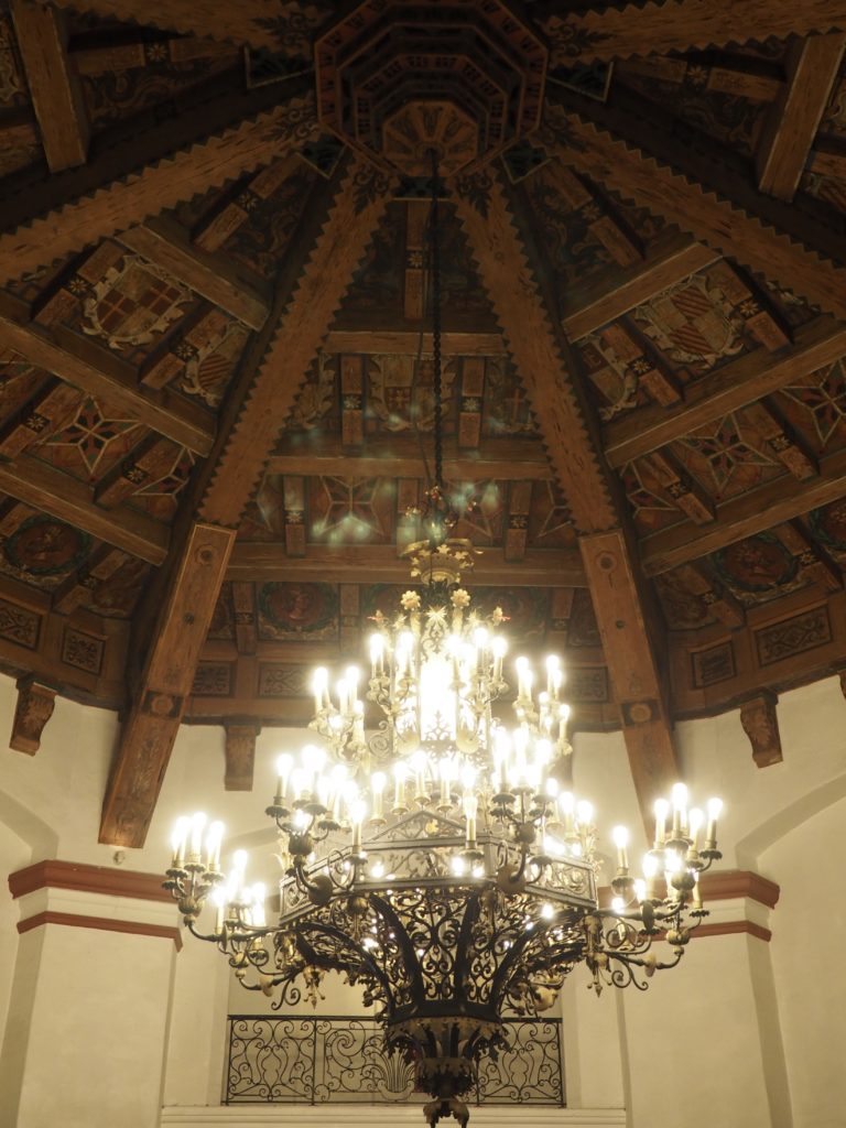
Original Chandelier, Riviera del Pacifico Casino
When the casino fell on hard times and closed, the property was abandoned and became derelict. Thieves scavenged almost anything of value. The lone chandelier to survive that humiliation was this one. The thieves couldn’t get it through the doorways because it had been fabricated on site.
Hiroshi
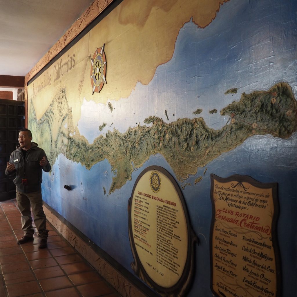
Our guide Hiroshi (native Ensenadan) used a topographical map at the social center to explain our trip down the peninsula, 700 miles as the crow flies (but we’re taking a bus). The lagoons we’ll be visiting to see the Gray Whales are primarily on the Pacific side.
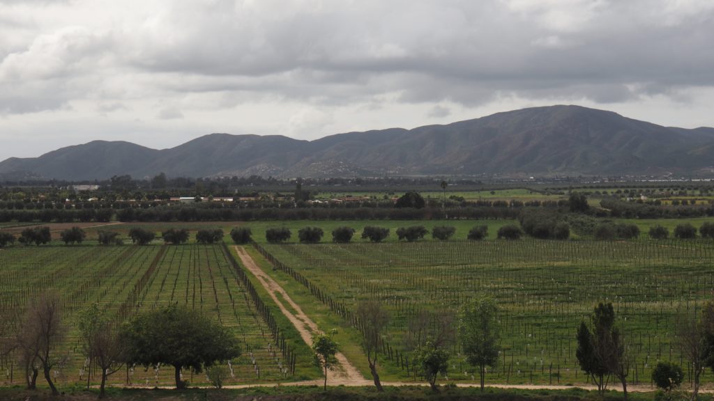
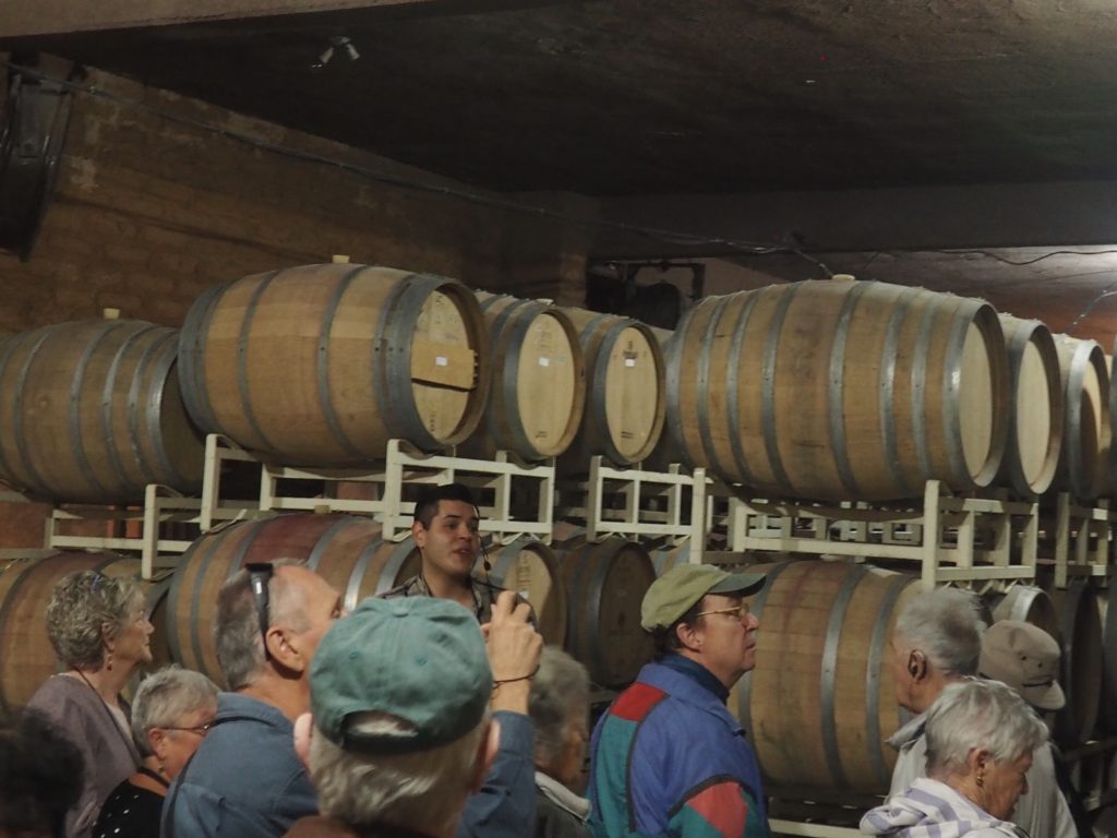
Vineyard, Guadelupe Valley
From Encenada we went out to the wine country.
We visited two wineries. One small, the other midsized. The ambiance was enjoyable, the wines not as much. We all have different preferences (thank goodness).
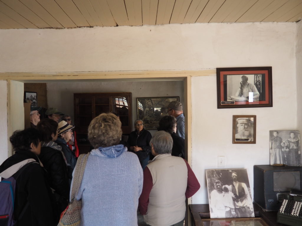
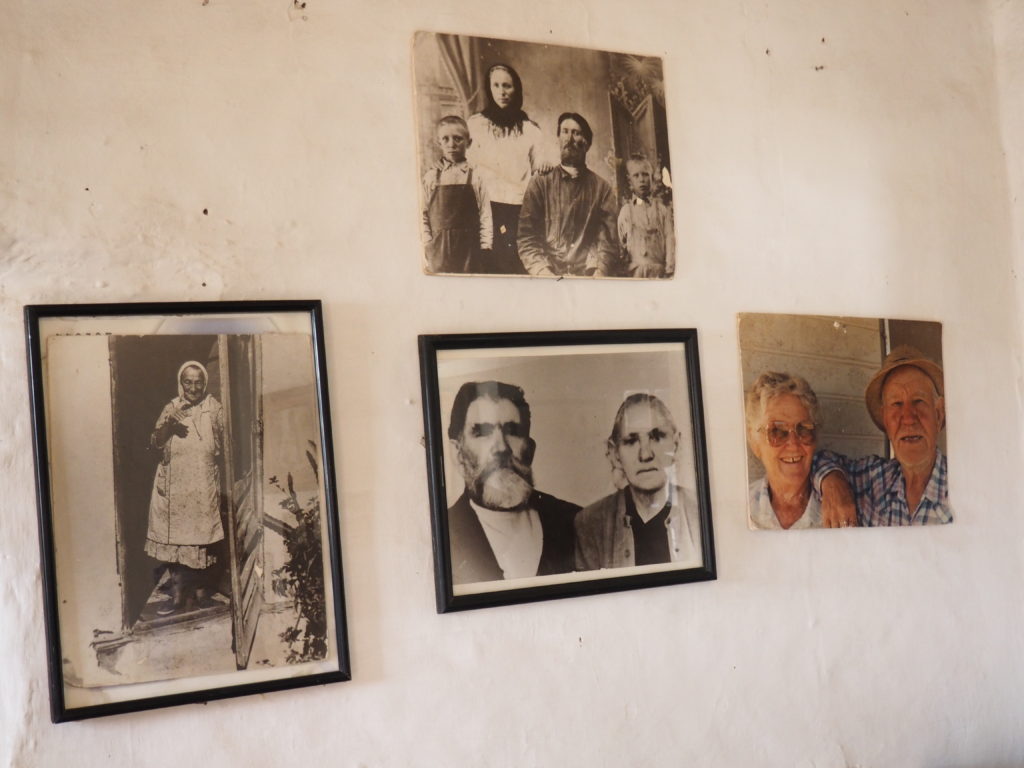
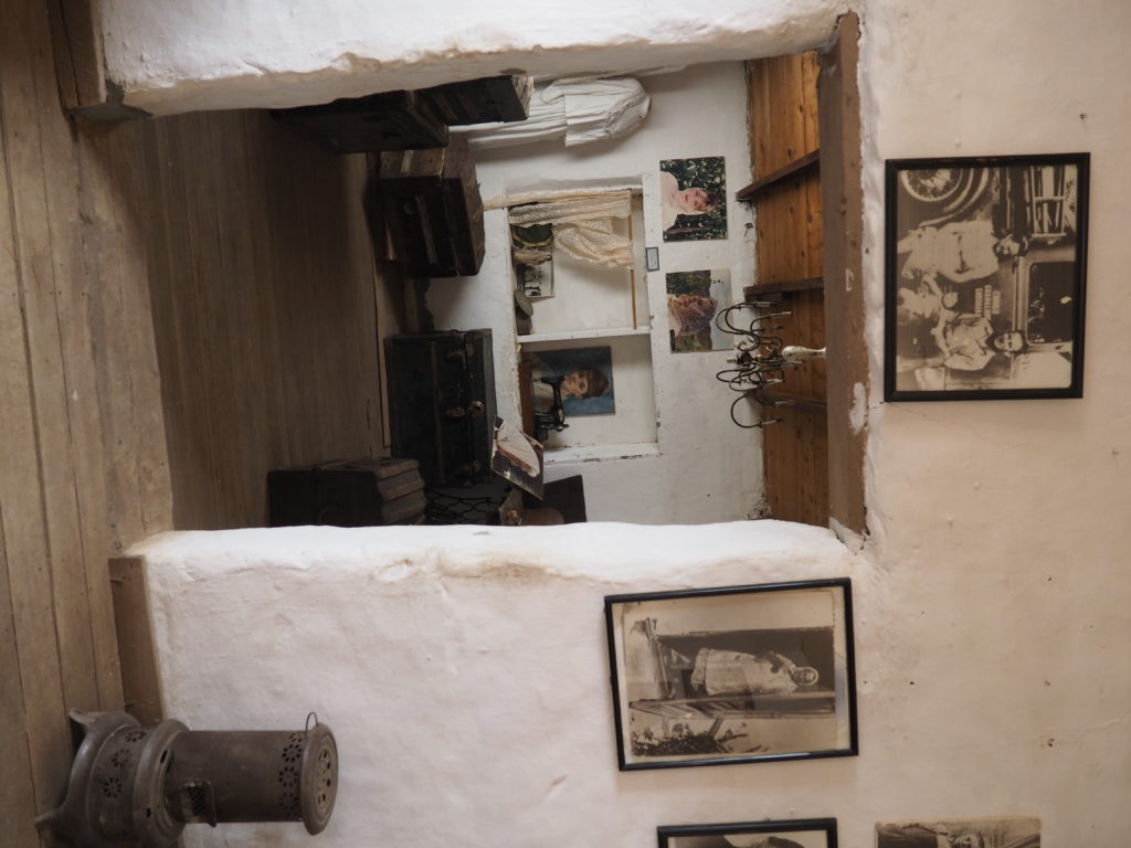
Molokan House Museum
Among the settlers in the Guadalupe Valley was a colony of Russians who considered themselves to be Spiritual Christians and who were called Molokans or milk drinkers by their Orthodox neighbors (they consumed dairy products during Christian fasting periods). Somewhat more than 100 of the families who fled persecution around 1900 and began farming in the valley.
The Molokans rejected the formalities and institutional structure of organized religions, focused on a spiritual and individualized practice of religion and elected their own councils of leaders. Their descendants in the valley have retained artifacts and mementos and family names, although none of the religious practice. But, they still make borscht. In the shop next door they were selling cheeses.
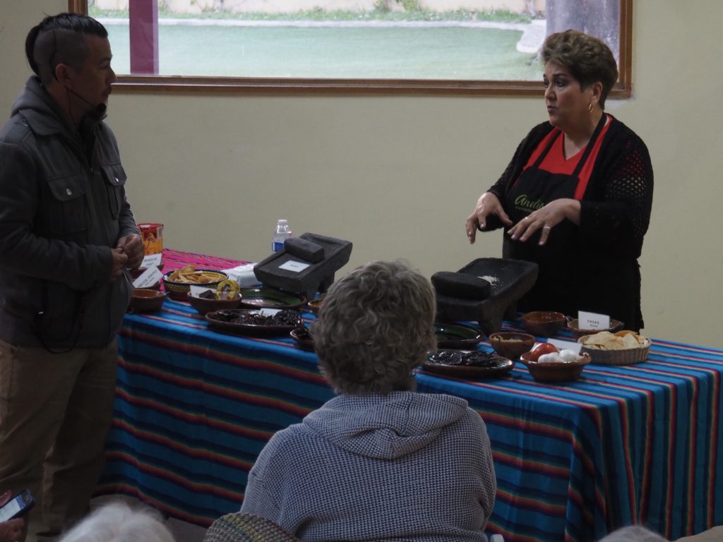
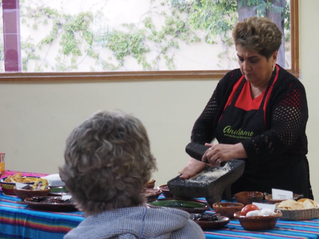
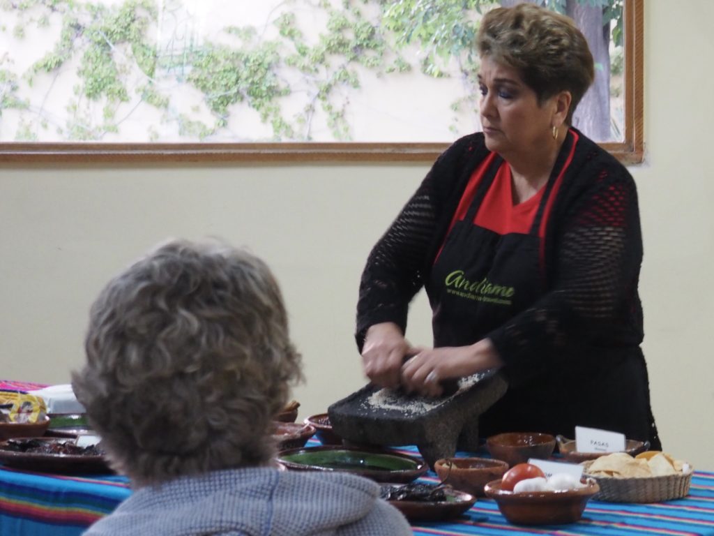
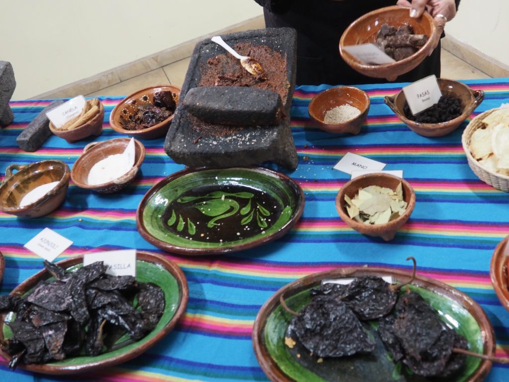
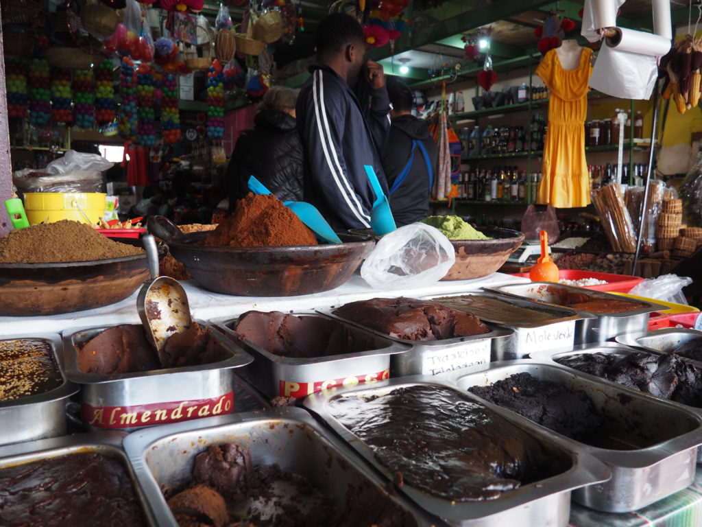
Cacao, Chocolate & Mole Demonstration
Among the gifts of the Native Peoples of Mexico to the culinary world is the cacao plant and its many uses.
Two operations were demonstrated. One was the making of mole from grinding sesame seeds, a pulp of several chiles, raisins, almonds, and chocolate. The other was a chocolate drink made by first grinding the cacao bean itself (removing the husk) and adding sugar and spice. The wrist action was truly impressive using the traditional metate. However, our expert uses a blender for everyday cooking.
We sampled the just made mole and then had a dinner of chicken mole.
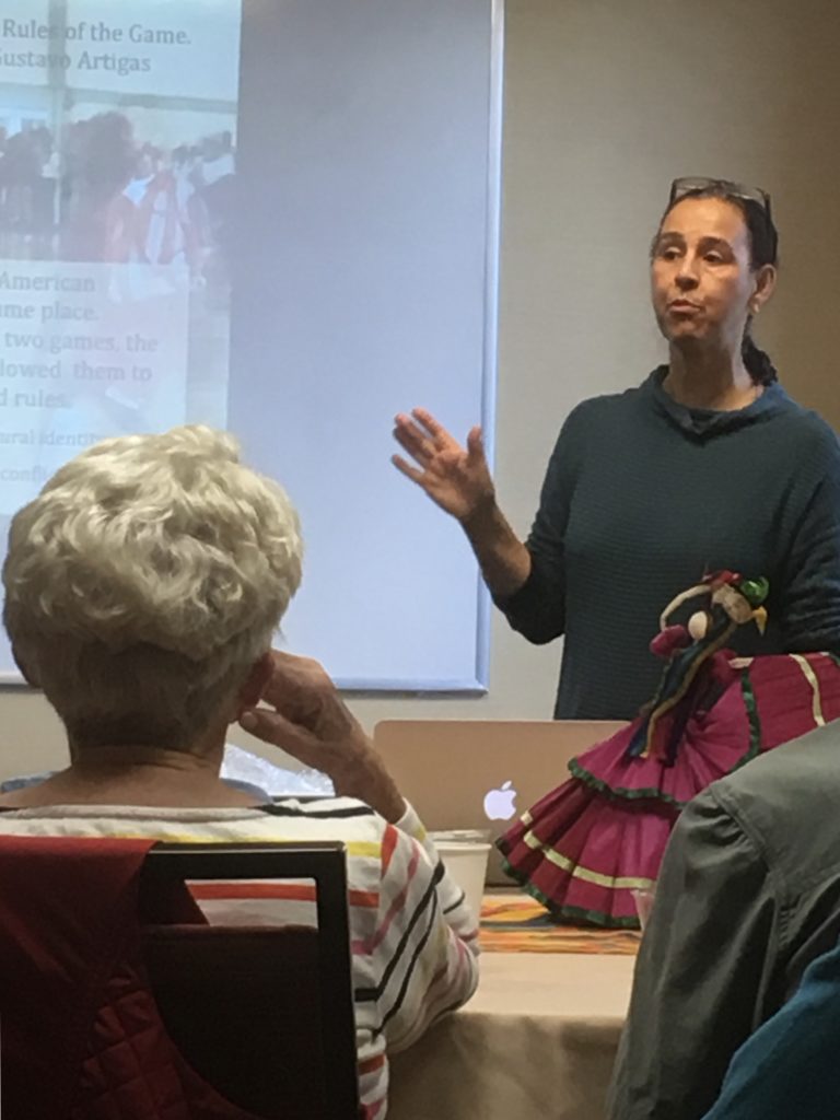
Norma Iglesias, Associate Professor, San Diego State University
Prior to heading across the border to Tijuana, Dr. Iglesias spoke with us about the border as a coherent region in which the fact of the border is the driving force in the lives of many regional residents. The imbalance in resources creates a dynamic in which the Tijuana residents adapt to provide the San Diego residents with the goods and services they desire, with hundreds of thousands of people crossing the border in either direction daily. While most academics study the border region either from the perspective of the U.S. or of Mexico, Iglesias calls herself a trans border specialist and strives to understand the border from the perspective of both cultures. Indeed, the integration of the border region is striking even from our brief visit. Although one of our Uber drivers was from Ukraine, more were from Mexico and one was from Ensenada (where we would be visiting). This last driver has started his own tourism company and gave us a restaurant recommendation in Ensenda (which turned out to be excellent).
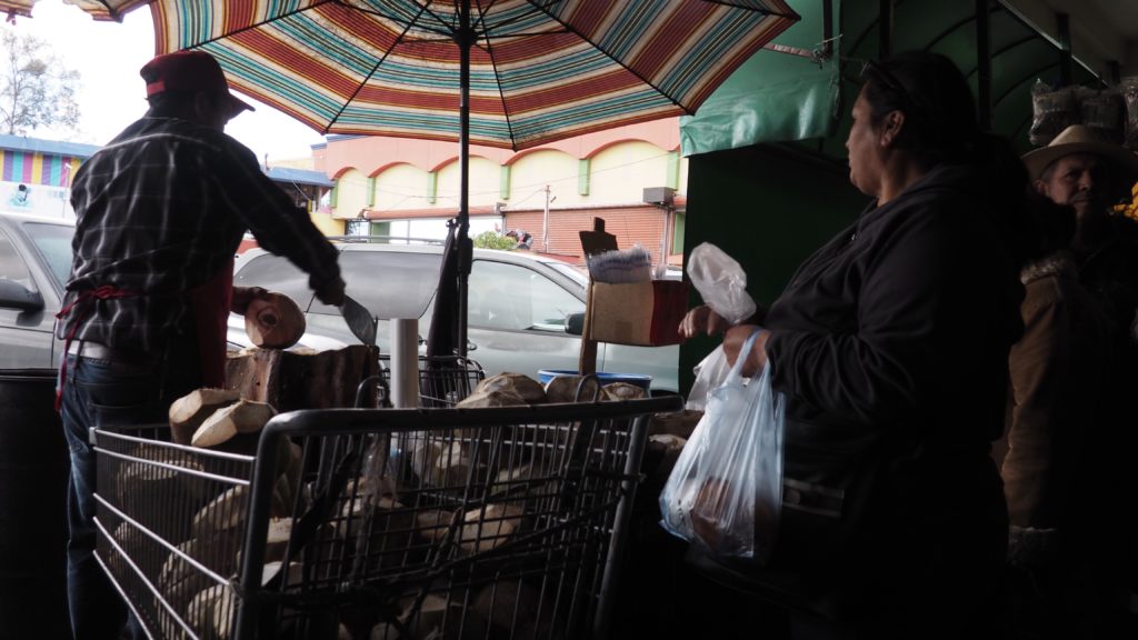
The Coconut Man
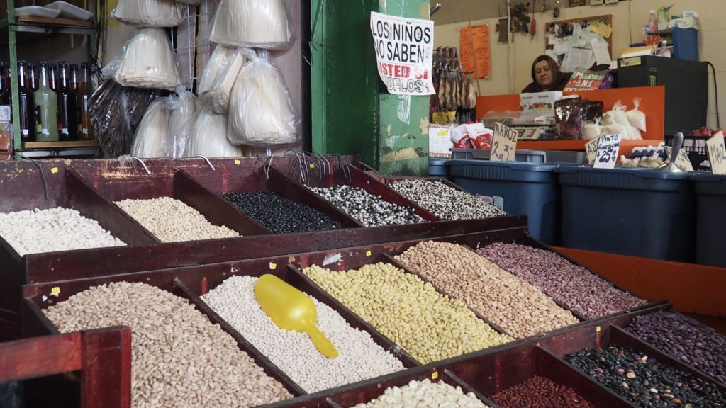
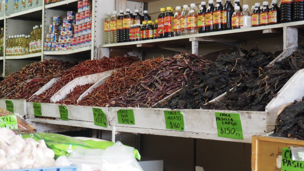
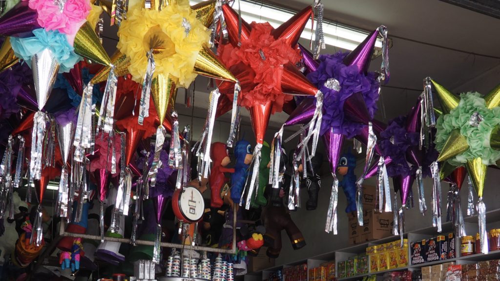
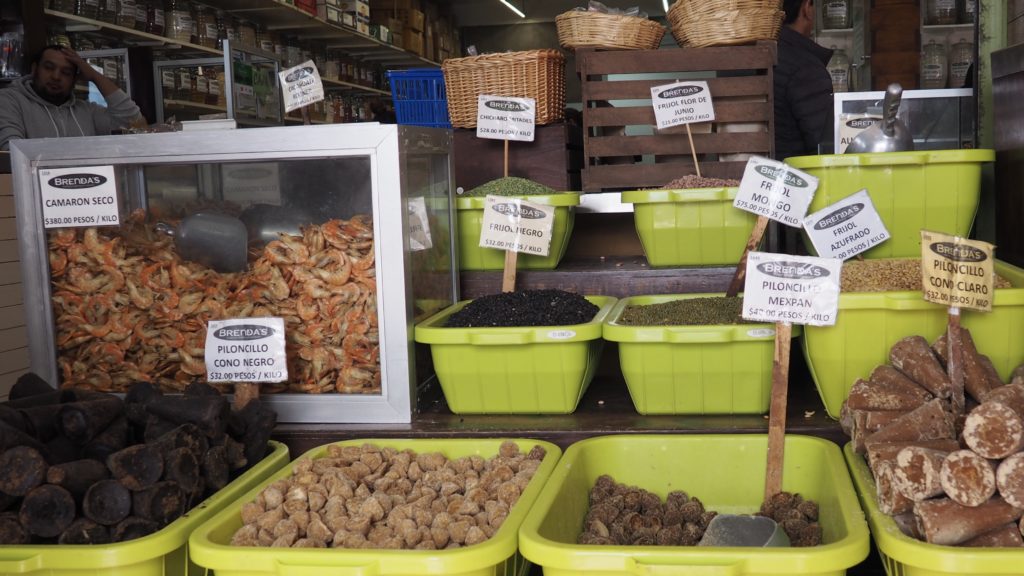
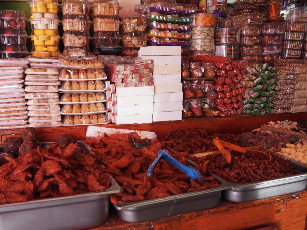
Once over the border, past the imposing steel barrier and cleared land sealed off with another imposing steel barrier, we made our way to a market in Tijuana to enjoy the sights and smells of fresh produce and wonders for us to try to identify.
Beans, beans, beans.Every sort of chileAnd fruitAnd, of course, mole.
Another key to understanding the border is that Tijuana and Baja California are melting pots of peoples and cultures, with immigrants coming from all over the world, from the Chinese and Japanese to Germans and Italians or, more recently, Haitians. People are not just refugees, but also come for the more sophisticated enterprises funded by foreign companies.
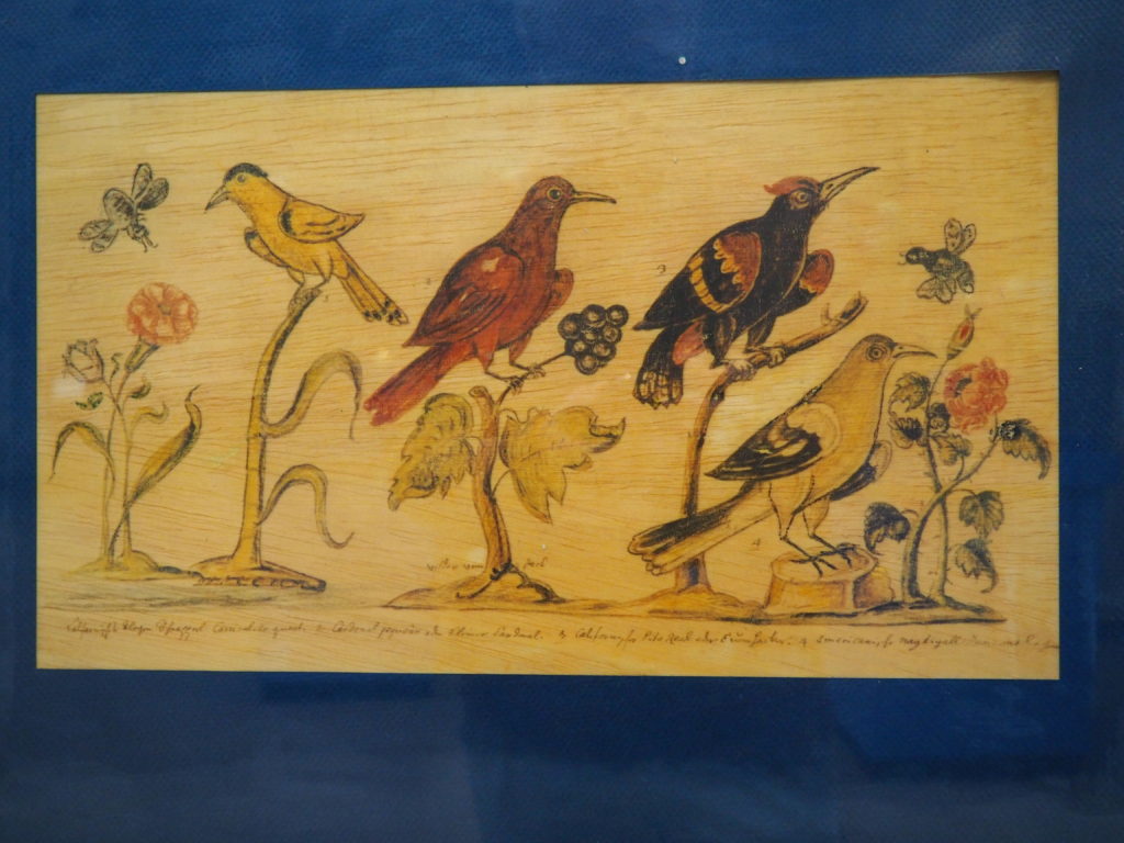
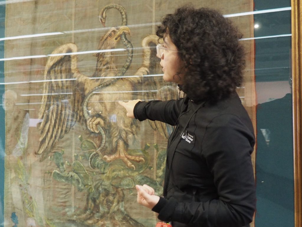
Reproductions of cave paintings from 5,000 BCE in Baja California Reproduction of one of a series of paintings of mission life by Father Ignacio Tirsch, painted after the expulsion of the Jesuits in 1769.Political party flag with design based on legend of the founding of Mexico City in which it was said the Aztec should found a city where an eagle would hold a snake on top of a lake.
After a lunch featuring a Caesar Salad from the restaurant originating the same (Caesar’s Restaurant), we went to the Tijuana Cultural Center and the Museo de las Californias to view the permanent exhibits on the history of the entire peninsula from prehistoric through modern times.
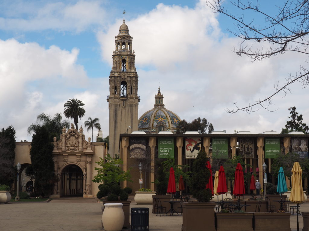
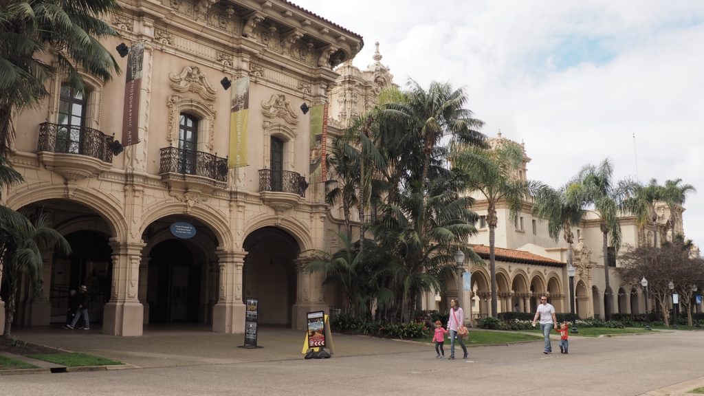
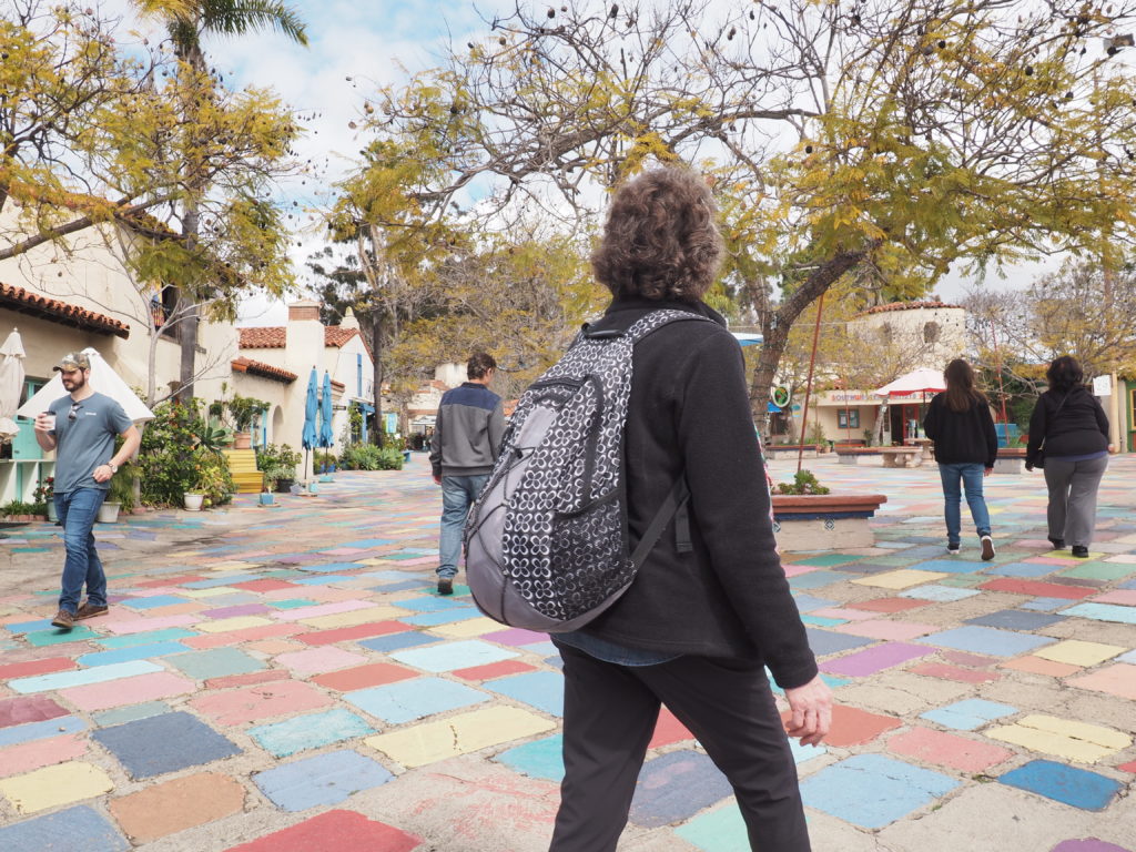
San Diego’s Balboa Park was created from the infrastructure built for two expositions, the Panama-California Exposition of 1915-16 and the California Pacific International Exposition of 1935-36 and includes over 15 museums, plus the zoo.
Along “El Prado”
It’s a wonderful place for strolling, but must be packed during tourist season. The buildings are wonderful examples of Spanish style architecture.
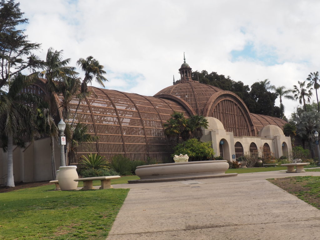
The Botanical Building is one of the world’s largest wood lathe structures.
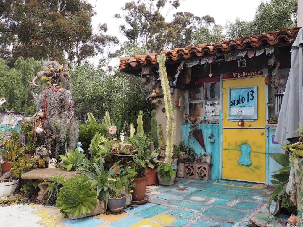
The Spanish Village Art Center is a funky complex with 37 working studios representing over 250 local artists. We chatted for quite a while with a silversmith who is obsessed with all the different weaves one might use for silver chains. She learned her craft from a Native American custodian at her public school in Wyoming when she refused to continue taking Home Ec.
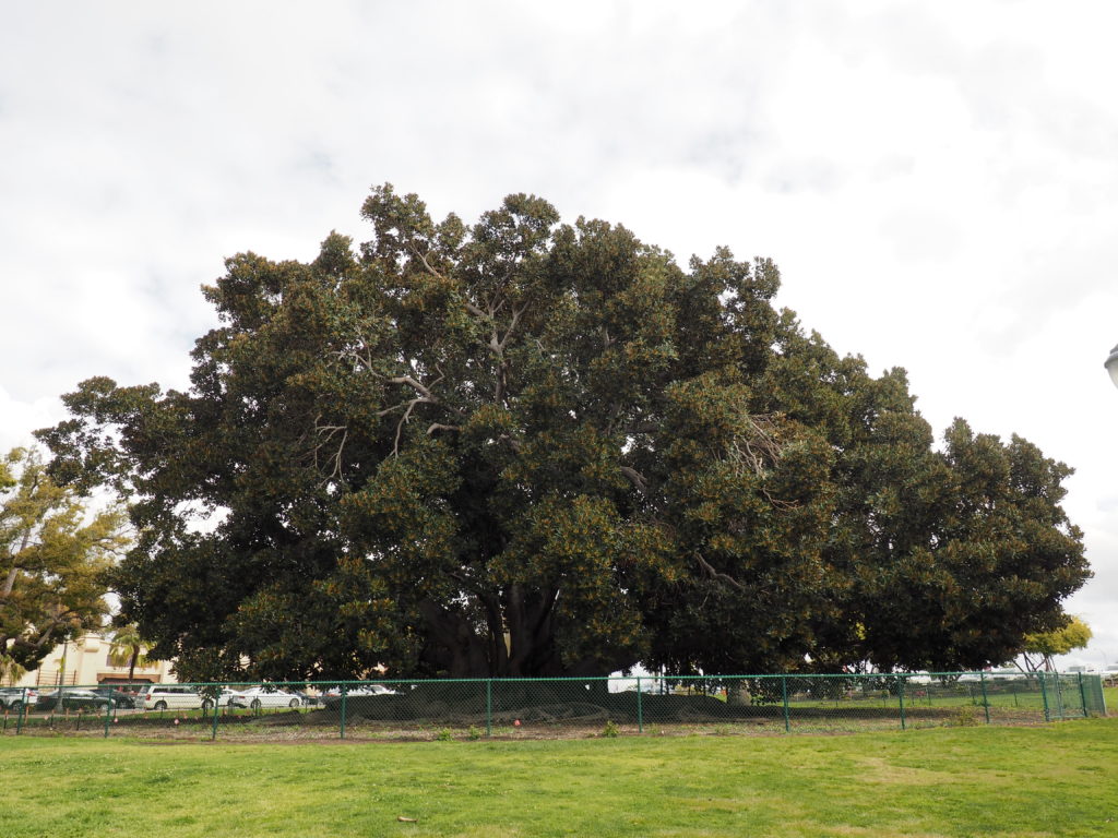
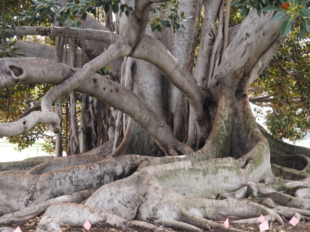
This Moreton Bay Fig tree was planted sometime before the first of those expositions and its canopy is roughly 150’ across. For understandable reasons, they’ve put a fence around it to help it survive for another hundred years.
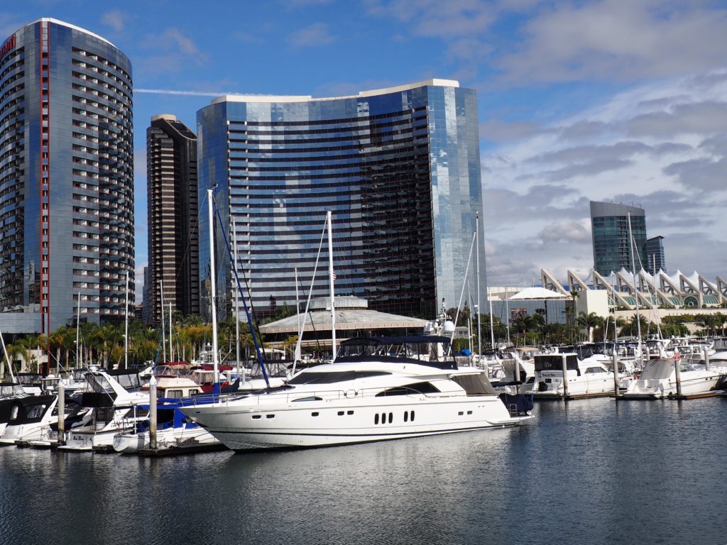
The Waterfront & the USS Midway
Waterfront with Convention Center in distance to the right
After wandering the Gaslight District and Downtown, we knew we had to make our way to the waterfront before leaving San Diego.
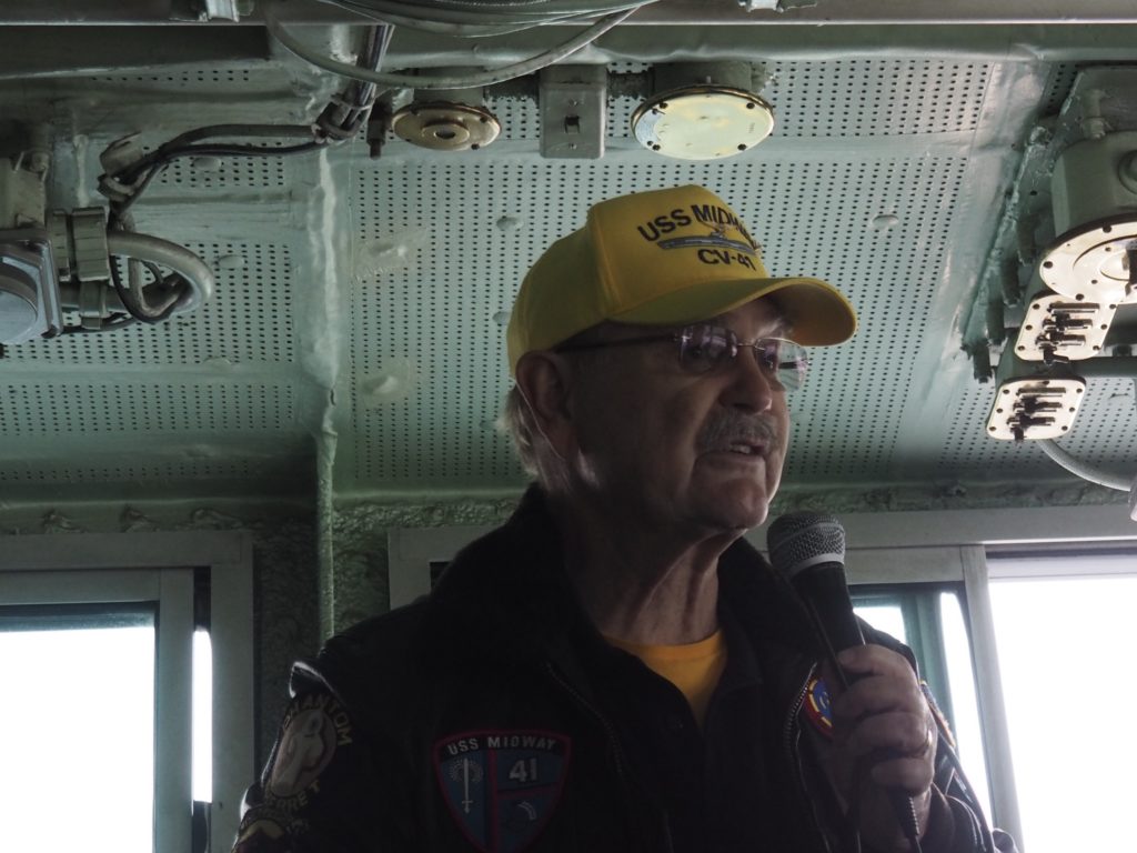
USS Midway, now a Museum
Commissioned one week after the end of WWII, the USS Midway was the largest ship in the world until 1955. It saw action in the Vietnam War and Desert Storm and was decommissioned in 1992. Its home port was Yokosuka, Japan, and was too large to go through the Panama Canal. In 2004 it was brought San Diego and became a privately run museum.
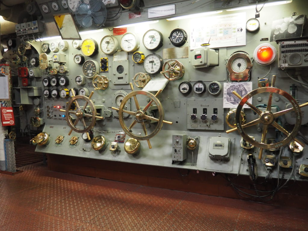
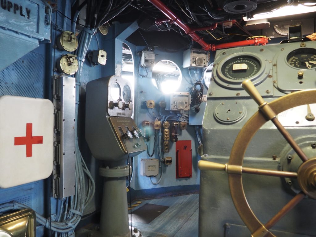
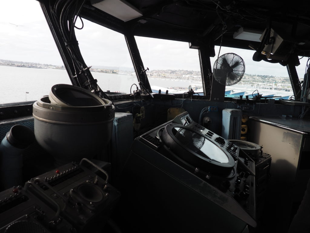
Power Generation Controls
The Helm (steering wheel)
Fortunately, there were tours and helpful volunteers (all retired Navy) to explain how this thing worked. On the left are the steam engine room controls that determine the power going to the propellers, whether the power source is diesel (this ship) or nuclear. In the photo to the right, the controls left of center are the fine tuning for speed. Make no mistake. This thing could move. In fact, you could waterski behind it.
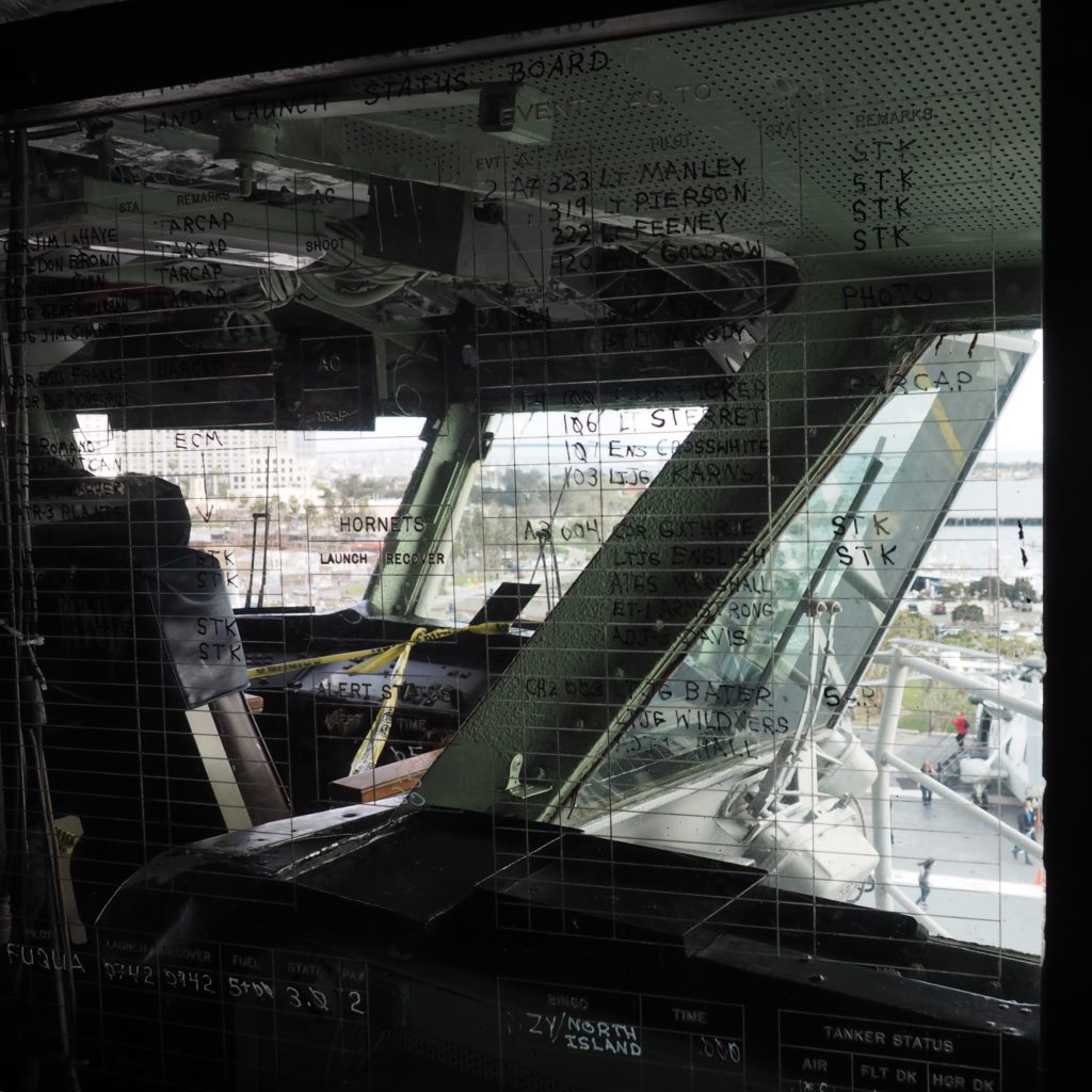
We took a tour of the Island, which is the structure on the flight deck with both the navigational controls and the operations center for takeoff and landing of the aircraft. On the left, you can see the Launch Status Board which was maintained with a marker on glass, writing backwards so that the officers in charge of flight operations would always have current information available to them.
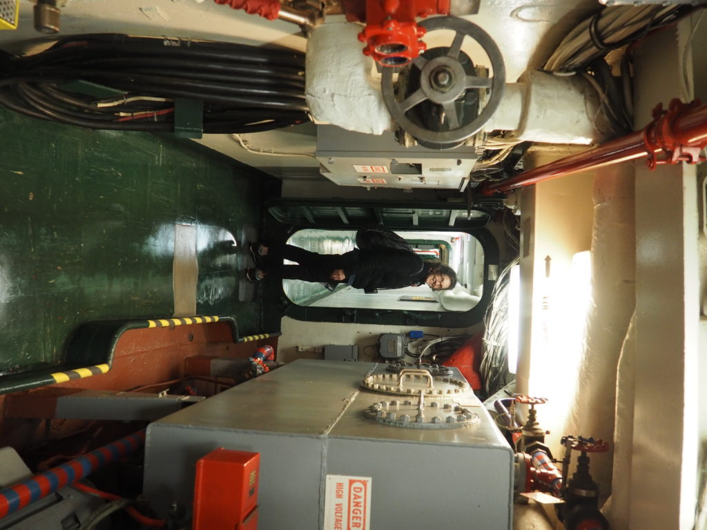
With 18 decks, it’s a wonder we didn’t get lost.
Plane at far left would be ready for launch with a catapult
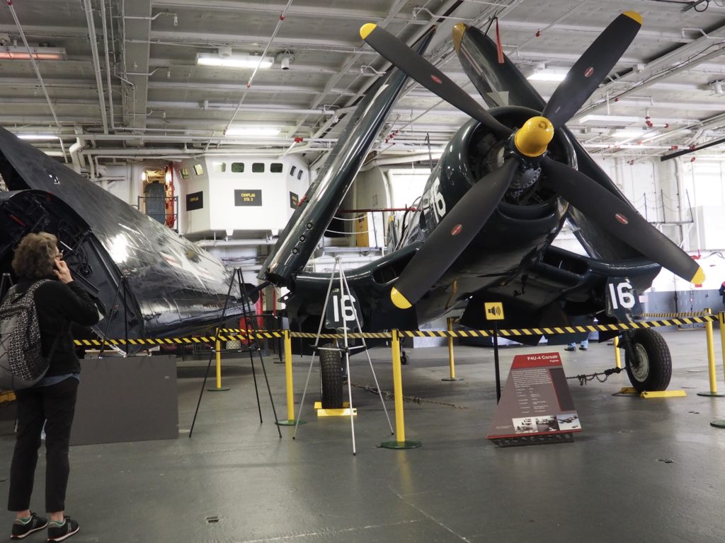
Corsair on Hanger Deck
At launch with the use of a catapult, the plane would go from zero mph to 170 mph in 3 seconds, or less. Planes were launched every 90 seconds. The Corsair fighter plane was a workhorse of WWII (would not have been on the Midway).
The Flight Deck has a nice assortment of aircraft, but isn’t nearly as busy as during combat operations.
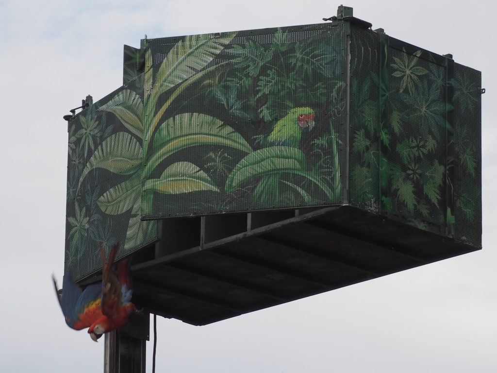
The Release of the Macaws (This fellow was kind enough to wait for Jim to wake up to what was going on.)
To say that the San Diego Zoo is a special zoo is like saying that the MET is a special art museum. All comparison fails. For one thing, everything opens just a little earlier than promised. Having just arrived from the east coast, we arrived before opening time and found ourselves among the first visitors and spectators for what’s apparently the daily release of the macaws to take their stations around the 100 acres of zoo.
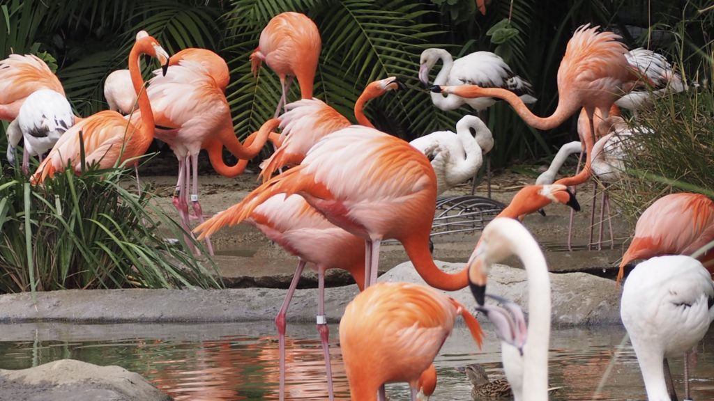
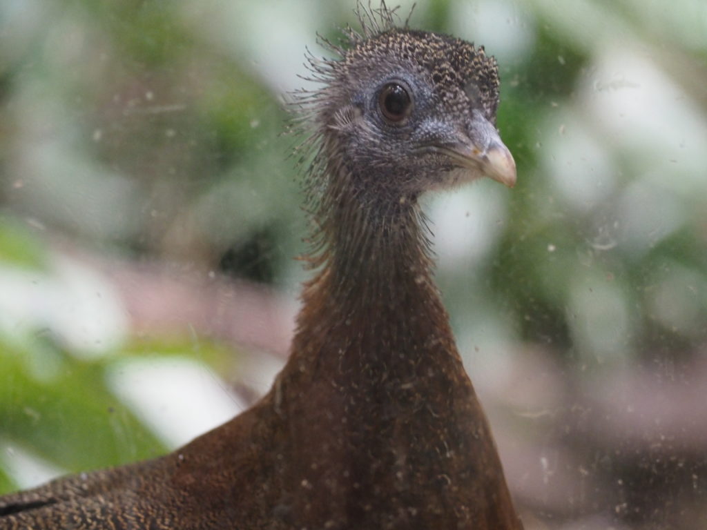
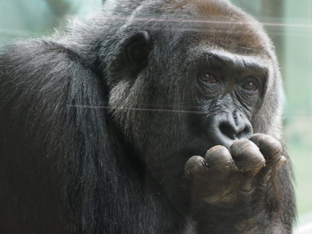
There’s What You Expect
Flamingoes
Meerkat
Malay Great Argus Pheasant
Gorilla
San Diego has plenty of what you expect to find in a zoo, only they are more visible and accessible and in generously sized enclosures that can make you forget that they are in captivity.
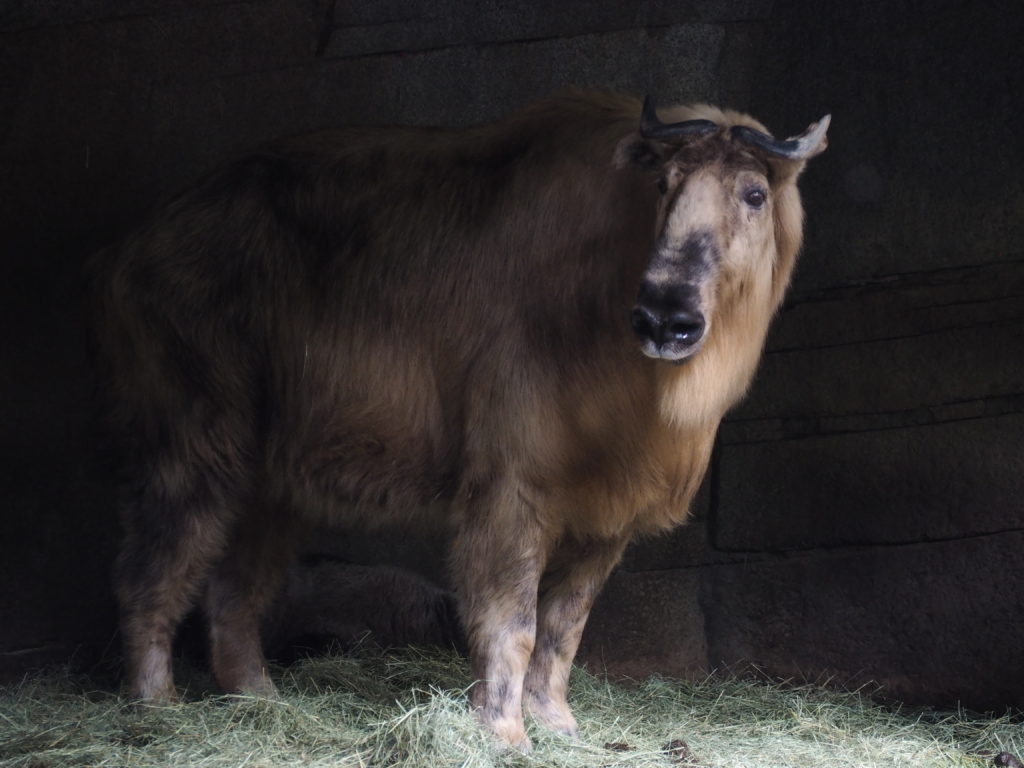
Takin, from the Himalayas and a Vulnerable species.
Conservation at the Heart of the Zoo
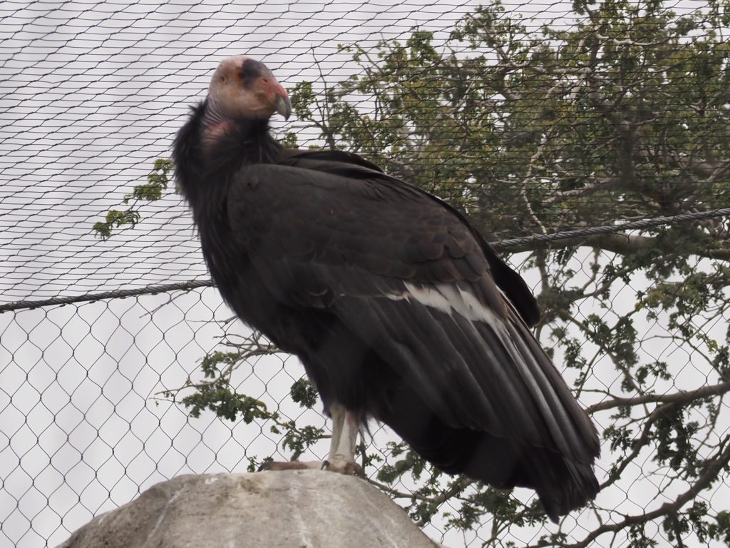
California Condor
One of the best known (tentative) successes of the rescue of species from almost certain extinction is that of the California Condor. They were extinct in the wild in 1987 when the remaining 27 individuals were rescued and brought into the San Diego and Los Angeles Zoos. In 1991 they were reintroduced to the wild and remain one of the world’s rarest bird species with 463 individuals either in the wild or in captivity. The infamous use of DDT, lead poisoning from consuming wild carrion (the condor being, of course, a scavenger), and electrocution from landing on power lines are among the causes leading to the critically endangered status of this largest bird of North America that can otherwise have a life span of 60 years.
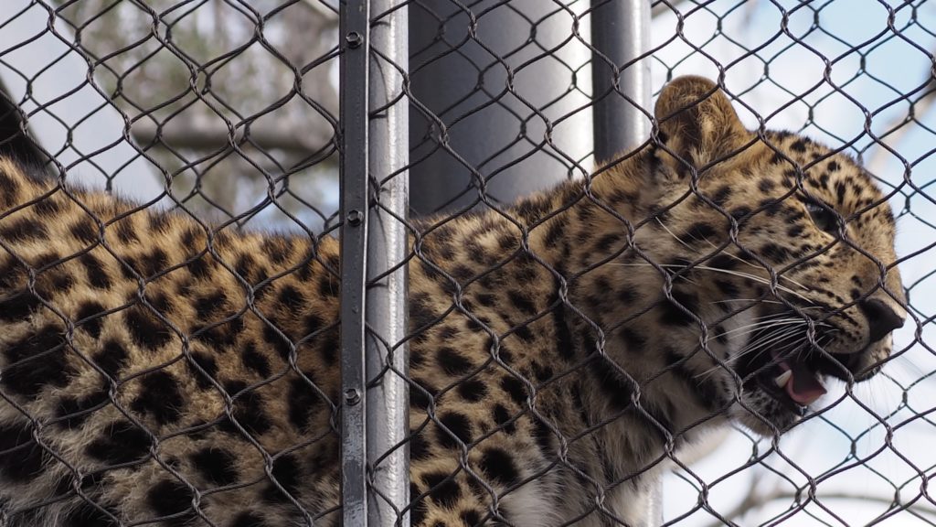
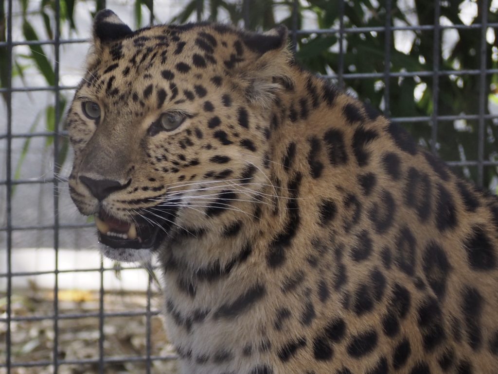
Amur Leopard in overpath walkwayAmur Leopard
The critically endangered Amur Leopard comes from a small area overlapping Russia, China and North Korea and benefits from another conservation effort in which the San Diego Zoo takes part by breeding this world’s rarest big cat for eventual return to the wild. The Chinese and Russians have both set aside substantial acreage, although it’s expected that it will be the grandchildren of a pair of two year old cubs born at the zoo who will join the effort. The population needs to be large enough that breeding in the wild can occur with individuals not overly related.
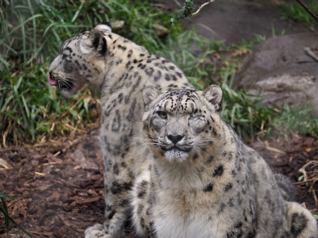
Snow Leopard
The Snow Leopard, from Central Asia, is also endangered and, along with the Amur Leopard, is unusual in being a Leopard from a cold climate. As part of its adaptation to the cold, the Snow Leopard has an enormous thick tail with which to curl up and which helps with balance in its rocky environment. This couple (they’re hoping they’ll breed) had to be moved away from the Amur Leopards after the birth of the Amur cubs because they found the scent to be wildly disturbing.
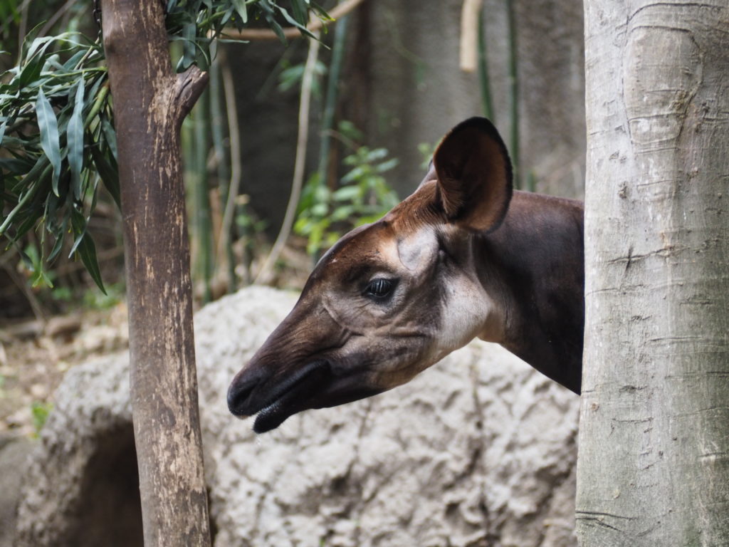
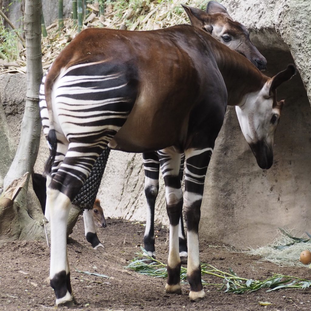
Okapi, Democratic Republic of the CongoYes, that’s junior poking his head out by ma’s back leg.
Okapi are endangered in the forests of the Congo due primarily to the hunting, logging, farming and mining by armed rebels.
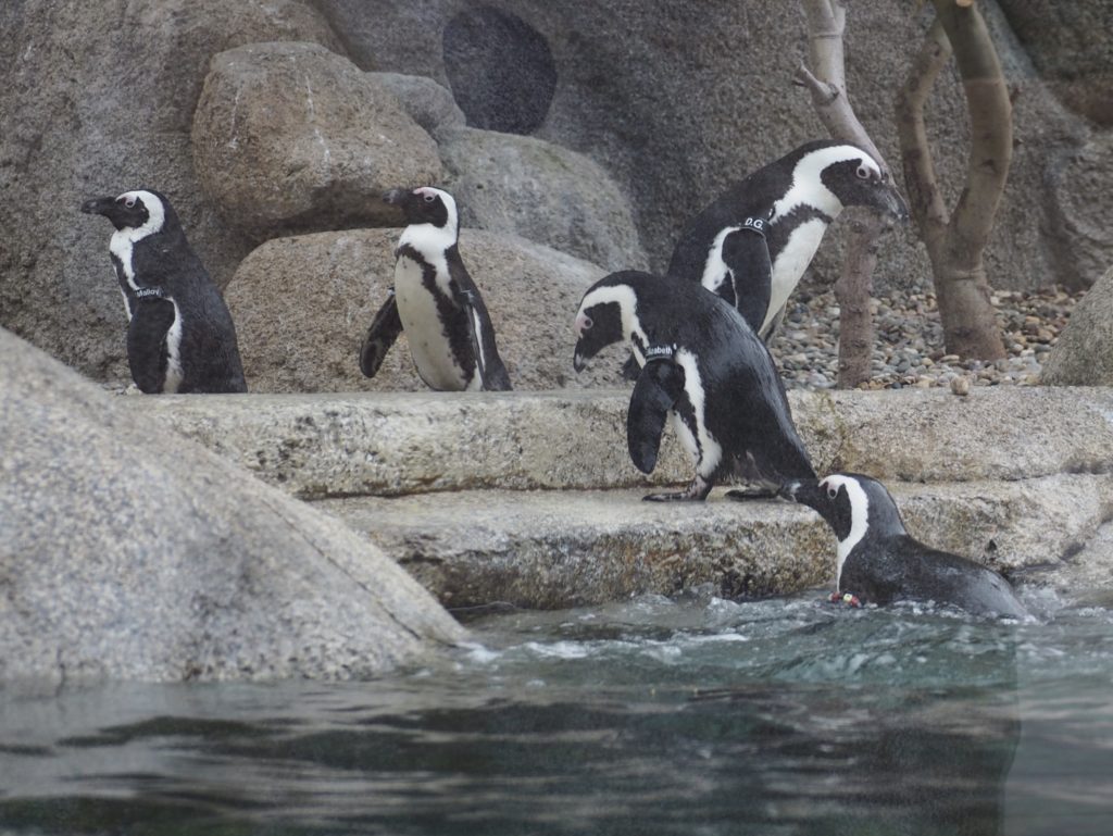
African Penguins (with their names on armbands)
From the beaches and coastal waters of Southern Africa, these penguins are endangered due a a lack of food resources and appropriate nesting areas (a common problem with bird species).
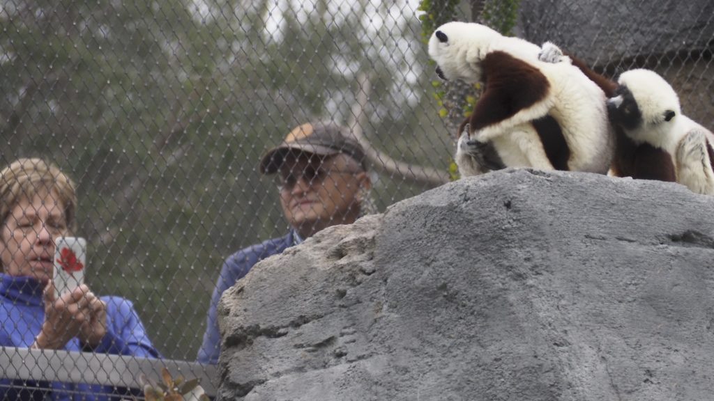
Coquerel’s Sifaka; Homo Sapiens
These endangered Coquerel’s Sifaka from the dry forests of Madagascar are fascinated by their visitors.
Giant Panda
In 2016 the Giant Panda was reclassified from being Endangered to a “Conservation-Reliant Vulnerable Species.” Of course, they’re adorable and a big attraction in the few zoos permitted by the Chinese government to breed them.
Yes, they’re big.
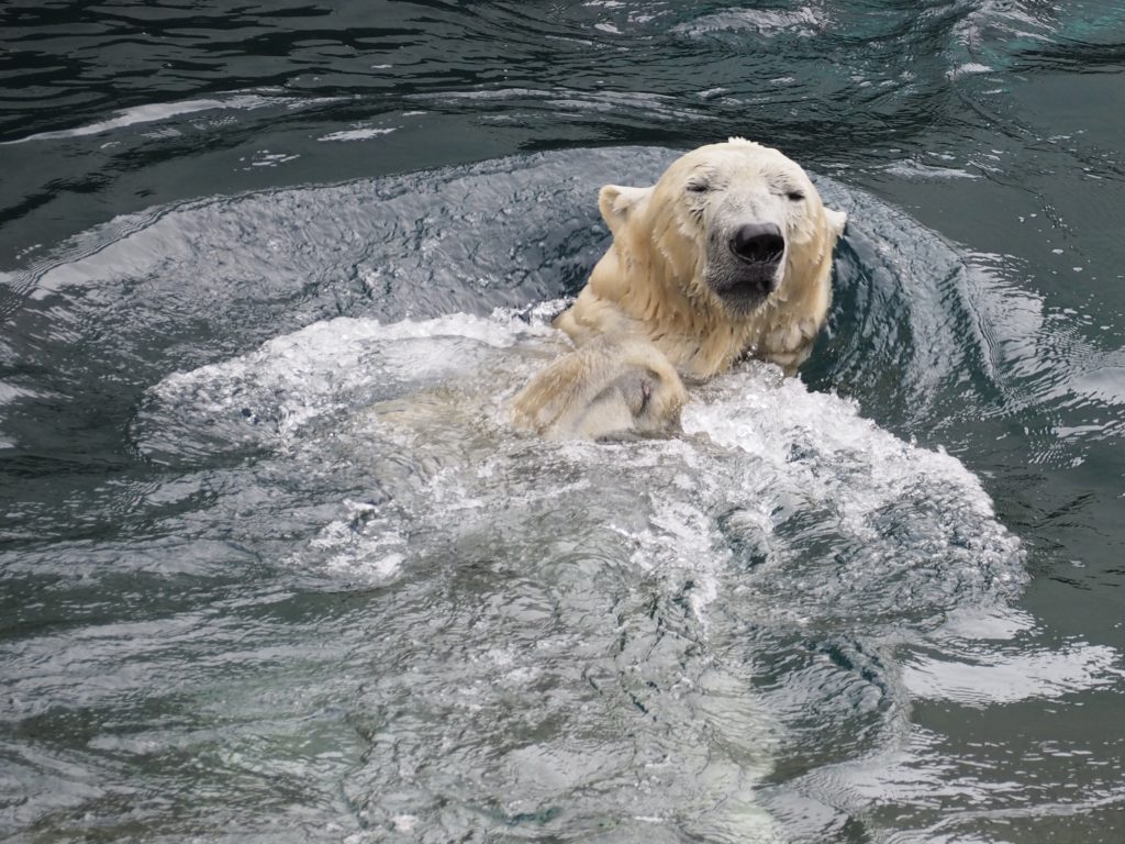
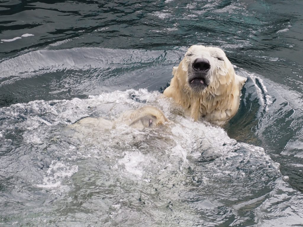
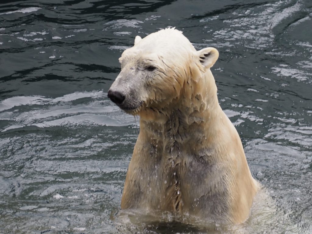
We all know the story of the vulnerability of the Polar Bear due to expected habitat loss from climate change. These bears were rescued from the wild when they were orphaned. They have a special low fat diet to accommodate them to the climate in San Diego where lots of body fat would make the heat a problem. They’ve come to enjoy lettuce and hard boiled eggs as treats. Conception is a puzzle the zoo is still trying to unravel.
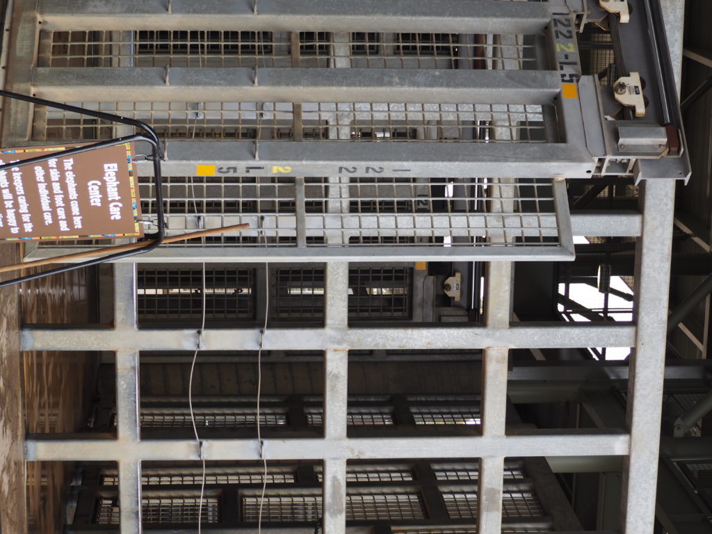
The Elephant Care Center looks like a set for Jurassic Park.San Diego has four older elephants in the downtown zoo, but a herd of elephants of all ages, including very young ones, at their Safari Park that’s a 40 minute drive from downtown (we didn’t go).Keeping all the animals both mentally and physically healthy involves providing puzzles and elaborate ways to provide snacks to, for instance, exercise the 400 different muscles in the elephant’s trunk. Treats were hidden under the tube.
More than a Zoo
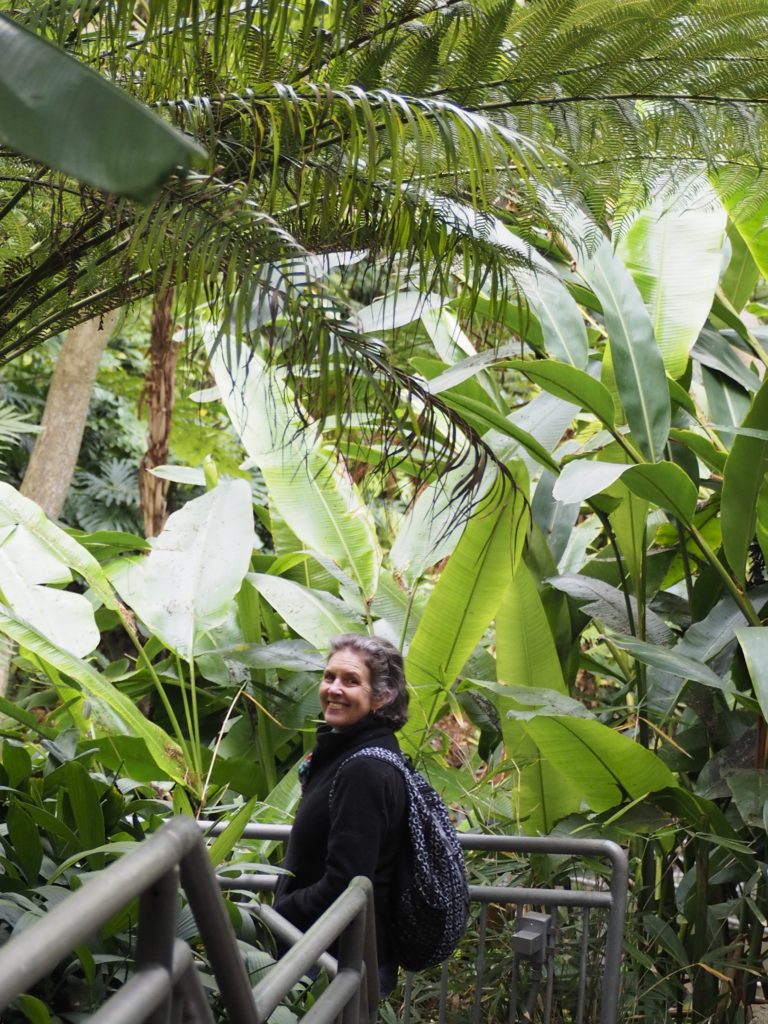
The zoo is also a botanical garden. A walkway through Ferns of every description.
The zoo not only creates a natural environment for its animal guests, but grows the specific plants required for the dietary needs of the animals such as particular varieties of bamboo that no other animal may eat.
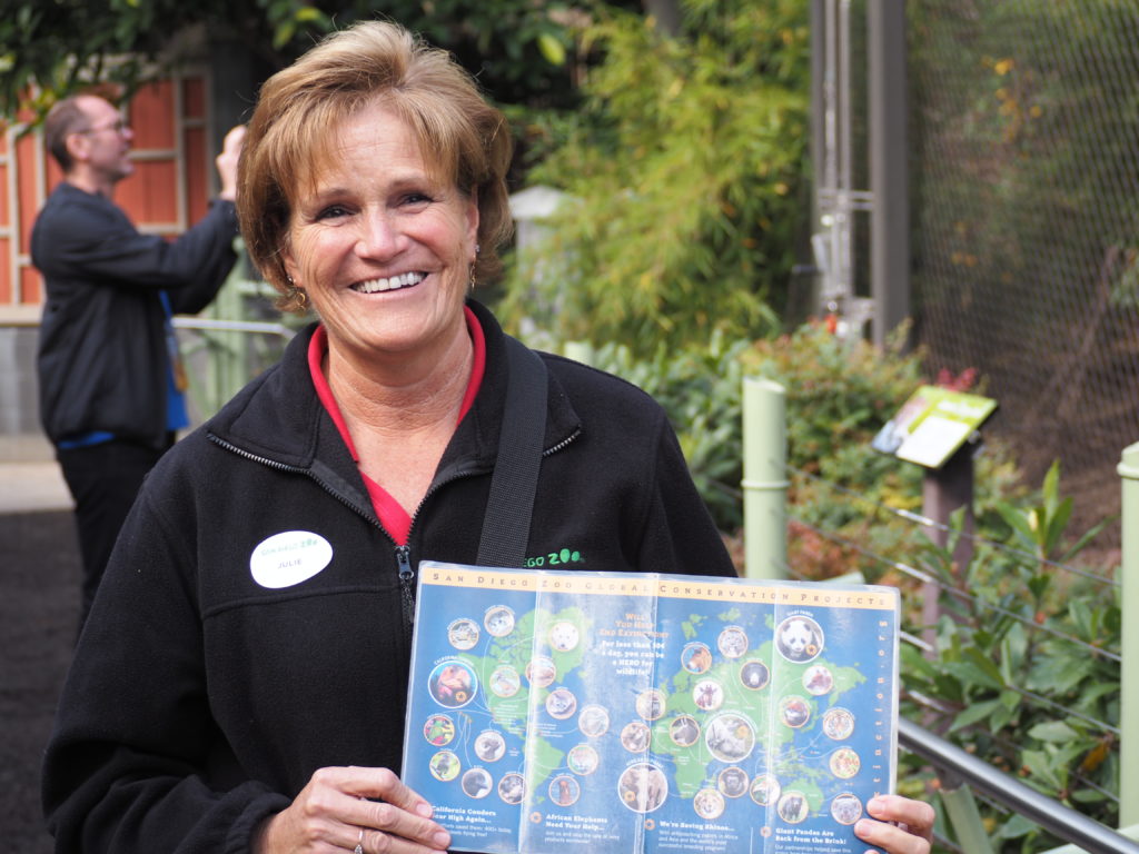
The docents also make the zoo a unique experience.
Everywhere we turned there would be a cheerful and enthusiastic docent eager to tell us about the animals and the work of the zoo. Julie’s holding a map showing the global conservation efforts of the San Diego Zoo.
A large number of enormous aviaries are throughout the zoo, many of which you enter to experience the birds.
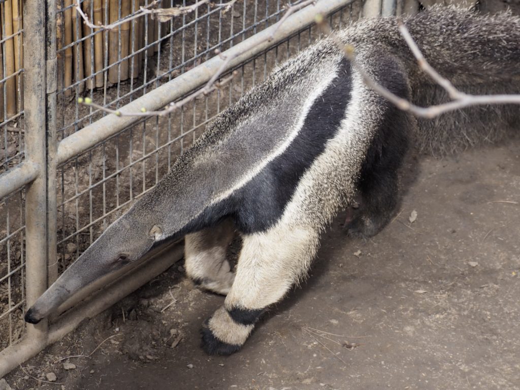
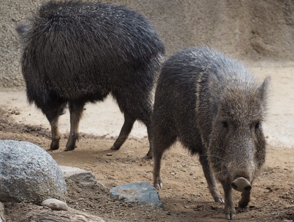
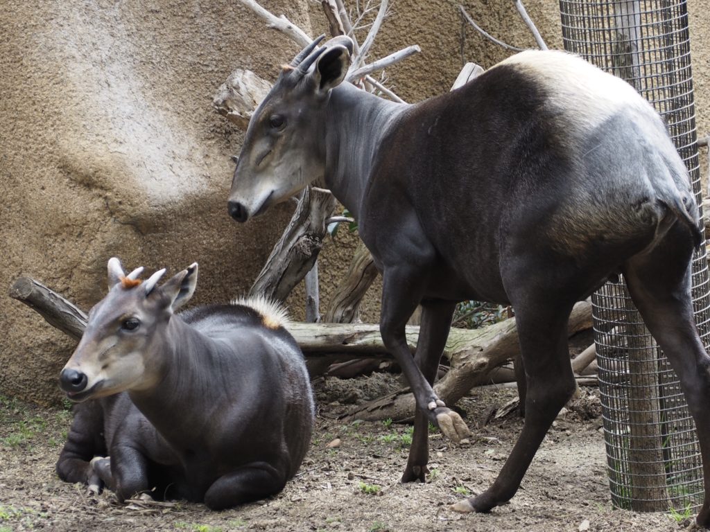
Whether endangered or not, some animals are just fun to watch.
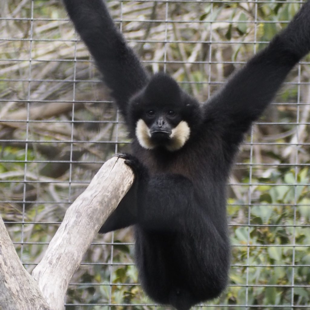
Giant Anteater
Peccary
Duiker
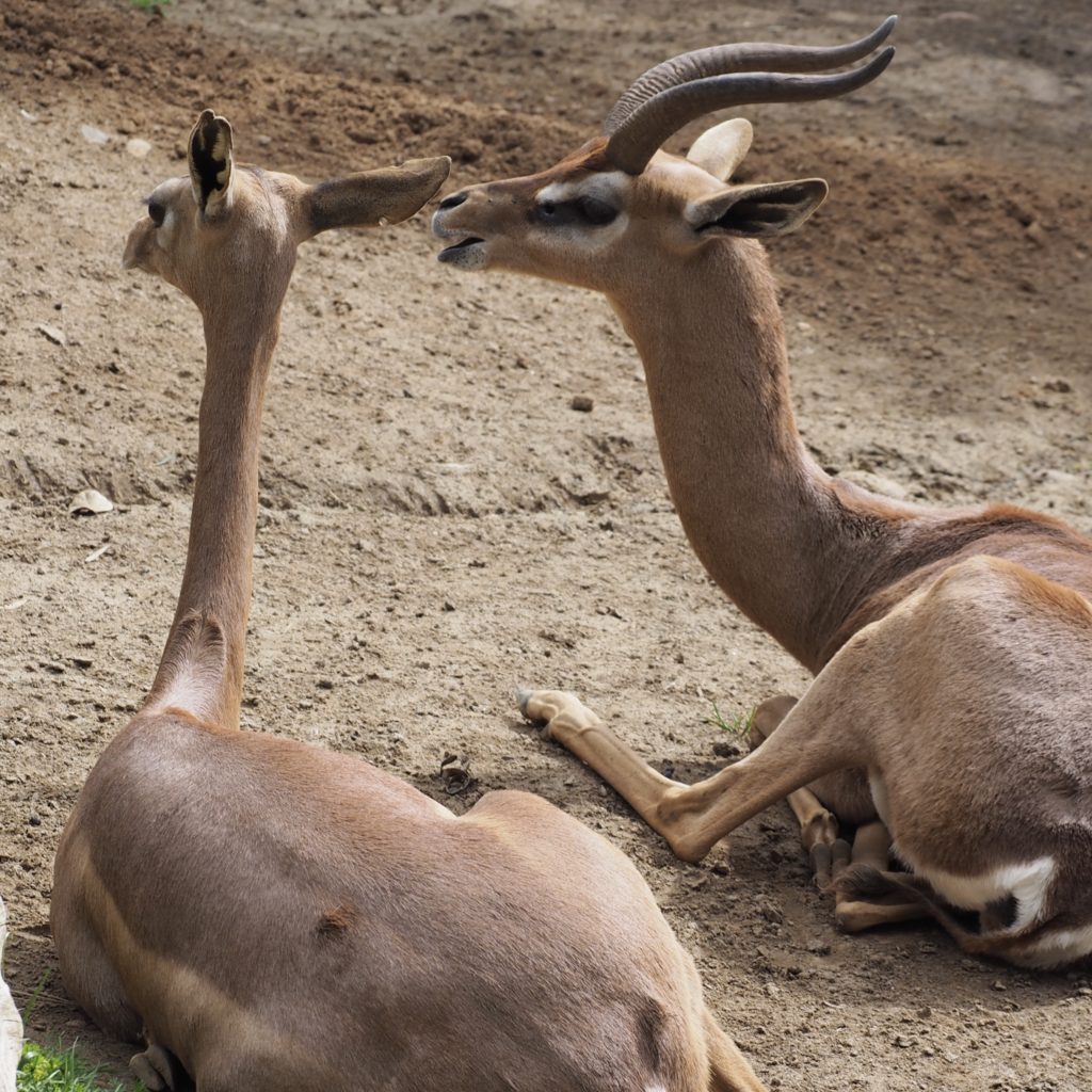
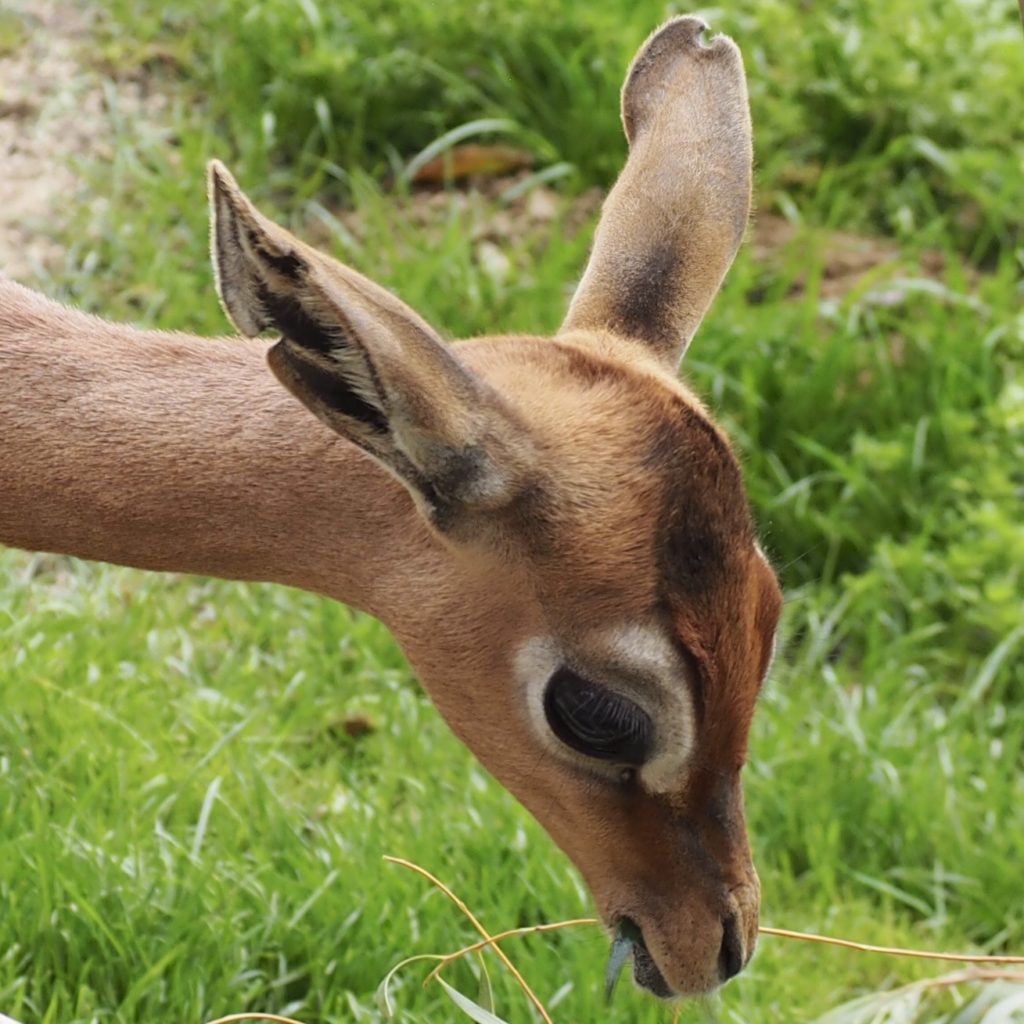
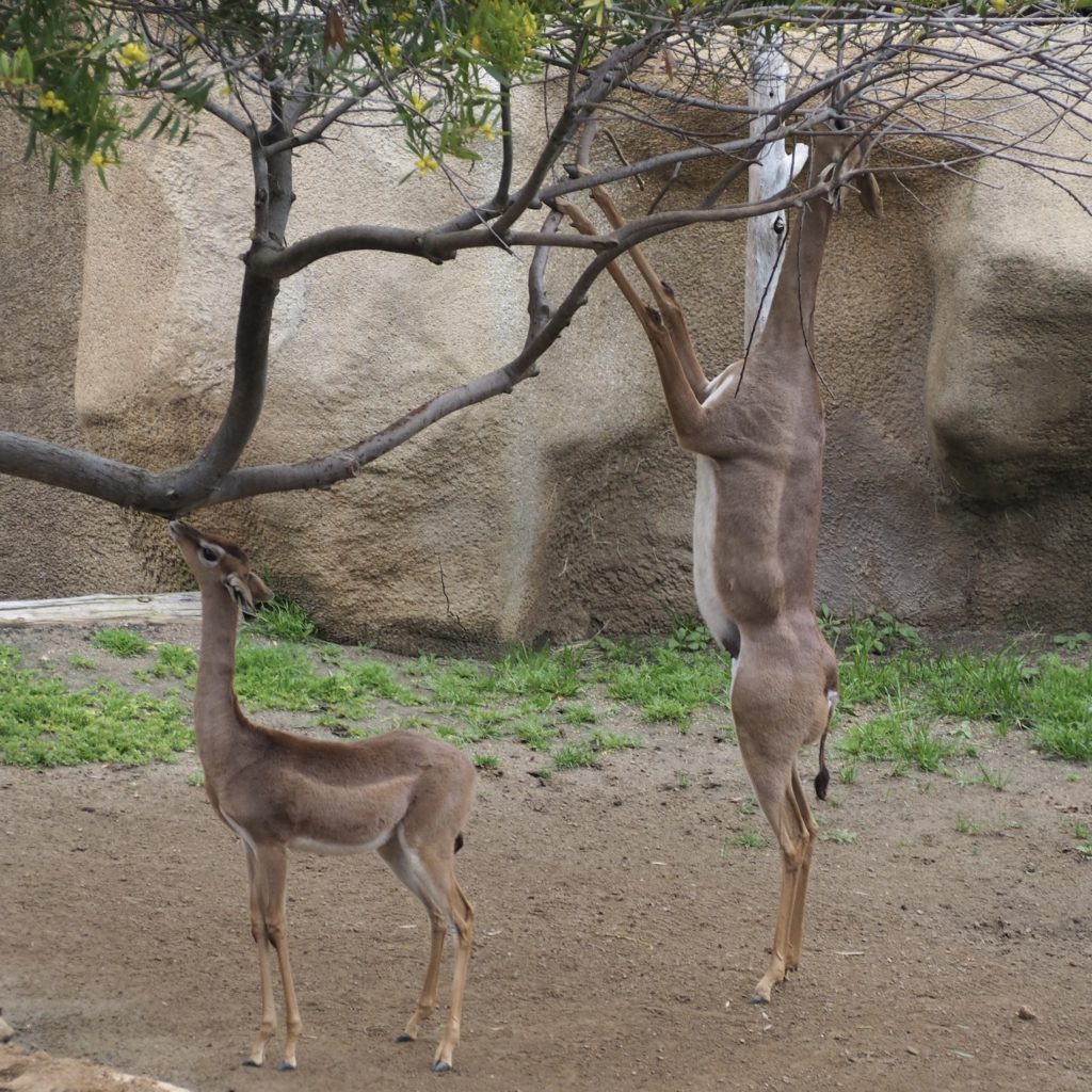
Gerenuk
Gerenuk
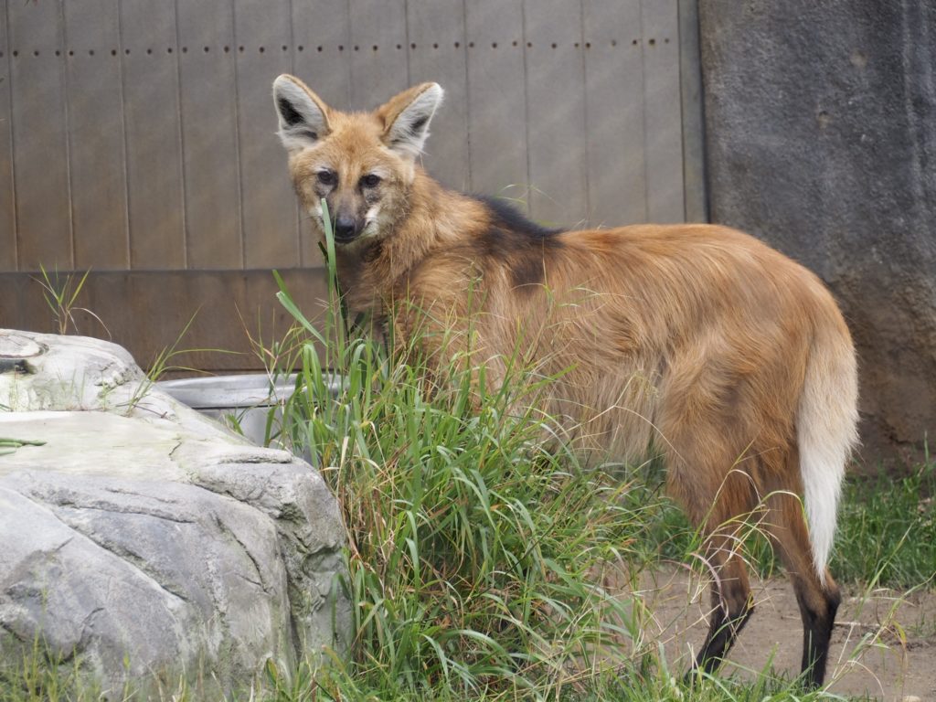
Maned Wolf (not really a wolf)
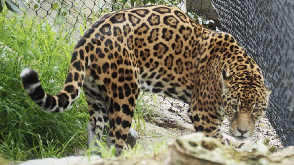
Jaguar
Gelada
Ibex
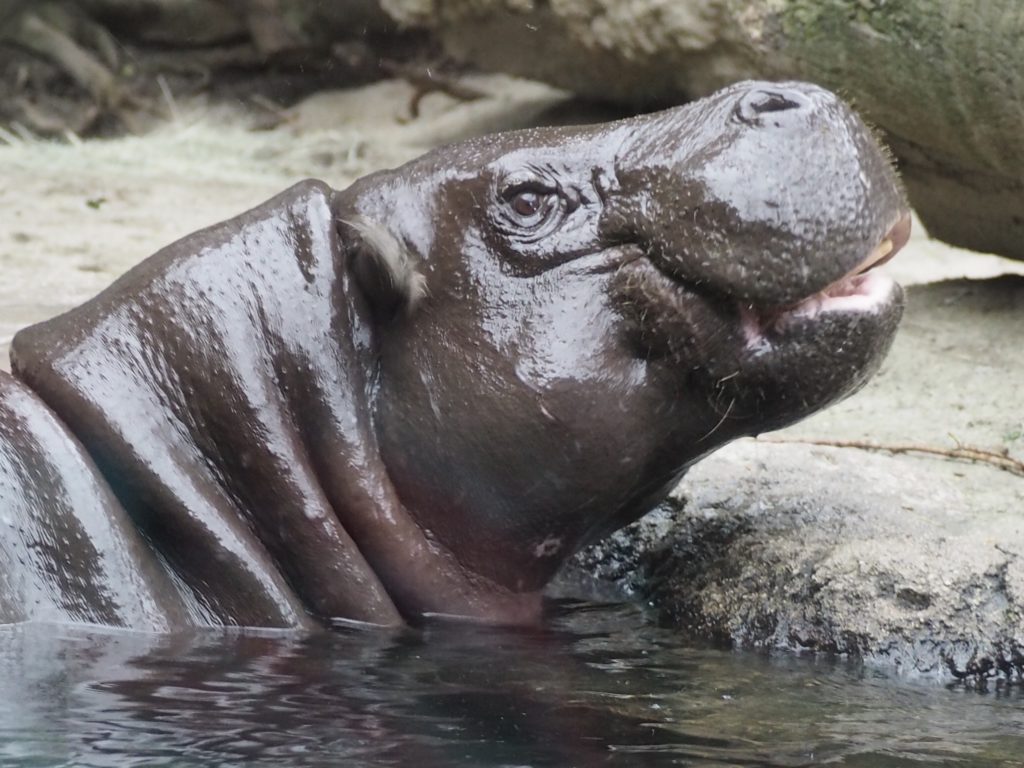
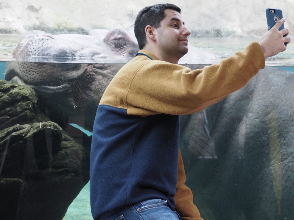
Pygmy Hippopotamus
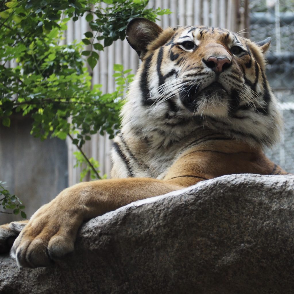
Malayan Tiger
Gerenuk
Scout, a Grizzly Bear rescued with his brother as a cub from Yellowstone
The fellow in the back seems to always hang out in the same place, looking for a chance for genuine interaction with another species.Yes, come closer.Let me whisper the secret of life.
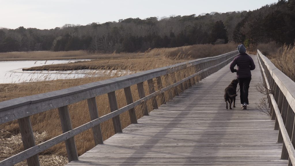
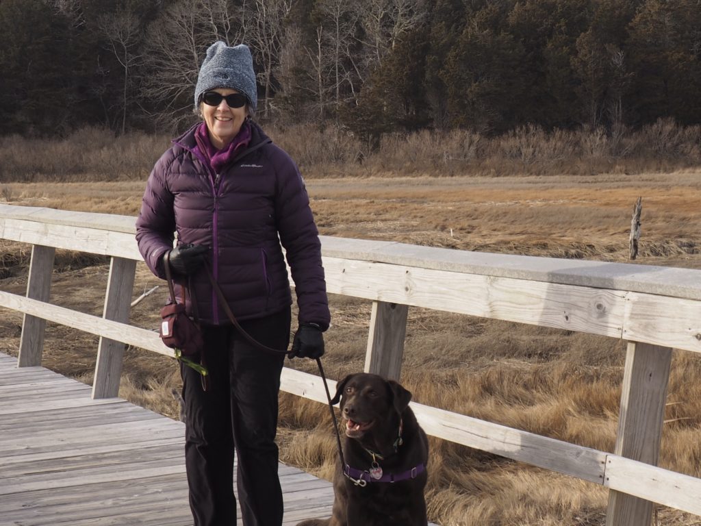
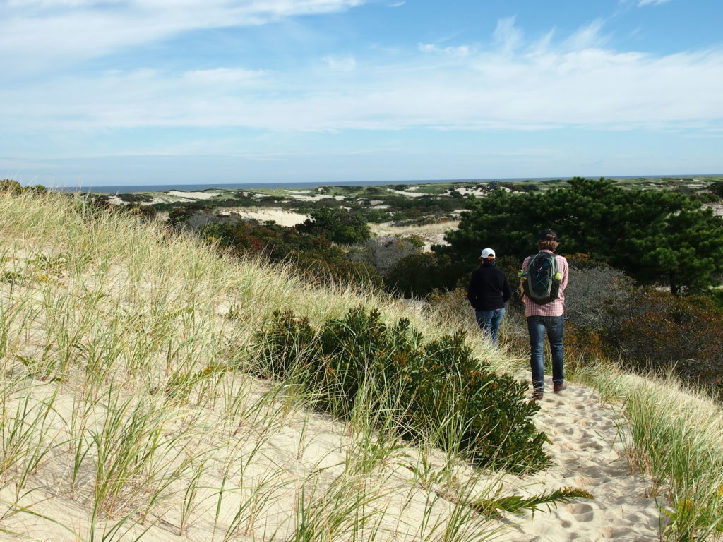
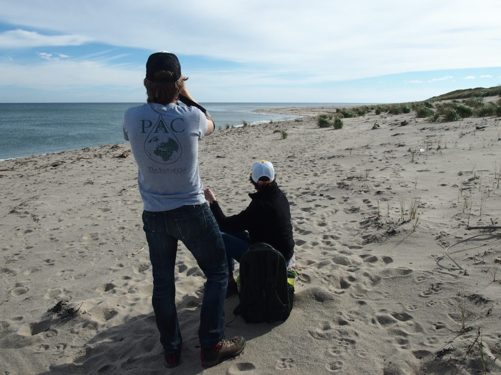
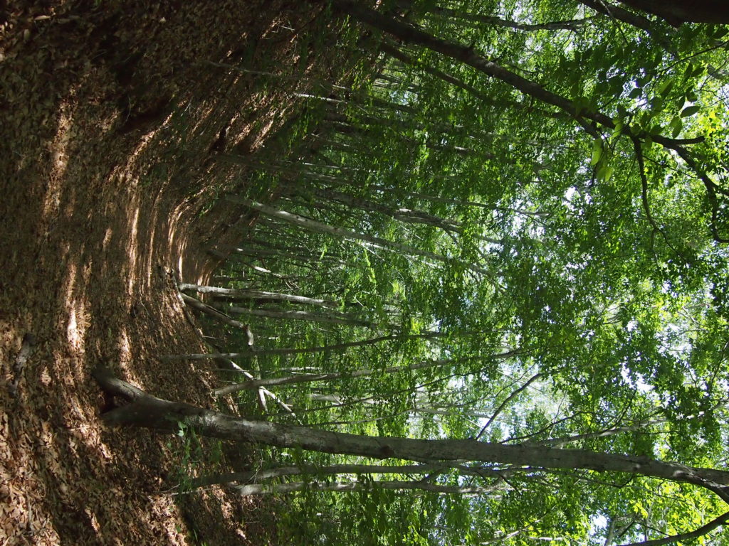
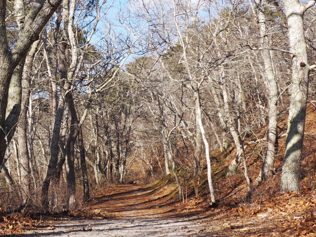
We travel far to discover what we take for granted when it’s close at hand. Living in South Jersey, we met people who had never been to Philadelphia, 20 minutes away. So, we decided to give Cape Cod the same treatment we give places we travel to visit and put together a post of some of the places we’ve explored, such as the trail from the Salt Pond Visitors Center to Coast Guard Beach.
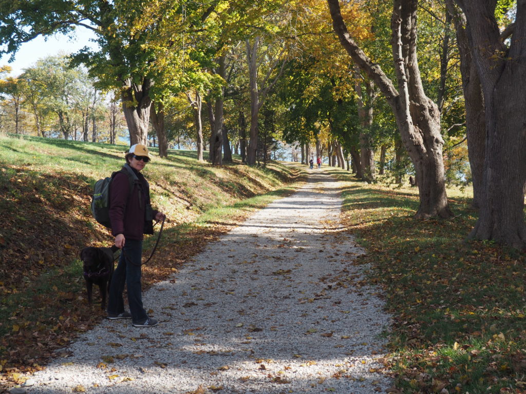
Fortunately, dogs are permitted on leash outside of tourist season (that’s Momo, the one who keeps us laughing)
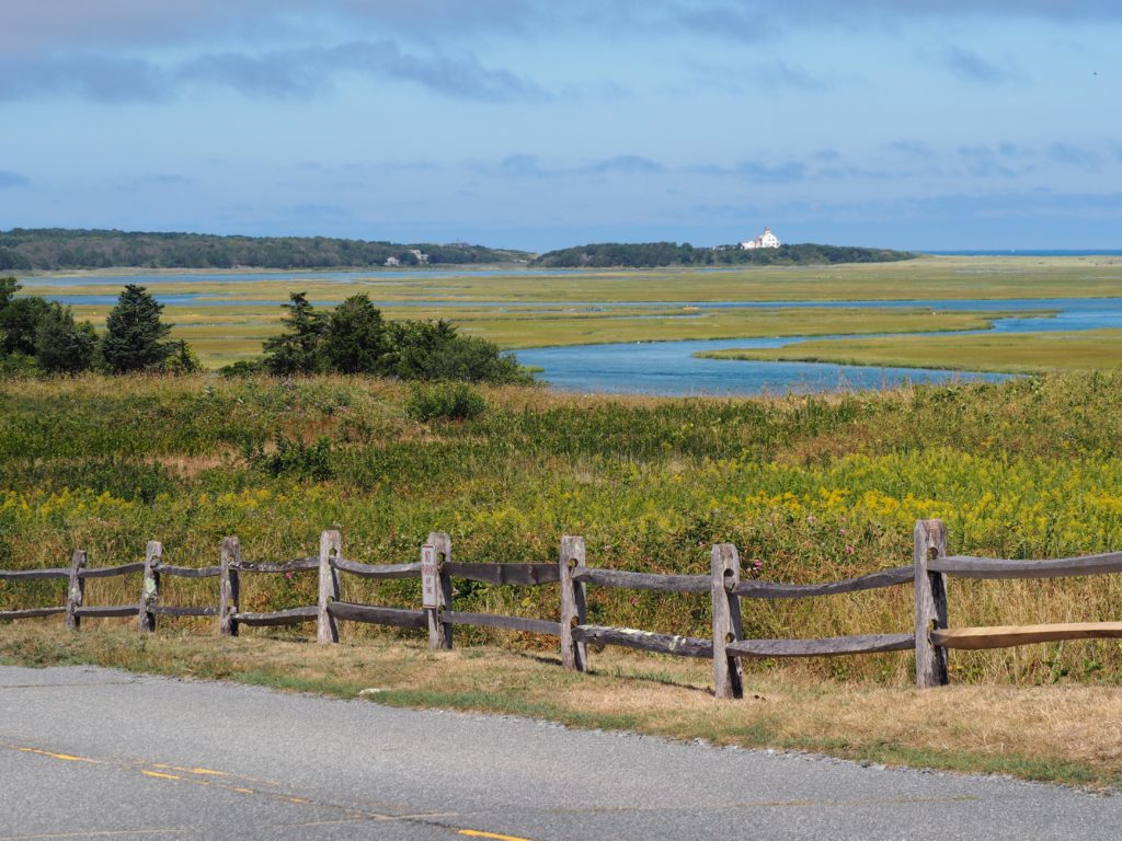
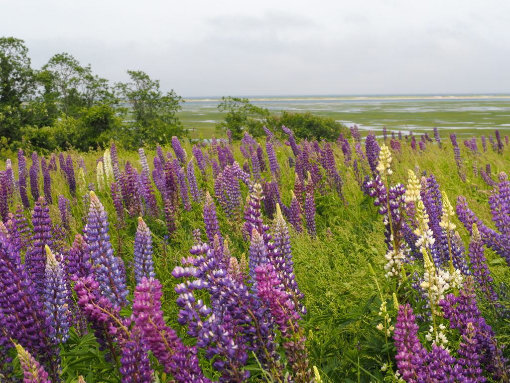
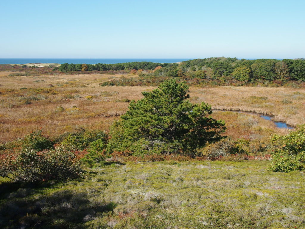
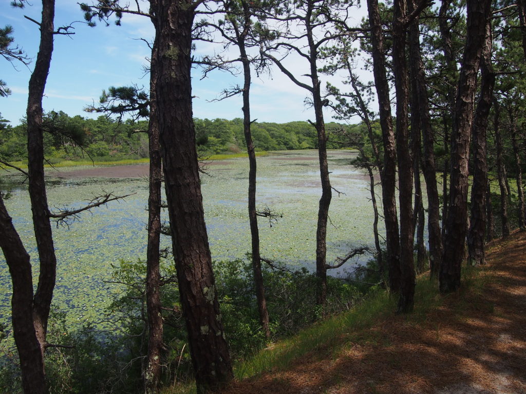
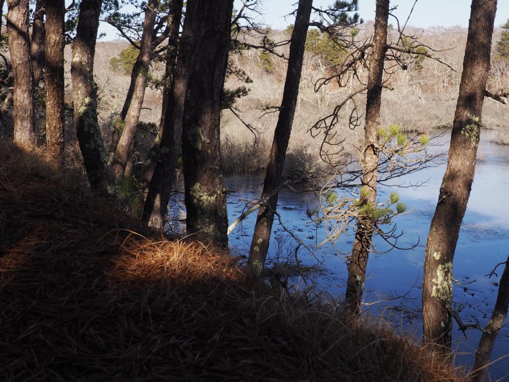
Nauset Marsh & Fort Hill
View from Fort Hill to Coast Guard StationLupine in bloom at Fort Hill, looking across Nauset Marsh to the Atlantic
As you might imagine from the photos, Fort Hill is a popular spot. On occasion, we’ve seen a line of cars waiting for a parking spot. We, of course, turn around and go home because it’s five minutes from the house. Within a short walk are an old sea captain’s house (tours courtesy of the National Park Service), a red maple swamp with boardwalks, a very large rock Native Americans used for sharpening (tool maintenance, of course) and great views of where there were Native American villages when Champlain came through (1605) and made a map of those seasonal villages around the edge of the bay/marsh (inhabited since 4,000 BCE). The marsh is also where our neighbor has his oyster grant, lest we forget that people still make a living from the sea.
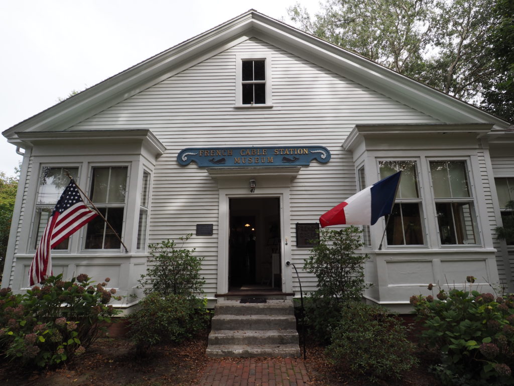
French Cable Station Museum, Orleans
The museum is on Town Cove, upstream from Nauset Marsh
Named after the Duc d’Orleans following his brief visit to the Cape (and secession from Eastham), Orleans is also where the first undersea cable established rapid and reliable communications across the Atlantic.
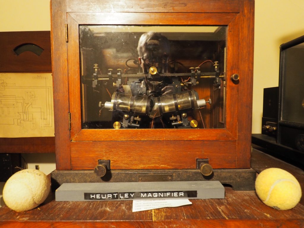
Robust as they seem, the cables suffered from being snagged AKA, photographer in the machine
Admittedly a bit wonky-charming, the museum is housed in the building where the connection was made, is staffed by enthused volunteers and had, on the day we visited, an actual delegation from St. Pierre island off of Newfoundland visiting. St. Pierre is a self governing territory of France where the telegraph cable was routed through on its way to Orleans until it was run directly to Orleans in 1898. Of course, up the road in Wellfleet is where Marconi had one of his receiving arrays in the early days of wireless, high on a cliff. Sometimes it pays to be out to sea.
Atwood-Higgins
Undisclosed location, Wellfleet
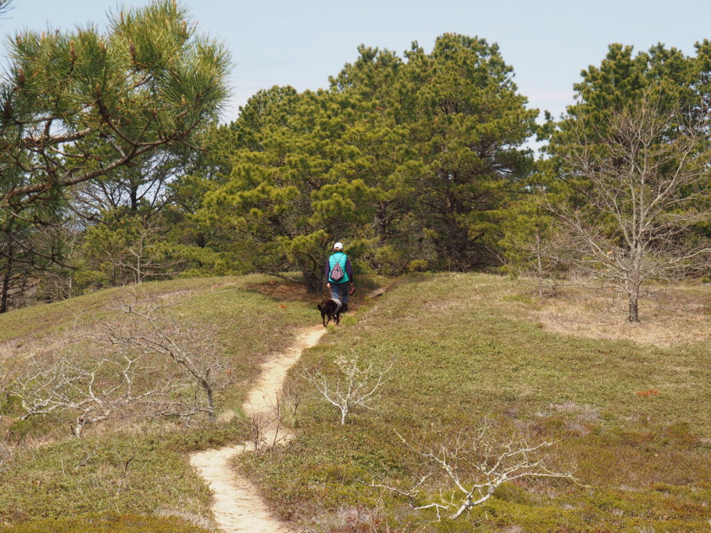
With all the controversy over geotagging, we do worry how long beautiful places can remain that way. This is the payoff of a glorious (and very hilly) walk in the National Park, preserved because it requires effort to get there.
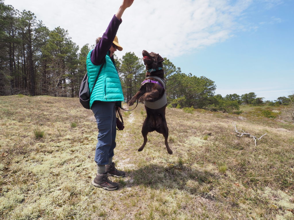
A wonderful walk, 12 months a yearThrough a heathland habitat, fast disappearing in developed areas because it’s very hard to re-establish. Reason enough to jump for joy (the treat may be the walk, but actual treats are even more inspiring)
The Atwood-Higgins house dates back to when the surrounding land was an island, people remembered there’s a reason to build in a hollow, and the captain could moor his sloop just a few yards from the house. Rarely open (although well worth visiting) it’s the woods that draws us at least once a week.
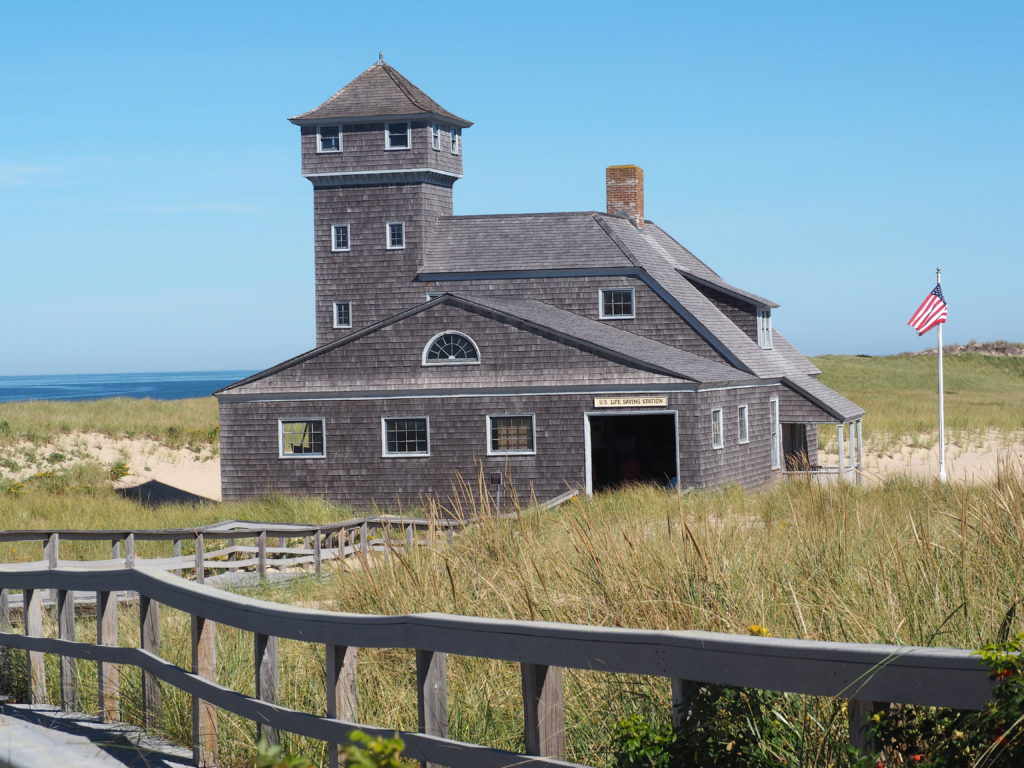
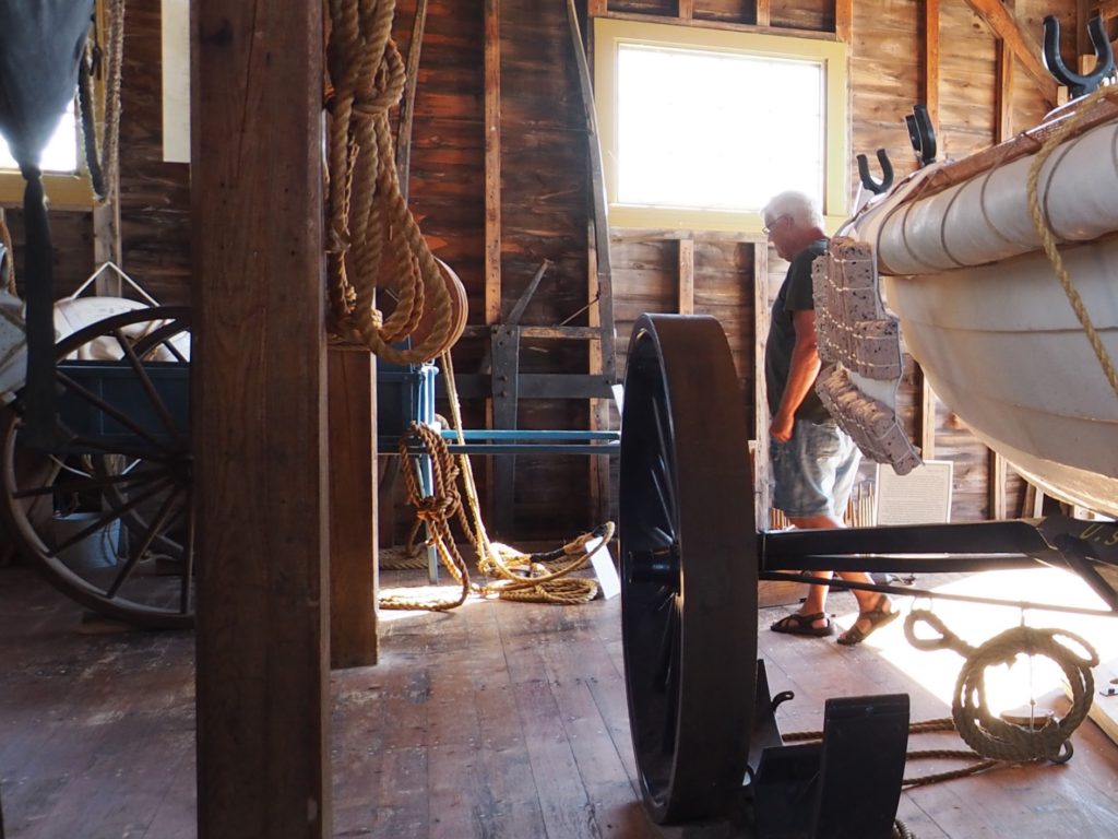
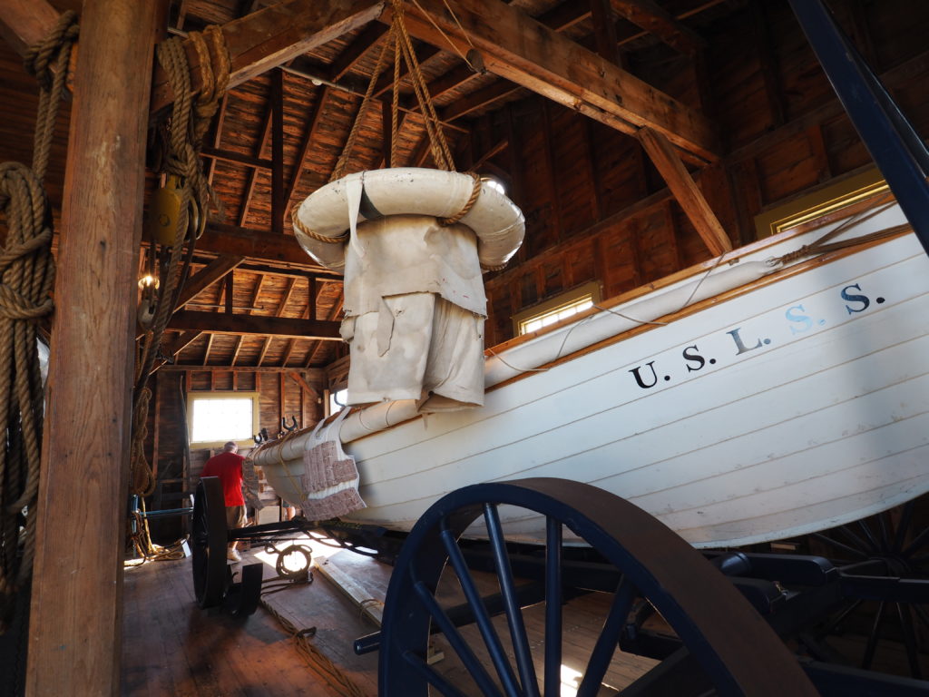
Old Harbor U.S. Life Saving Station
Race Point Beach, Provincetown
Built in 1897 in Chatham, the life saving station was rescued by the National Park Service in 1973, sawn in half and floated by barge to Provincetown where it presides at Race Point Beach.
The docents are helpful and it’s mostly hands on. All in all, it makes you grateful for modern equipment.
All up and down the Outer Cape the life saving service was extremely busy before the canal was built, as the passage around the Cape is exceptionally dangerous. Hiking in remote areas you can still come across the remains of old outposts.
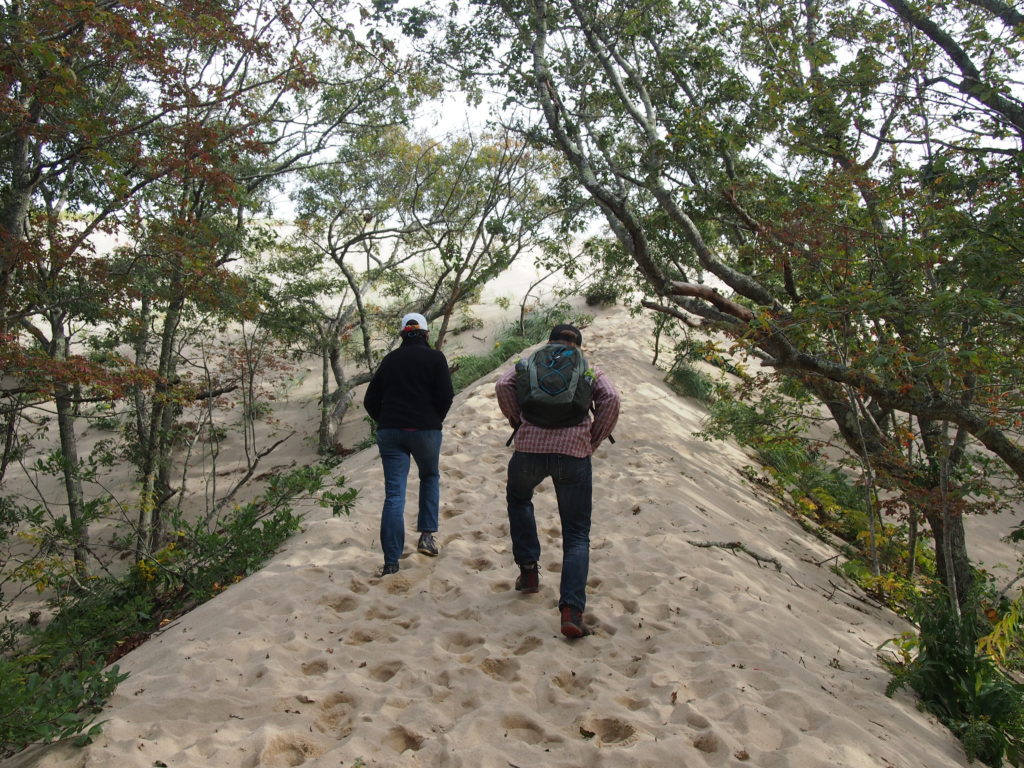
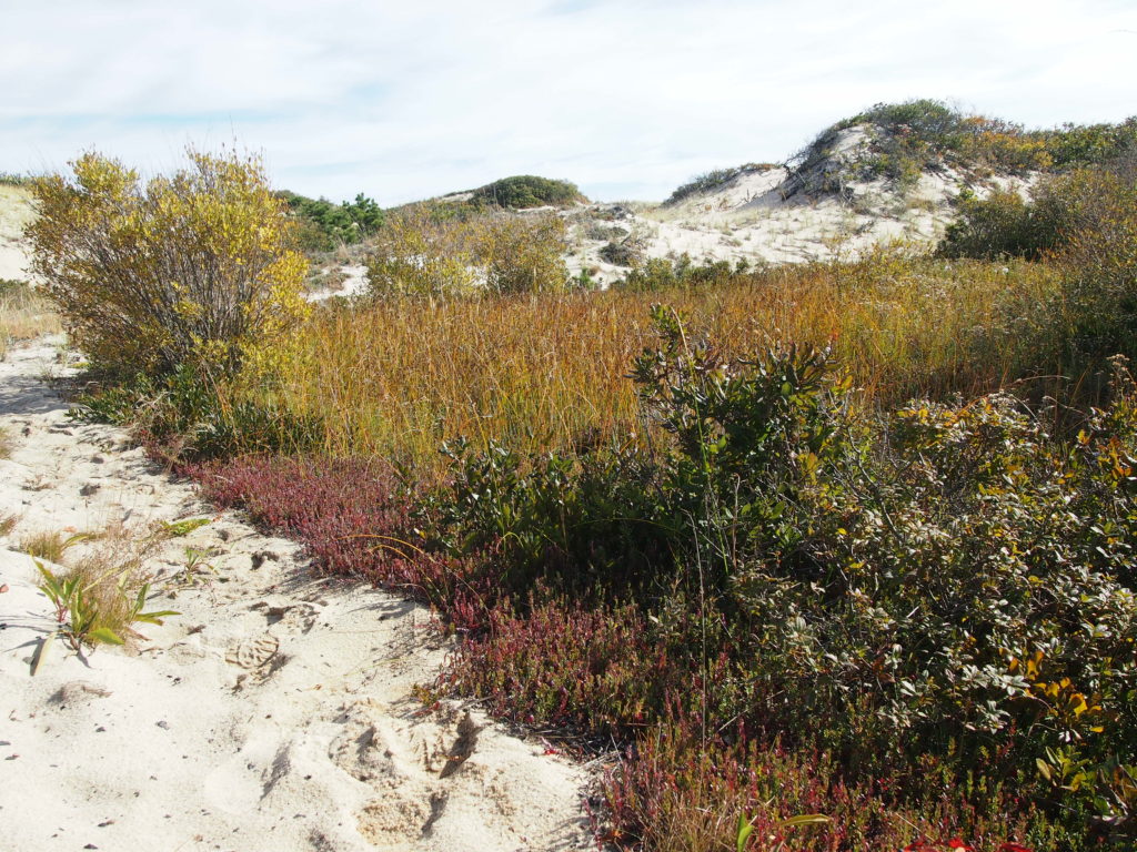
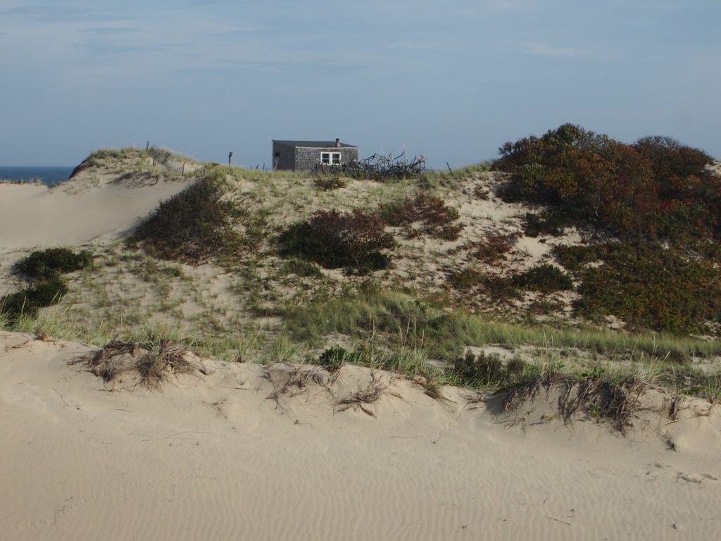
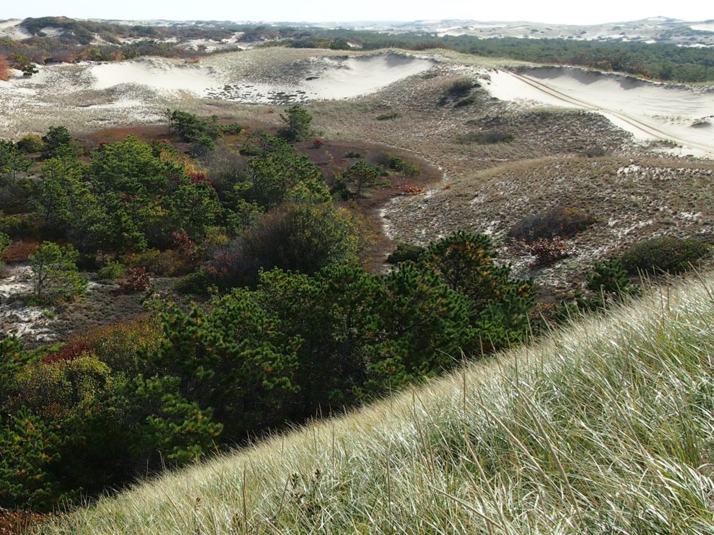
The Provincetown Dunes
Entering the dunes at Snail Road
Much of Provincetown is part of the National Seashore. So, in addition to a colorful downtown jam packed with summertime tourists, it offers abundant nature, including whale watching (see our post on Looking for Whales from August of 2014), a dramatic beach forest and outstanding dunes.
Through the dunes to the ocean. The regularity of the grass shows it’s the result of adding “plugs” as part of dune restoration.
The hike from Route 6 out to the ocean can work up a sweat, especially in summer.
Checking out the seals down the beach
It’s surprising how lush the vegetation can be in the lee of a dune
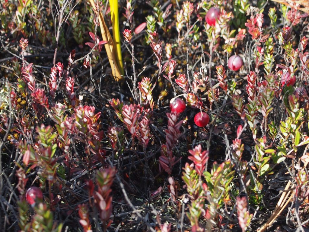
We didn’t take any cranberries with us and they’re much too tart to munch on the go.
Dune shack
Spread through the dunes in Provincetown are old cottages, now owned by the Park Service, but leased to organizations that make them available as artist’s retreats. Definitely off the grid, vehicular access is tightly controlled.
Dunes provide a variety of habitat
The changes in habitat within dunes are sometimes quite startling. It can be like coming upon a remote and hidden valley.
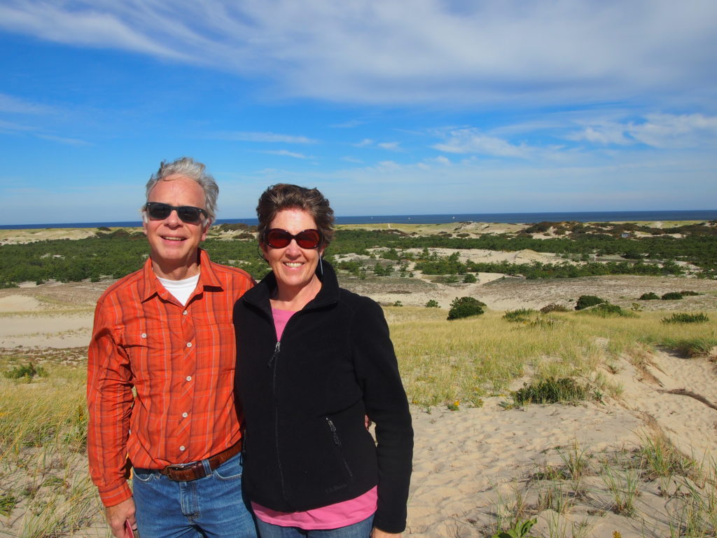
Amanda & Jim (photo courtesy of Ken)
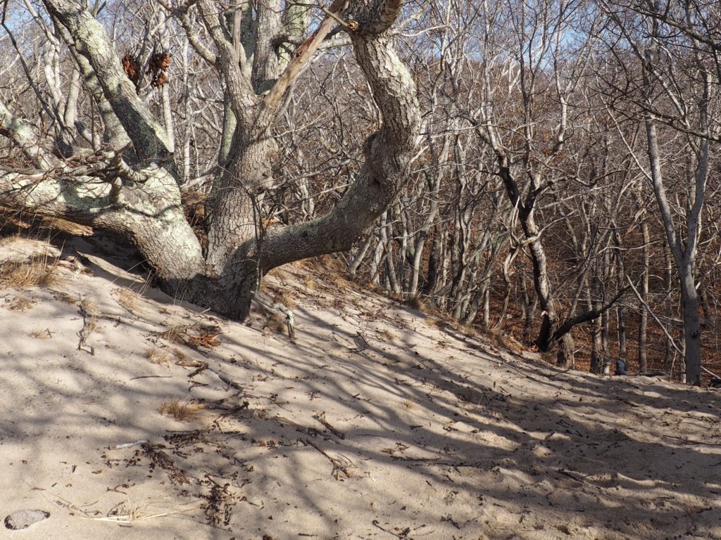
And, a Forest within the Dunes
From the heights of a dune into the forest below
Nestled within the Provincetown dunes lies a beach forest well marked by the Park Service with trails through it and this steep climb up to an adjacent dune.
The beach forest in summer Winter offers a distinct beauty. We were surprised to find ferns still green in an especially sheltered spot.The trail runs next to a pond thick with water liliesWhere the view in January has open water below
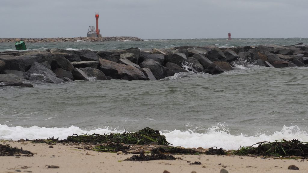
The Cape Cod Canal
Entering the Cape Cod Canal. Remember: “Red Right Returning”
It was Myles Standish who first scouted a possible route for a canal to avoid the treacherous journey around Cape Cod, trade with the Dutch of New Netherlands and the Native Americans around Narragansett Bay being critical to paying off the Pilgrim’s debts.
For a time, a modestly safer route cut through what was known as Jeremiah’s Gutter, between what is now Orleans and Eastham by the rotary and the Stop and Shop (where they predict a bridge will be needed as waters continue to rise). It was used by smugglers, we’re told, up through the late 19th Century.
Alas, dreams came true (except for motorists) when a canal was at last completed in 1916. And, it’s a big one. 480 feet wide, 32 feet deep at mean low tide, and seven miles long. It would take a lot to fill it in, as some propose. But, that would mean a longer trip around for everyone who’s waterborne, including the whales and porpoises who have also gotten used to the shortcut.
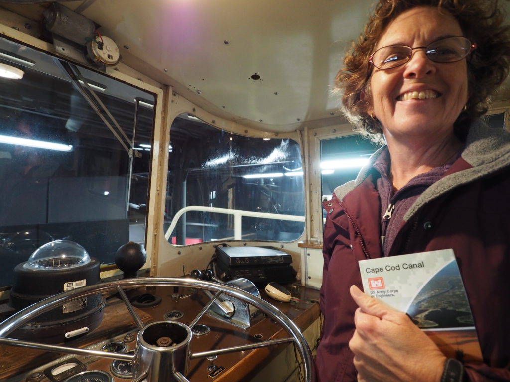
Aboard a tugboat, safely inside the museum.
The US Army Corps of Engineers not only maintains the canal, the have a rather nice little museum complete with boats in climb around in.
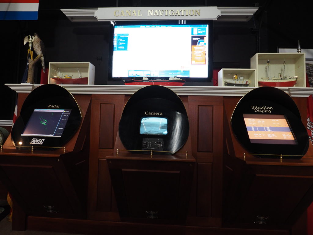
There’s also a nifty control room area. This isn’t the actual canal.
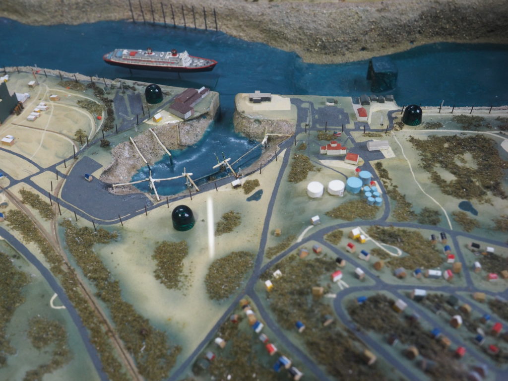
And, who can resist a rather well done model. (Takes us back to the days of train tables and trying to keep them from constantly derailing.)
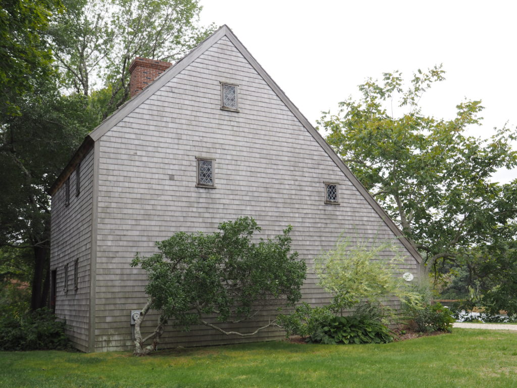
The Hoxie House
The Hoxie House, mid 17th Century
There are those little museums, often house museums, that don’t seem that special until you go inside and start to look around and listen to what the docents have to say. The Hoxie House is one of those.
Abraham Hoxie wasn’t the first one to live in this salt box cottage. A whaling captain, he didn’t move in until the middle of the nineteenth century.
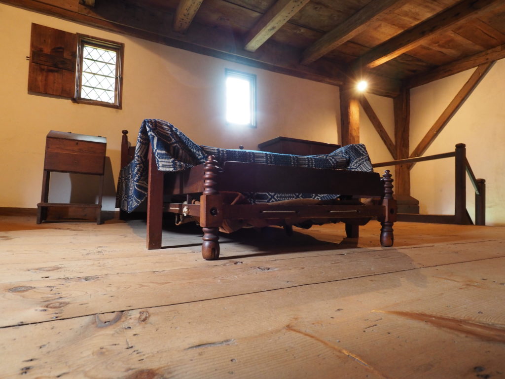
The sleeping quarters, upstairs.
The first known occupant was the Reverend John Smith, along with his wife and 13 children, who was the pastor of the First Church of Sandwich from 1673 until 1689. It was a Separatist congregation. Smith was also a member of the legislature and was known for advocating tolerance of those irritating Quakers. They moved into the house around 1675.
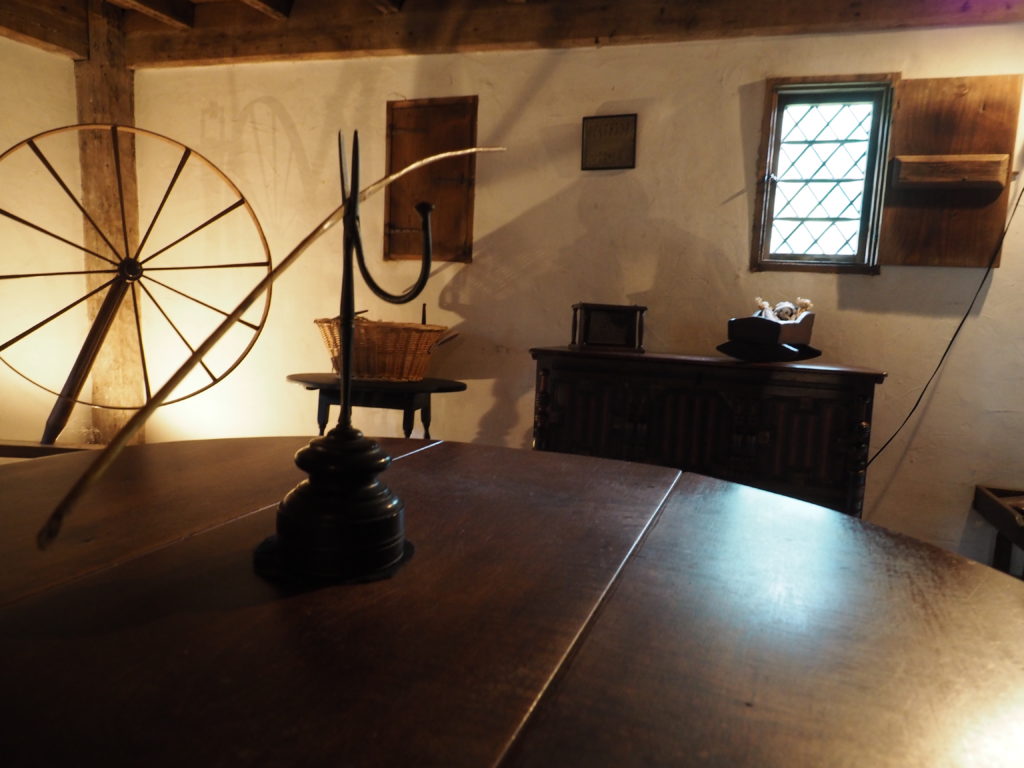
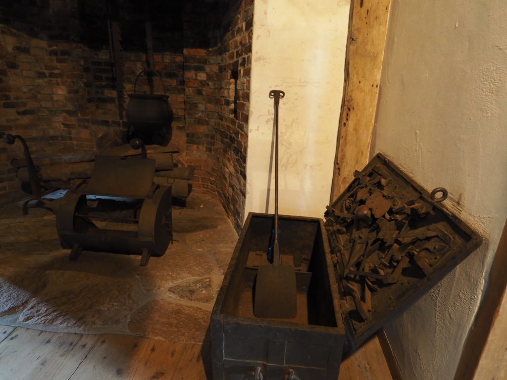
One of two ground floor rooms.A chest with a locking mechanism near the hearth in the other ground floor room. A very old window (300+ years?).
Until the house was purchased by the Town in the early 1950s, it had no electricity, no central heating and no indoor plumbing. (We suppose that isn’t saying much since Jim remembers when his grandparents put in indoor plumbing, also in the 1950s, although they did have electricity and central heat.)
What makes a place like the Hoxie House, of course, are the stories, including the ones we always love to be horrified by, like the old custom of putting bell pulls inside coffins – just in case.
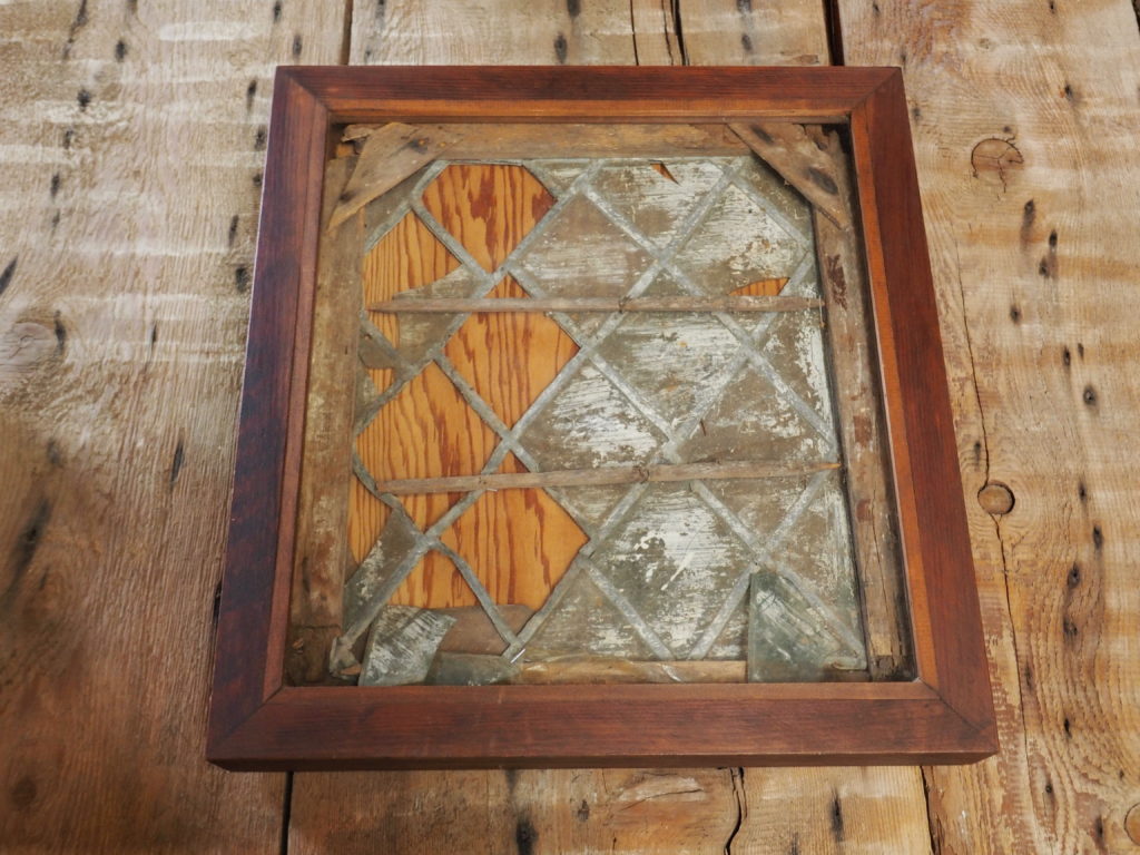
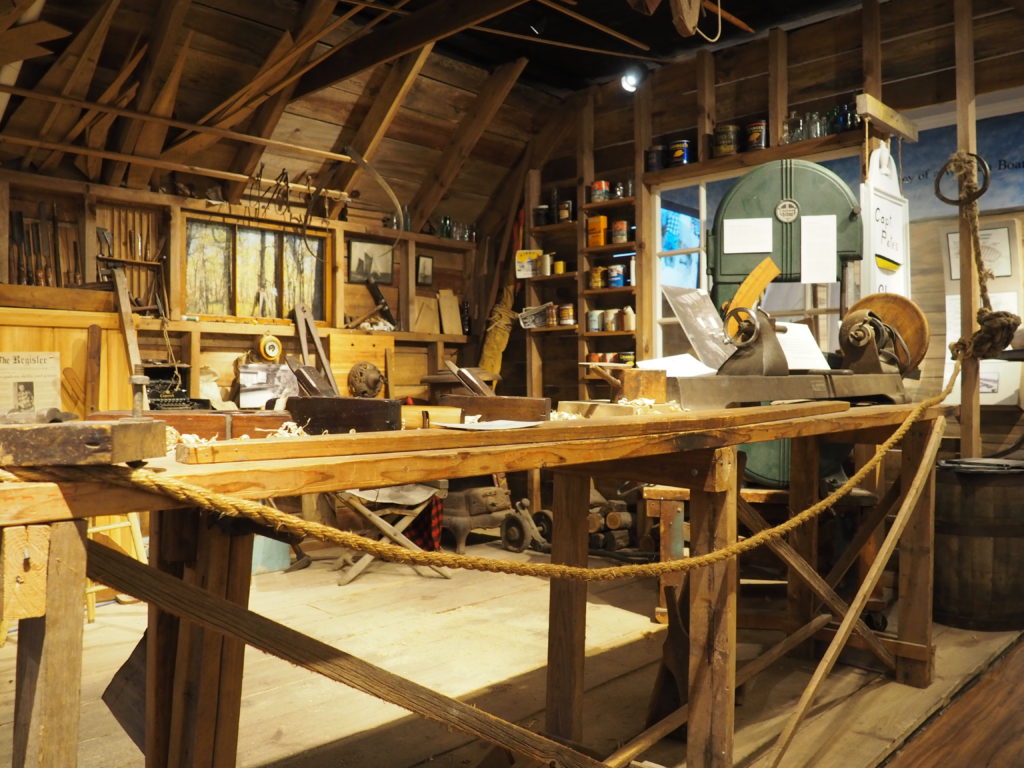
Cape Cod Maritime Museum
“Captain Pete’s” boat building workshop, complete with homemade planes, has been installed in the museum.
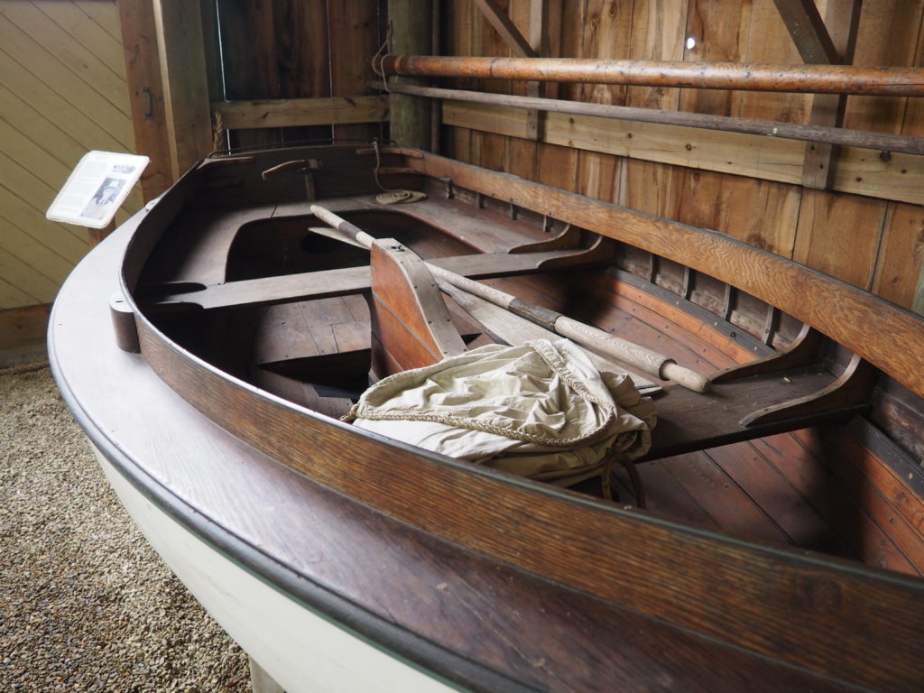
This museum may be small, but it has plenty of personality. From workshops and classes for beginning boat builders to a boat shed of interesting small boats.
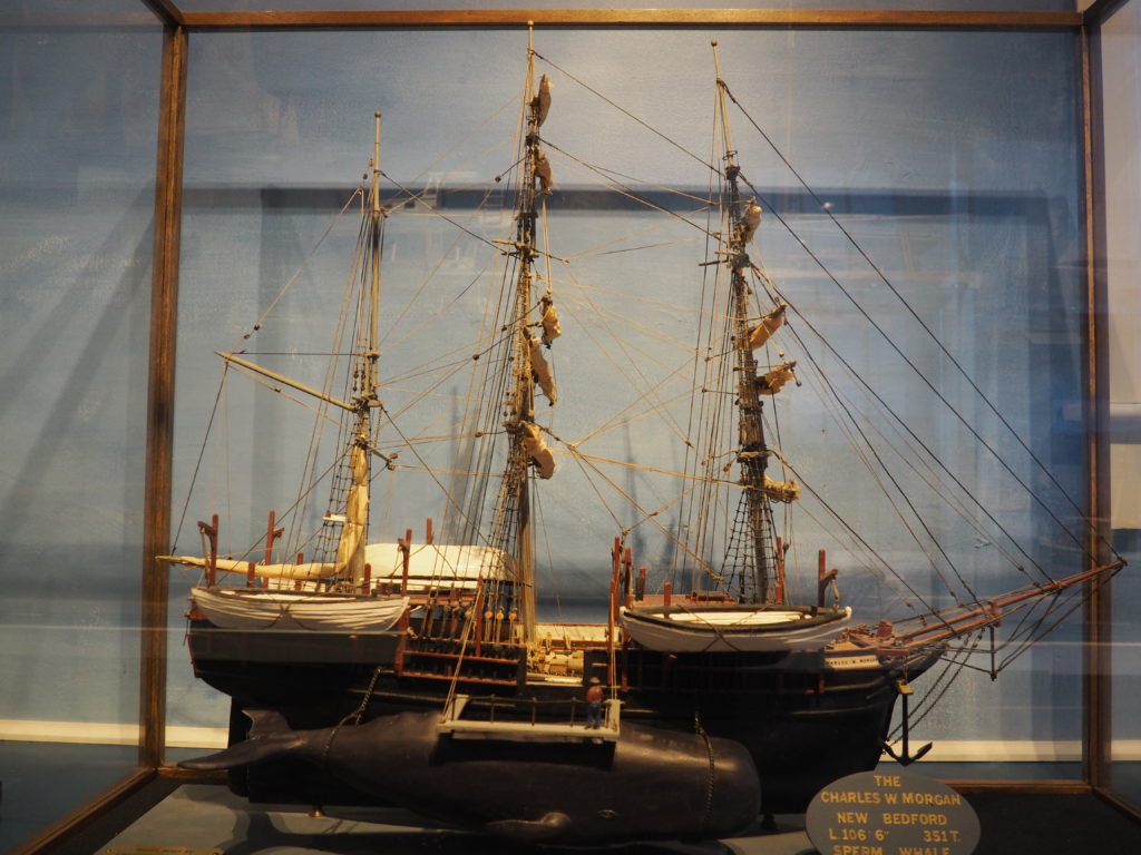
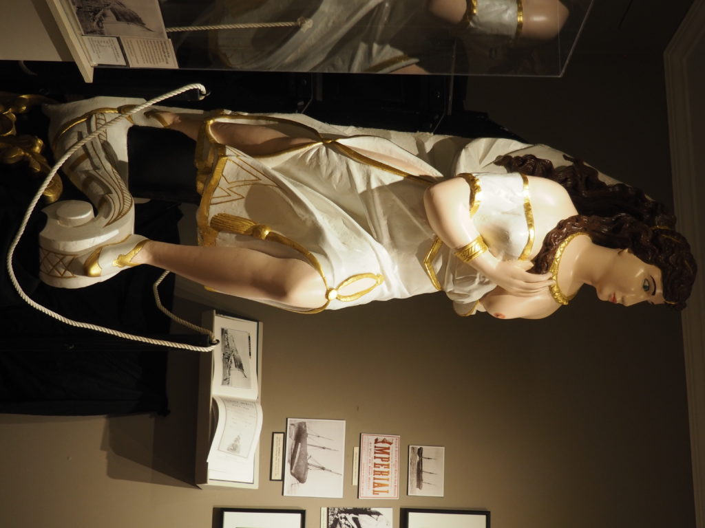
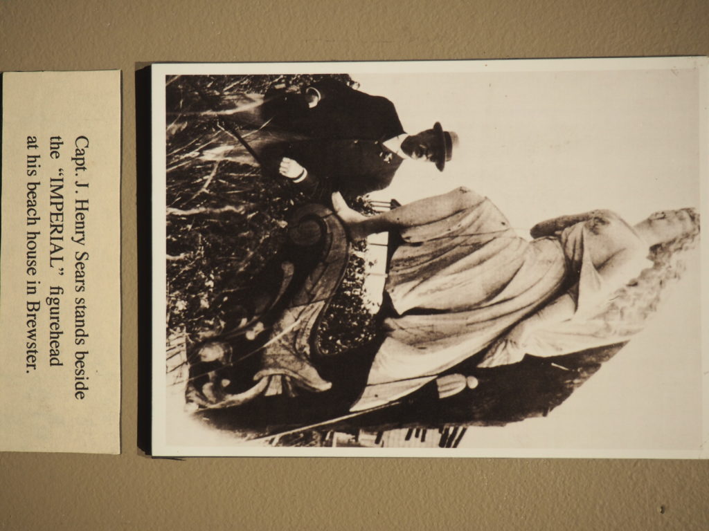
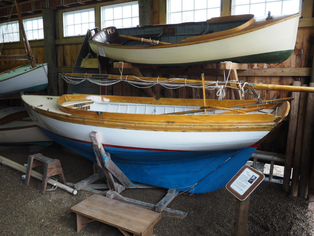
Taking a look at the whale alongside this whaling ship reminds us just how crazy those whalers were. Especially when you consider that few of them knew how to swim. Restored figurehead of the Imperial. After the ship went down, the Captain recovered it and put it on the bluff at his home in Brewster. A spritsail boat from Woods Hole, c. 1899.
12 1/2’ gaff rigged keel boat, built as a training boat for children. 1932.
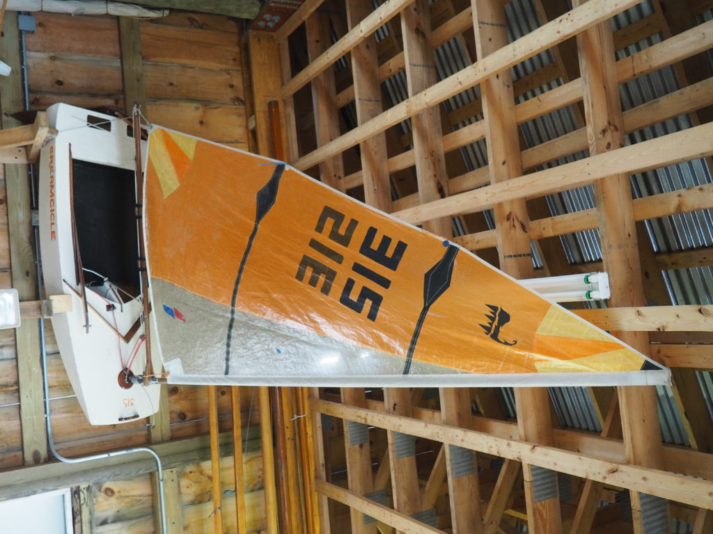
Cape Cod Frosty, a Frostbite boat, made of 1/4” plywood in a stitch and glue process from a design by Tom Leach from 1984 and built by Don Stucke in 1985. These boats are only sailed in the winter. All of 6’4” long with the hull weighing only 34 pounds, they’re incredibly portable. Don regaled us with stories of racing them, even taking them on the ferry with his friends to Nantucket to race with Nat Philbrick over there. We weren’t sure whether this was fun or insane.
This seems like a good place to put in a plug for another museum, but one that doesn’t allow photography. We were surprised at how interesting and engaging the Whydah Pirate Museum is. The collection is primarily from the underwater archeology undertaken by the organization to recover artifacts from, you got it, a sunken pirate ship. It’s all about pirates, the lives they lived and the treasure they acquired by unlawful means. In a back room of the museum you can even talk with an archeologist as she works on restoring recovered artifacts. Truly fascinating and very well organized and presented.
World’s End
“A New End,” an installation by Jeppe Hein.
World’s End is about as far away as we can justify in talking about Cape Cod. It isn’t on Cape Cod, with or without taking into account the canal. However, being in Hingham, it’s an easy day trip. So there you are.
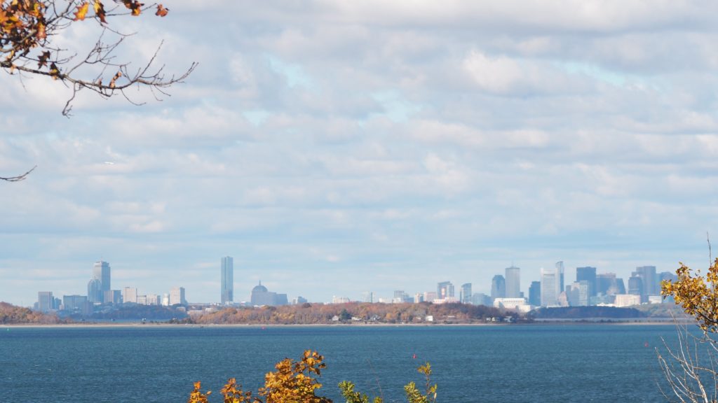
There are 250 acres of landscape designed by Frederick Law Olmsted. With carriage paths that reminded us of the Rockefeller property up in Maine near Acadia National Park.It’s a wonderful place for a relaxing walk with Momo.And, there’s even an impressive view of Boston.
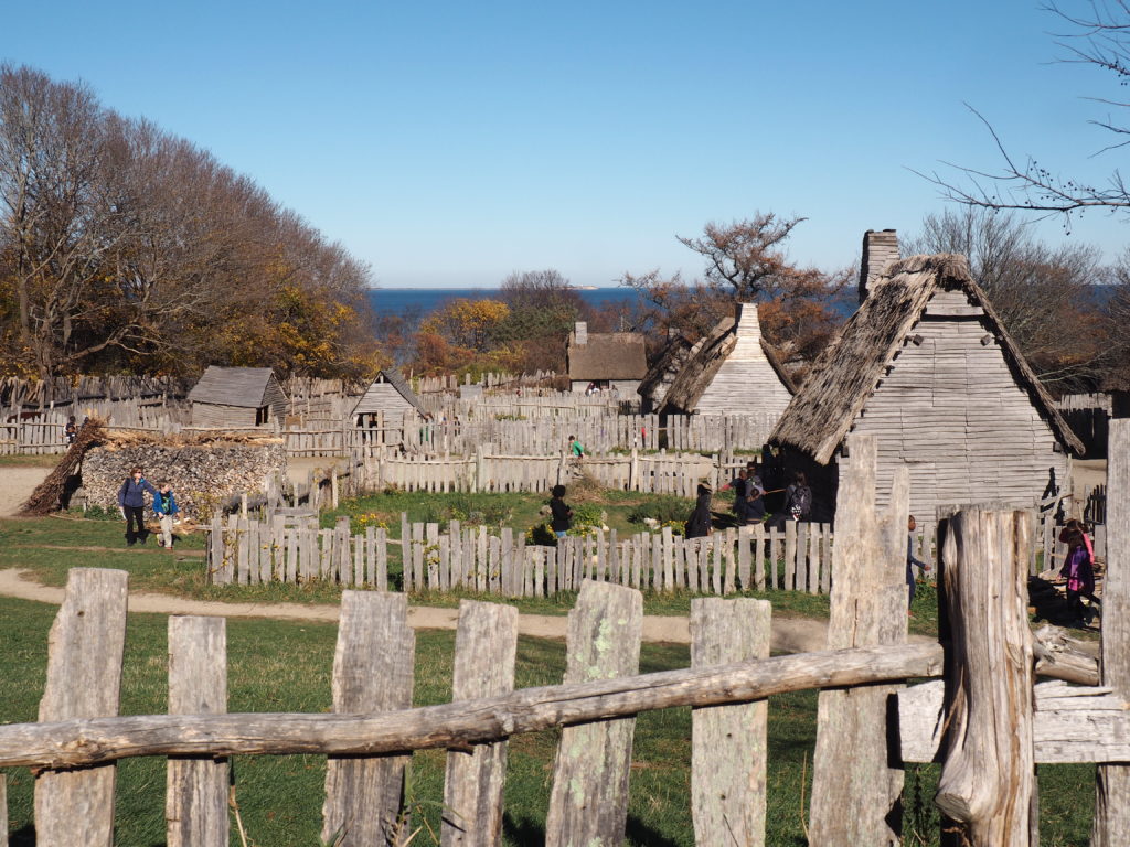
Plimouth Plantation
A reconstruction of the village of Plimouth Plantation at Plymouth.
Okay, fair enough, we fully acknowledge that this is not Cape Cod. However, our excuse is again that it’s not far away and there is a very solid connection to not only the Cape, but to Eastham in particular. You see, Eastham was founded by folks who found the life of Plimouth to be a bit constricting and returned to where they had first made landfall and contact with the Native Americans. Both communities are preparing for the onslaught of Mayflower descendants celebrating the 400th anniversary of 1620.
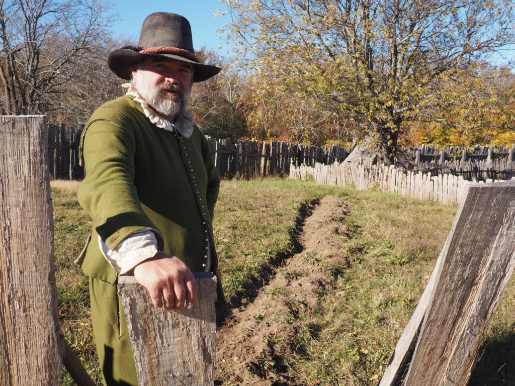
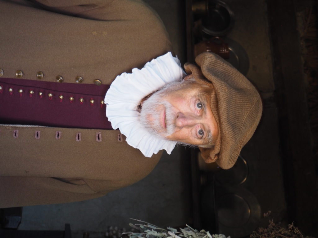
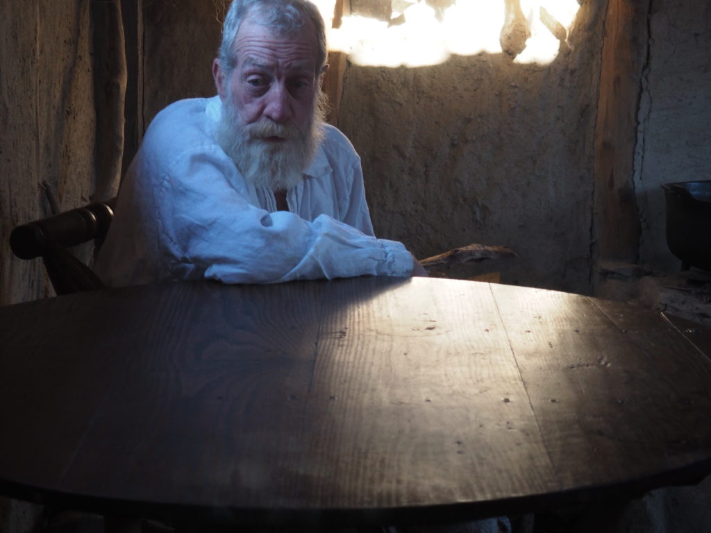
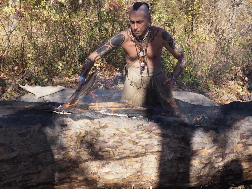
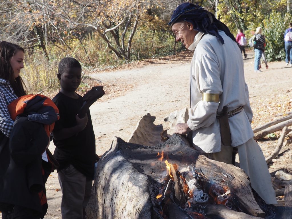
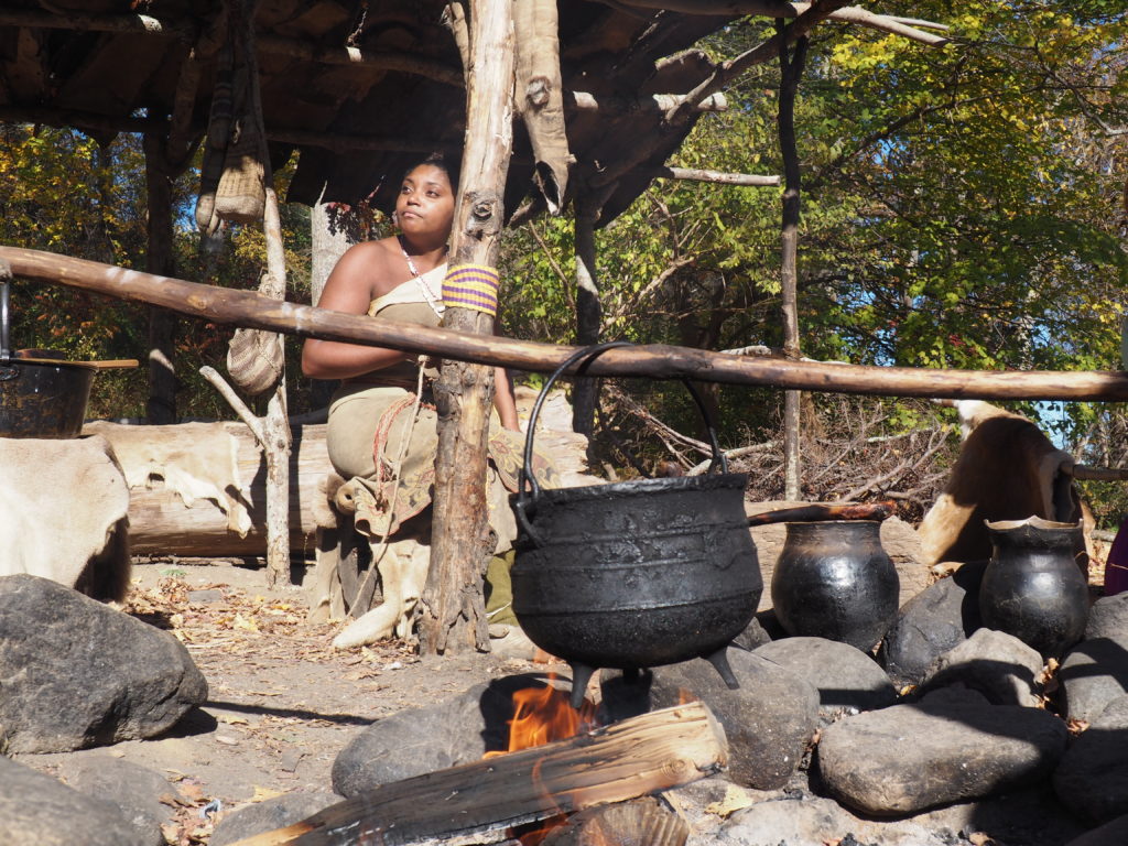
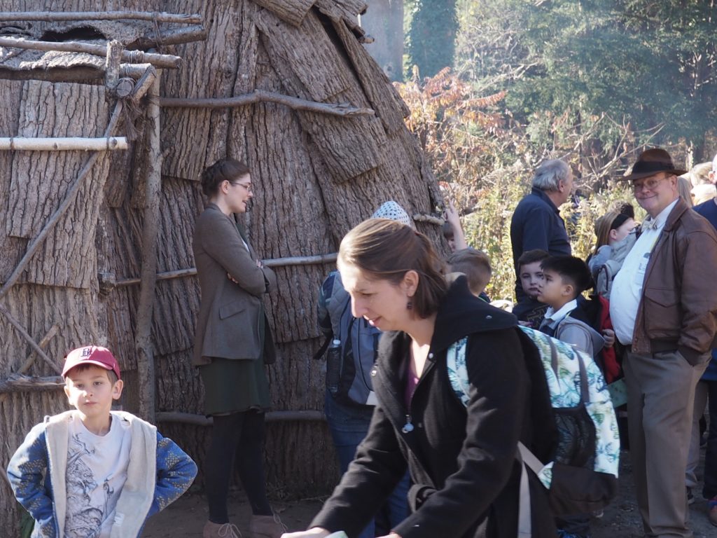
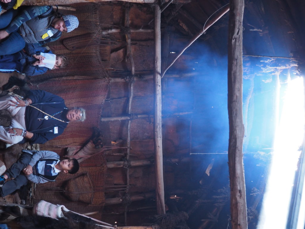
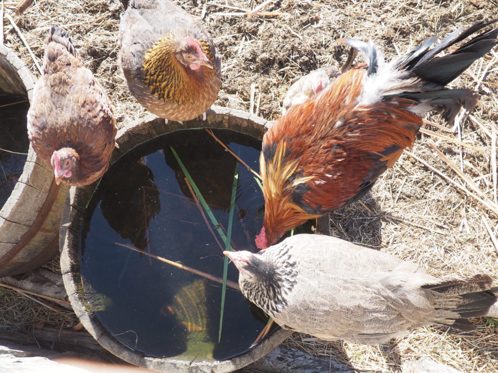
A reenactor in the Pilgrim’s village.Reenactors stay in character and true to their time period while engaging with you about their life and experiences. They are specific individuals and have researched not only the times, but the lives of the people they portray. And, they have stories to tell. In the nearby Wampanoag village, the reenactors do engage with you as contemporaries, sharing what they have learned about their ancestors.Making dugout canoes always draws people in.It’s a nice area to wander around, watch both the reenactors and the tourists, and soak up the atmosphere of the village. We all need to wait for our turn in the lodge. Of course, it was our bad judgment to go there the week before Thanksgiving when school trips are especially popular. Where there are more stories to tell. Jim, of course, tried to make friends with the chickens.
Bringing It Home
Thanks to Kyle for the photo.
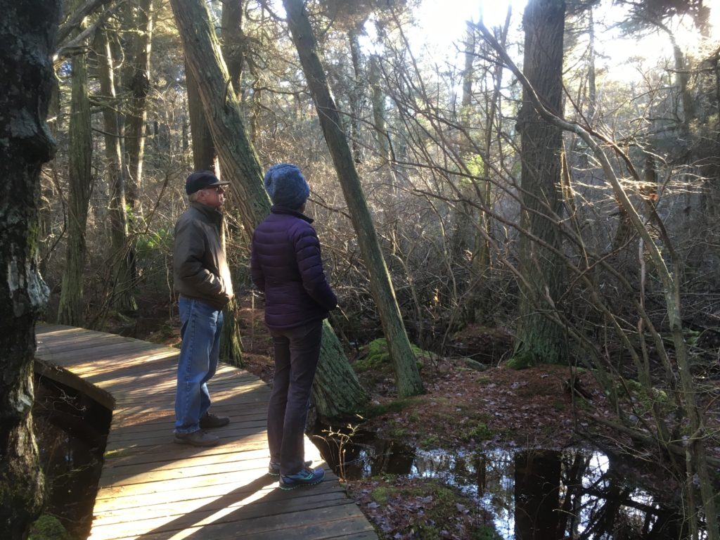
It’s not a diorama and it’s not Louisiana. As featured in a prior post, the White Cedar Swamp in Wellfleet seems like a magical nether world at any time of year, where you expect some giant winged creature to come flapping out of the deep woods scaring the wits out of you. It’s beautiful, actually.
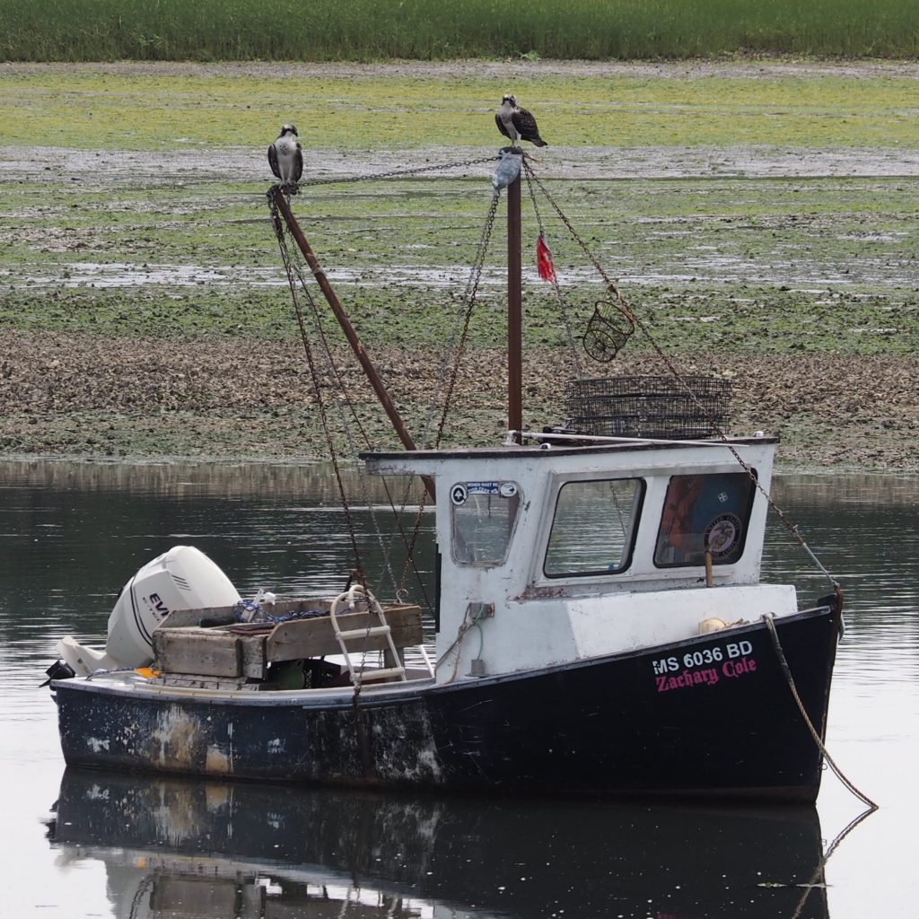
Juvenile ospreys in Wellfleet Harbor. Fog pulls back out to sea.
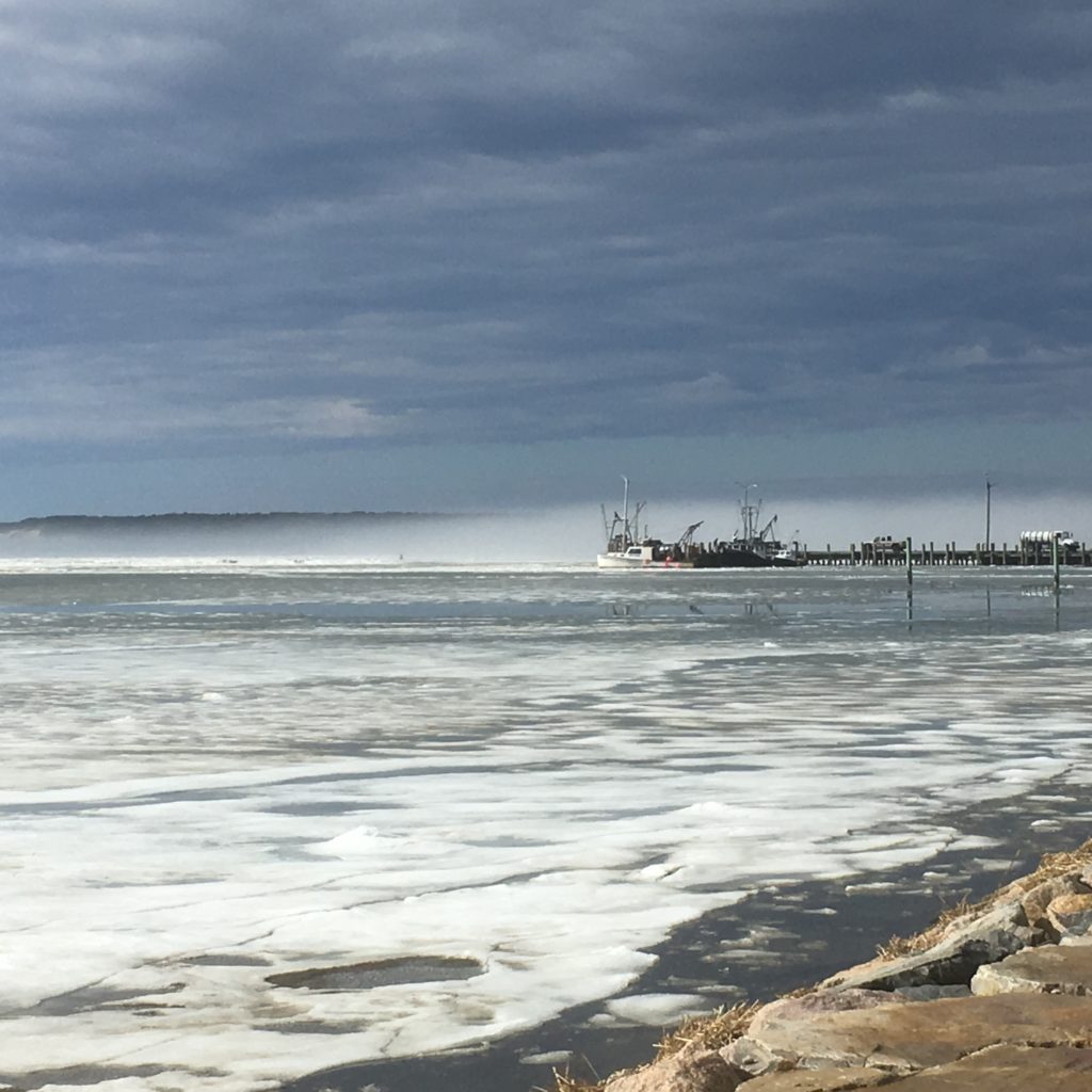
Then there is the simplest place to take a walk, with a 1 1/4 mile marked track around the perimeter of the pier at Wellfleet Harbor. In summer the thing is to walk carefully and quickly under the ospreys’ nest, to avoid being splattered. In fall, you might spot a stranded mola or ocean sunfish, as we did. In winter, when the docks have all been pulled and stacked, all crusted with barnacles, and the small boats have found a parking space on top of the pier you can still be surprised by how beautiful it all is.
Ken and Momo coming off the flats at First Encounter Beach