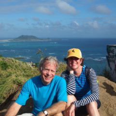
Having enjoyed our National Parks trip (Yellowstone, Teton, etc.) 6 years ago, we signed up in January for a New York Times sponsored trip to the canyons of Utah and Arizona to take place in September. In April, Jim suffered from a debilitating physical condition that necessitated cancelling a May trip to China. In June, with the final payment date for the Canyon trip approaching, although much improved, it did not seem prudent for Jim to go on what the itinerary described as a strenuous trip. He graciously agreed to let me go and for son Ken to be his surrogate. Photos are courtesy of Ken.
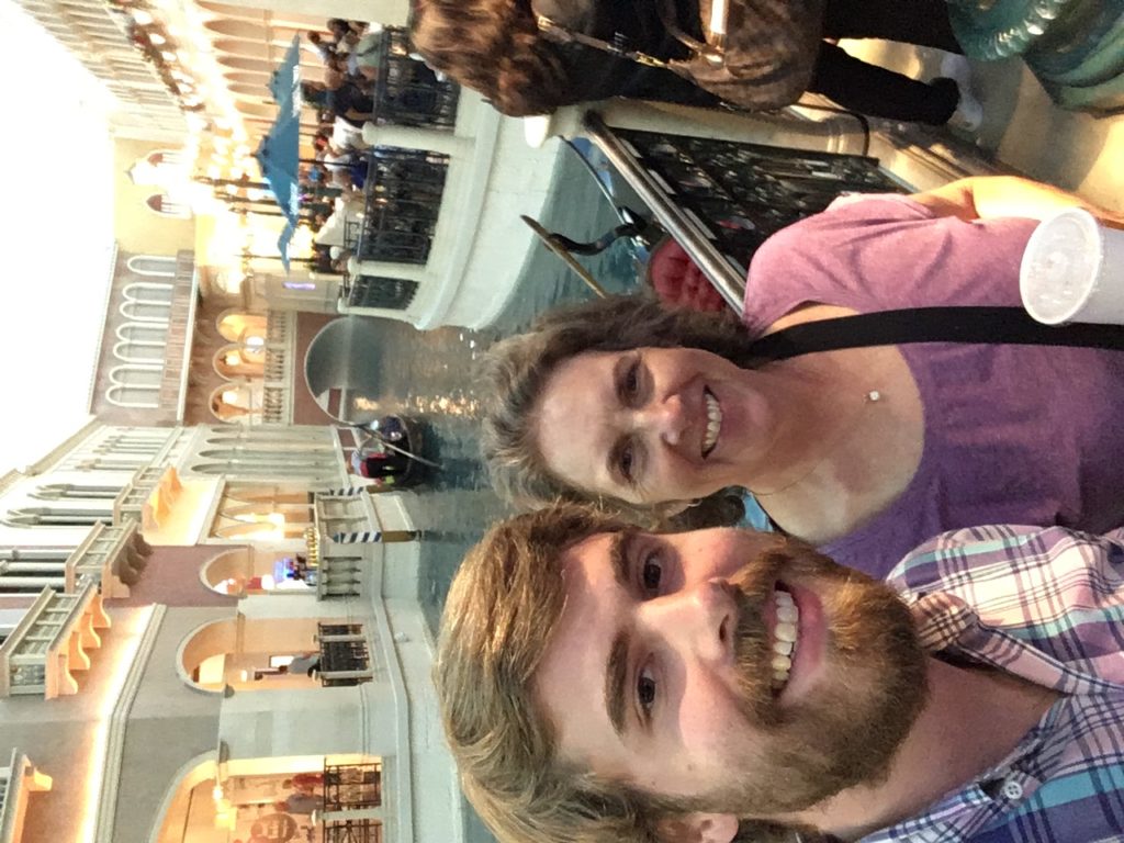
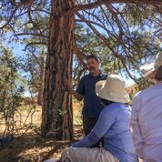
Our trip started in Las Vegas. Here we are at the “Grand Canal” at The Venetian. Over a dinner of tapas, we met the other participants, the tour leaders and the New York Times Expert, Jim Robbins. Jim has written for the NYTimes for over 35 years, mostly on science and environmental issues. He also wrote for The Christian Science Monitor. In addition, he has done research on the polygamist groups of the Mormon Church. His commentary and lectures during the trip were informative and fascinating.
Through the Mojave Desert and on to Zion National Park.
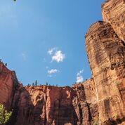
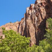
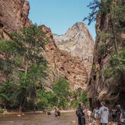
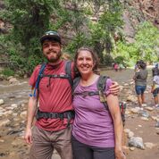
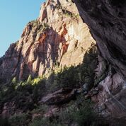
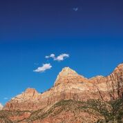
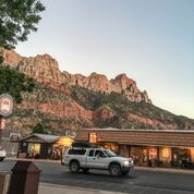
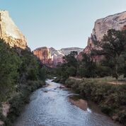
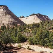
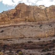
We left the glitter of Las Vegas and traveled through the Mojave Desert with its Joshua Trees dotting the landscape. A stop in a park for lunch and introductions before we reached Zion. Zion became a national park in 1919. It is characterized by its sheer multicolored walls of sandstone narrow canyons and the Virgin River which runs through them. We hiked the Riverside Walk which follows the Virgin River to the narrows, a spot where the canyon walls come close enough to the river to necessitate continuing in the water, we turned back at this point. Along the way we saw hanging gardens, plants holding on to the sides of the canyon walls. Night in Springdale.
Zion Day 2
After breakfast at the Zion Lodge, we hiked the Emerald Pools Trail, a wooded hike that leads to a waterfall and the lower Emerald Pool. The path ended where it had been washed out by a flash flood in July of this year. Flash floods, occurring mostly during monsoon season (July and August) turn the calm Virgin River into a raging force.
On the way to Bryce.
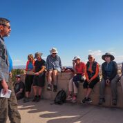
We made our way to Bryce National Park passing through some spectacular scenery, saw Smokey and heard a lecture by Jim Robbins over lunch.
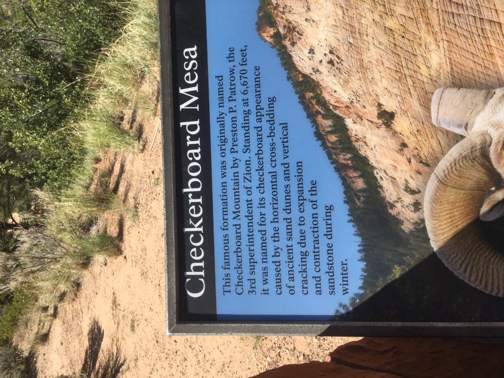
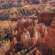
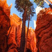
What’s a HooDoo?
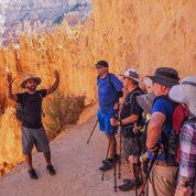
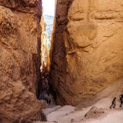
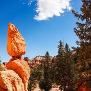
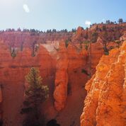
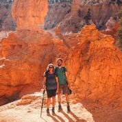
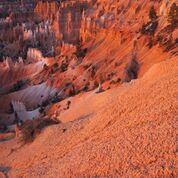
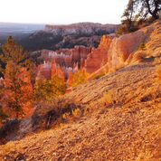
Bryce Canyon is not a canyon, but rather a collection of natural amphitheaters. It became a National Park in 1928. The HooDoos are the geological structures that fill the amphitheaters. The towers of rocks were formed by years of wind and water erosion that carved away some of the rock. The word hoodoo may come from voodoo and the legend told by the Ancestral Puebloans that a powerful Coyote turned some evil people into stone. Either way, the resulting structures are spectacular. Bryce Canyon got its name from an early Mormon pioneer named Ebenezer Bryce who described the canyon as “a helluva place to loose a cow” Our hike down into the HooDoos included passing through “Wall Street” with its 200 foot tall cliffs and a sighting of “Queen Victoria.’
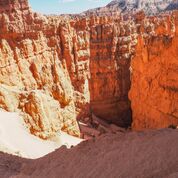
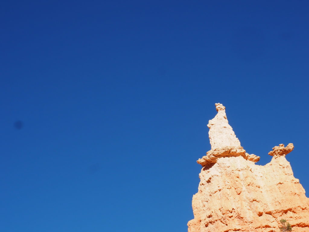
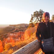
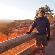
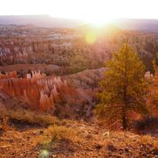
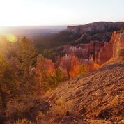
Sunrise Over the HooDoos.
We ventured out early, in the dark to catch the first glimpses of the sun as it lit up Bryce Canyon. Definitely worth braving the chilly morning air.
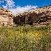
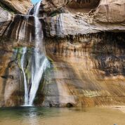
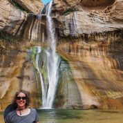
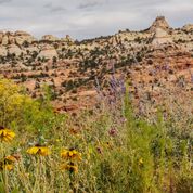
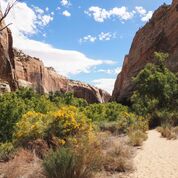
Grand Staircase-Ecalante National Monument.
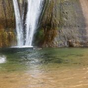
Bill Clinton designated this area, nearly 1.9 million acres a national monument in 1996. In 2017, it was reduced to 1 million acres by presidential proclamation It was the last land to be mapped in the contiguous United States. It is a mostly undeveloped area of canyons, mesas, plateaus and river valleys. Another lecture along the way. Ken and I opted for the more challenging Lower Calf Creek Falls Hike through a canyon to a waterfall. We were rewarded for our efforts, trudging through sand, with the spectacular waterfall. Ken took a swim.
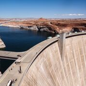
Glen Canyon Dam, Lake Powell and Antelope Canyon.
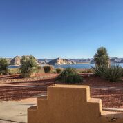
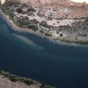
Leaving the HooDoos behind after another spectacular sunrise, we made our way to Glen Canyon Dam on the Colorado River. Glen Canyon Dam was completed in 1966 and is named for the canyon flooded by the Lake Powell reservoir. Lake Powell is named for John Wesley Powell, who led the first boat expedition of the Grand Canyon in 1869. This was after he lost an arm to a cannonball in the Battle of Shiloh. Glen Canyon Dam was built to ensure equal water rights to the Upper Basin (Colorado, Wyoming, and most of New Mexico and Utah) and the Lower Basin (California, Nevada and most of Arizona). Unfortunately, with the prolonged drought in the area, there are concerns about the ability of the reservoir to meet the needs of agriculture and cities dependent on the Colorado River for water. The talk given by Jim Robbins at this stop gave a somewhat bleak outlook for the situation. Lake Powell, our evening destination is a popular recreation area, especially with boaters.
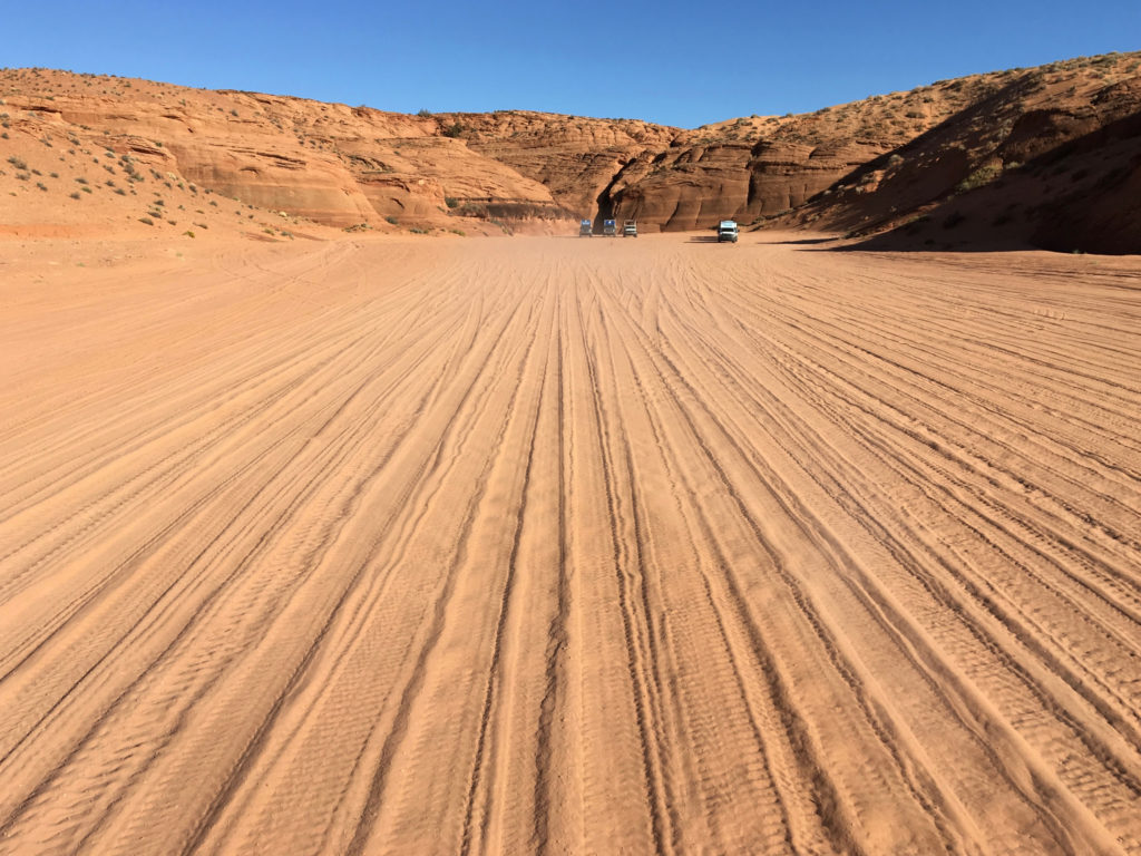
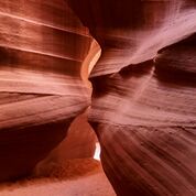
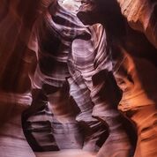
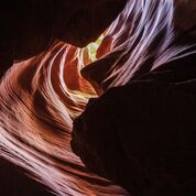
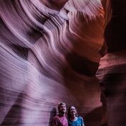
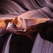
After lunch, we headed to the town of Page, Arizona where, after a brief visit to the Powell Museum, we took a tour of the Antelope Canyon on the Navajo Reservation. The Navajo name for the Canyon translates into “the place where water runs through rocks,” which is fitting since flash floods in the monsoon season carved away the sandstone in the slot canyon. To get to the Canyon you must take a tour organized by Native Americans. We climbed into the back of a pick-up truck fitted with bench seats holding 6 or 7 on a side. There were three seatbelts on each side which the driver explained was to keep the passengers from standing up and getting bounced out. Bounce was an understatement. We arrived at a clearing before an entrance to the Canyon (along with hundreds of other tourists). Our guide Nate set everyone’s phone or camera to the best setting to capture the beautiful colors. Supposedly, the highest price ever paid for a photograph, $6.5 million, was one taken in the Canyon in 2014.
A side note about time zones: Our hotel on Lake Powell was in Page, Arizona and was on Mountain Standard Time, the nearby Navajo Reservation was on Mountain Daylight Time, so our electronic devices, depending on which cell tower they were picking up, could display different times even when situated next to each other.
On our way to the Grand Canyon.
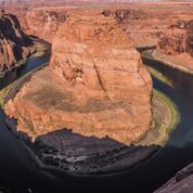
Our first stop was Horseshoe Bend in Glen Canyon, a widely photographed area where the Colorado River makes a sharp turn around a sandstone escarpment. I understand the railings were a recent addition – yikes! The view was spectacular.
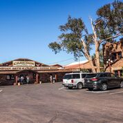
We made a brief stop at Cameron Trading Post, open since 1916. A wide offering from trinkets to exquisite weaving, but nothing to tempt us.
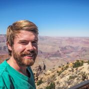
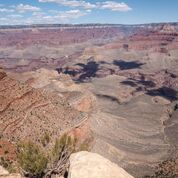
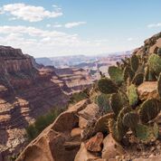
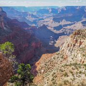
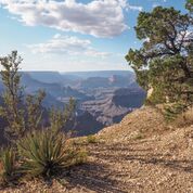
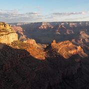
Wow! It’s the first word that comes to mind when you see the Grand Canyon. I had visited the Grand Canyon in 1980 with my brother and I remembered that it was beautiful and that it snowed in May. The Grand Canyon was designated a National Monument in 1908 and a National Park in 1919 by an act of Congress. It is 277 river miles long, roughly 4,000 feet deep and on average, 10 miles across.
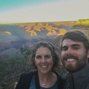
After lunch which included a serenade by one of the enormous ravens, we explored the south rim, where our hotel, The Thunderbird Lodge was located. Our group began a hike down the Bright Angel Trail, but many turned back deciding that the trail edge was too daunting. We explored the Kolb Studio, where there was an exhibit of plein air paintings created as a part of a special celebration of art event. Many of the buildings on the South Rim were designed by Mary Colter early in the 20th century.
After dinner, Ken and I explored the trail leading to Hermits Rest.
Grand Canyon Day Two.
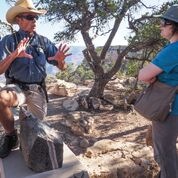
We started out the day with a guided walk on The Trail of Time, led by a geologist from the Grand Canyon Field Institute. The Trail of Time is an interpretive path representing one billion years of time and the corresponding geological timeline.
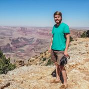
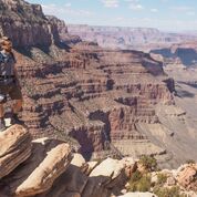
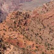
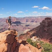
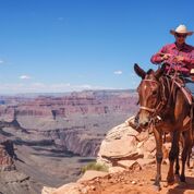
After we collected our hiker’s lunches, the group split up into the ambitious, less ambitious, and non-ambitious. Ken, of course, was in the ambitious group (2 plus guide) who went to walk part of the South Kaibab Trail. As the guide was leaving he asked if it was okay to take pictures of Ken doing dangerous things – what’s a mother to say? From the guidebook description “the trail travels on ridge lines with expansive views.” Ken descended 1 1/2 miles or 1,500 vertical feet, had lunch, did some dangerous stuff, and hiked back out. His pictures are below.
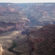
I opted for the less ambitious outing which included taking the bus to the Hermits Rest to enjoy the views and a short hike to one of the other lookout points. I then headed back to the hotel where I ran into Ken. We then headed out to the Abyss with our watercolors. The Abyss is a lookout point where the canyon walls drop 2,600 feet, once again providing a spectacular view.
Last Day.
We got up early and hiked down part of the Bright Angel Trail to view the sunrise, it did not disappoint. After breakfast we stopped by the History Room to see a fireplace made of rocks of the Grand Canyon in geological order.
Then into the vans for the trip to the airport in Phoenix with a stop at a Mexican restaurant in Sedona, the only Mexican food on our trip. We traveled through the Sonoran Desert, distinguished by the Saguaro Cactus. The trip ended with a red-eye flight back to Boston and we went from 100 degrees to 60.