Cape Cod: Pleasures Close at Hand

Boardwalk over the Marsh behind Coast Guard Beach

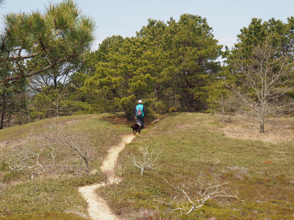
We travel far to discover what we take for granted when it’s close at hand. Living in South Jersey, we met people who had never been to Philadelphia, 20 minutes away. So, we decided to give Cape Cod the same treatment we give places we travel to visit and put together a post of some of the places we’ve explored, such as the trail from the Salt Pond Visitors Center to Coast Guard Beach.

Fortunately, dogs are permitted on leash outside of tourist season (that’s Momo, the one who keeps us laughing)

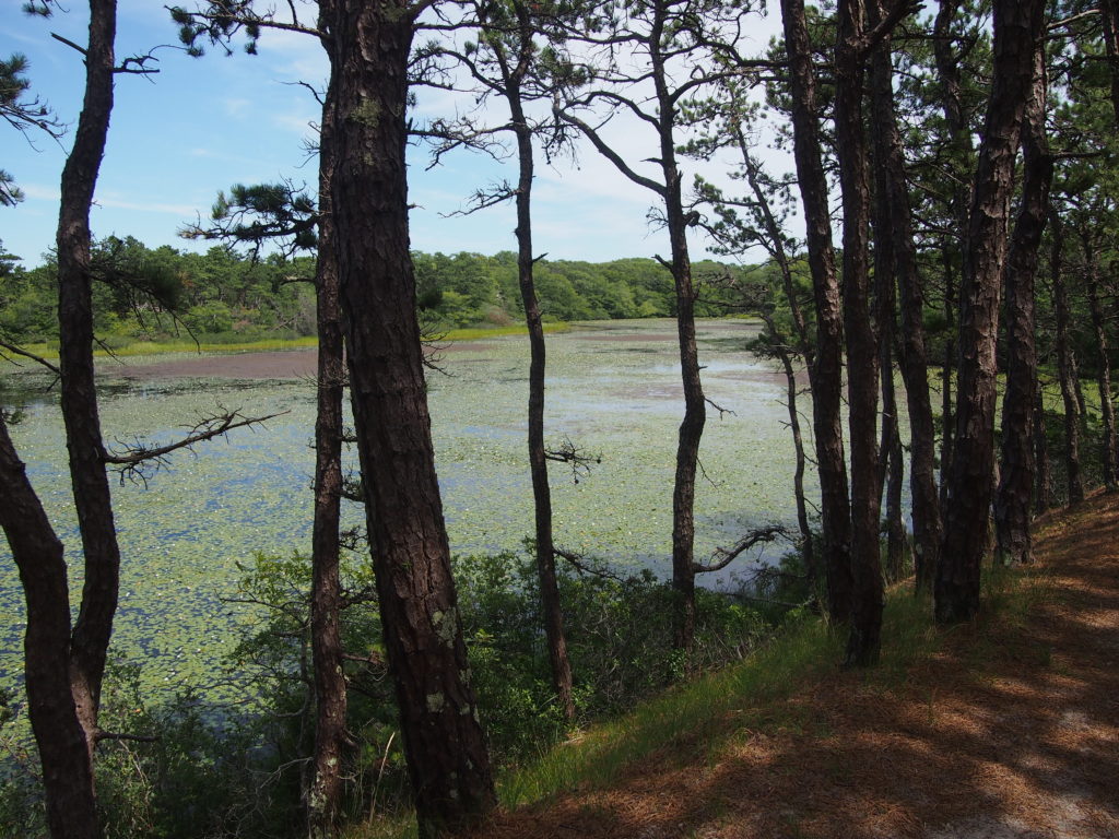
Nauset Marsh & Fort Hill

View from Fort Hill to Coast Guard Station
Lupine in bloom at Fort Hill, looking across Nauset Marsh to the Atlantic

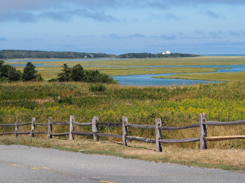
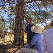
As you might imagine from the photos, Fort Hill is a popular spot. On occasion, we’ve seen a line of cars waiting for a parking spot. We, of course, turn around and go home because it’s five minutes from the house. Within a short walk are an old sea captain’s house (tours courtesy of the National Park Service), a red maple swamp with boardwalks, a very large rock Native Americans used for sharpening (tool maintenance, of course) and great views of where there were Native American villages when Champlain came through (1605) and made a map of those seasonal villages around the edge of the bay/marsh (inhabited since 4,000 BCE). The marsh is also where our neighbor has his oyster grant, lest we forget that people still make a living from the sea.

French Cable Station Museum, Orleans

The museum is on Town Cove, upstream from Nauset Marsh

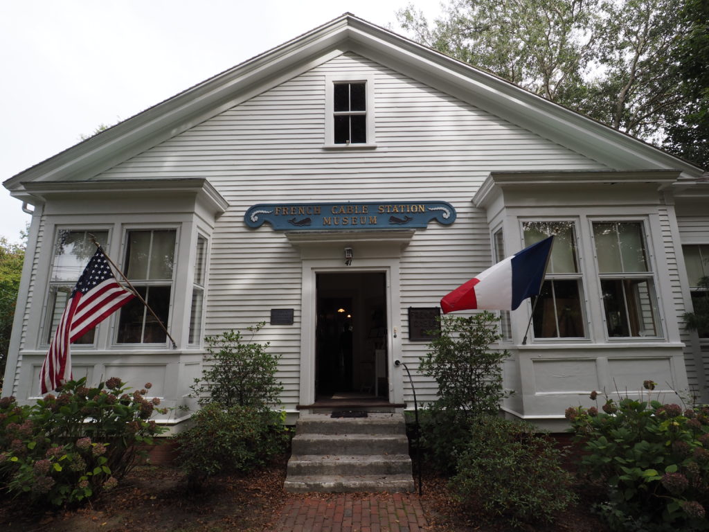
Named after the Duc d’Orleans following his brief visit to the Cape (and secession from Eastham), Orleans is also where the first undersea cable established rapid and reliable communications across the Atlantic.

Robust as they seem, the cables suffered from being snagged
AKA, photographer in the machine

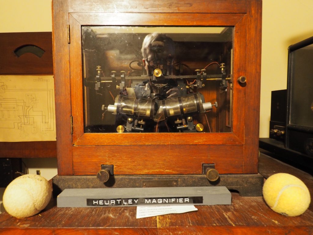
Admittedly a bit wonky-charming, the museum is housed in the building where the connection was made, is staffed by enthused volunteers and had, on the day we visited, an actual delegation from St. Pierre island off of Newfoundland visiting. St. Pierre is a self governing territory of France where the telegraph cable was routed through on its way to Orleans until it was run directly to Orleans in 1898. Of course, up the road in Wellfleet is where Marconi had one of his receiving arrays in the early days of wireless, high on a cliff. Sometimes it pays to be out to sea.
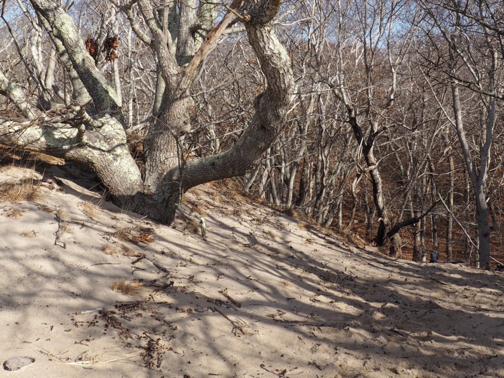
Atwood-Higgins

Undisclosed location, Wellfleet

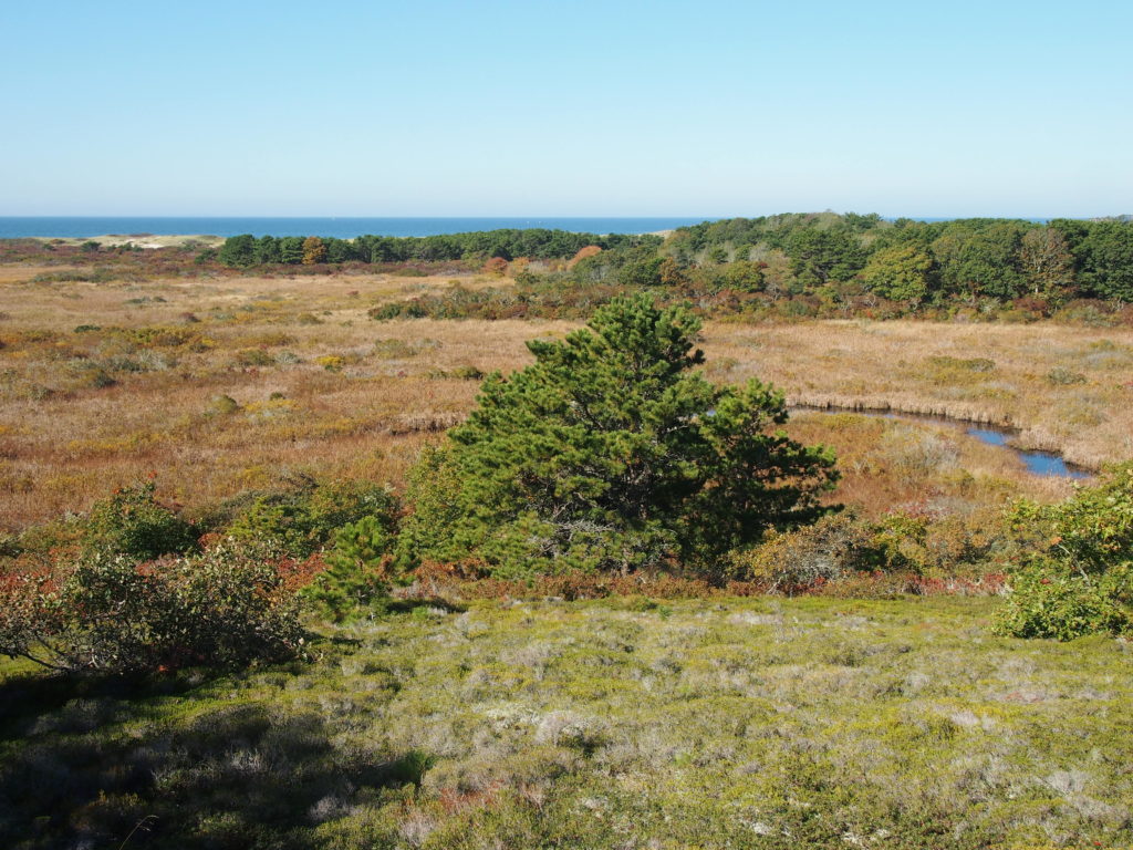
With all the controversy over geotagging, we do worry how long beautiful places can remain that way. This is the payoff of a glorious (and very hilly) walk in the National Park, preserved because it requires effort to get there.

A wonderful walk, 12 months a year
Through a heathland habitat, fast disappearing in developed areas because it’s very hard to re-establish.
Reason enough to jump for joy (the treat may be the walk, but actual treats are even more inspiring)

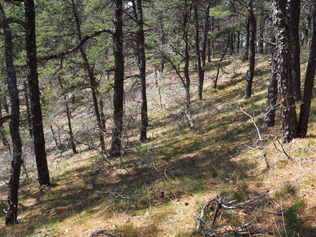
The Atwood-Higgins house dates back to when the surrounding land was an island, people remembered there’s a reason to build in a hollow, and the captain could moor his sloop just a few yards from the house. Rarely open (although well worth visiting) it’s the woods that draws us at least once a week.

Old Harbor U.S. Life Saving Station

Race Point Beach, Provincetown

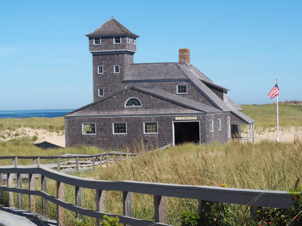
Built in 1897 in Chatham, the life saving station was rescued by the National Park Service in 1973, sawn in half and floated by barge to Provincetown where it presides at Race Point Beach.

The docents are helpful and it’s mostly hands on.
All in all, it makes you grateful for modern equipment.

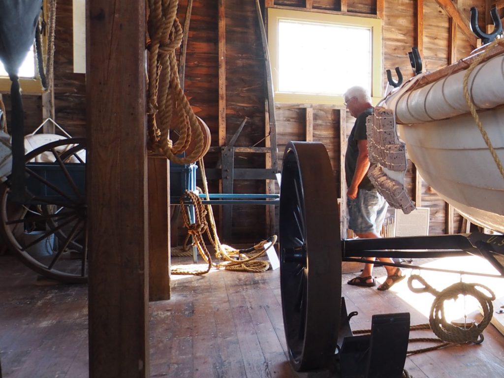
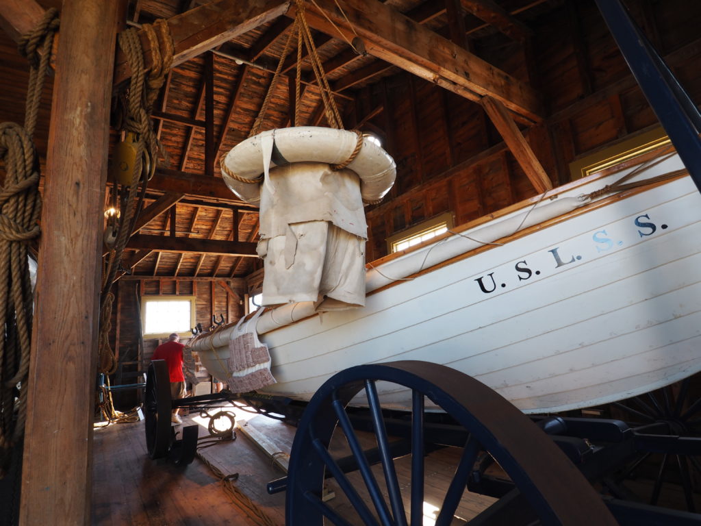
All up and down the Outer Cape the life saving service was extremely busy before the canal was built, as the passage around the Cape is exceptionally dangerous. Hiking in remote areas you can still come across the remains of old outposts.

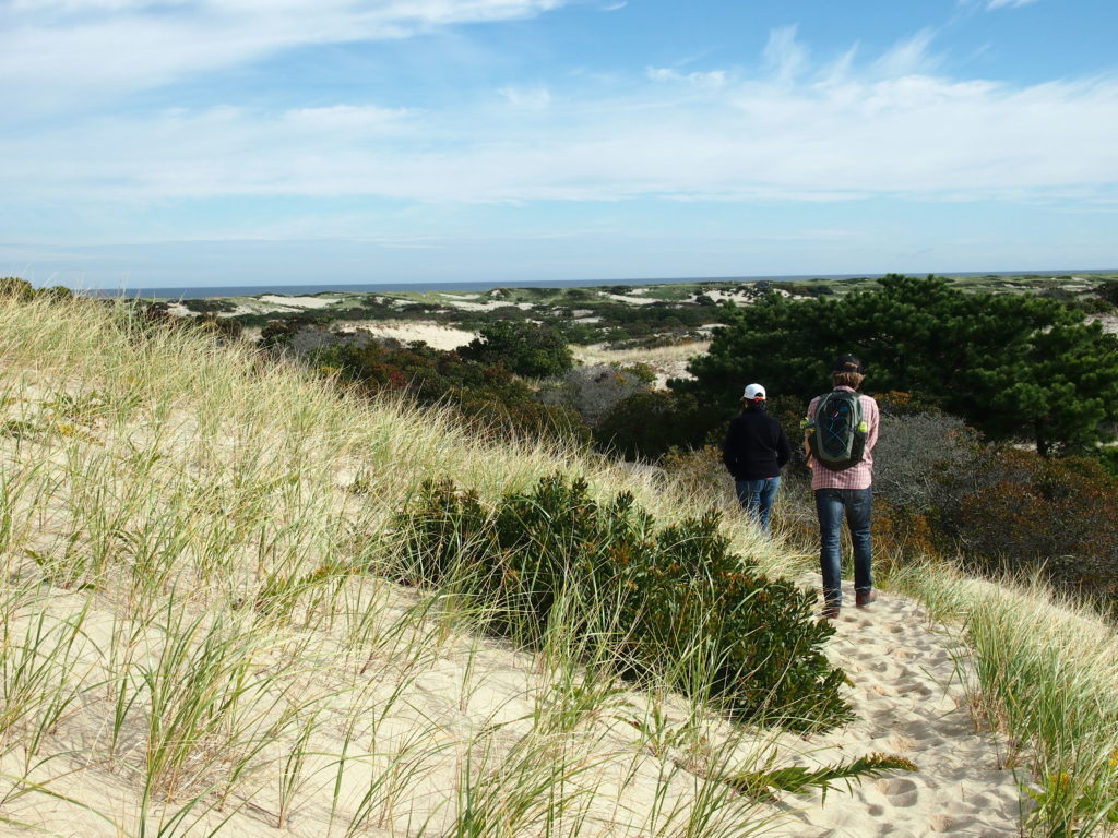
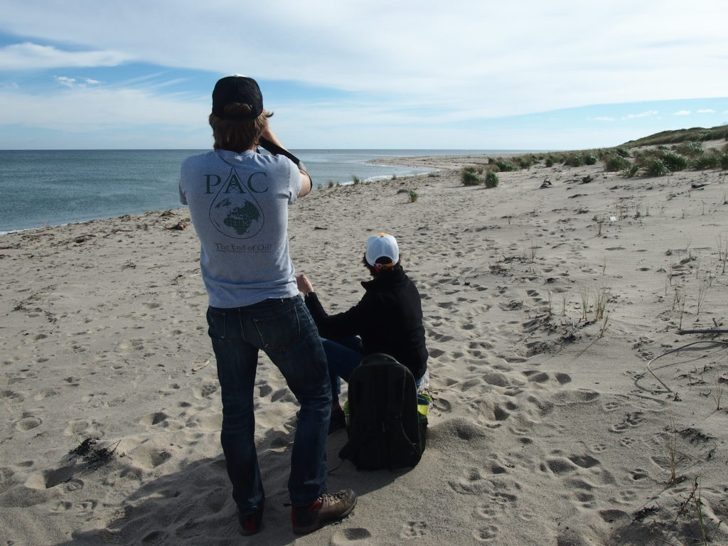
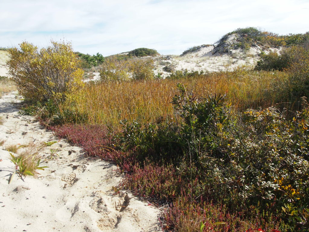
The Provincetown Dunes

Entering the dunes at Snail Road

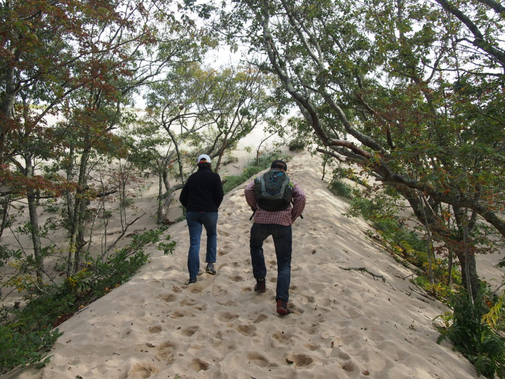
Much of Provincetown is part of the National Seashore. So, in addition to a colorful downtown jam packed with summertime tourists, it offers abundant nature, including whale watching (see our post on Looking for Whales from August of 2014), a dramatic beach forest and outstanding dunes.

Through the dunes to the ocean. The regularity of the grass shows it’s the result of adding “plugs” as part of dune restoration.

The hike from Route 6 out to the ocean can work up a sweat, especially in summer.

Checking out the seals down the beach


It’s surprising how lush the vegetation can be in the lee of a dune


We didn’t take any cranberries with us and they’re much too tart to munch on the go.


Dune shack

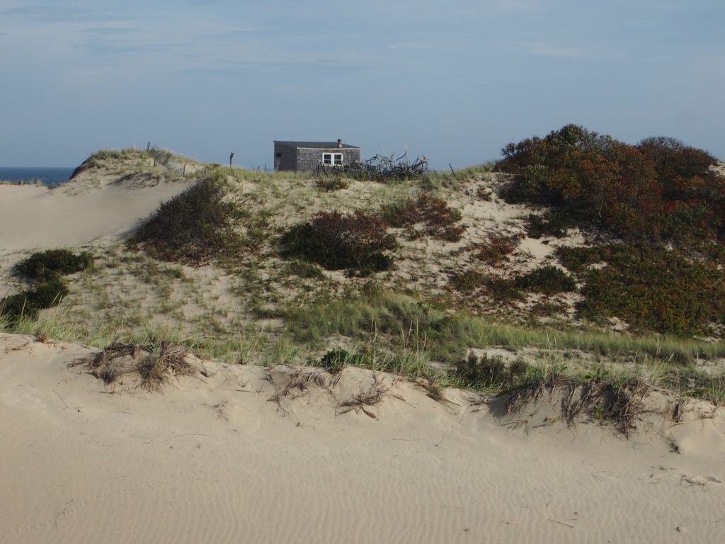
Spread through the dunes in Provincetown are old cottages, now owned by the Park Service, but leased to organizations that make them available as artist’s retreats. Definitely off the grid, vehicular access is tightly controlled.

Dunes provide a variety of habitat

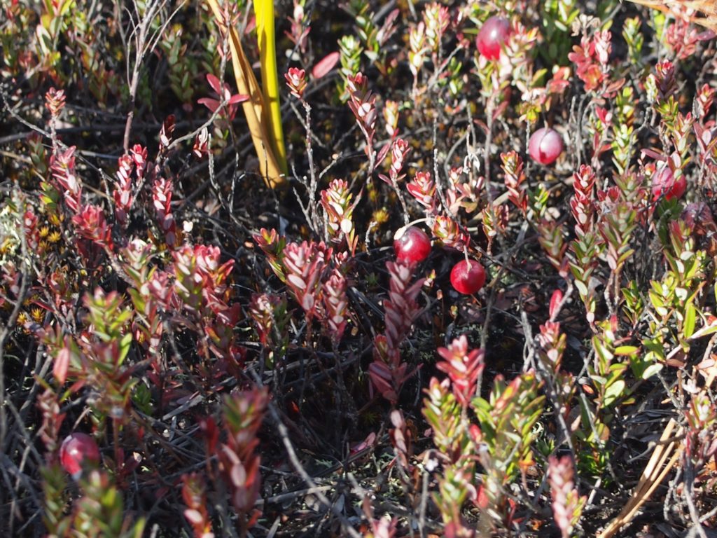
The changes in habitat within dunes are sometimes quite startling. It can be like coming upon a remote and hidden valley.

Amanda & Jim (photo courtesy of Ken)

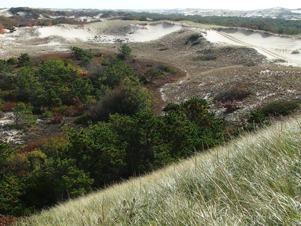
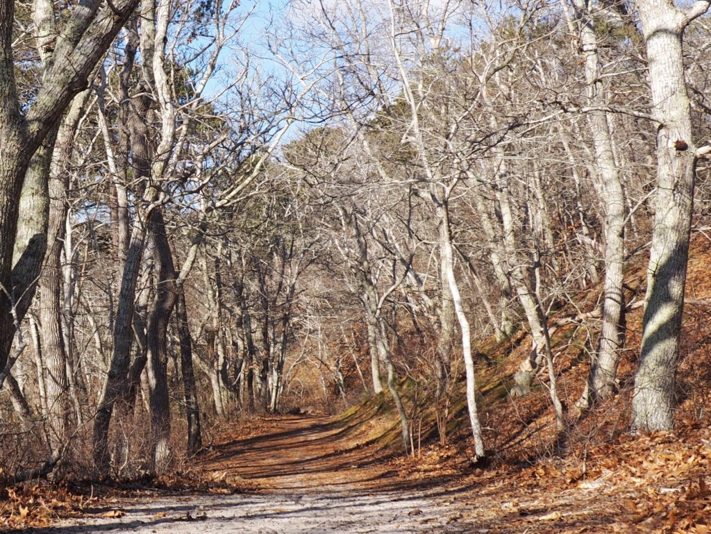
And, a Forest within the Dunes

From the heights of a dune into the forest below

Nestled within the Provincetown dunes lies a beach forest well marked by the Park Service with trails through it and this steep climb up to an adjacent dune.
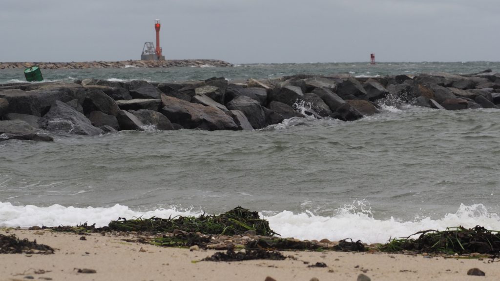
The beach forest in summer
Winter offers a distinct beauty. We were surprised to find ferns still green in an especially sheltered spot.
The trail runs next to a pond thick with water lilies
Where the view in January has open water below

The Cape Cod Canal

Entering the Cape Cod Canal. Remember: “Red Right Returning”

It was Myles Standish who first scouted a possible route for a canal to avoid the treacherous journey around Cape Cod, trade with the Dutch of New Netherlands and the Native Americans around Narragansett Bay being critical to paying off the Pilgrim’s debts.

For a time, a modestly safer route cut through what was known as Jeremiah’s Gutter, between what is now Orleans and Eastham by the rotary and the Stop and Shop (where they predict a bridge will be needed as waters continue to rise). It was used by smugglers, we’re told, up through the late 19th Century.

Alas, dreams came true (except for motorists) when a canal was at last completed in 1916. And, it’s a big one. 480 feet wide, 32 feet deep at mean low tide, and seven miles long. It would take a lot to fill it in, as some propose. But, that would mean a longer trip around for everyone who’s waterborne, including the whales and porpoises who have also gotten used to the shortcut.

Aboard a tugboat, safely inside the museum.

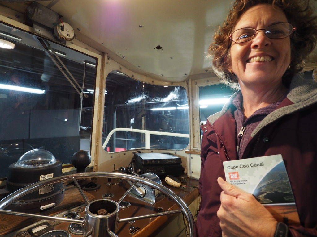
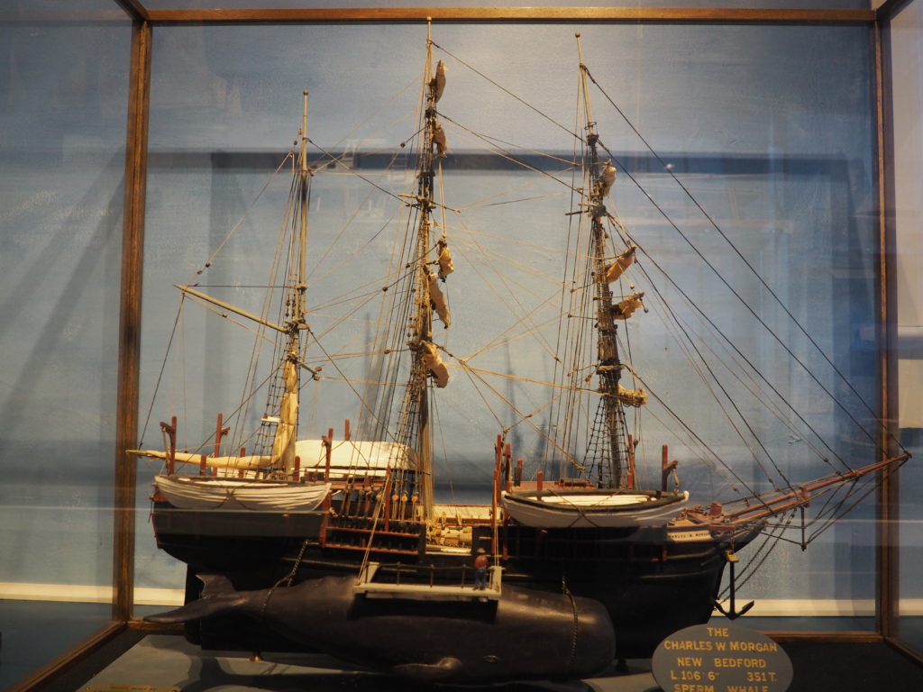
The US Army Corps of Engineers not only maintains the canal, the have a rather nice little museum complete with boats in climb around in.

There’s also a nifty control room area.
This isn’t the actual canal.

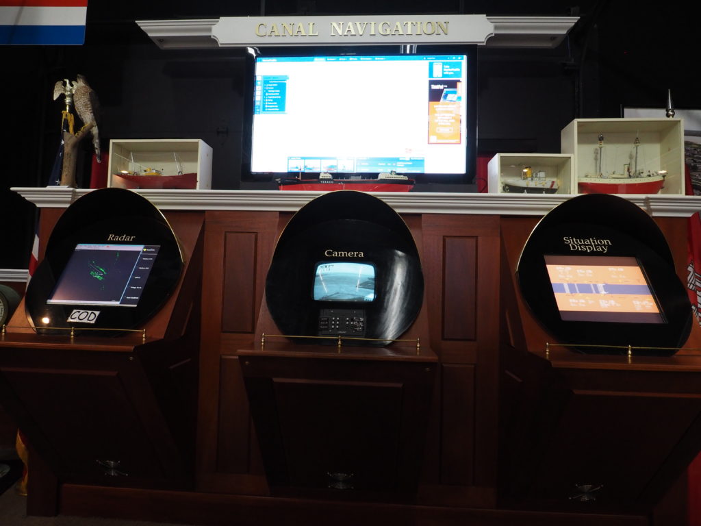
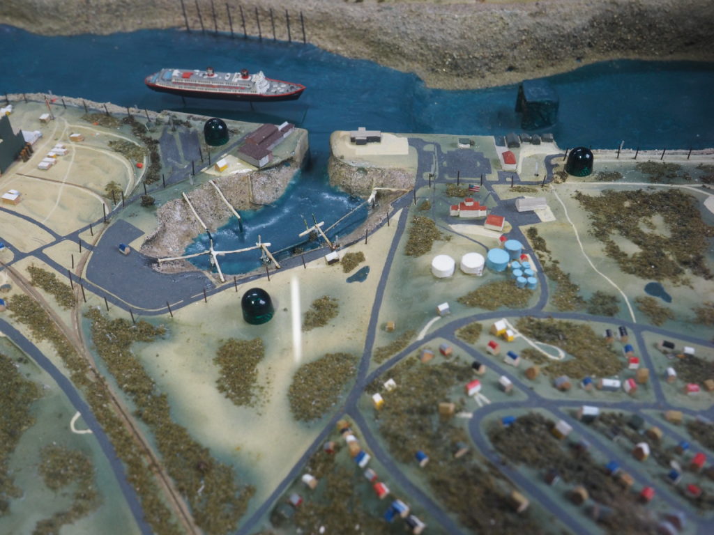
And, who can resist a rather well done model. (Takes us back to the days of train tables and trying to keep them from constantly derailing.)
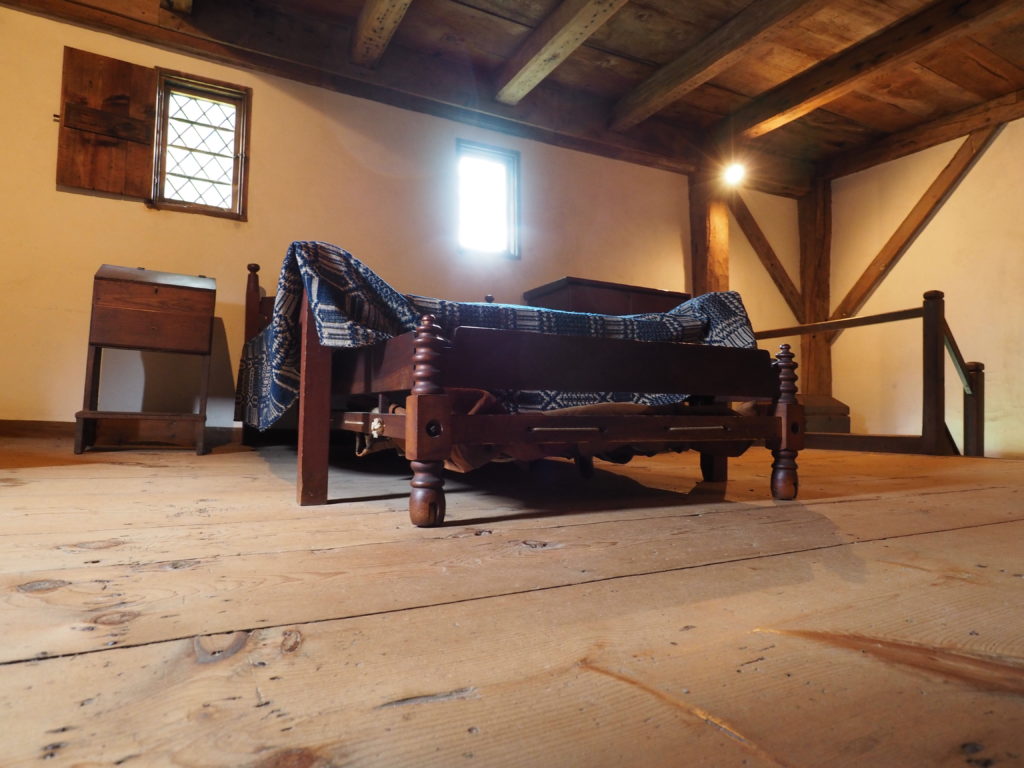
The Hoxie House

The Hoxie House, mid 17th Century

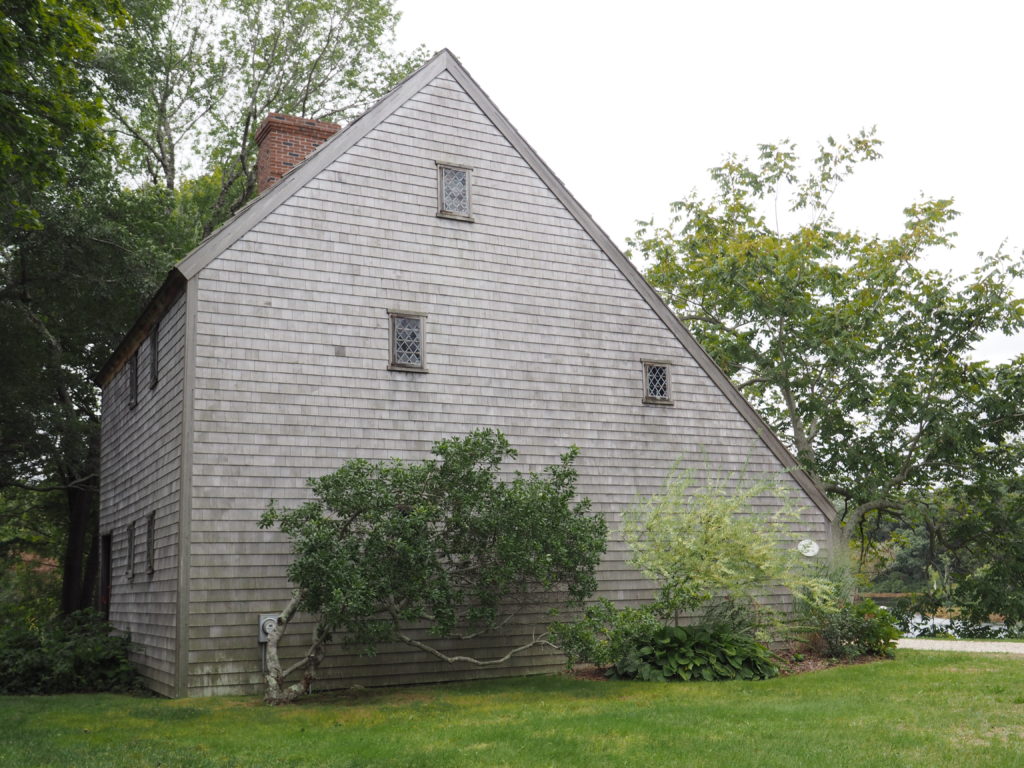
There are those little museums, often house museums, that don’t seem that special until you go inside and start to look around and listen to what the docents have to say. The Hoxie House is one of those.

Abraham Hoxie wasn’t the first one to live in this salt box cottage. A whaling captain, he didn’t move in until the middle of the nineteenth century.

The sleeping quarters, upstairs.

The first known occupant was the Reverend John Smith, along with his wife and 13 children, who was the pastor of the First Church of Sandwich from 1673 until 1689. It was a Separatist congregation. Smith was also a member of the legislature and was known for advocating tolerance of those irritating Quakers. They moved into the house around 1675.

One of two ground floor rooms.
A chest with a locking mechanism near the hearth in the other ground floor room.
A very old window (300+ years?).

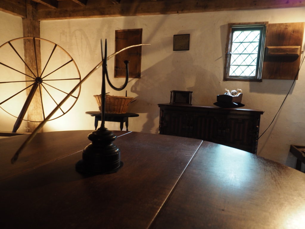
Until the house was purchased by the Town in the early 1950s, it had no electricity, no central heating and no indoor plumbing. (We suppose that isn’t saying much since Jim remembers when his grandparents put in indoor plumbing, also in the 1950s, although they did have electricity and central heat.)

What makes a place like the Hoxie House, of course, are the stories, including the ones we always love to be horrified by, like the old custom of putting bell pulls inside coffins – just in case.

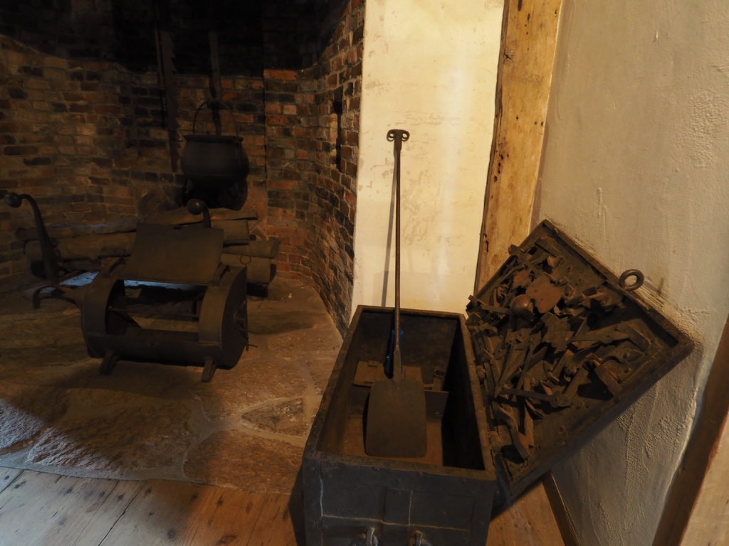
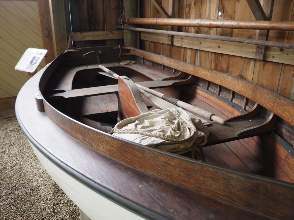
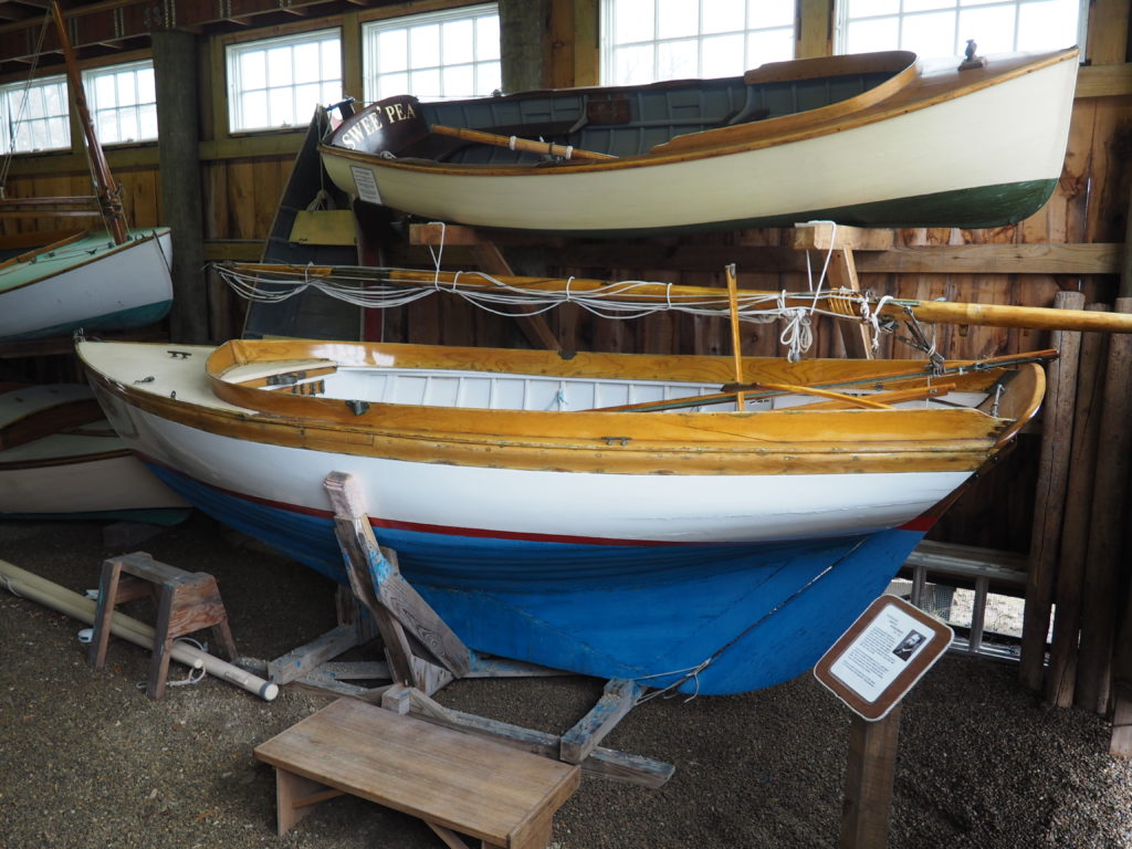
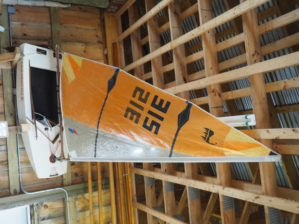
Cape Cod Maritime Museum

“Captain Pete’s” boat building workshop, complete with homemade planes, has been installed in the museum.

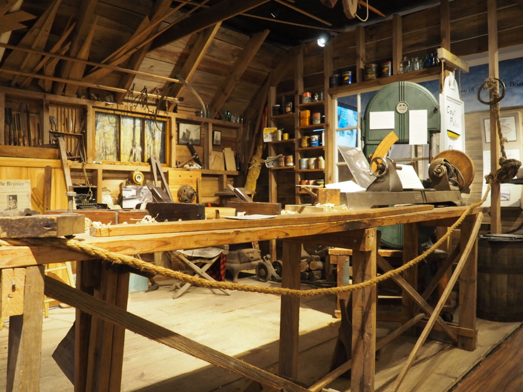
This museum may be small, but it has plenty of personality. From workshops and classes for beginning boat builders to a boat shed of interesting small boats.

Taking a look at the whale alongside this whaling ship reminds us just how crazy those whalers were. Especially when you consider that few of them knew how to swim.
Restored figurehead of the Imperial.
After the ship went down, the Captain recovered it and put it on the bluff at his home in Brewster.
A spritsail boat from Woods Hole, c. 1899.


12 1/2’ gaff rigged keel boat, built as a training boat for children. 1932.


Cape Cod Frosty, a Frostbite boat, made of 1/4” plywood in a stitch and glue process from a design by Tom Leach from 1984 and built by Don Stucke in 1985. These boats are only sailed in the winter. All of 6’4” long with the hull weighing only 34 pounds, they’re incredibly portable. Don regaled us with stories of racing them, even taking them on the ferry with his friends to Nantucket to race with Nat Philbrick over there. We weren’t sure whether this was fun or insane.

This seems like a good place to put in a plug for another museum, but one that doesn’t allow photography. We were surprised at how interesting and engaging the Whydah Pirate Museum is. The collection is primarily from the underwater archeology undertaken by the organization to recover artifacts from, you got it, a sunken pirate ship. It’s all about pirates, the lives they lived and the treasure they acquired by unlawful means. In a back room of the museum you can even talk with an archeologist as she works on restoring recovered artifacts. Truly fascinating and very well organized and presented.
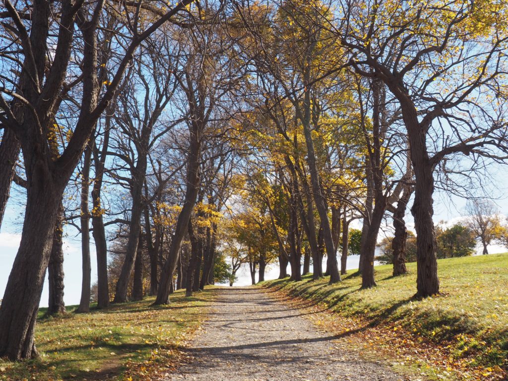
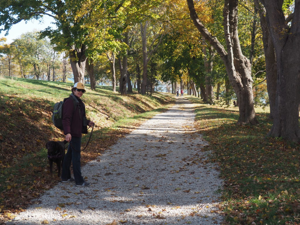
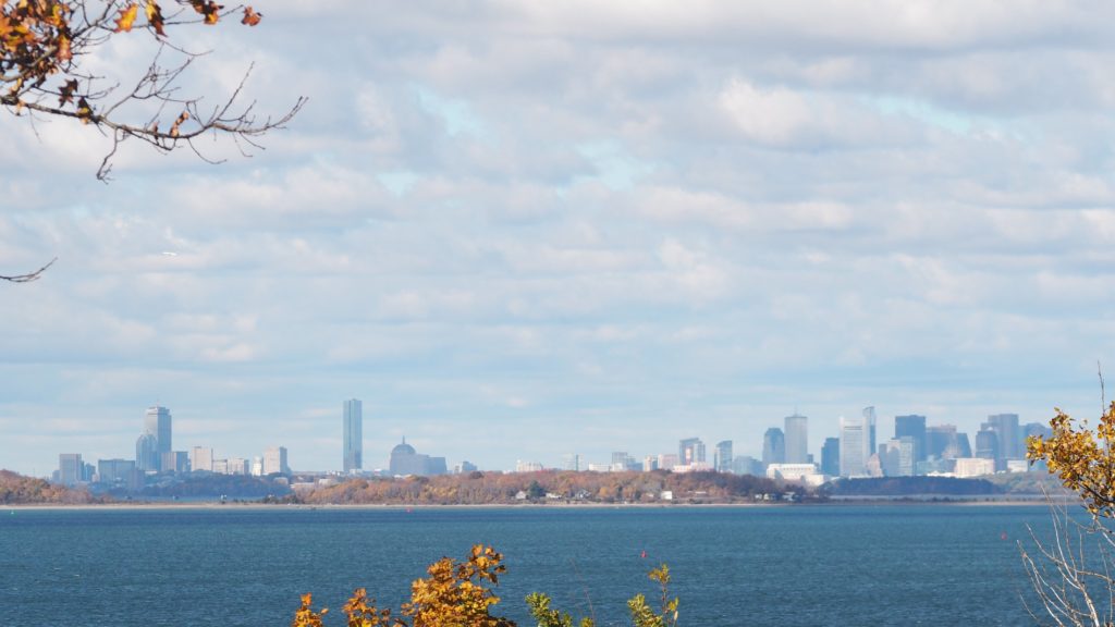
World’s End

“A New End,” an installation by Jeppe Hein.

World’s End is about as far away as we can justify in talking about Cape Cod. It isn’t on Cape Cod, with or without taking into account the canal. However, being in Hingham, it’s an easy day trip. So there you are.
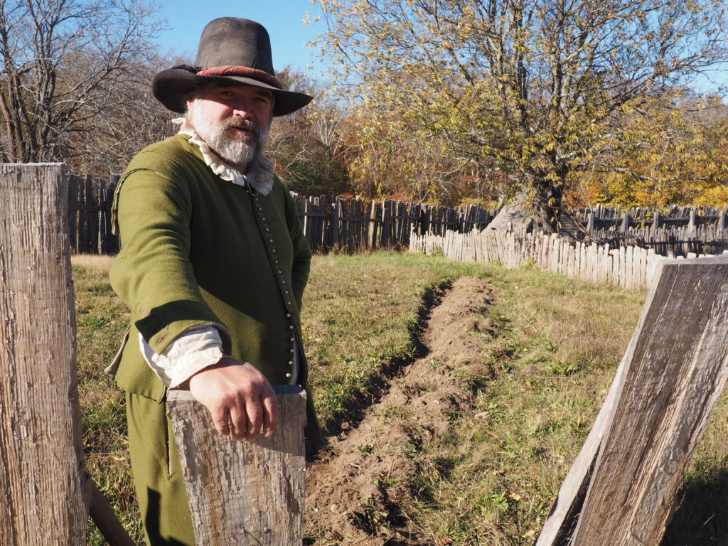
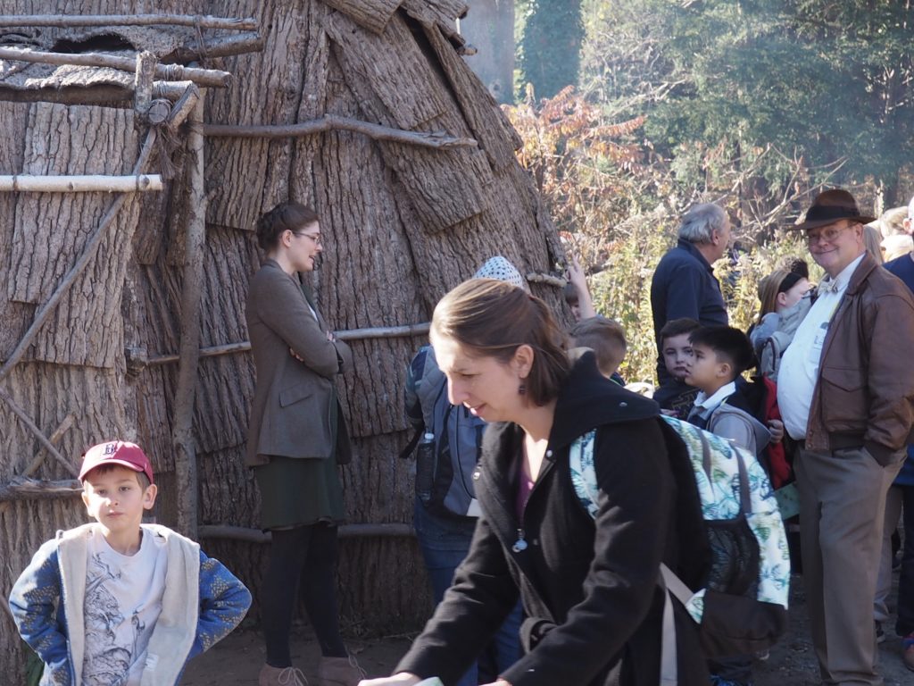
There are 250 acres of landscape designed by Frederick Law Olmsted.
With carriage paths that reminded us of the Rockefeller property up in Maine near Acadia National Park.
It’s a wonderful place for a relaxing walk with Momo.
And, there’s even an impressive view of Boston.

Plimouth Plantation

A reconstruction of the village of Plimouth Plantation at Plymouth.

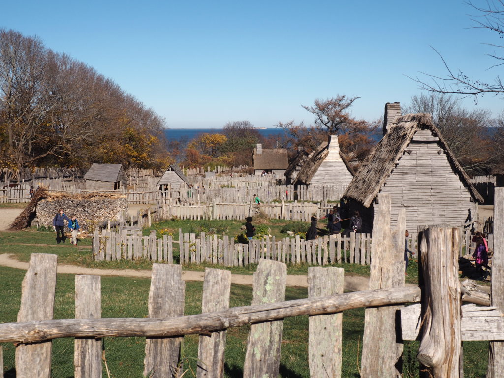
Okay, fair enough, we fully acknowledge that this is not Cape Cod. However, our excuse is again that it’s not far away and there is a very solid connection to not only the Cape, but to Eastham in particular. You see, Eastham was founded by folks who found the life of Plimouth to be a bit constricting and returned to where they had first made landfall and contact with the Native Americans. Both communities are preparing for the onslaught of Mayflower descendants celebrating the 400th anniversary of 1620.

A reenactor in the Pilgrim’s village.
Reenactors stay in character and true to their time period while engaging with you about their life and experiences.
They are specific individuals and have researched not only the times, but the lives of the people they portray. And, they have stories to tell.
In the nearby Wampanoag village, the reenactors do engage with you as contemporaries, sharing what they have learned about their ancestors.
Making dugout canoes always draws people in.
It’s a nice area to wander around, watch both the reenactors and the tourists, and soak up the atmosphere of the village.
We all need to wait for our turn in the lodge. Of course, it was our bad judgment to go there the week before Thanksgiving when school trips are especially popular.
Where there are more stories to tell.
Jim, of course, tried to make friends with the chickens.

Bringing It Home

Thanks to Kyle for the photo.

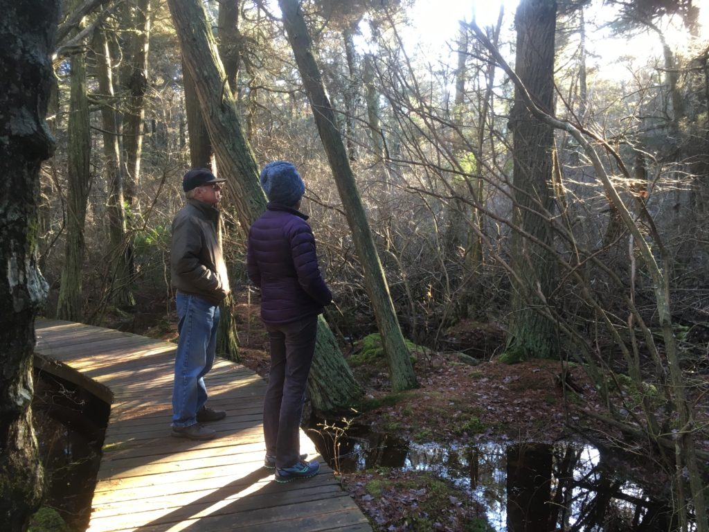
It’s not a diorama and it’s not Louisiana. As featured in a prior post, the White Cedar Swamp in Wellfleet seems like a magical nether world at any time of year, where you expect some giant winged creature to come flapping out of the deep woods scaring the wits out of you. It’s beautiful, actually.

Juvenile ospreys in Wellfleet Harbor.
Fog pulls back out to sea.

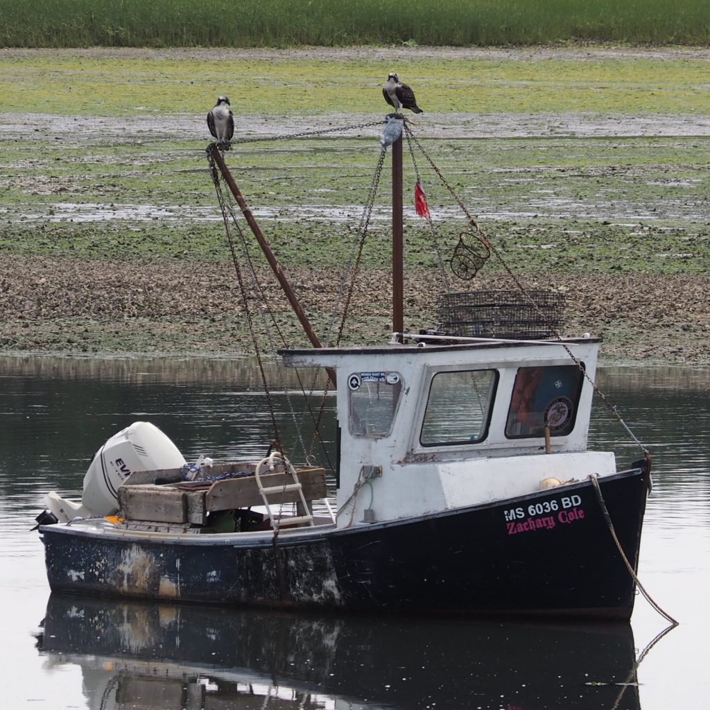
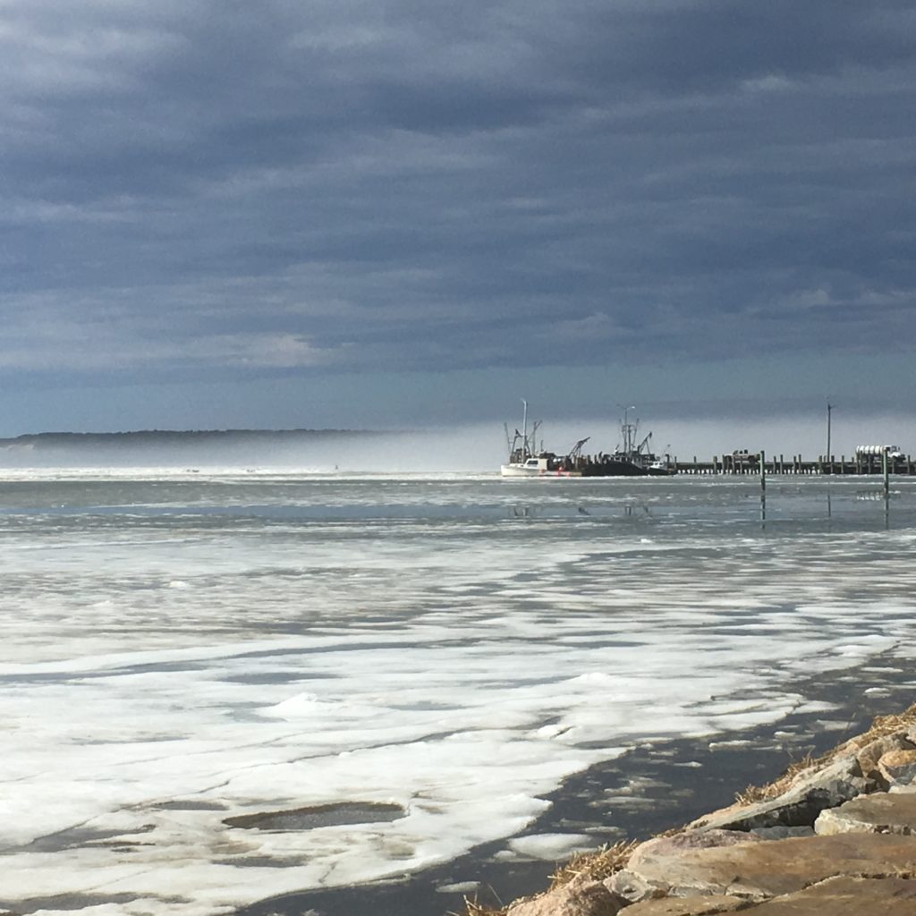
Then there is the simplest place to take a walk, with a 1 1/4 mile marked track around the perimeter of the pier at Wellfleet Harbor. In summer the thing is to walk carefully and quickly under the ospreys’ nest, to avoid being splattered. In fall, you might spot a stranded mola or ocean sunfish, as we did. In winter, when the docks have all been pulled and stacked, all crusted with barnacles, and the small boats have found a parking space on top of the pier you can still be surprised by how beautiful it all is.

Ken and Momo coming off the flats at First Encounter Beach

Back where we start, in Eastham.

Canyons of the Southwest

Having enjoyed our National Parks trip (Yellowstone, Teton, etc.) 6 years ago, we signed up in January for a New York Times sponsored trip to the canyons of Utah and Arizona to take place in September. In April, Jim suffered from a debilitating physical condition that necessitated cancelling a May trip to China. In June, with the final payment date for the Canyon trip approaching, although much improved, it did not seem prudent for Jim to go on what the itinerary described as a strenuous trip. He graciously agreed to let me go and for son Ken to be his surrogate. Photos are courtesy of Ken.

Our trip started in Las Vegas. Here we are at the “Grand Canal” at The Venetian. Over a dinner of tapas, we met the other participants, the tour leaders and the New York Times Expert, Jim Robbins. Jim has written for the NYTimes for over 35 years, mostly on science and environmental issues. He also wrote for The Christian Science Monitor. In addition, he has done research on the polygamist groups of the Mormon Church. His commentary and lectures during the trip were informative and fascinating.

Through the Mojave Desert and on to Zion National Park.

We left the glitter of Las Vegas and traveled through the Mojave Desert with its Joshua Trees dotting the landscape. A stop in a park for lunch and introductions before we reached Zion. Zion became a national park in 1919. It is characterized by its sheer multicolored walls of sandstone narrow canyons and the Virgin River which runs through them. We hiked the Riverside Walk which follows the Virgin River to the narrows, a spot where the canyon walls come close enough to the river to necessitate continuing in the water, we turned back at this point. Along the way we saw hanging gardens, plants holding on to the sides of the canyon walls. Night in Springdale.

The Narrows
Amanda and Ken at The Narrows
Mule Deer
Downtown Springdale

Zion Day 2

After breakfast at the Zion Lodge, we hiked the Emerald Pools Trail, a wooded hike that leads to a waterfall and the lower Emerald Pool. The path ended where it had been washed out by a flash flood in July of this year. Flash floods, occurring mostly during monsoon season (July and August) turn the calm Virgin River into a raging force.

On the way to Bryce.

We made our way to Bryce National Park passing through some spectacular scenery, saw Smokey and heard a lecture by Jim Robbins over lunch.

What’s a HooDoo?

Bryce Canyon is not a canyon, but rather a collection of natural amphitheaters.  It  became a National Park in 1928. The HooDoos are the geological structures that fill the amphitheaters. The towers of rocks were formed by years of wind and water erosion that carved away some of the rock. The word hoodoo may come from voodoo and the legend told by the Ancestral Puebloans that a powerful Coyote turned some evil people into stone. Either way, the resulting structures are spectacular. Bryce Canyon got its name from an early Mormon pioneer named Ebenezer Bryce who described the canyon as “a helluva place to loose a cow” Our hike down into the HooDoos included passing through “Wall Street” with its 200 foot tall cliffs and a sighting of “Queen Victoria.’

Wall Street
Ponderosa Pine
Queen Victoria

Sunrise Over the HooDoos.

We ventured out early, in the dark to catch the first glimpses of the sun as it lit up Bryce Canyon. Definitely worth braving the chilly morning air.

Grand Staircase-Ecalante National Monument.

Bill Clinton designated this area, nearly 1.9 million acres a national monument in 1996. In 2017, it was reduced to 1 million acres by presidential proclamation It was the last land to be mapped in the contiguous United States. It is a mostly undeveloped area of canyons, mesas, plateaus and river valleys.  Another lecture along the way. Ken and I opted for the more challenging Lower Calf Creek Falls Hike through a canyon to a waterfall. We were rewarded for our efforts, trudging through sand, with the spectacular waterfall. Ken took a swim.

Ken floating near the waterfall
Brook Trout

Glen Canyon Dam, Lake Powell and Antelope Canyon.

Leaving the HooDoos behind after another spectacular sunrise, we made our way to Glen Canyon Dam on the Colorado River. Glen Canyon Dam was completed in 1966 and is named for the canyon flooded by the Lake Powell reservoir. Lake Powell is named for John Wesley Powell, who led the first boat expedition of the Grand Canyon in 1869. This was after he lost an arm to a cannonball in the Battle of Shiloh. Glen Canyon Dam was built to ensure equal water rights to the Upper Basin (Colorado, Wyoming, and most of New Mexico and Utah) and the Lower Basin (California, Nevada and most of Arizona). Unfortunately, with the prolonged drought in the area, there are concerns about the ability of the reservoir to meet the needs of agriculture and cities dependent on the Colorado River for water. The talk given by Jim Robbins at this stop gave a somewhat bleak outlook for the situation. Lake Powell, our evening destination is a popular recreation area, especially with boaters.

After lunch, we headed to the town of Page, Arizona where, after a brief visit to the Powell Museum, we took a tour of the Antelope Canyon on the Navajo Reservation. The Navajo name for the Canyon translates into “the place where water runs through rocks,” which is fitting since flash floods in the monsoon season carved away the sandstone in the slot canyon. To get to the Canyon you must take a tour organized by Native Americans. We climbed into the back of a pick-up truck fitted with bench seats holding 6 or 7 on a side. There were three seatbelts on each side which the driver explained was to keep the passengers from standing up and getting bounced out. Bounce was an understatement. We arrived at a clearing before an entrance to the Canyon (along with hundreds of other tourists). Our guide Nate set everyone’s phone or camera to the best setting to capture the beautiful colors. Supposedly, the highest price ever paid for a photograph, $6.5 million, was one taken in the Canyon in 2014.

Photo courtesy of John Baston


A side note about time zones: Our hotel on Lake Powell was in Page, Arizona and was on Mountain Standard Time, the nearby Navajo Reservation was on Mountain Daylight Time, so our electronic devices, depending on which cell tower they were picking up, could display different times even when situated next to each other.

On our way to the Grand Canyon.

Our first stop was Horseshoe Bend in Glen Canyon, a widely photographed area where the Colorado River makes a sharp turn around a sandstone escarpment. I understand the railings were a recent addition – yikes! The view was spectacular.

We made a brief stop at Cameron Trading Post, open since 1916. A wide offering from trinkets to exquisite weaving, but nothing to tempt us.


Wow! It’s the first word that comes to mind when you see the Grand Canyon. I had visited the Grand Canyon in 1980 with my brother and I remembered that it was beautiful and that it snowed in May. The Grand Canyon was designated a National Monument in 1908 and a National Park in 1919 by an act of Congress. It is 277 river miles long, roughly 4,000 feet deep and on average, 10 miles across.

After lunch which included a serenade by one of the enormous ravens, we explored the south rim, where our hotel, The Thunderbird Lodge was located. Our group began a hike down the Bright Angel Trail, but many turned back deciding that the trail edge was too daunting. We explored the Kolb Studio, where there was an exhibit of plein air paintings created as a part of a special celebration of art event. Many of the buildings on the South Rim were designed by Mary Colter early in the 20th century.

After dinner, Ken and I explored the trail leading to Hermits Rest.

Grand Canyon Day Two.

We started out the day with a guided walk on The Trail of Time, led by a geologist from the Grand Canyon Field Institute. The Trail of Time is an interpretive path representing one billion years of time and the corresponding geological timeline.

After we collected our hiker’s lunches, the group split up into the ambitious, less ambitious, and non-ambitious. Ken, of course, was in the ambitious group (2 plus guide) who went to walk part of the South Kaibab Trail. As the guide was leaving he asked if it was okay to take pictures of Ken doing dangerous things – what’s a mother to say? From the guidebook description “the trail travels on ridge lines with expansive views.” Ken descended 1 1/2 miles or 1,500 vertical feet, had lunch, did some dangerous stuff, and hiked back out. His pictures are below.


I opted for the less ambitious outing which included taking the bus to the Hermits Rest to enjoy the views and a short hike to one of the other lookout points. I then headed back to the hotel where I ran into Ken. We then headed out to the Abyss with our watercolors. The Abyss is a lookout point where the canyon walls drop 2,600 feet, once again providing a spectacular view.


Last Day.

We got up early and hiked down part of the Bright Angel Trail to view the sunrise, it did not disappoint. After breakfast we stopped by the History Room to see a fireplace made of rocks of the Grand Canyon in geological order.

Then into the vans for the trip to the airport in Phoenix with a stop at a Mexican restaurant in Sedona, the only Mexican food on our trip. We traveled through the Sonoran Desert, distinguished by the Saguaro Cactus. The trip ended with a red-eye flight back to Boston and we went from 100 degrees to 60.