
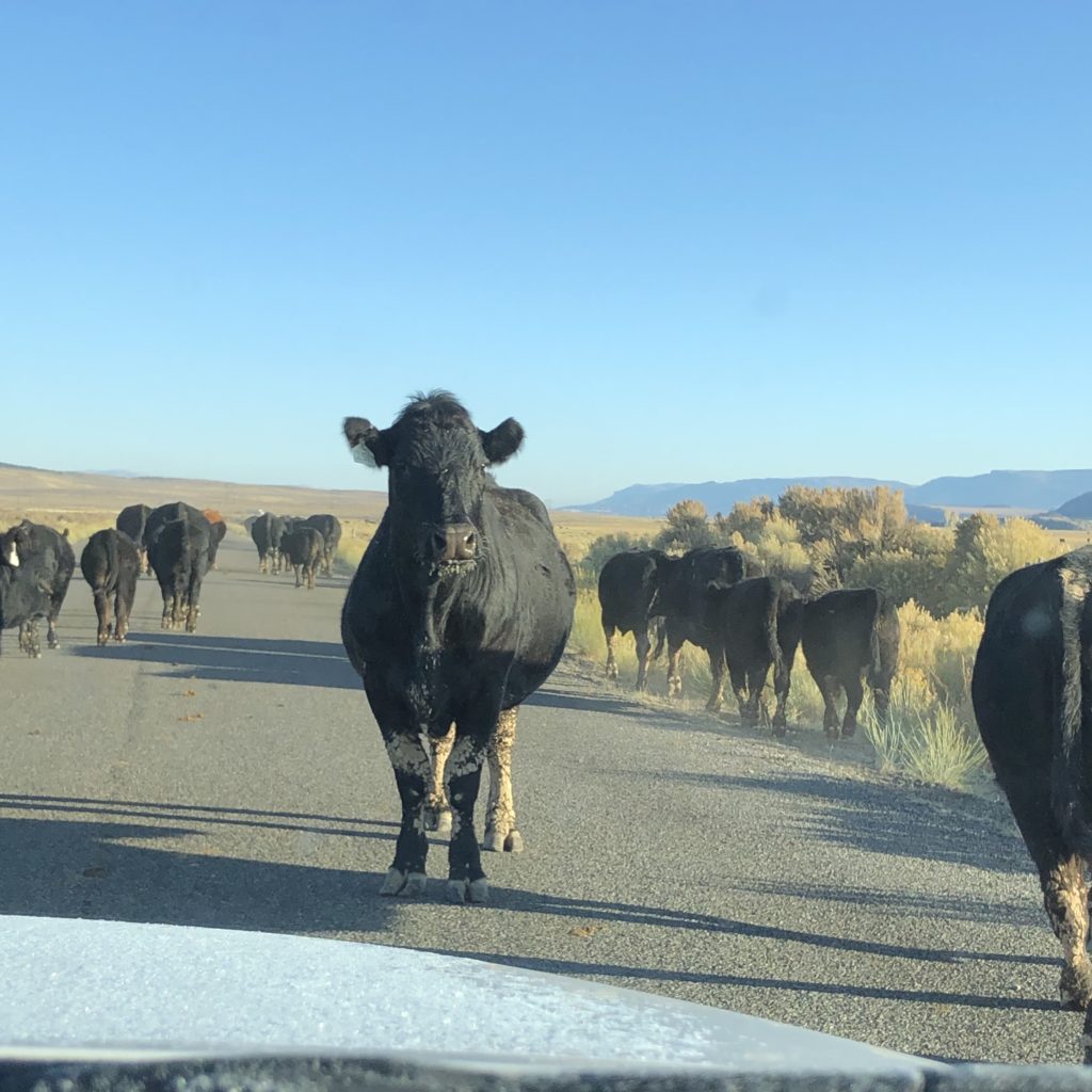
The great loop taking us from and back to Grand Junction, Colorado, and down through the Colorado Plateau and the Four Corners region also led us through the National Parks more known for devastating scenery than for dabbling in the human history of our continent. We revisited most of the itinerary Amanda and Ken followed last year, but with some different twists and in cooler weather. We also came across the delightfully unexpected, like these cattle in southern Utah being herded down a road we had begun to marvel at for the total lack of traffic. (Guess the locals knew.)
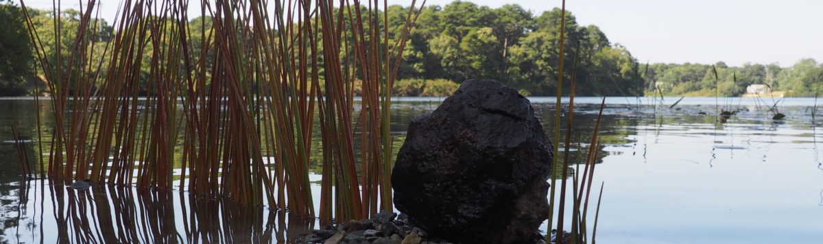
Rattlesnake, Hovenweep 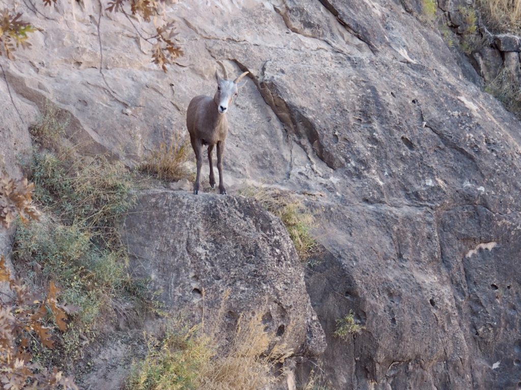
Bighorn Sheep, Grand Canyon
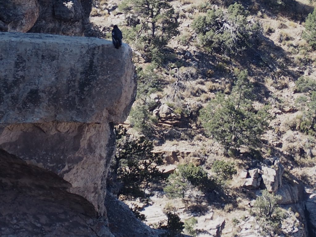
California Condor, Grand Canyon 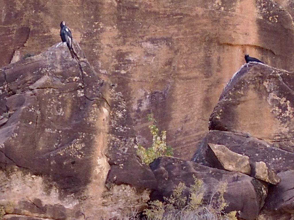
California Condors (adult on left, fledging on right – Condor #1000 in reintroduction)
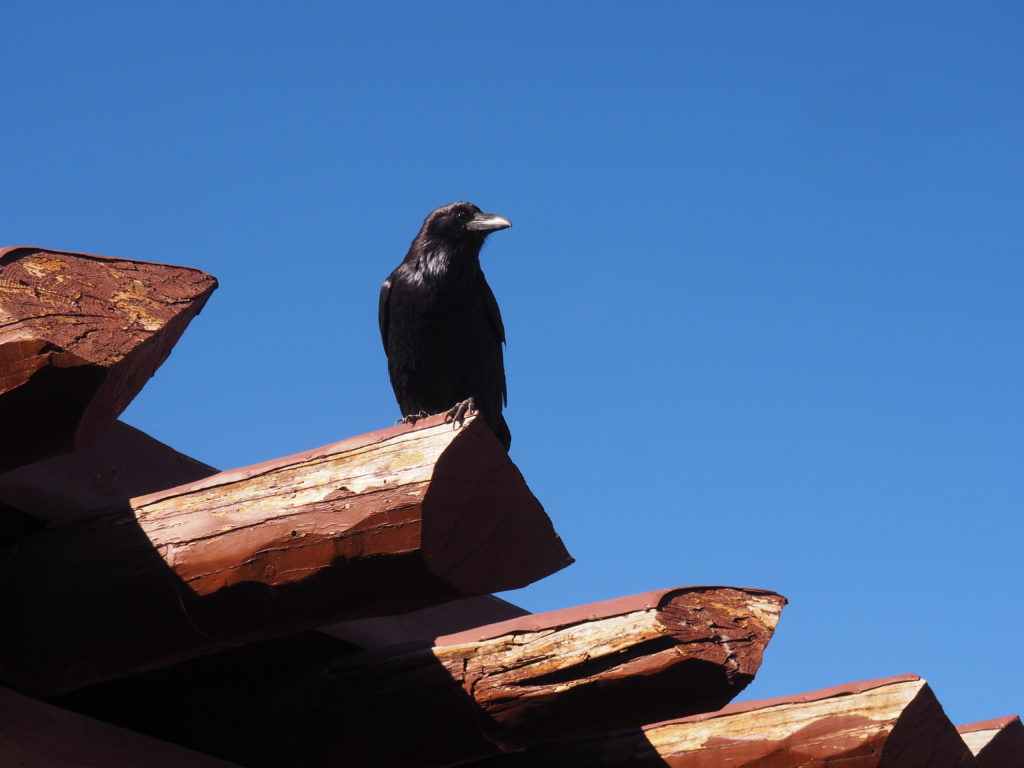
Raven, Grand Canyon. They may be everywhere, but we still love them.
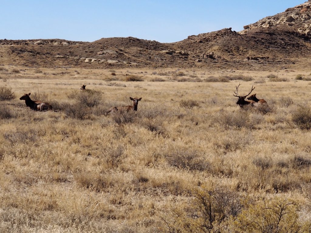
Elk, Chaco Canyon 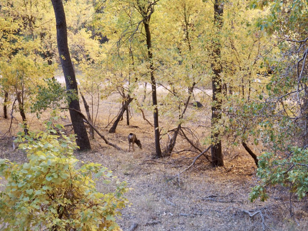
Mule Deer, Zion NP
Throughout our trip we were fortunate to also see lots of rabbits, lizards and turkeys. Plus, those wild mustangs in Canyon de Chelly.
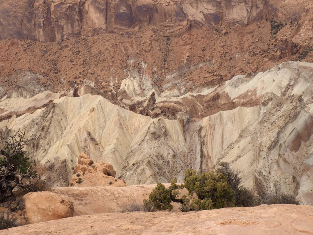
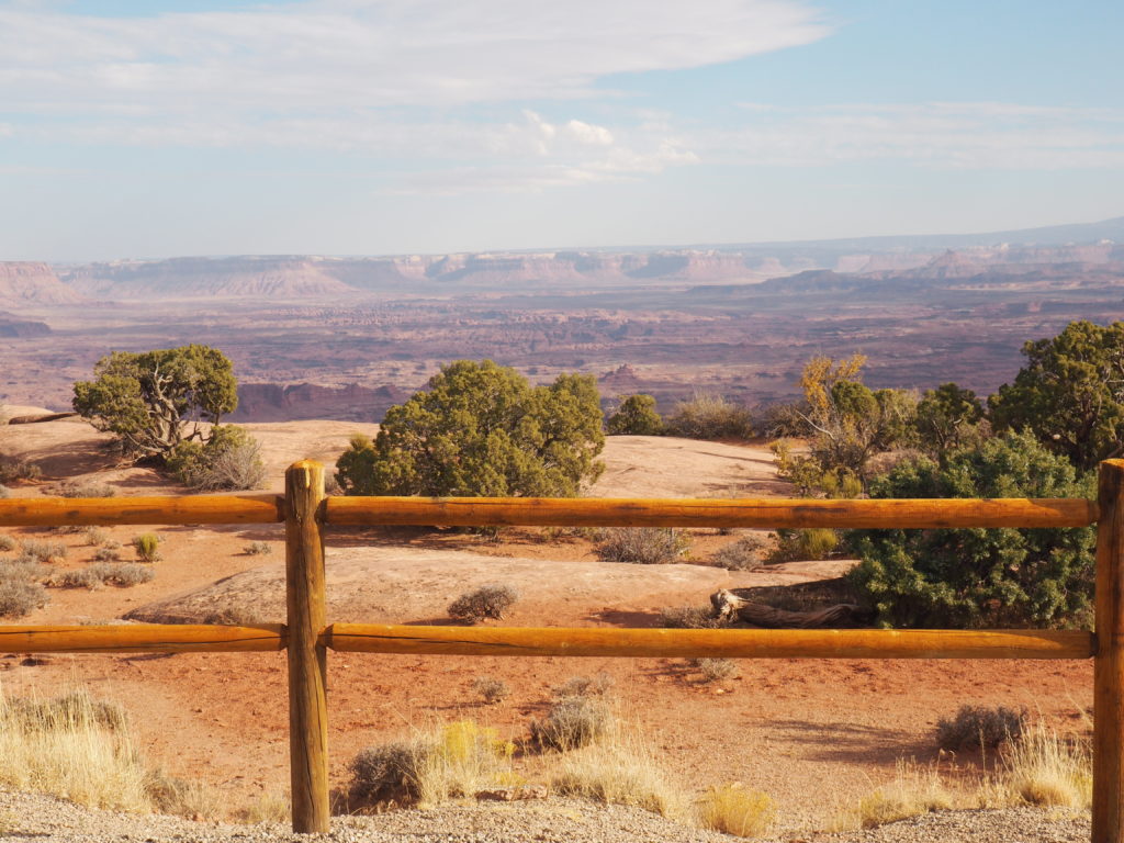
Canyonlands National Park
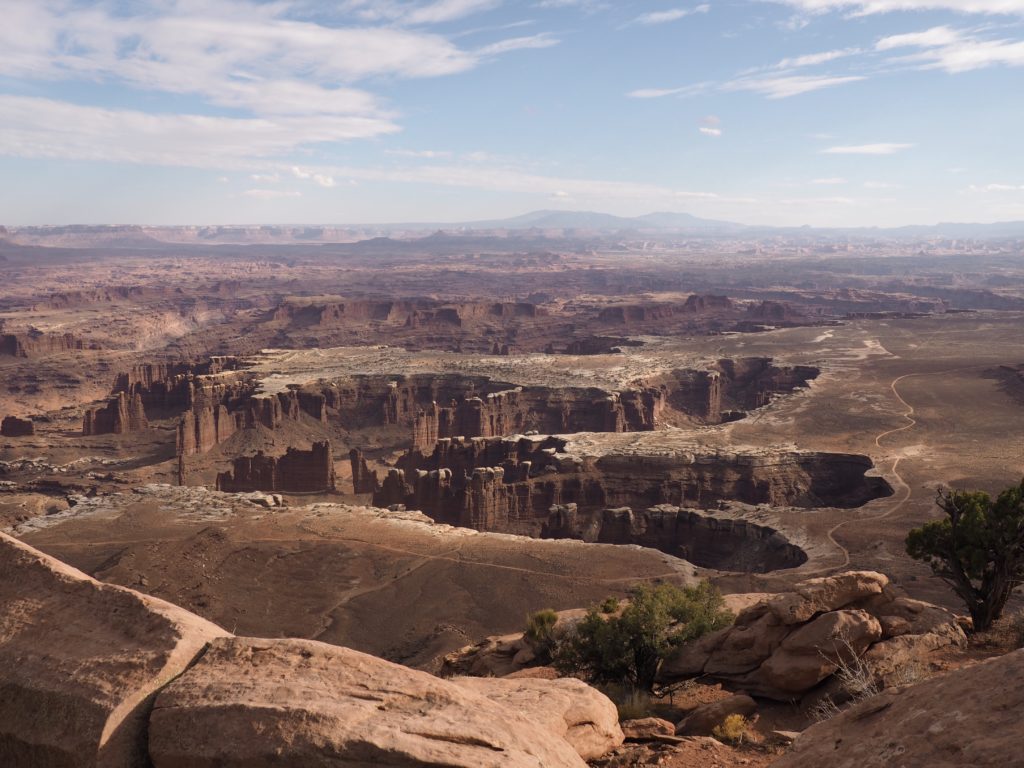
But, this is why people come to the National Parks on the Colorado Plateau!
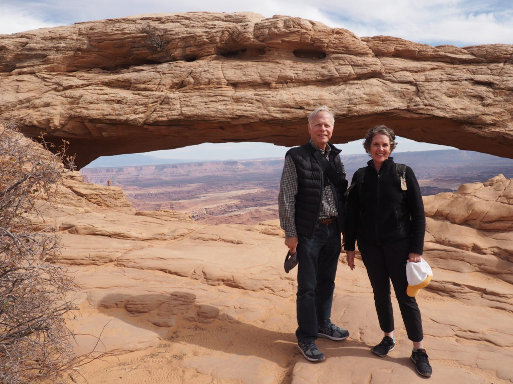
Mesa Arch 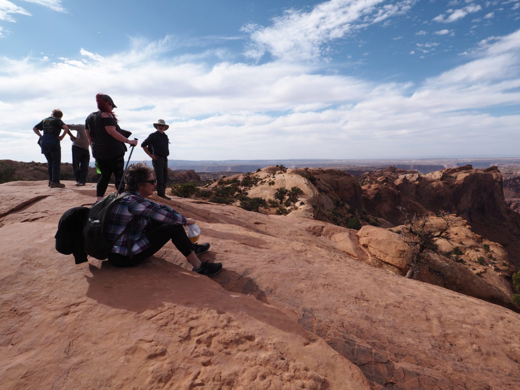
Overlook to Upheaval Dome
Upheaval Dome (formed by a meteorite impact?)
Another view from Grand View Point Overlook that looks
like it was painted for a movie studio in the 1960s.
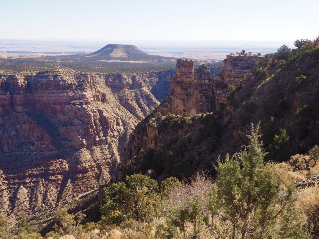
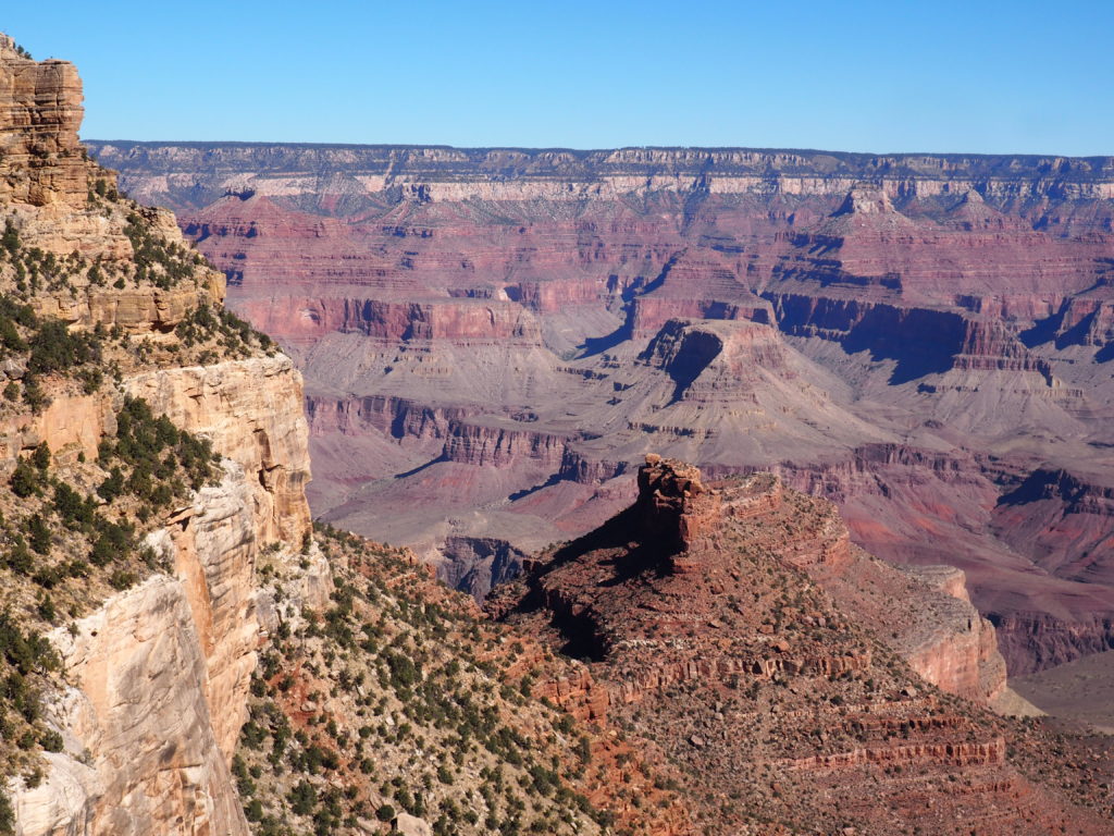
Grand Canyon National Park
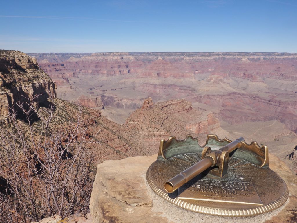
Speaking of spectacular cinematic views, the Grand Canyon has long been the “must see” of the National Parks. The lore of our National Parks is deeply ingrained in the place.
Mary Colter (born 1869) was given some Sioux drawings (one, a piece of ledger art) as a child, sparking a life long and intent fascination with Native Americans and their art. She became first an interior designer and then chief architect for the Fred Harvey Company (restaurants and lodgings) and the Santa Fe Railroad. In the early years of the Grand Canyon, these were the developers who began bringing tourists in to the Canyon. Colter’s interest in Native Americans comes through strongly in her architecture and design.
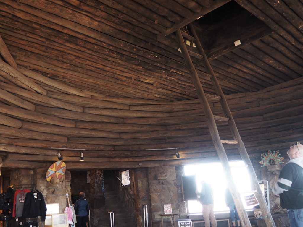
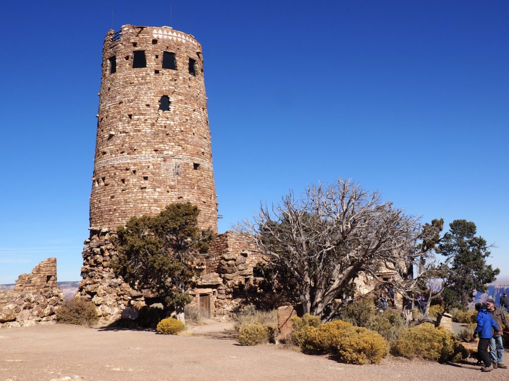
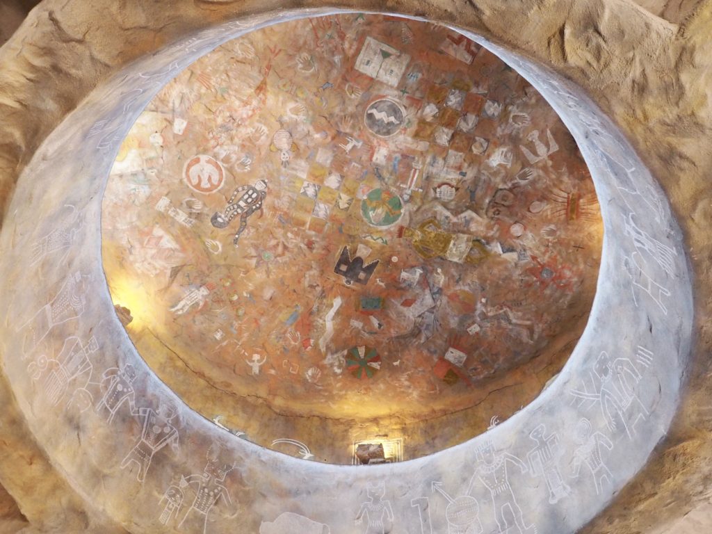
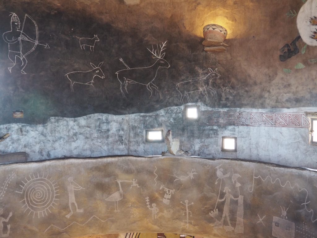
Kiva design feature in Watchtower 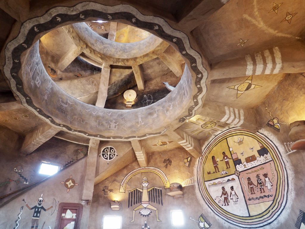
Inside the Watchtower
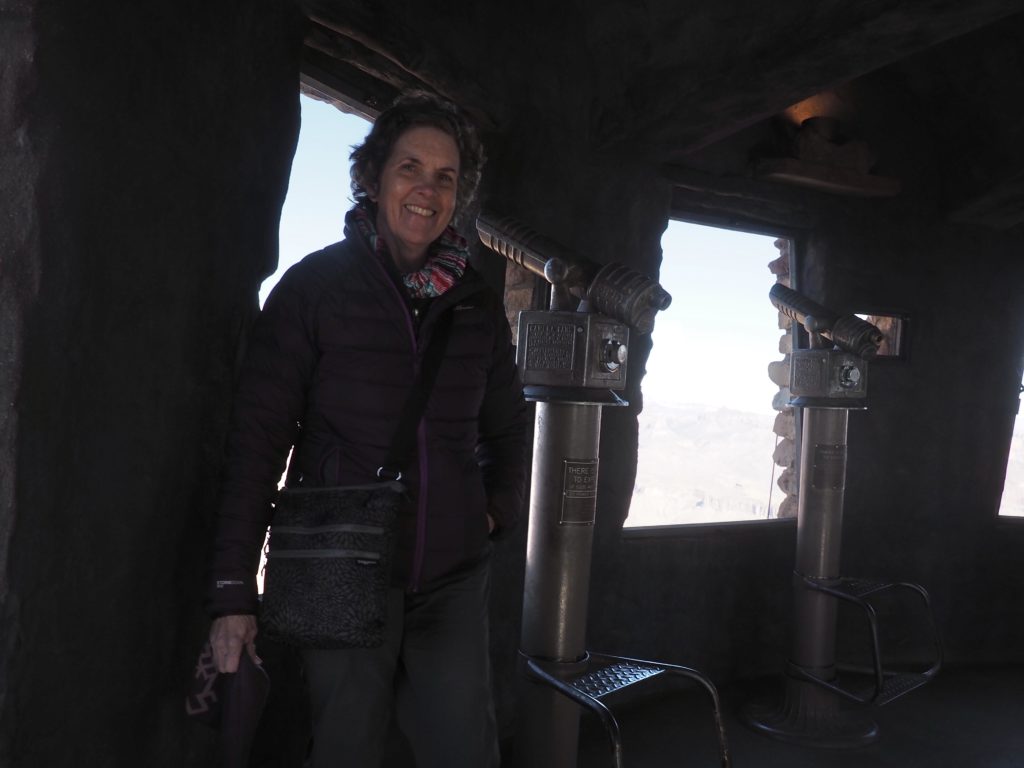
Amanda enjoying views from
the Desert View Watchtower.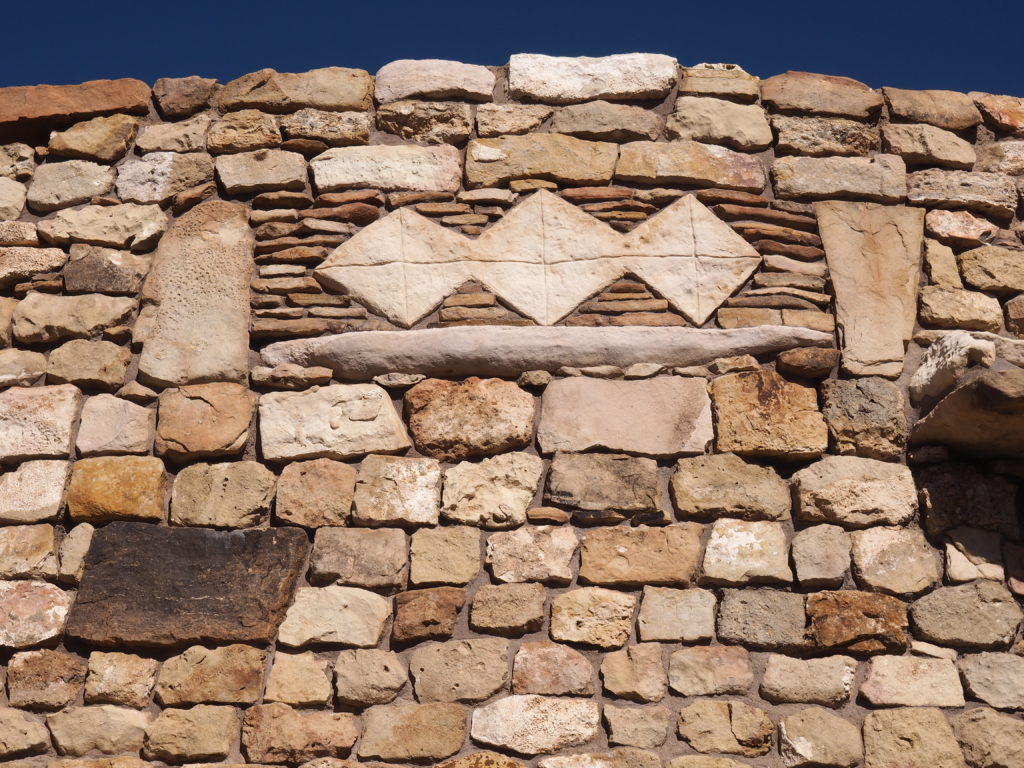
Colter copied the protective element added by Navajo Medicine Men at Chaco Canyon (see the blog post on Beneath the Surface of the Four Corners)
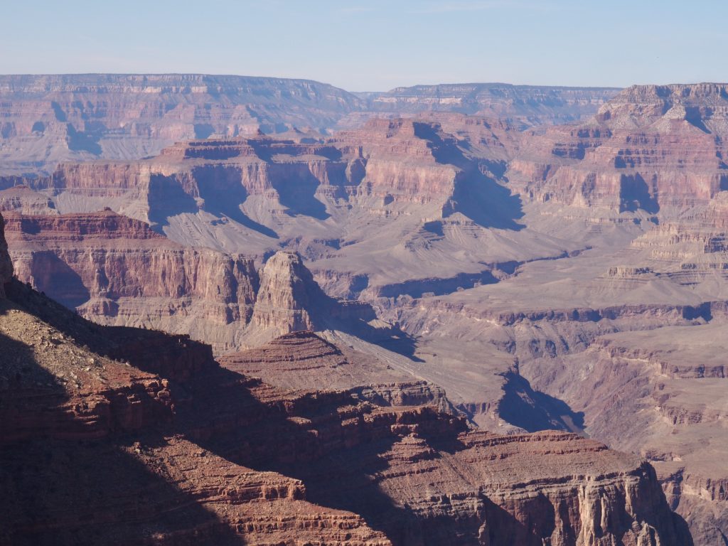
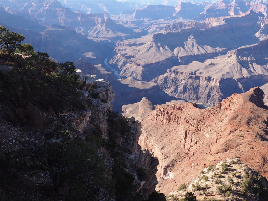
Below is the Colorado River, which we have to thank for all this! 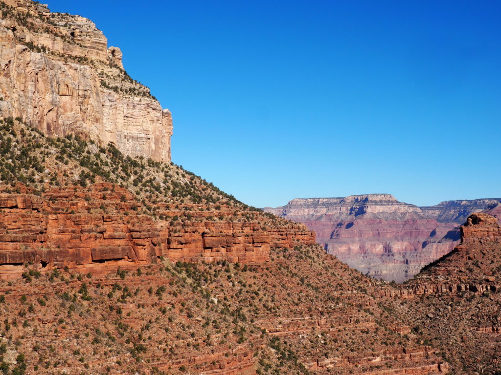
From the Bright Angel Trail
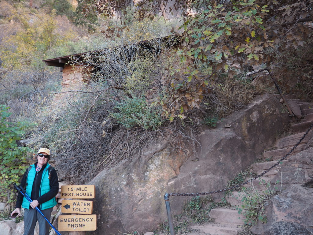
The Bright Angel Trail (and proof we made it this far!)
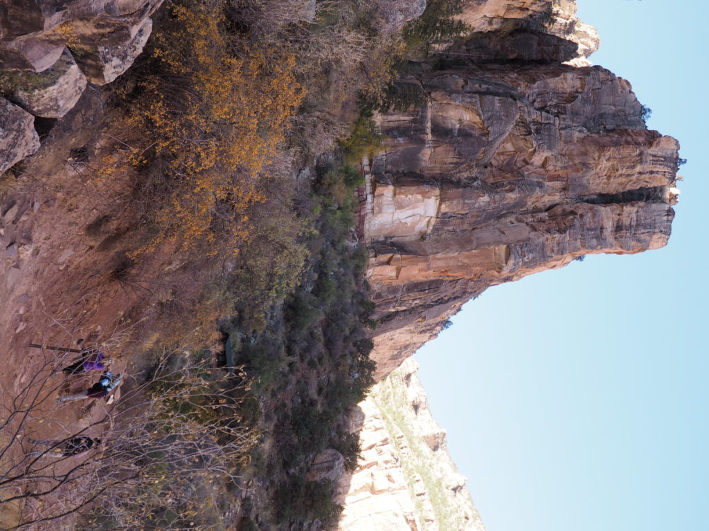
Fellow hikers with the rim above. We were all grateful for the cool weather.
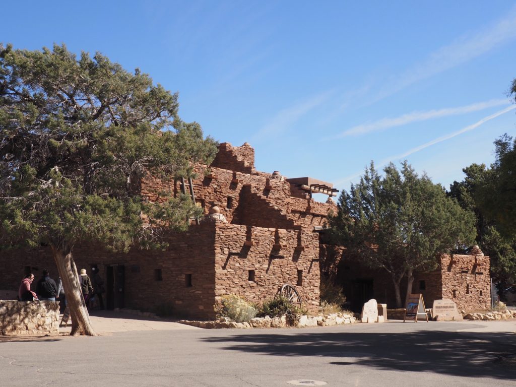
Hopi House, Mary Colter’s first project 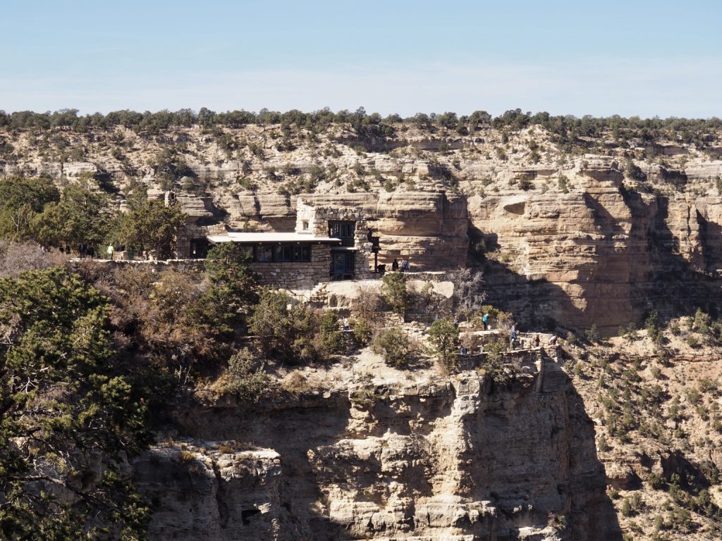
Colter’s Lookout Studio
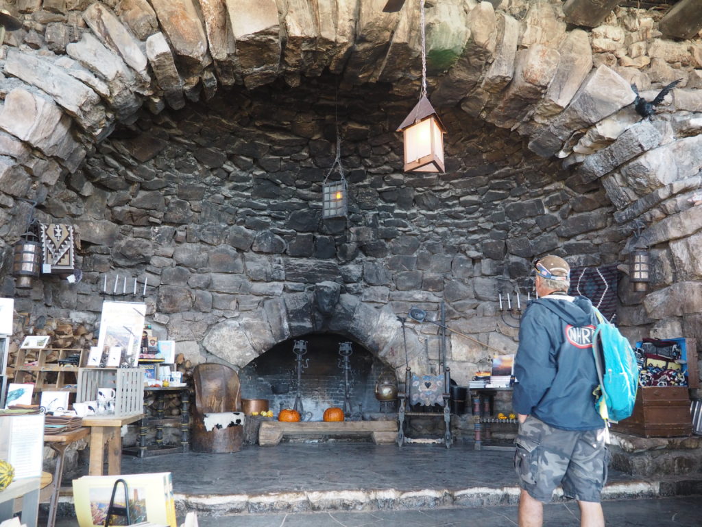
Hermit’s Rest was designed by Colter as a place travelers could warm themselves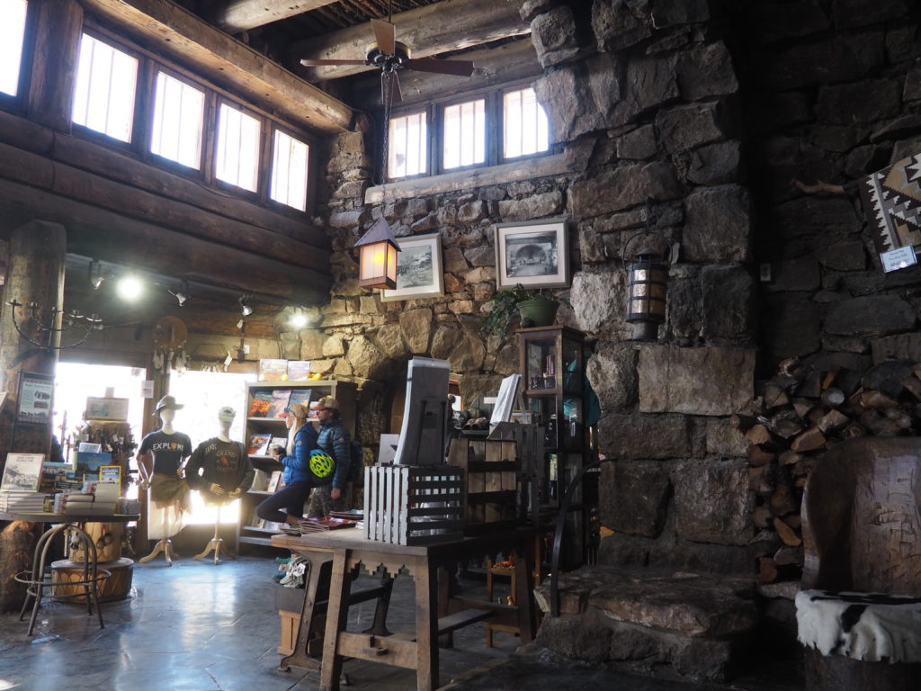
after a 3 hour stagecoach ride from the El Tovar hotel, also on the canyon’s rim.
Grand Canyon National Park can seem too groomed, tamed, with nature subdued for our contemplation, but it is spectacular scenery not to be missed. It also captures that age of Mary Colter, that wonderful early 20th century sensibility, the era of an evening stroll in your Sunday best on the seaside boardwalk to see and be seen, of the streetcar companies building amusement parks in the countryside at the end of their rail lines. Or, better yet, a retreat for the well-heeled to venture by train and stagecoach and be amazed at what nature hath wrought over millions of years.
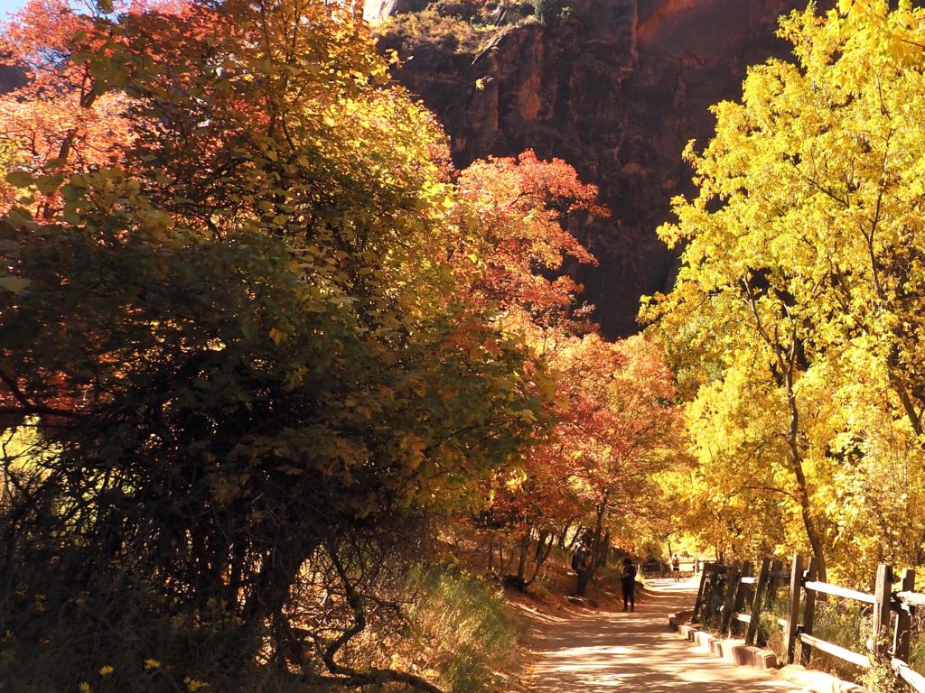
Zion National Park
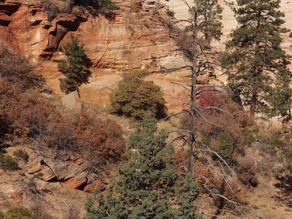
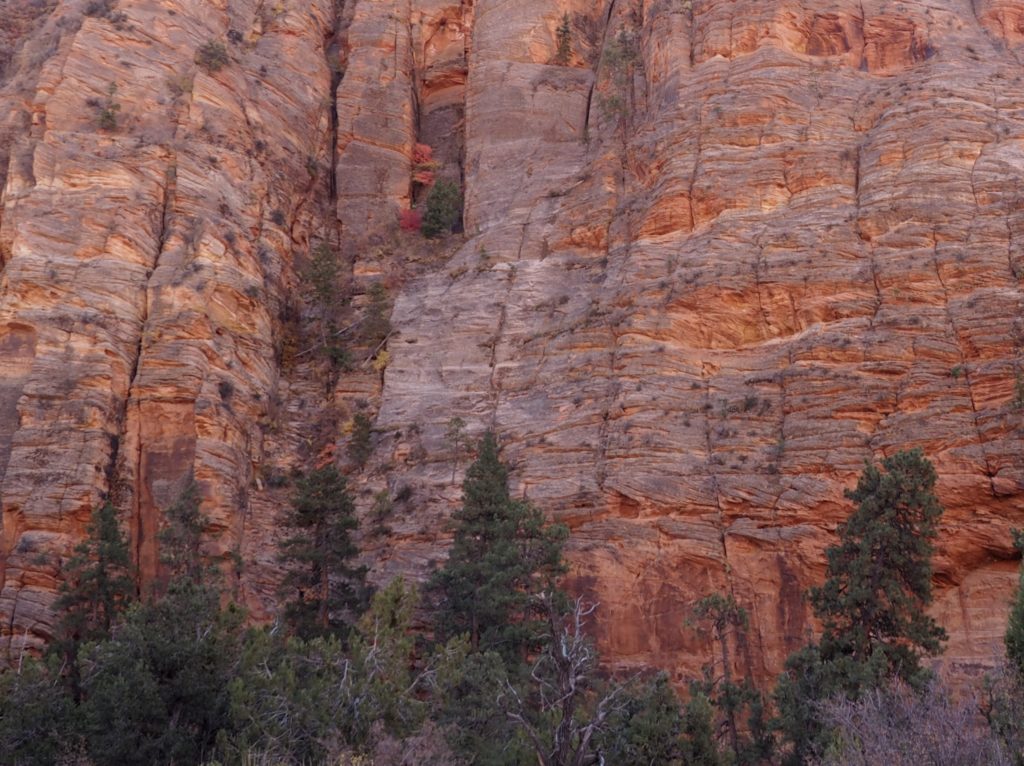
Sometimes Zion does feel like the Promised Land. For one thing, there are plenty of options for hiking in the dazzling landscape and the roads are closed to cars with a shuttle bus system conveying gawkers and hikers throughout the park.
A beautiful riverside hike leads up
a canyon to where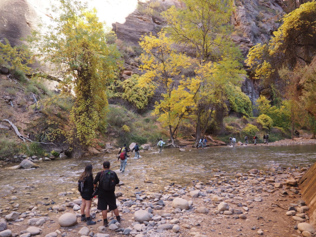
the river takes up the width and people wade through “the Narrows.”
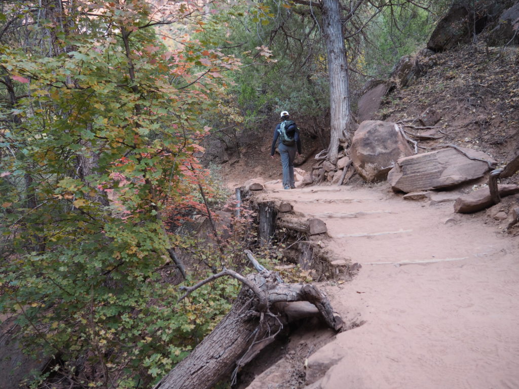
Or, you hike up out of the canyon bottom 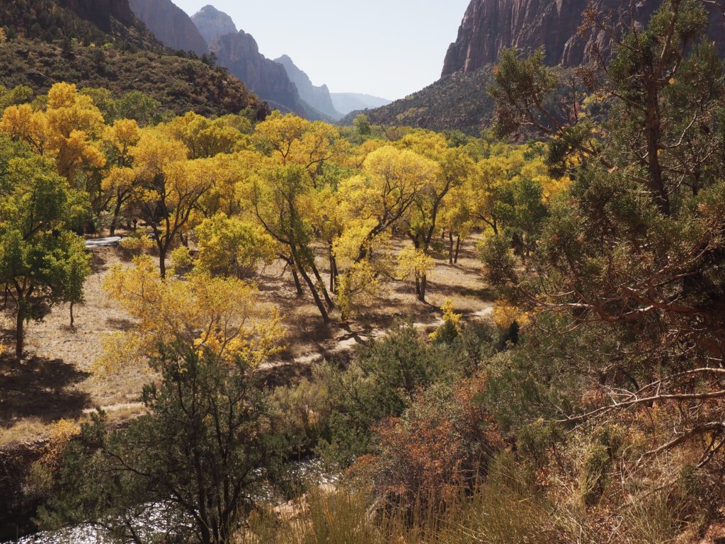
to enjoy the views below.
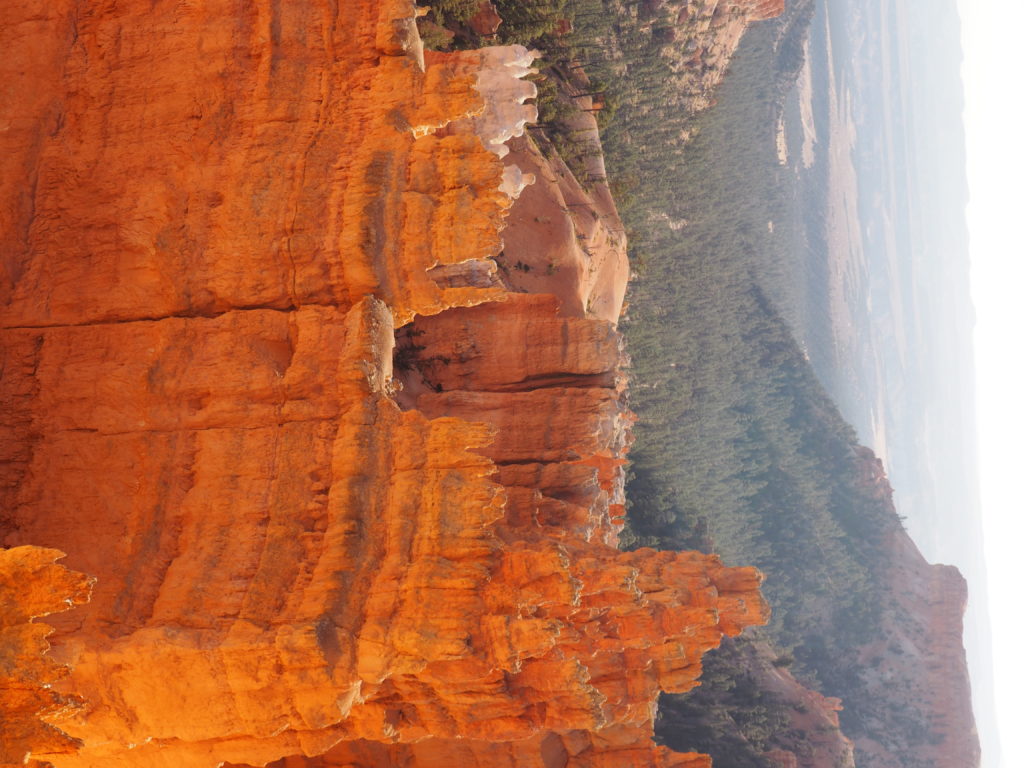
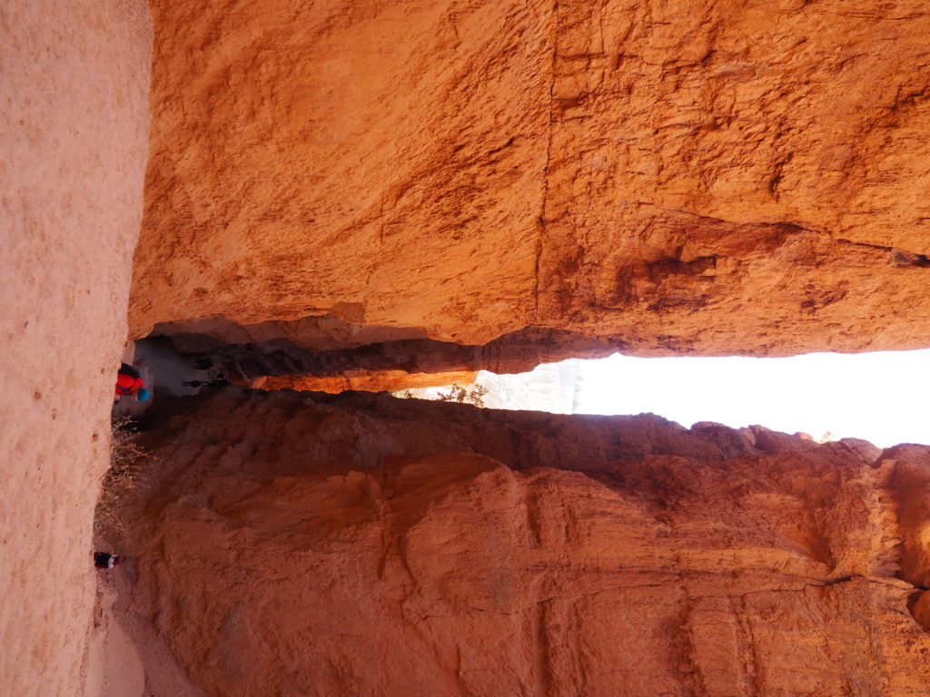
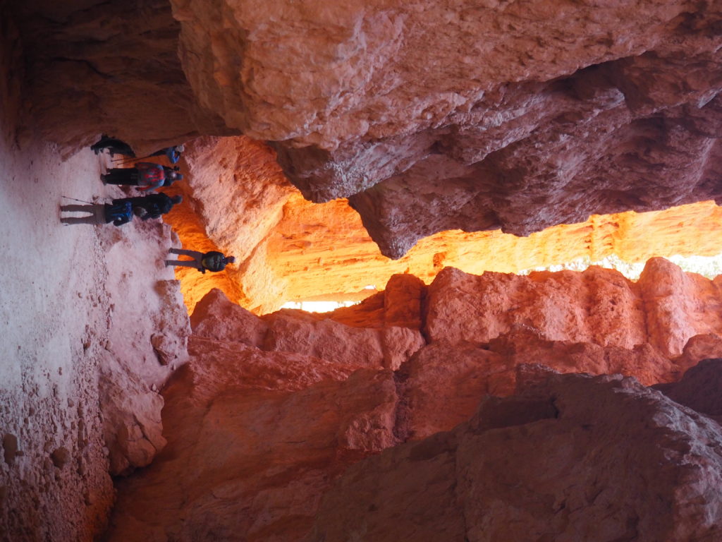
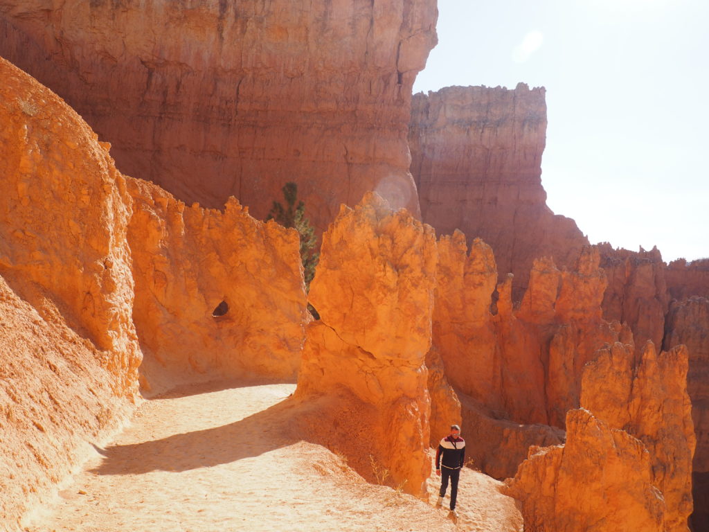
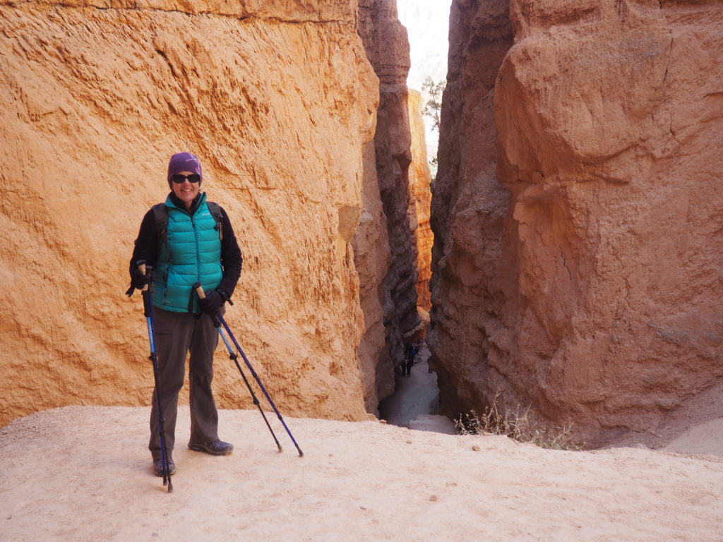
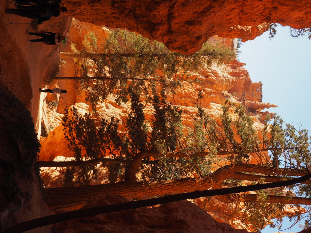
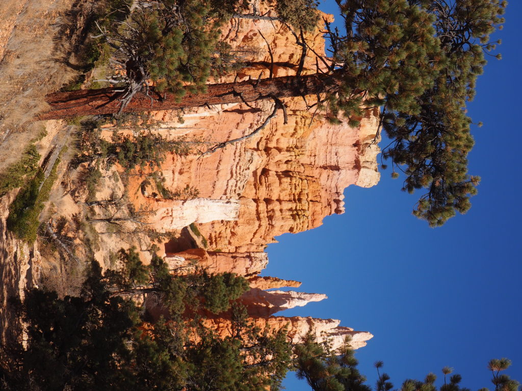
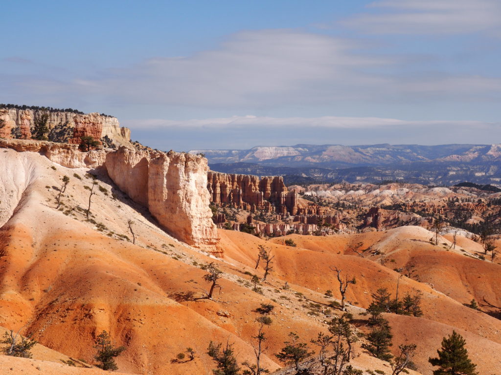
Bryce Canyon National Park
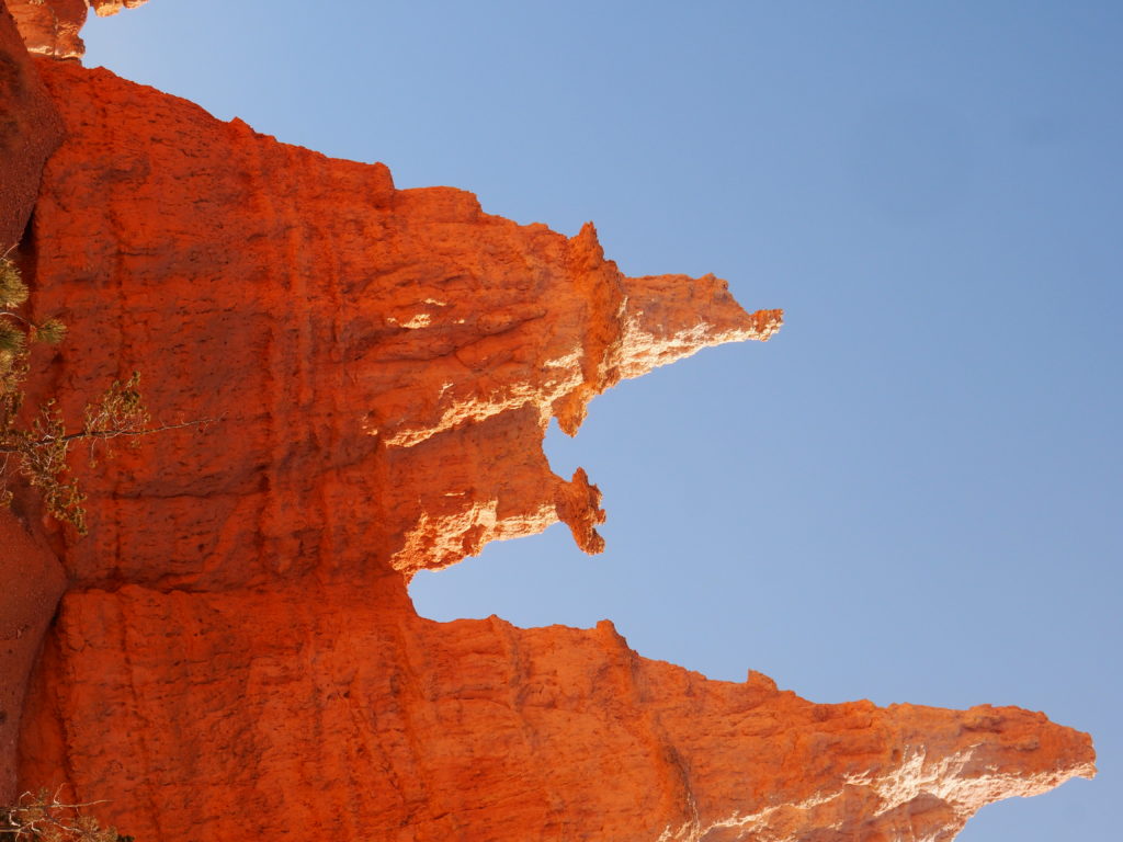
“Queen Victoria” 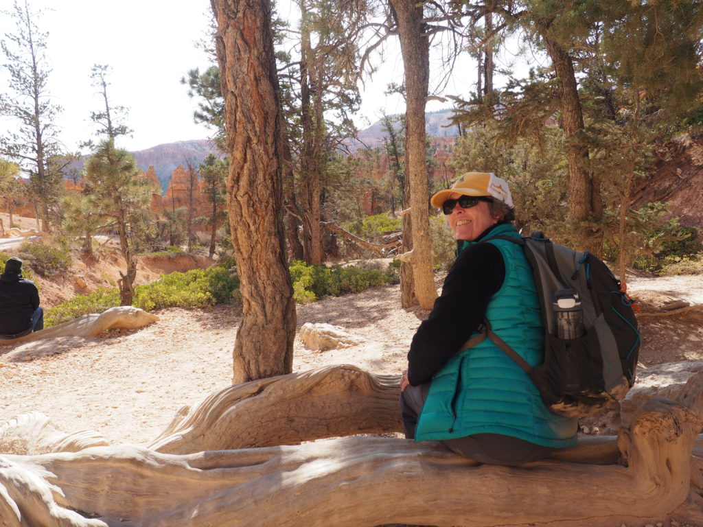
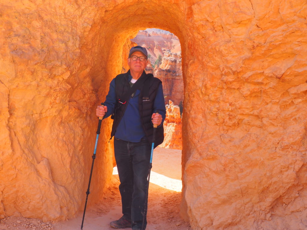
Stopping for a break along the Navajo Loop/Queen’s Garden Trails 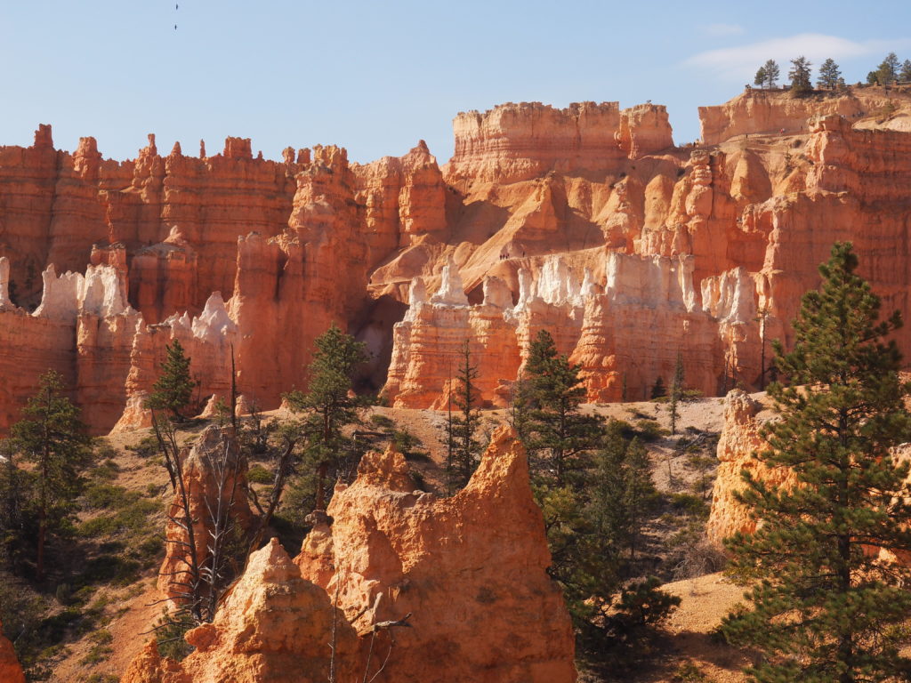
Hoodoos are the defining feature of Bryce Canyon National Park. You can just look or you can go in amongst them. We trooped along the Queen’s Garden trail and the Navajo Loop and were stunned by the extravagance of it all.
“I’m here to see the Queen!” 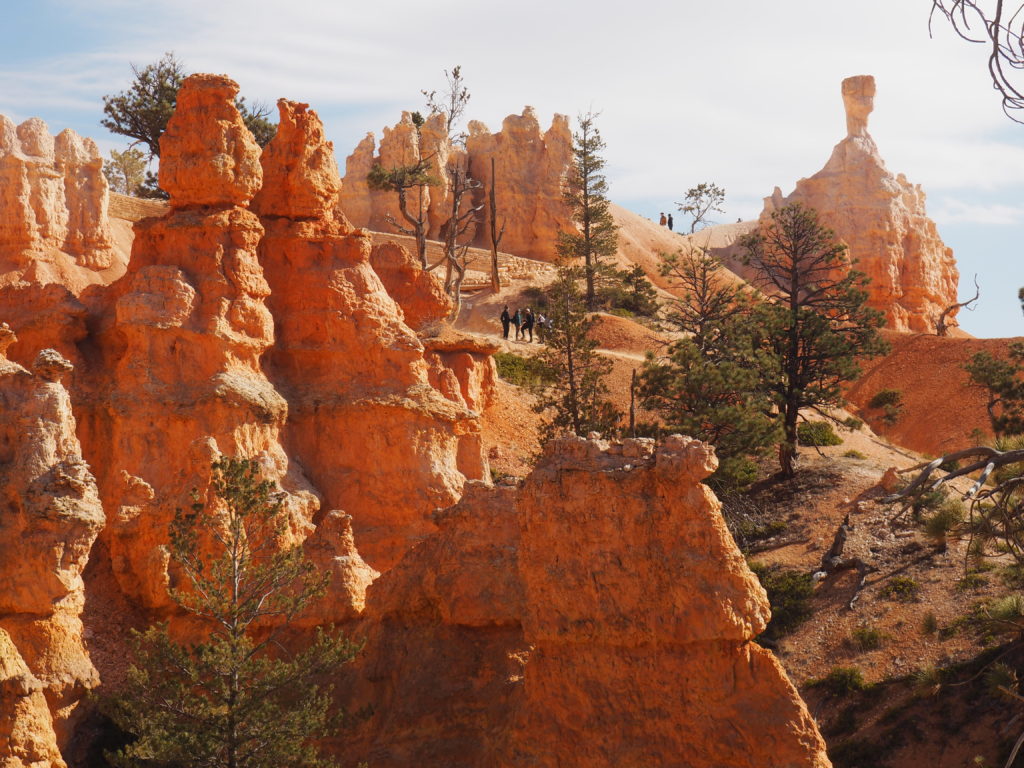
Fellow hikers.
A view to the future of
features made of sandstone.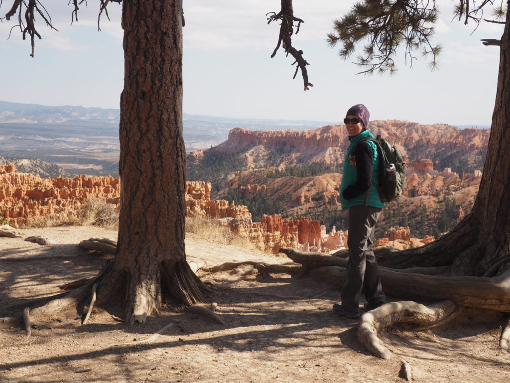
But, they’ll still be fun to see
for the next few million years.
Capitol Reef National Park
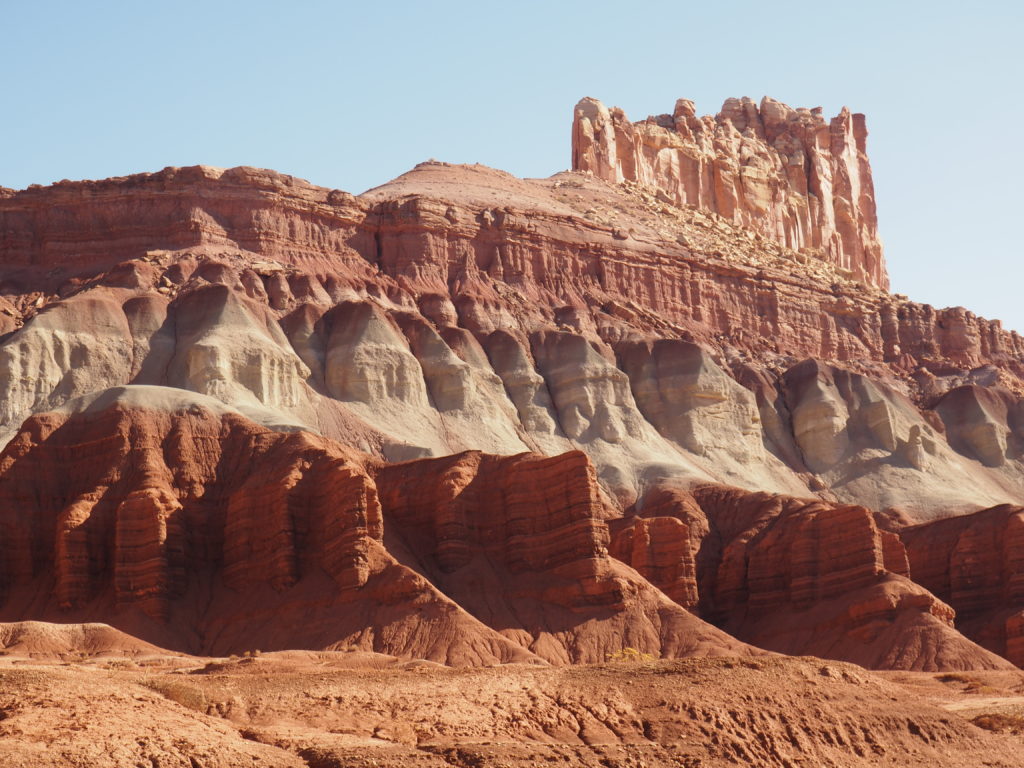
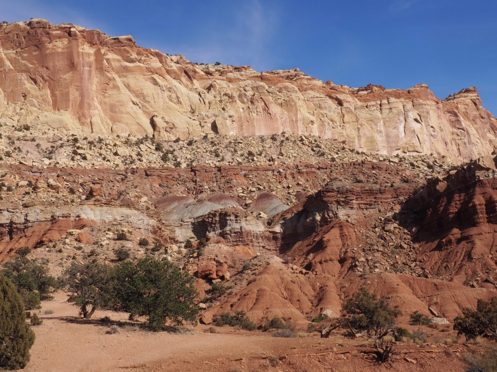
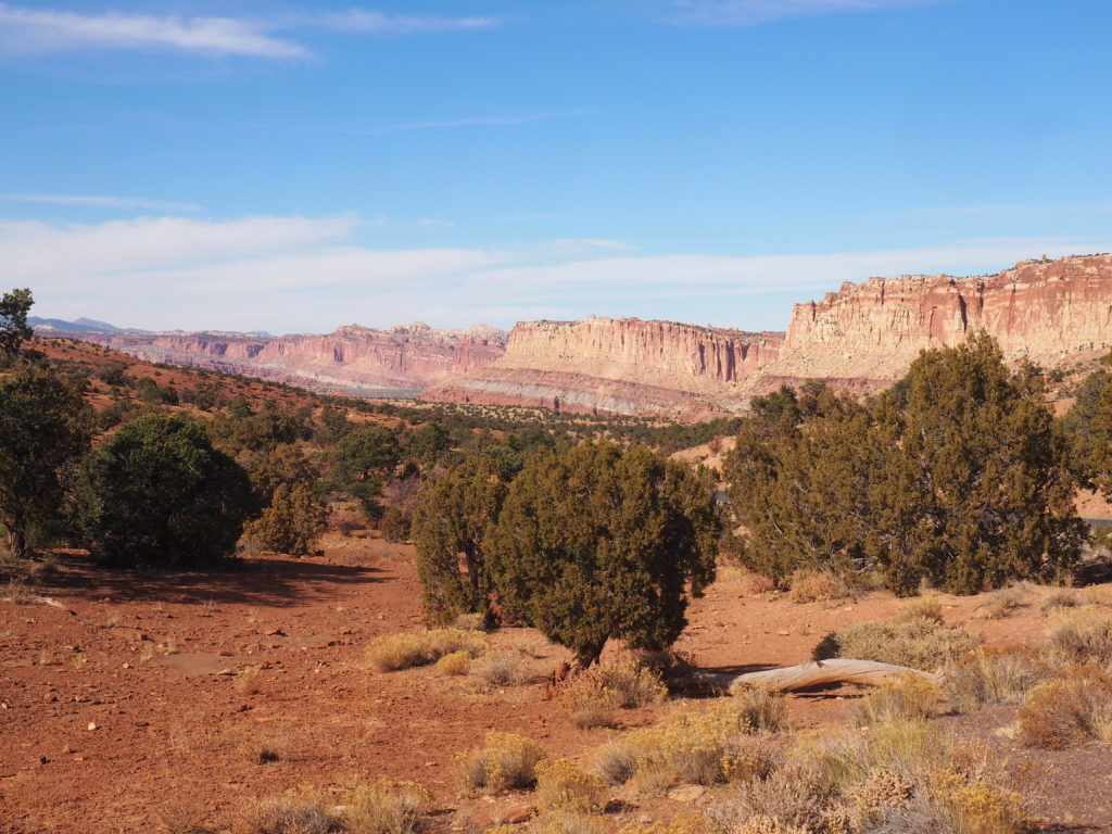
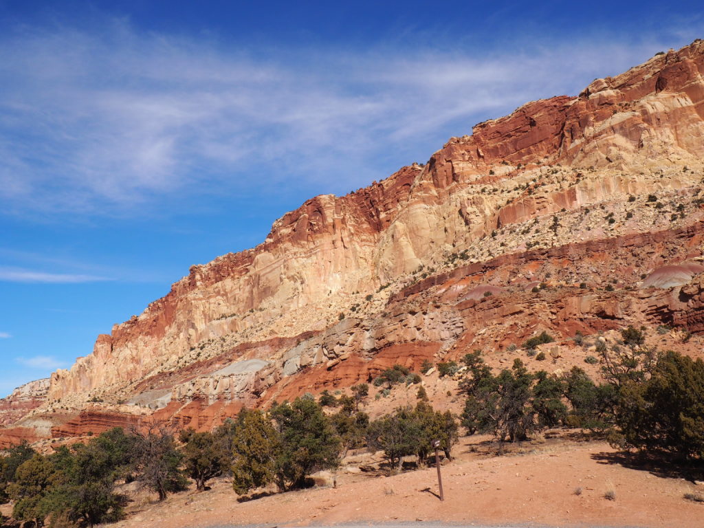
If you visit the National Parks on the Colorado Plateau, it’s hard to avoid geology. It’s a wrinkle or a fold in the earth’s crust that defines the oddly named Capitol Reef (something about easterners, familiarity with the ocean, and the grandeur of capitol buildings, or something like that). In any case, it’s some odd looking combinations of rocks out there, let us assure you.
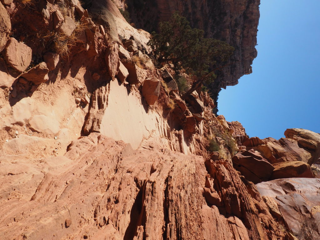
Where this led us was up a steep, edge hugging trail with a few “yikes!” from Jim.
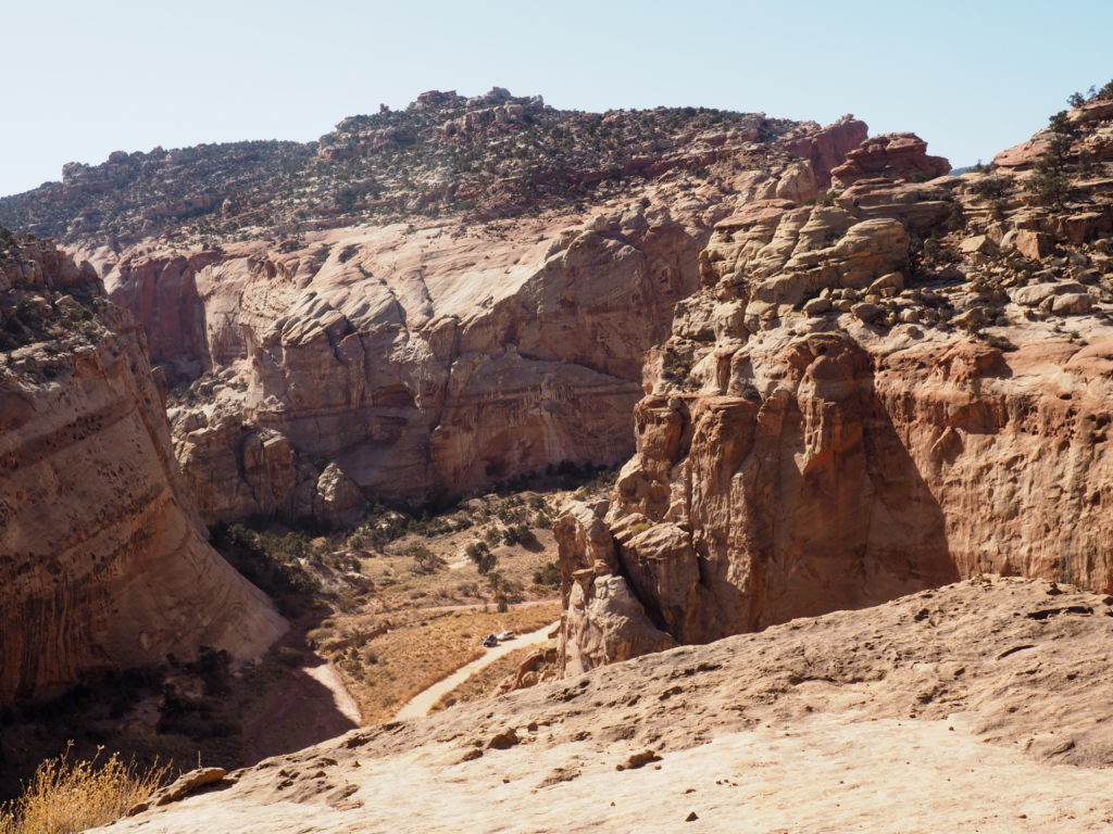
To a view overlooking a wash and around 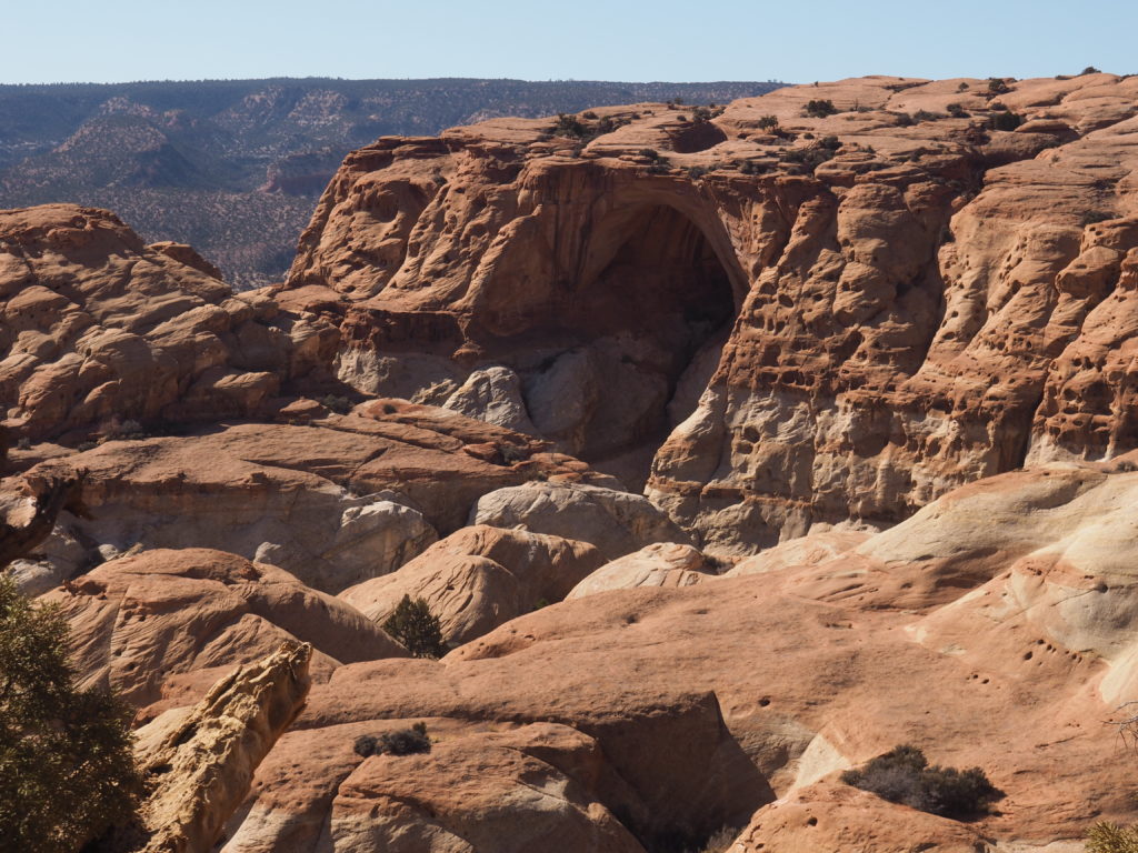
another turn in the canyon to see an arch.
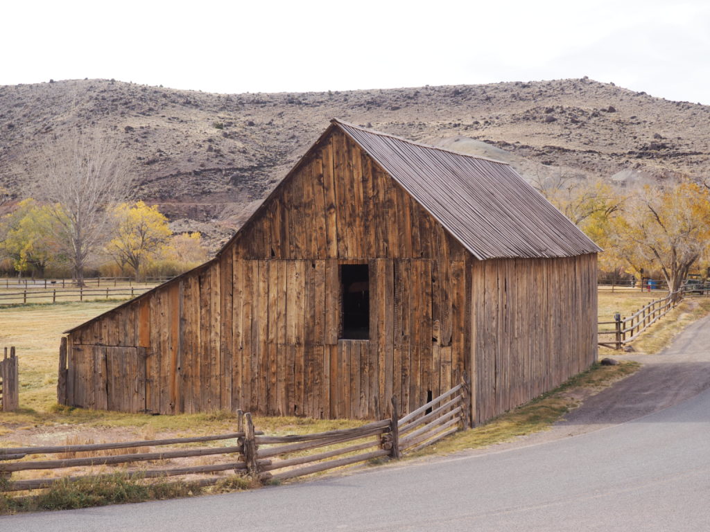
Capitol Reef also has an old Mormon settlement 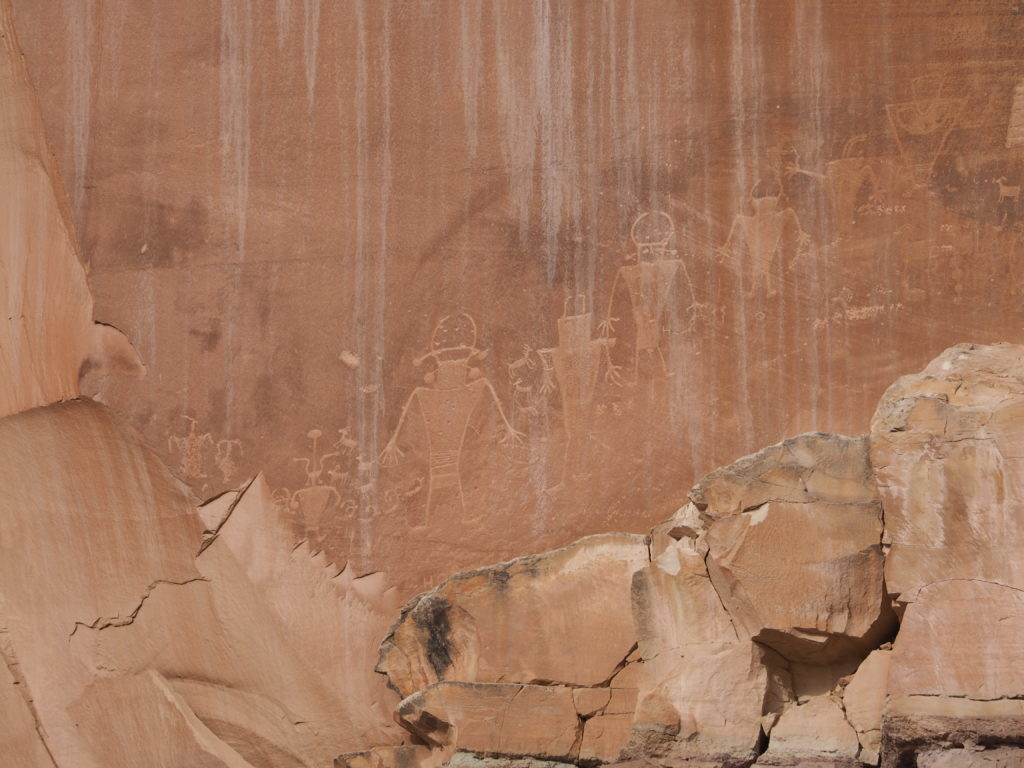
and more petroglyphs (really?)
Established as a National Monument in 1937 and a National Park in 1971, one of the things that makes Capitol Reef special is the maintenance of the small 1880s Mormon settlement of Fruita by the Park Service. There are orchards, the Gifford homestead (selling delicious little pies), a schoolhouse and blacksmith shop harkening back to pioneer days along the Fremont River. In the transition to becoming a National Park, the Giffords were bought out. It must have been hard to leave such a beautiful spot.
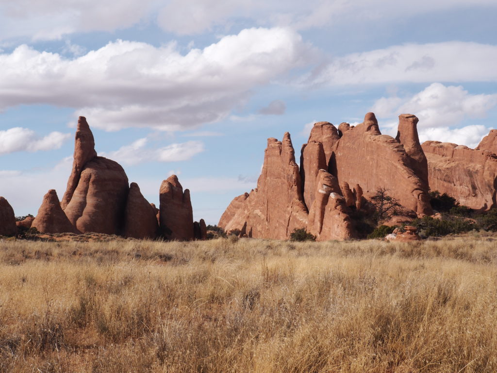
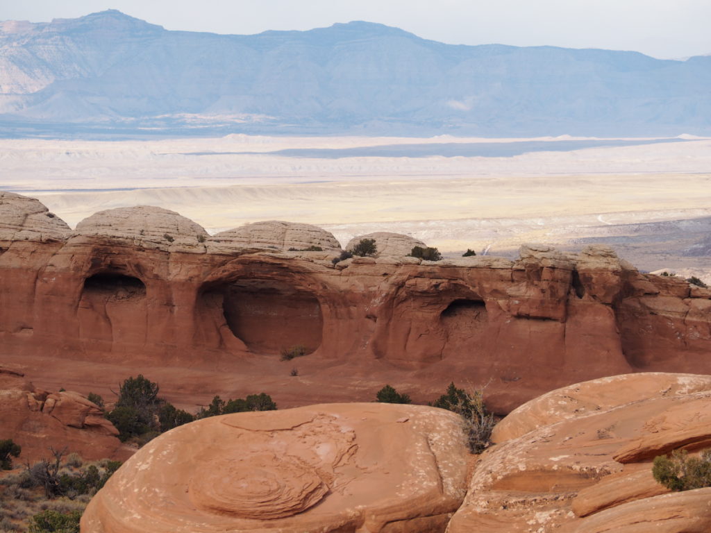
Arches National Park
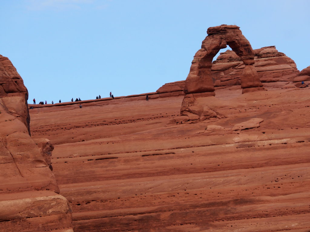
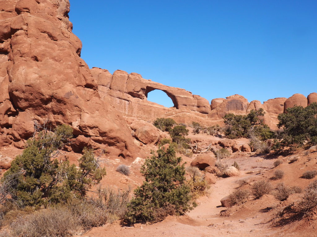
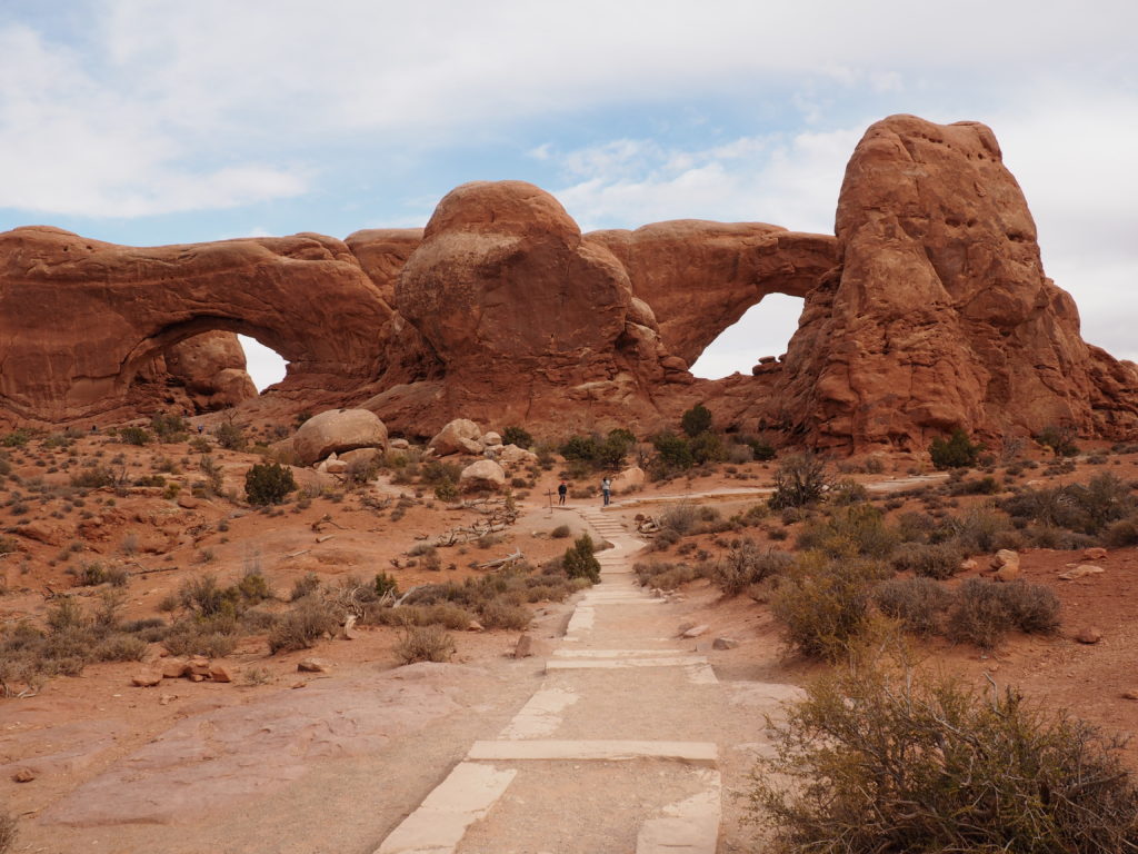
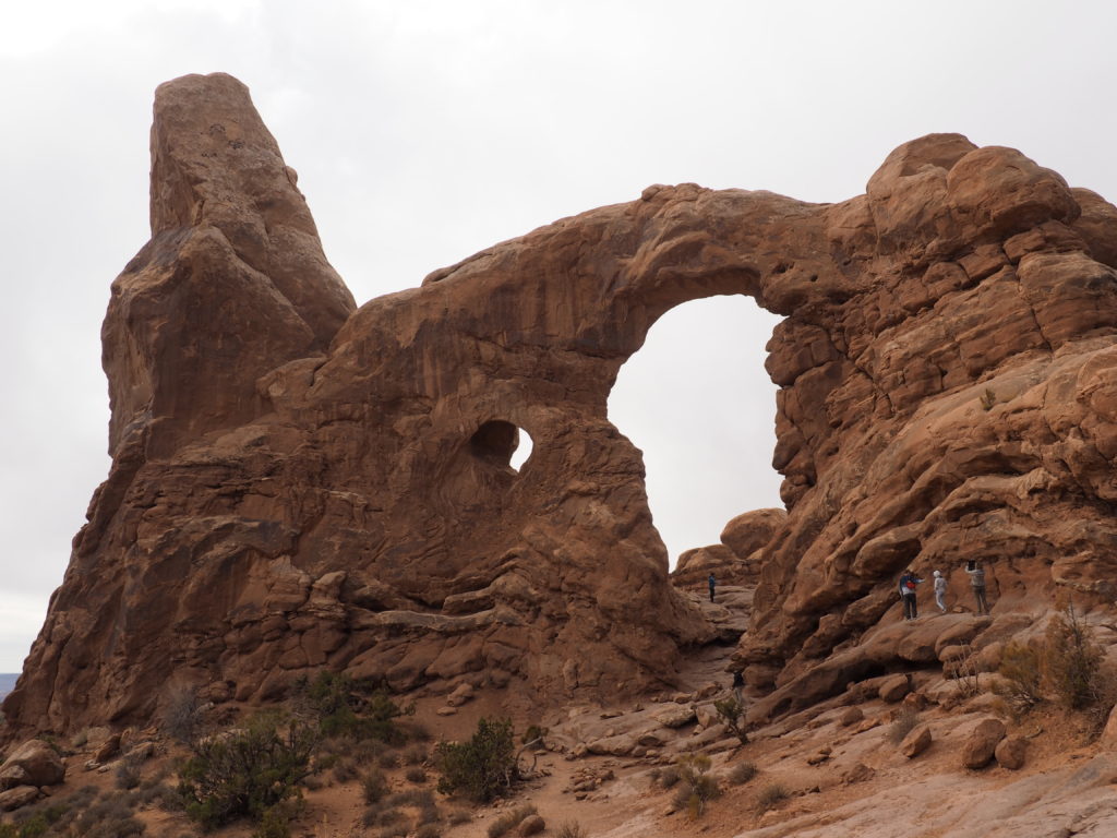
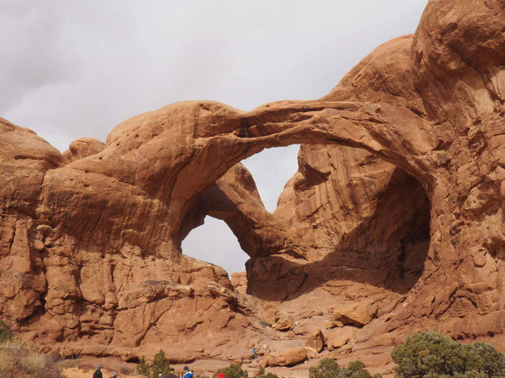
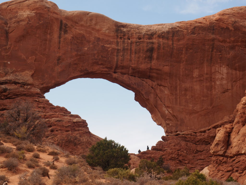
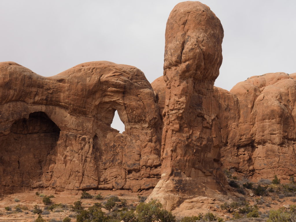
They claim there are 2000 arches or natural bridges within Arches National Park. That’s not hard to believe. And, it’s funny how something so unique and unusual in nature can seem commonplace when you’re in the midst of such a crazy concentration of it. But, water has continued to do its work here and is continuing to do so. There’s a great photo at the beginning of the walk out to the one that’s at the top right in this montage showing that in 1930 the opening was half as big as it is now. In fact, throughout our trip we kept seeing those precariously balanced enormous pieces of rock that look like they’re about to break loose. Sometimes they do, like that stupendous piece of cliff that took out some of the back part of Pueblo Bonito down in Chaco Canyon. Fortunately, those folks had moved out over 700 years ago.
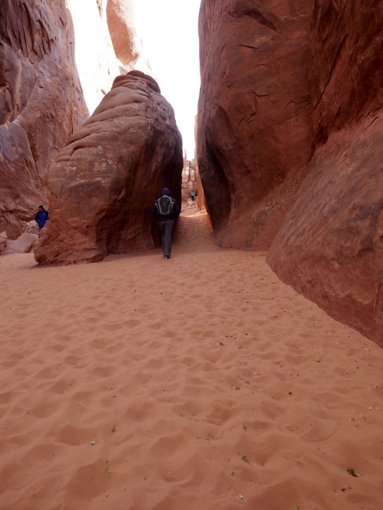
Sand Dune Arch, Arches National Park
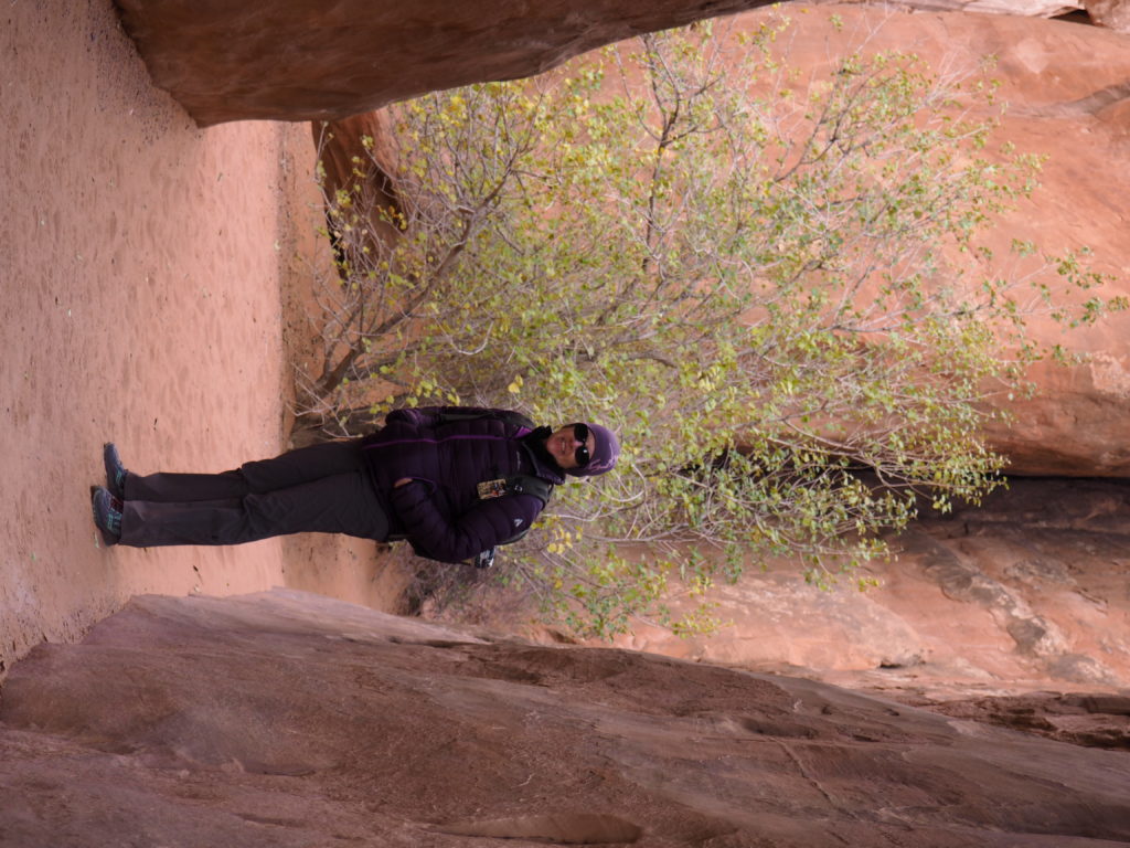
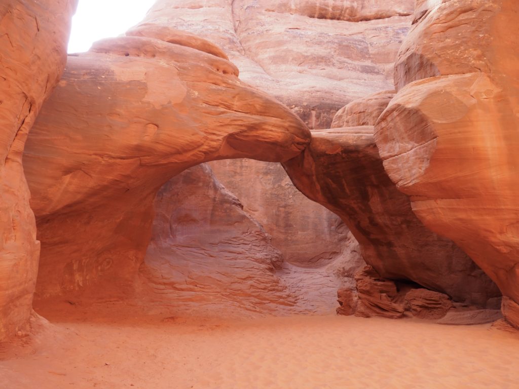
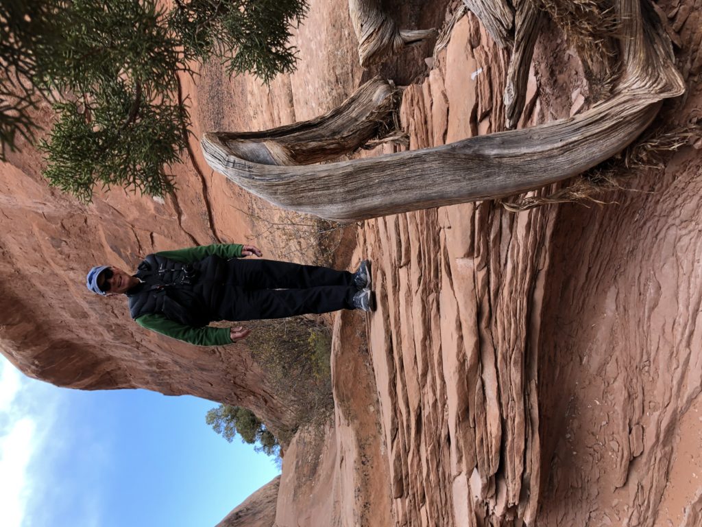
For the last hike of our trip, we decided to take on a hike that would take us by Sand Dune Arch and then through Broken Arch (it isn’t). We had to dump even more sand out of our hiking shoes than usual (which was a lot).
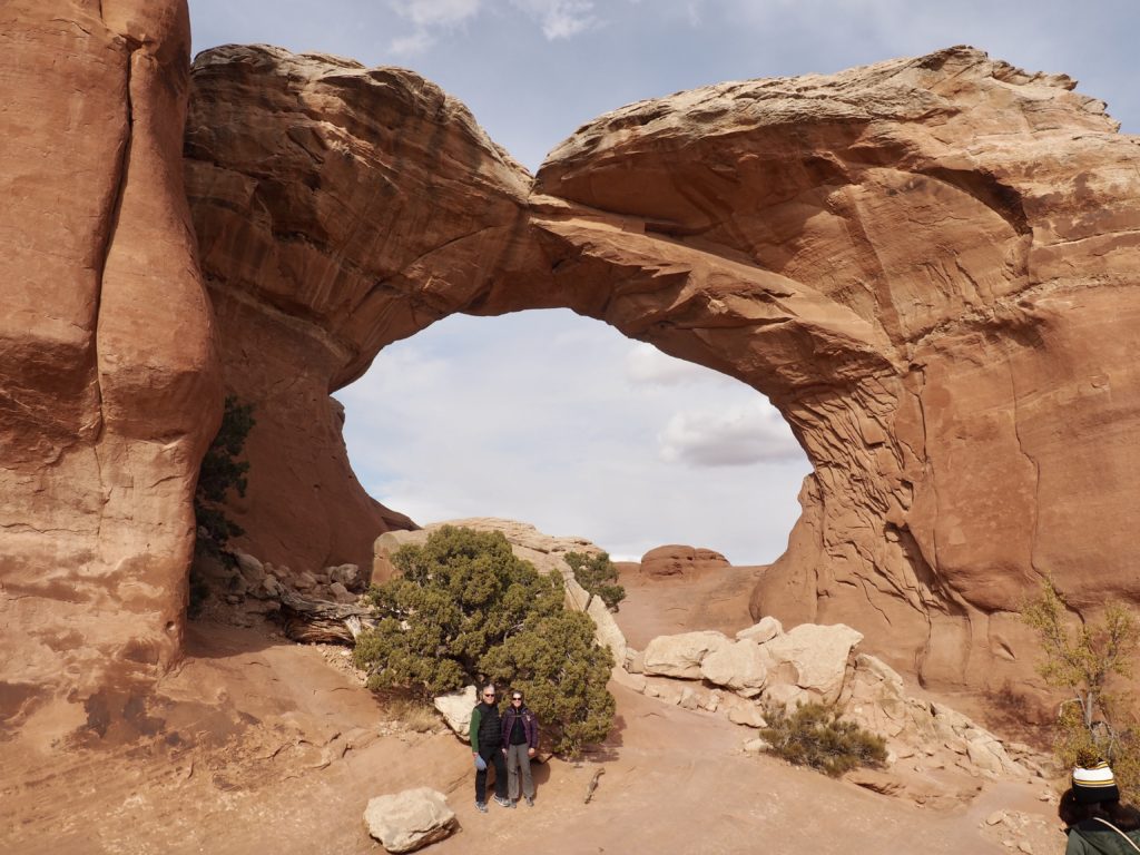
That’s us, in front of (un)Broken Arch, thanks to one of the many very friendly people we met.
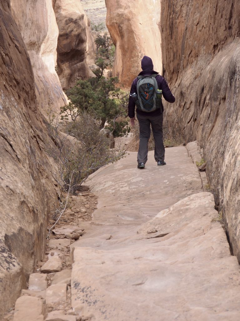
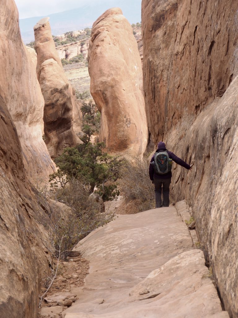
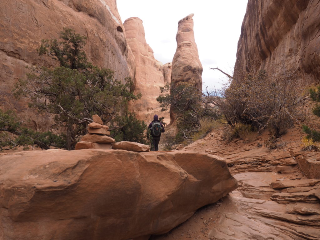
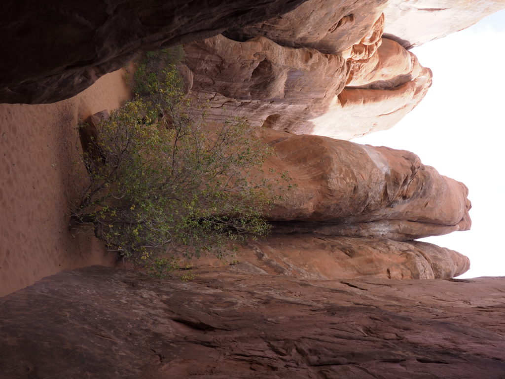
We would have gotten lost many times were it not for the trail marking cairns.
And, we were rewarded for our efforts
every step along the way.